We chose the Katy Trail as the finale of our Spring North Tour. Not only would it conveniently return us to St. Louis and reconnect us with our car, but we suspected that finishing with a flat, dedicated bike trail would be a nice way to ease ourselves to the finish.

The Katy trail stretches 240 miles across Missouri and is the longest rails-to-trails project in the country. We started at Clinton, its westernmost terminus, and headed east. Using our normal mileages, we calculated that four days would be enough to complete the trail. But after the first day or so, we quickly adjusted our plans to add an extra day. It didn’t make sense to rush through – the trail is designed so that cyclists can enjoy the many towns along the way. That appealed to me, and even after slowing down I wished we’d left more time to explore.
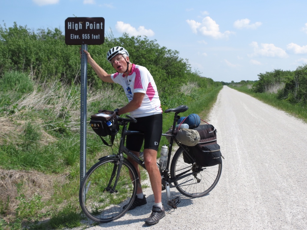
From Clinton to Booneville, the trail angles to the northeast heading to the Missouri River. Although railroad beds are known for being very flat, we were surprised to find that there was actually quite a bit of elevation change in that section. It was all very gradual, but we did reach the highest point of the trail. Rich seemed to think it was quite a climb!
The trail surface is crushed limestone. For the most part, it is very well maintained and rough spots are very well marked. It makes for good cycling, but it does take its toll. It’s not like rolling over smooth pavement where it is easy to gain momentum and glide along. The rougher limestone takes more effort, costing us a gear or two, and even with 1400 miles behind us we could feel that extra work by the end of the day.

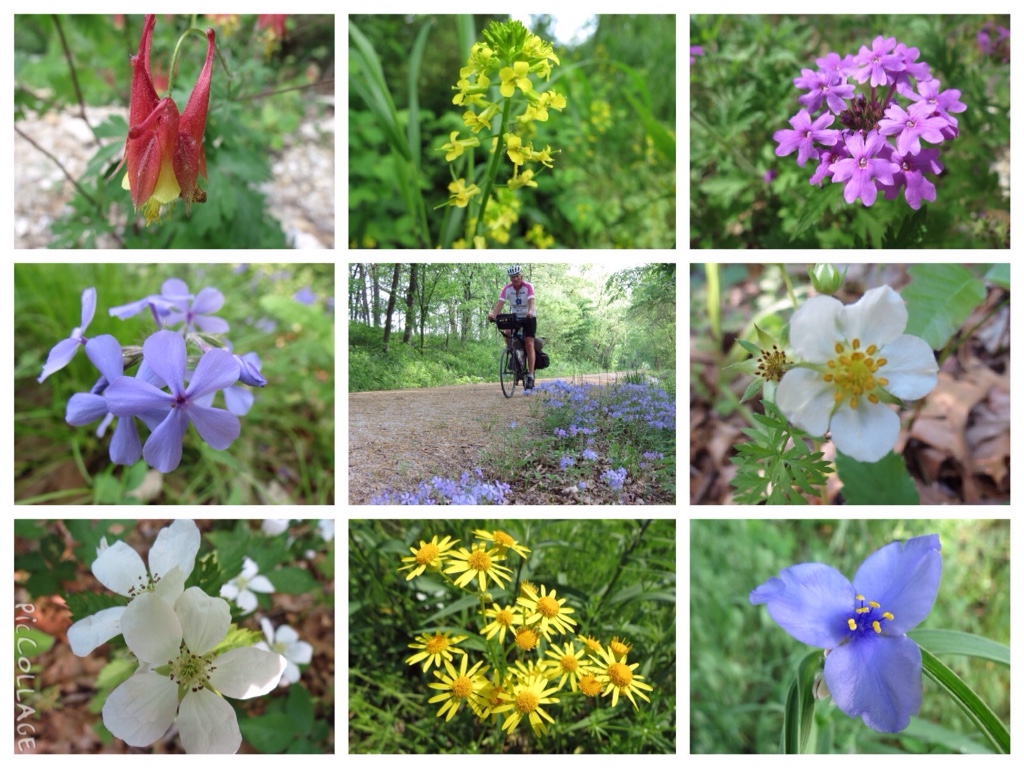
The surroundings of the trail changed frequently. At times it was out in the wide open, surrounded by farm fields and flat land. In some areas they were working to restore the prairie grasses. Other times there were trees lining the trail, which were a welcome wind break for us. Best of all were the wooded sections, with thick undergrowth and trees that stretched to meet over our heads forming a tunnel.
We were still being treated to an abundance of wild flowers, and my eyes were glued to the sides of the trail searching out different varieties throughout the day.
There are still reminders of the Katy Railroad along the trail. Old switch boxes and signals are visible, and the truss bridges now carry cyclists across the frequent steams and rivers. A few of the beautiful old depots still stand, frequently serving as information centers at the trail heads. And caboose cars are also popular fixtures in some of the towns.

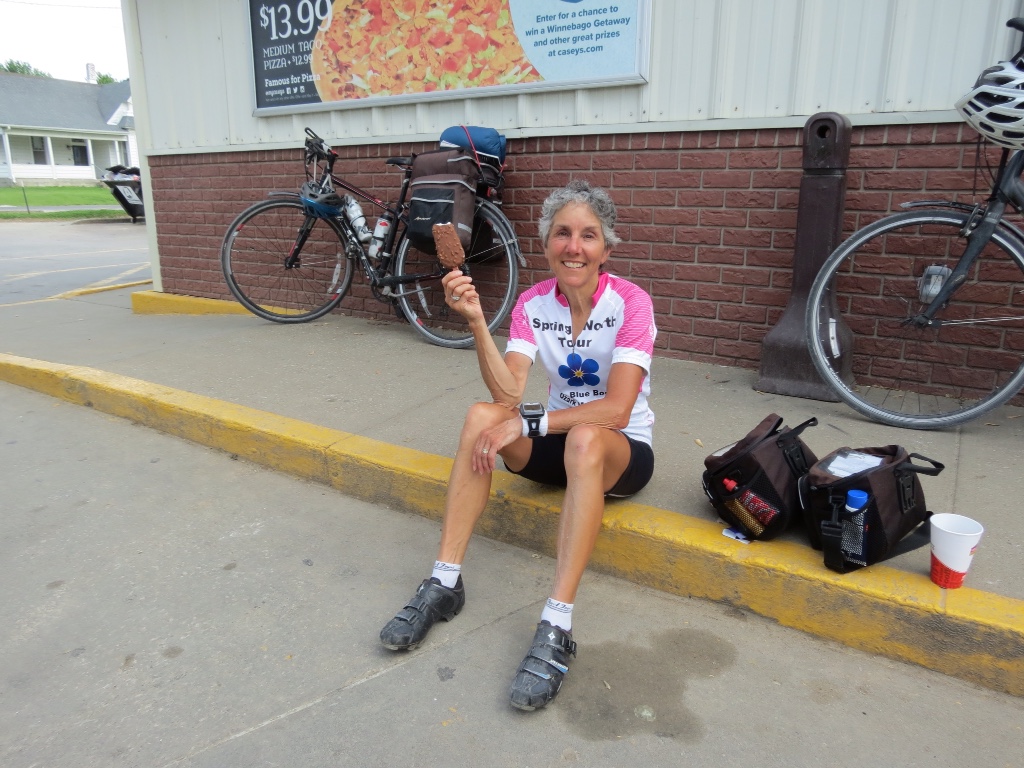
It makes for a nice change from navigating the roads, figuring out directions and dealing with cars. But one thing doesn’t change. Even heading down the Katy Trail, there’s nothing like ice cream at the end of the day.

Lovely and as always inspiring, good planning on the route. I have enjoyed following your adventure.
Wow- great non-stop read! Thanks!