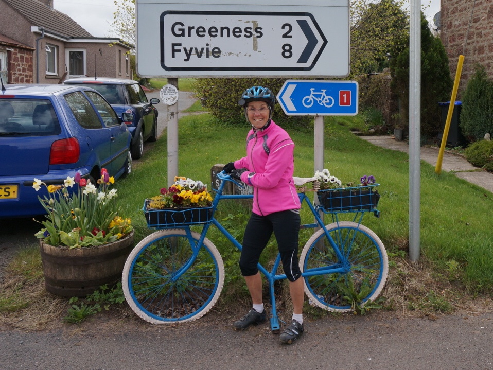
We have learned to love that sign. The blue arrow with a bicycle and red #1 has been our guide since arriving in Scotland. We'd be lost without it. Literally.
The National Cycle Network covers the length and breadth of the UK with over 14,000 miles of cycle routes. These are a combination of traffic-free paths and quiet on-road routes that connect to every major town and city. Looking at the map, Scotland has a much lower density of cycling routes – in all likelihood due to its rugged terrain and lower population. But they are serving us well.
Before leaving on our trip, Rich ordered two sets of maps from Sustrans, the non-profit that supports the cycle network. This was a drastic departure from his usual reliance on Google Maps for planning and navigating our routes. But something told him that the highly detailed maps would be useful. That turned out to be an understatement.
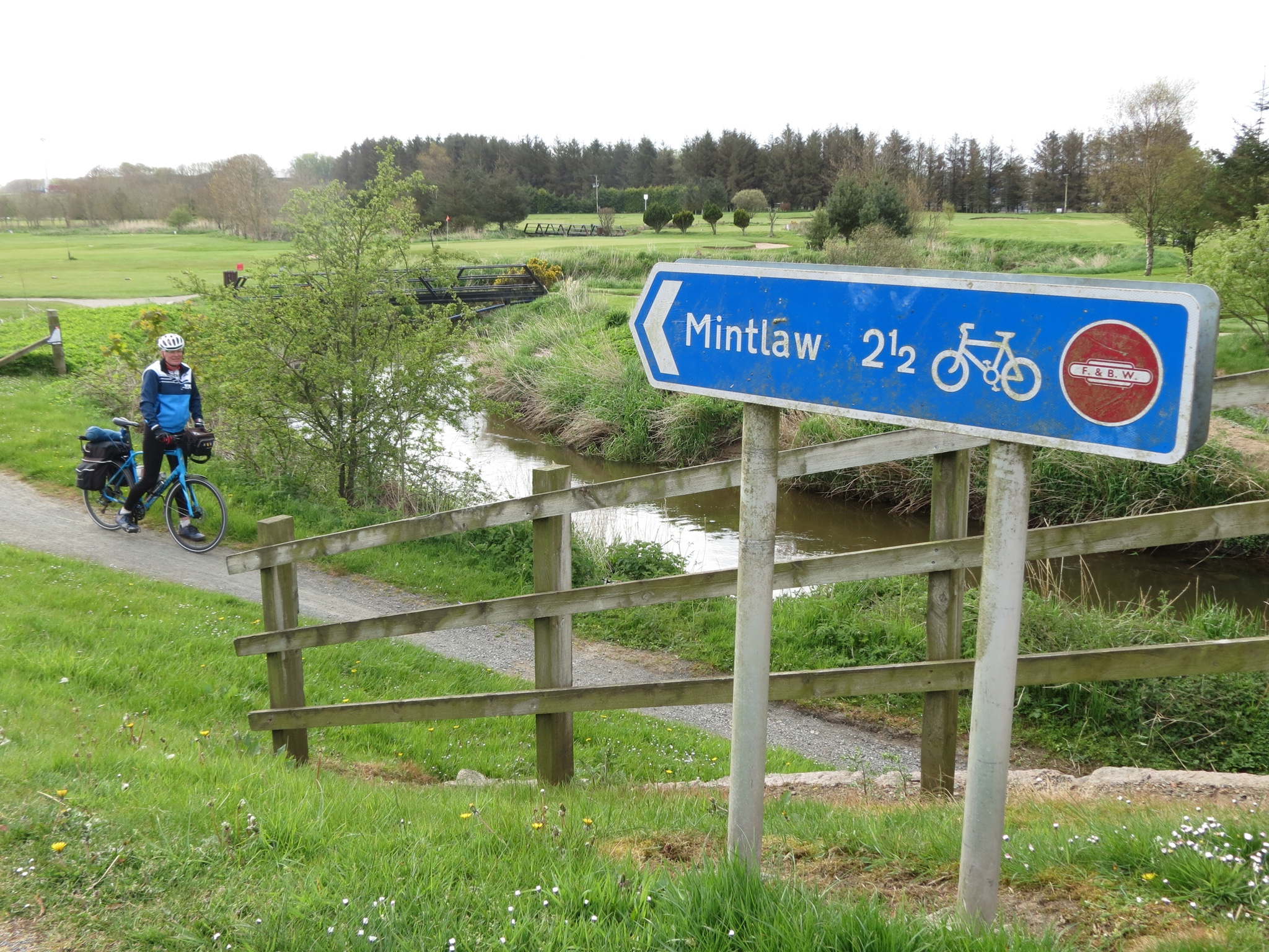
The best part is that these routes are so well marked. At nearly every turn we find our little blue sign. As we travel a road, there it is every so often assuring us we are still going the right way. Since they follow myriad little back roads, which are often small and obscure, it saves us from constantly having to check our maps. And we could never have figured out such a route in the first place. We're so grateful that someone has done it all for us.
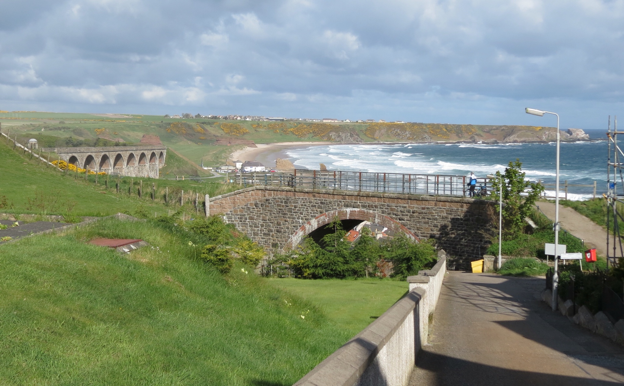
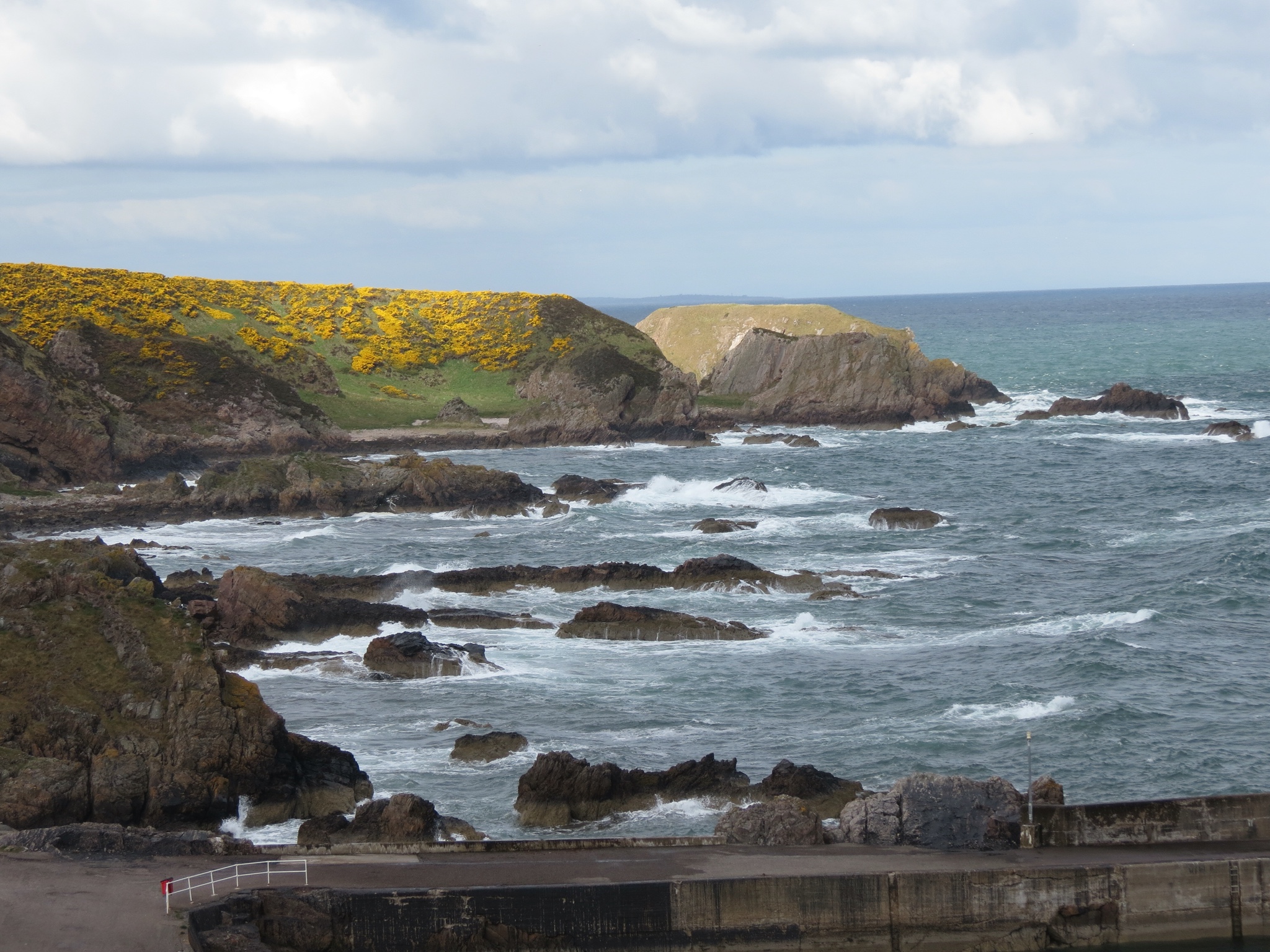
We learned early on that dirt paths were allowable. Thankful for our touring bikes and more durable wheels, those sections have often been the best of all, taking us places not even cars can access. My absolute favorite so far was the morning we left the hostel in Cullen. The route took us away from the harbor, where we reached a cycle path high above the water. We followed the shoreline across the cliff tops, crossing a high via duct and overlooking the sea from a vantage point available only to cyclists and walkers. I wanted it to go on forever.
Already I have many vivid visual images of traveling down this network of cycling routes:
- Cruising along narrow single track roads with passing places
- Dry stonewall defining the neat farm fields across the landscape
- A patchwork of fresh brown furrows, verdant green fields and the sunshine yellow of rapeseed
- Winds buffeting us along the coast, fresh off the sea
- Craggy cliffs and angry waves
- Following a river, crossing over and back multiple times
- Wild flowers blooming in the moist shade along the path – yellow, white and purple
- Gorse bushes lining the roads and paths with their brilliant gold blossoms
- Entering towns on quiet on streets, making our way through neighborhoods and parks
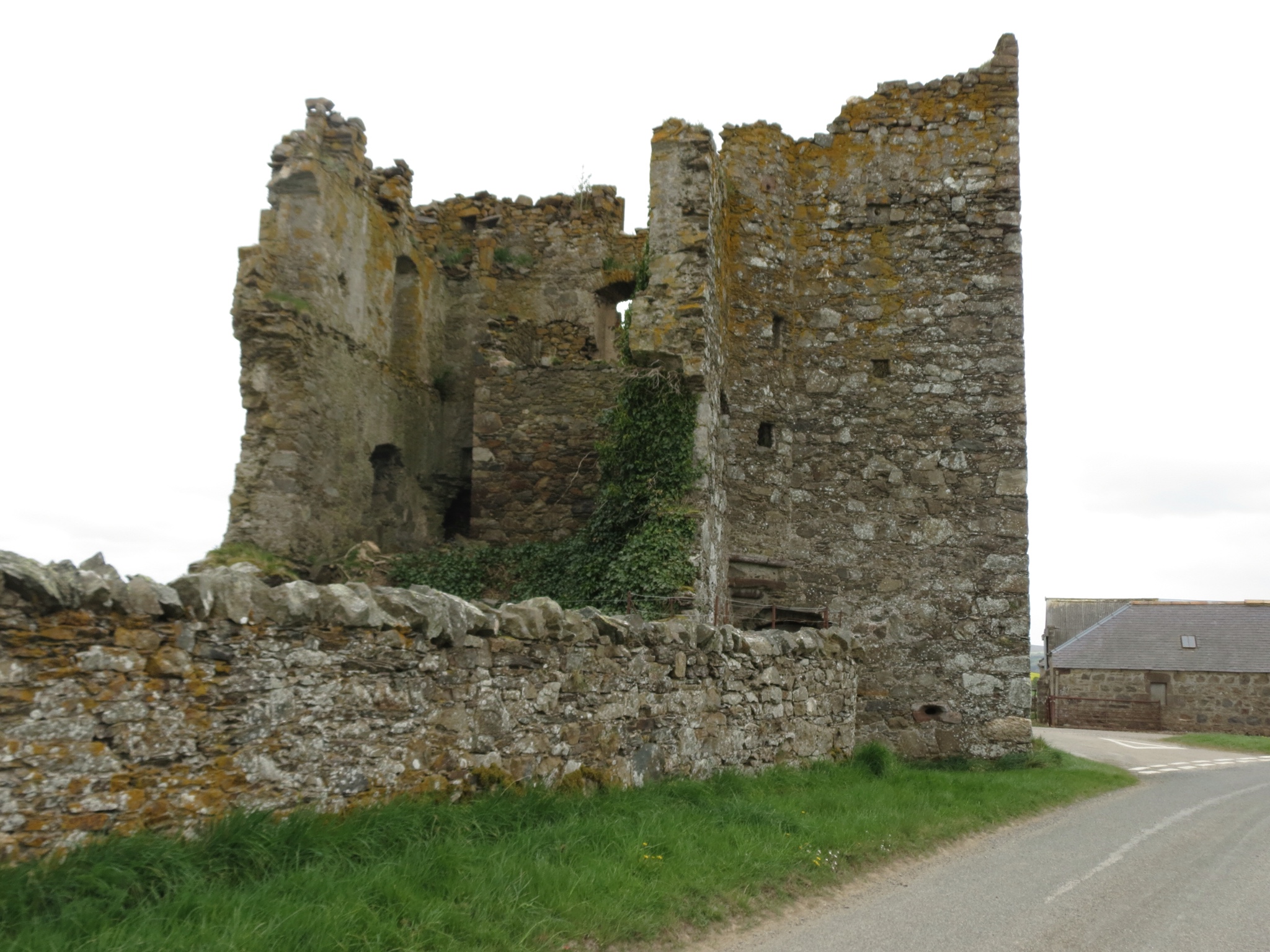
- Climbing a long hill and rounding a corner to see the ruins of a random fortress
- Traveling the coast to look down and see a town nestled in the next valley, bathed in morning sunlight
Thank you, Sustrans, for this great cycling tour of Scotland. We will most certainly continue to follow that sign!


Dear Molly,
On our trip to Alaska in 2014, we drove through Canada, where we saw miles and miles of rapeseed growing. They call it canola, and the bright yellow fields would shine in the sun, and roll on and on to the horizon.
Phillis and Bill
What fantastic pictures you’ve taken! Louise
On Tue, May 17, 2016 at 2:01 AM, Superior Footprints wrote:
> Molly posted: “We have learned to love that sign. The blue arrow with a > bicycle and red #1 has been our guide since arriving in Scotland. We’d be > lost without it. Literally.The National Cycle Network covers the length and > breadth of the UK with over 14,000 miles” >