I’ve Been Bridged!

I could see it from a distance. The red light that meant the bridge was up. Being on the Park Point side of the Aerial Bridge when the roadbed is raised means staying there until the boat passes through. There is no other way off the narrow strip of land that forms the Duluth Harbor.

Most people don’t mind. They know that when going over to Park Point there is a distinct possibility they may need to wait for the bridge in order to return. And today I was solidly in that camp.

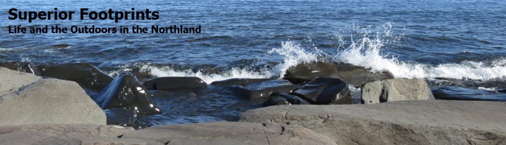
I’d chosen to do an easy bike ride instead of a hard workout. It was one of Duluth’s finest days, with sunshine playing off Lake Superior and comfortable warm temperatures. Cycling along the Lakewalk is by definition a leisurely ride, as it is shared by numerous runners, walkers, dogs and tourists, and winter has provided more than a few heaves in the pavement. Besides, it is prime territory for just looking out at the lake.

Cycling down Park Point and back is easy going. It’s flat and straight, with plenty of shoulder. I love looking at the jumbled assortment of houses along the way, from tiny cabin-like homes, to huge modern structures built high enough to see over the dunes to the lake. They are wedged close together and sometimes one in front of the other, all trying to get a piece of the prime beachfront or harbor shoreline. And there always seems so be an abundance of flowers. The area must be a magnet for zealous gardeners.

So approaching the end of the line of cars waiting for the bridge, it was an easy choice to swing onto the pier and just take it all in. It didn’t matter that the bridge was only half way up and that it was the Vista Queen tour boat going under instead of an ore boat of foreign freighter. It was an opportunity to slow down, take a break and have a closer look at what was around me. Like the bridge coming down, right over me. Like the view of the bridge, from below. Like seeing the bridge from the harbor side – how often do we look at it from there? No need to rush back and cycle over when the bridge was back down. After all, I had all the excuses I needed. I’d been bridged.

The calm after the storm

I don’t remember the big Duluth flood of 1972. Odd, I lived here, and I can’t claim I was too young to remember. We weren’t here for the recent rainfall in Duluth or yesterday’s flooding, but we followed it closely on the web as water tore through the city wreaking havoc and leaving devastation in its path.

We drove up to Duluth in the evening. By that time, the day had cleared, the sun was setting and the air was calm. We had only one detour off I35, south of Cloquet, and there was an eerie beauty to the standing water on the roadside. Before reaching the top of Thompson Hill, we could see a double rainbow in the sky, terminating down in the troubled city of Duluth in the distance. It seemed to be an omen. The remainder of the route was clear, including the tunnels, yet we were almost the only car on the road. Emerging from the final underground portion, we could see a flock of ships in the now calm waters of the lake. For all the day’s turbulence, it was a strange feeling to see it all in the quiet afterglow of the day. We were traversing streets that had suffered only water and mud, not collapse, so the day’s pictures felt surreal in comparison.

Reaching our home, we were pleased but not surprised to find it high and dry. Blessed with the lack of a basement, our landscaper‘s effective water management planning, and being perched on a hill kept it out of harm’s way. But we now understood the reality of the creek’s high water mark and set-back regulations for building which had seemed so absurd at the time.

We immediately headed across the street to see Amity Creek. Having seen earlier pictures of the gazebo at “The Deeps” surrounded by swirling, angry water, we were eager to see it for ourselves. The water had receded significantly, and the creek was back within its rocky borders, mostly. It was still thunderous and raging, and far higher than we’ve seen it before, but had returned to some resemblance of a creek. But all around us were remnants of its earlier rampage. There was mud everywhere, and huge trees and limbs were thrust against anything left standing, showing us the outline of where the thrashing water had overrun the area. The power of rushing water.

Here are some during and after pictures of the footbridge and gazebo from three different perspectives.  The flood pictures were taken by others.  The after pictures I took the next day.

This flood I will remember.  Even though I wasn’t here.

The Best of the Canadian Rockies

After spending a week in the Canadian Rockies with our son, Erik, we have compiled our list of Bests. As a point of reference, our focus was on hiking and the outdoors, which has a clear influence on our choice of categories.

  • Best Drive – Highway 93 (Icefields Parkway) entering Jasper, for all the wildlife we saw in a short span
  • Best View – Wilcox Pass, with snowbound mountains in all directions
  • Best Lake – Glacier Lake, for its blue-green coloring, mountain and forest surroundings, and absence of people. (We gave this the Best Campsite vote also.)
  • Best Hike – Plain of Six Glaciers, for the uniqueness of traversing snow, wildlife sightings, views and avalanche!
  • Best Waterfall – Stanley Falls on Beauty Creek, for being tucked away, unimpeded by railings and extensive length
  • Best Wildflowers – Calypso Orchid, for it’s delicate purple shape and Indian Paintbrush, for it’s brilliant red color
  • Best Wildlife Sighting – Mama Bear and three cubs
  • Best Boating – The illicit rowboat on Fifth Lake
  • Best Meal – Hearty soup and slices of thick homemade bread at the Teahouse at the top of the Plain of Six Glaciers
  • Best Restaurant – Earl’s in Jasper, for the view, outdoor patio and good food  (Erik gave their Albino Rhino the Best Beer vote too.)
  • Best Lodging – Paradise Lodge and Bungalows in Lake Louise, for the impeccably maintained log cabins, cozy interiors, gracious innkeepers and the breakfast treats and coffee in the lodge
  • Best Coffee Shop – Bear’s Paw in Jasper, for the superb pastries and local ambiance

We also compiled a few fun statistics from our trip:

  • Total distance driven = 600 miles
  • Total kilometers hiked = 100 km  (62 miles)
  • Longest Hike = 15 km  Glacier Lake Trail
  • Most Elevation Gained = 2,276 ft  Glacier Lake Trail
  • Highest Elevation Reached = 7,750 ft  Wilcox Pass Trail
  • Steepest Hike (most elevation gained per km) = Wilcox Pass Trail
  • Usual morning temperature = 45 F
  • Usual afternoon temperature = 58 F
  • Highest afternoon temperature = 70 F
  • Wildlife seen: bears (4 grizzly, 11 black bears), elk, gray wolf, marmot, porcupine, mountain goats, mule deer, chipmunks, Clark’s Nutcracker, grouse, woodpecker

There is very little that is second-best in the Canadian Rockies!

What a difference a week makes

Our last day in the Canadian Rockies. It meant retracing our route back down the Icefields Parkway to Banff for our final night. Just one week since we journeyed north, but already there was change.

The timing of this trip was no accident. It had to fit between Erik’s graduation and starting his new job. But it also coincided with our philosophy of traveling in the shoulder or off-season. There are a few drawbacks to be sure, but the advantages suit our style. It means avoiding crowds and having places to ourselves. It’s simpler, less stressful and more economical.

The main barrier on this trip was the reduced access to hiking trails. Many were still closed due to snow, and more than once we had to change plans on the fly when faced with weather conditions. Today was a prime example. On reaching our chosen trail head, not only could we see that the hike started in the snow, but hikers preparing to leave were outfitted with gear and clothing we clearly did not have. Good sign that we should seek a different trail at a lower elevation. But fortunately, the area is filled with alternate options.  We were not able to summit peaks or access some passes.  Wildflowers were only just beginning to bloom, temperatures were chilly to cold at times, and some areas had yet to green up. But early spring conditions have their own appeal.

On the flip side, we rarely shared trails with anyone. Major sites had only a handful of visitors. Restaurants greeted us eagerly and offered prime tables with views. Innkeepers were still fresh with the season opening and offered lower rates. And the volume of RVs and tour buses on the roads was easily tolerable.

Our return route gave us a taste of high season. We traveled on a Saturday, and visitors abounded in each turnout and viewpoint. Reaching Johnston Canyons which we visited practically by ourselves the previous Saturday (granted it was the day that snowed), we were astounded to see cars, trucks and RVs spilling out of the ample parking lots onto both sides of the road! If we weren’t convinced of our early season strategy by then, that sealed it.

We also found previously ice bound lakes to be opening up. And wildlife was in great evidence. We got our first close up look at elk with huge racks, at two different spots along the road.

Banff was teaming with activity when we arrived. The source was the annual Banff National Park Bike Fest, and that day they were holding criterium races, on a 1 km loop around the main streets of town. We’d never seen such events before, and with the help of a local who explained the rules to us, we joined the spectators lining the route and enjoyed the excitement of the races.  It was a fun and unexpected way to end our trip.

We’re sticking with our strategy.  We picked the right week.

Maligne Lake – Timing is Everything

Molly canoeing on Maligne Lake

Our plan was to spend the day canoeing on Maligne Lake. We held off until Friday, as it had the best weather forecast during our stay in Jasper. The rain did indeed cease, and the clouds lifted enough to reveal the mountains, mostly. There even were small patches of blue sky. We got an early start to maximize our time on the water. But our timing was off. Emergency road maintenance on the only road to the lake required a 2-day closure at starting at 1:00pm. Today. All day suddenly became a few hours. We did get out in the canoe, and the lake was blissfully calm. It was great canoeing weather, and we relished the quiet and peaceful environs. Maligne Lake is about 14 miles long, and we probably only saw the first couple of miles. But it was preferable to seeing more of it from one of the tour boats. The canoe was more our style.

Mama bear and three cubs

On our way up to Maligne Lake, we had impeccable timing. A mama bear and three cubs were placidly eating plants on the narrow strip of land between the road and the river. We were only the second car in what became a major “wildlife jam” and had a close up view of the activity. They were easily in sight, and the curious cubs kept coming up to the road to inspect the truck in front of us. Surprisingly, mama bear never followed them, but she certainly kept her eye out and we had no doubt she would follow rapidly if necessary. The cubs were especially active, and the group kept us entertained until they finally moved to a more obscured spot behind some bushes. That was our best bear sighting yet!

Erik after conquerying Patricia Lake

The afternoon turned out to be beautiful. The sun came out and it even felt warm. We did some more hiking then enjoyed spending time around our resort, which was on Patricia Lake just outside Jasper. Erik kept eying the lake and the challenge it presented… Sure it was cold, but should he jump in? Yes, why not! First he made sure the hot tub was ready, then into the water he went – much to the amazement and amusement of other guests. Leave it to a Minnesotan!

We topped off the day by returning to Earl’s restaurant in Jasper, this time dining on the outdoor patio. They had heaters and blankets, just in case, but we didn’t even need them. The timing was just right for dining al fresco.

Unexpected Adventure

It seemed like a benign choice of hiking trail. The distance was moderate, the elevation gain was minimal (at least for a hike in the mountains), and its proximity to Jasper meant that it was well traveled and maintained. But the Valley of the Five Lakes held some surprises for us.

Molly at First Lake

As Its name implies, the trail’s main attraction is that it circles five lakes, imaginatively named First Lake, Second Lake… Each boasts a unique shade of jade and blue, depending on its depth. First Lake is the largest and we lingered along its shore to admire the view, stopping at various points for photos. Suddenly, Rich shouted out and pointed down the lake. What he initially took to be a large rock was moving across the lake – it was a bear swimming, and judging by its size, it had to be a grizzly! The bad news is that it was swimming toward our side of the lake, not far down the shore from where we stood. The good news is that it had no bear cubs with it. Our vantage point was such that we could not see it exit the water and get a good look at it, but we knew it was somewhere ahead of us. We allowed Mr. Bear ample time to go on its merry way, then proceeded with caution, making LOTS of noise. You never heard jollier hikers, singing boisterous songs (about bears), clapping and shouting along their way. It worked, anyway.

Erik and Rich on Lake Five

Lakes Two through Four passed by uneventfully, as we duly noted their colors, and warned hikers traveling the opposite direction about Mr. Bear. It was at Lake Five that things got interesting again. Erik was the one to spot two rowboats at the end of the lake. Upon investigation, he noticed that one boat’s chain was locked but not securely attached to the boat… It only took a few seconds to exchange guilty glances and mutually agree on a course of action. Seeing the lake from its center, admiring the loons, circumnavigating the tiny island, and investigating the end of the lake around the bend was sinfully delightful. And we enjoyed every minute of it!

Bear paw prints

Our afternoon hike was just a short distance down the road, and took us to Wabasso Lake which was created by beavers. By then we were spoiled by the five lakes, and found its brown waters less appealing. What was of most interest was actually underfoot. In the muddier sections of the trail recent wildlife footprints could easily be seen. We saw elk or caribou, but my favorite were the bear prints, some of which clearly showed the claws. Just like the morning encounter, that was close enough for me.


Jasper, in the rain

Today the mountains disappeared. Rain and low clouds obliterated the peaks we have come to love seeing as a backdrop to everything here. And it posed a question – what to do on a rainy day in Jasper? The Info Center had plenty of ideas for us, and we were divided on the opinion of hiking in the rain. The answer was to divide and conquer – Erik and I went ahead with the original plan to hike to Christine Lake just outside of Jasper, while Rich enjoyed a quiet and dry morning relaxing in our cabin.

Erik at Christine Lake

Decked out in our rain gear we set off down the trail. Soon the trees overhead sheltered us from the bulk of the raindrops, and we found the hike to be quite pleasant. Once again, the nature of the environs were different, this time a less dense forest of pines with a lot of undergrowth. The spring green was a brilliant color and we found the wild flowers to be more advanced in blooming there, including Indian Paintbrush. There were actually three lakes at the terminus, but we liked Christine Lake the best for its tiny islands, outcroppings of rock and pine surroundings. While visiting Virl Lake, the clouds lifted enough to give us a glimpse of the mountains in the background. We returned with wet feet, mainly from thrashing through bushes to avoid some soggy parts of the trail, but definitely glad we had not let the rain deter us from our hike.

In the afternoon, the rain appeared to be abating, so we headed over to Maligne Canyon. The trail along the waterway had the feel of a tourist attraction, with it’s wide proportions and some paved portions. But the views of the deep cavern and tumultuous waterfalls made it worth sharing the trail with others. There were excellent interpretive signs along the way, and helped us understand the complex system of underground water flows that fed the river. Our enjoyment of the spectacle was greatly enhanced by the sun’s reappearance during our visit and the veil lifting on the mountains.

The evening turned out to be very nice indeed. We unwittingly chose a restaurant that was on the second floor, which afforded wonderful views out over the other buildings of Jasper’s main street. Even the mountains decided to reappear.

Experiencing the Icefields Parkway

Peyto Lake

“It’s a scenic drive, not a transportation corridor.” So states the Parks Canada brochure of the Icefields Parkway. Perhaps that’s why the 140 mile route from Lake Louise to Jasper took us 10 hours. The scenery alone was cause for diversion, and there were plenty of turnouts and viewpoints to indulge our appetite for views of the surrounding mountains, rivers, lakes and woods. A favorite stop was the overlook at Peyto Lake. The deep hues of its blue green water contrasting with the snow capped mountains and a bit of luck with the sunlight provided us with an astounding sight.

View from Wilcox Pass

Of course, we did take time to do a few select hikes along the way. Our first was at Wilcox Pass, and proved that every hiking experience has its own unique flavor. This time we followed a ridge line high above the highway. It was wide open terrain, open to the wind, but providing constant views of the peaks around us. Passing above the tree line and into the meadow which formed the mountain pass, we were once again in the land of snow. We managed to continue forward progress crossing the snowy patches by literally following in the deep footsteps of earlier hikers. A few mis-steps revealed just how deep the snow really was! We ultimately reached a rocky pinnacle that provided a 360 degree panorama of snowy peaks. To travel beyond would have required snowshoes, and we were not that well prepared (but we did meet some hikers earlier who were – now we know why!). We took on our fill of the scene, took an abundance of photos, and mutually agreed that we had reached the far extent of our travels for that hike.

Stanley Falls

Or second hike was a hidden gem. Its only marking from the highway was a little hiker sign, and the initial path did not seem to hold much promise. But the Information Center guide had assured us there were six waterfalls, and he didn’t let us down. We soon came upon the lowest of Stanley Falls on Beauty Creek, and were captivated. The thundering creek had cut a deep gourge into the rocks, and the water tore downhill and around bends. We followed the trail upstream, marveling at how perilously close to the edge one could venture – it both afforded excellent views and invited danger. We did indeed find six falls, although it was almost continuous waterfall. It was a hike well worth doing, yet we didn’t meet anyone else on the trail.

Finally, as we closed in on Jasper, our progress was further delayed by wildlife. What appeared to be a long pileup of cars at the side of the road up ahead turned out to be motorists gawking at a black bear. There he was, along side the road, leisurely eating and ambling along. Naturally we joined the throng and took our share of pictures. The next encounter was a gray wolf, frustrated in his attempt to cross the road, and we tracked him just barely in the woods (from the car) until he moved further inland. Our last encounter was with three elk on a smaller road, and they made it clear that they owned the roadway as they crossed in front of us.

Sometimes drives are not meant to be rushed. This was one of them.

Glacier Lake Trail

Rich and Erik on the Glacier Lake Trail

We could have been on a hiking trail in northern Minnesota. We traveled over well worn ground carpeted by pine needles, deep in a green forest with only the earliest spring wild flowers displaying their colors. Sunshine streaked through the branches, showering us with light only when the canopy allowed it through. Sounds of rushing water in overflowing spring streams were easily confused with the rustle of the wind in the treetops overhead.

View from the trail

But as soon as a broader vista was available, the myth was dispelled and it was obvious we were in the Canadian Rockies. All it took was a bit of a break in the trees to see the snow covered peaks beyond. But even better were the overlooks, where we could see mountains in all directions. And every time we saw them, it felt new to us all over again. An amazing vista.

Today we were blessed with sunshine, blue sky and a return to summer! It helped that we followed the knowledgeable advice gained at the Information Center in Lake Louise and chose a hike at a lower elevation, known to be snow-free early in the season. It was a 9 km hike to Glacier Lake, which was over rolling terrain with one long climb up to a high ridge and then down to the shores of the lake. The spring runoff overwhelmed the trail at times, sending us scrambling for footholds or into the surrounding brush in an attempt to keep our feet dry.

Arriving at Glacier LakeBut arriving at the lake was the best part of all. We emerged from the woods to the shores of a turquoise blue lake ringed by snowy mountains. And not another sole in sight. We had a picnic lunch on the rocky beach, soaking up the sun and the view. A bit of quick exploration revealed Campsite viewbeautiful campsites right on the lake shore, and left us envious of others who would be staying the night in such a gorgeous location. We would all have traded our comfy cabin for a tent on the lake in a heartbeat. Even after significant lingering time, it was all we could do to tear ourselves away and begin our return trip. But then, it’s always better to leave wanting more.

Hiking Lake Louise and beyond

The “snow fall” theme for this trip continues, although today it came in the form of snow falling down the mountainside – an avalanche! But I’m getting ahead of myself.

Our destination for today’s hike was the Plain of Six Glaciers. We started off alongside the popular Lake Louise. One can see why its clear blue green water surrounded by mountain peaks is such a draw, but we were happier when we continued beyond the populated tourist trails and ventured into the wilderness areas. We passed through pine forest, followed rushing water, looked up sheer rock faces, and picked our way on rocky footings and across deep snowy fields. As Erik commented, “This is what I came for!”

Tea House at Six Glaciers

The reward for our efforts was reaching a Tea House on the mountainside. It had only been open for a week so far this season, and the staff willingly answered all our questions about how they get supplies up there (answer, helicopter drops once a season plus pack horses). We settled ourselves at a bright red table on the log balcony of the stone building, and savored outstanding soup and home made bread, flavor enhanced by the outdoor experience.

We did quite well in the wildlife department, spotting mountain goats, a marmot, porcupine, Clark’s Nutcracker, and even a mama Grizzly bear and two cubs. The latter were far across the lake, but we followed their progress along the entire shoreline.

Snow resting at the foot of the avalanche

There were signs warning hikers of avalanche danger in the area, and in fact, we could hear and see them up high on the distant mountains. It was on our return trip that the experience became distinctly personal. Just before crossing a large snow field, we heard the telltale sounds, and there directly in front of us was an avalanche, spewing snow above our trail! It looked just like a waterfall coming down the mountain, but the spray and masses of moving moisture were snow not water. The accumulated mounds of snow formed large snowballs that slid down the slope in a very liquid manner. It was fascinating to watch, even though it threatened to cover our path. We watched in amazement, as it poured on and on, wondering if and when it would be safe for us to continue. It eventually came to rest well above our path, and we high tailed it across, only to see it reactivate when we reached the other side.

Day 2 in the Canadian Rockies – never a dull moment.