Tour Preparations

Packing for a cycling trip is not hard.  It’s rather like following a script.  There is no room to improvise.  Literally, every inch of space is already allocated.

It helps to have done this before.  Last year’s trip was the true test, and after two months on the road I can say with absolute certainty that I got it just right.  I had exactly what I needed. No more, no less.  And so I return to my List.  It will not surprise anyone who knows me to find out that I have detailed documentation on every single item I carried.  And despite the brevity of contents in my panniers, my list runs to four pages.  I’m nothing if not thorough.  Want to know how many ziplock bags I used to keep everything dry?  My list will tell you: 8 gallon and 9 quart sized bags.

IMG_5186
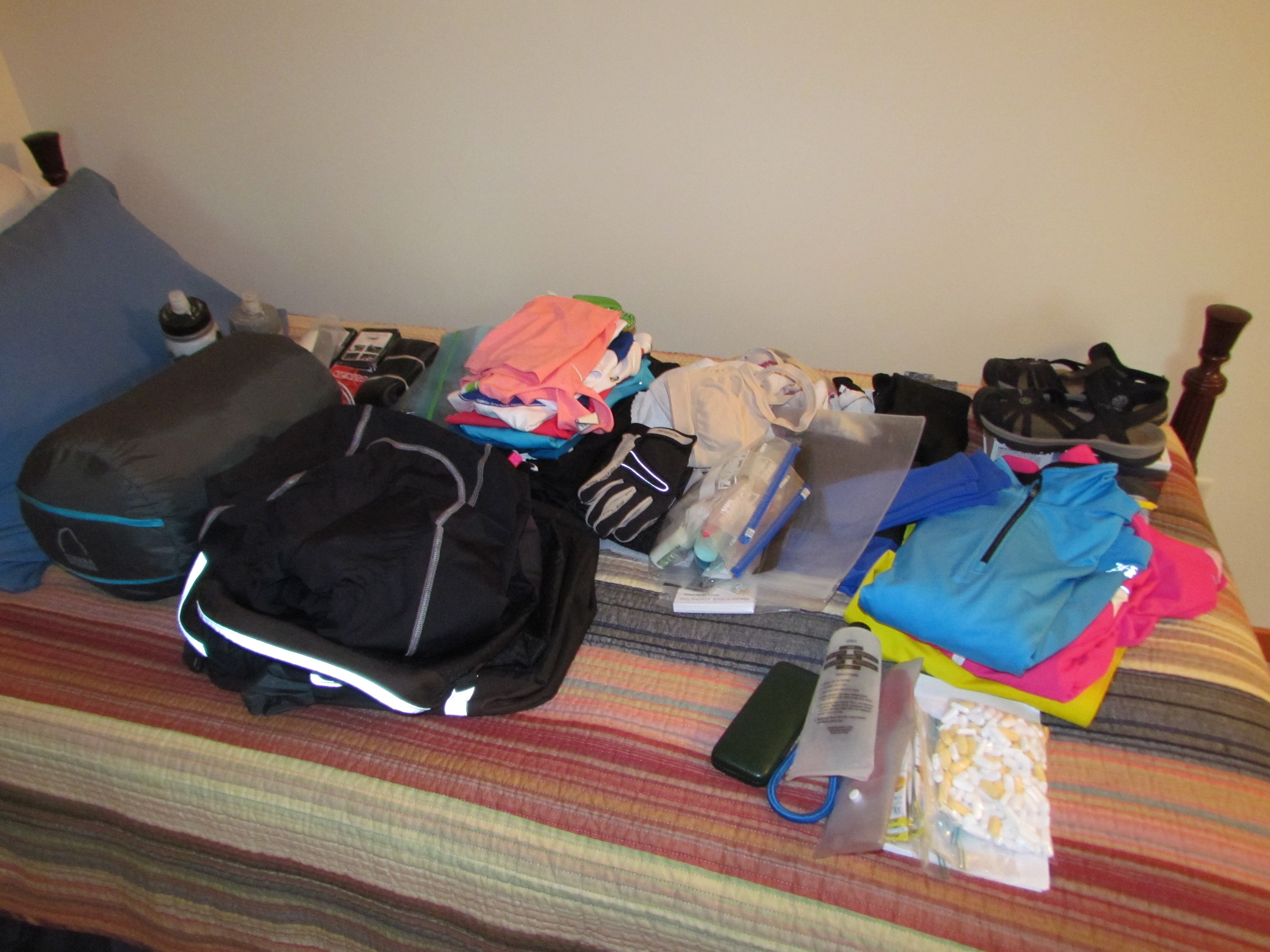
The hardest part is collecting everything.  Where did I put my Swiss Army Knife?  What happened to the little bottles for toiletries?  Looks like I’d better put granola bars on my shopping list.  But before long, I fill my assigned spare bed in the guest room.  All the paraphernalia I’ll need IMG_5188
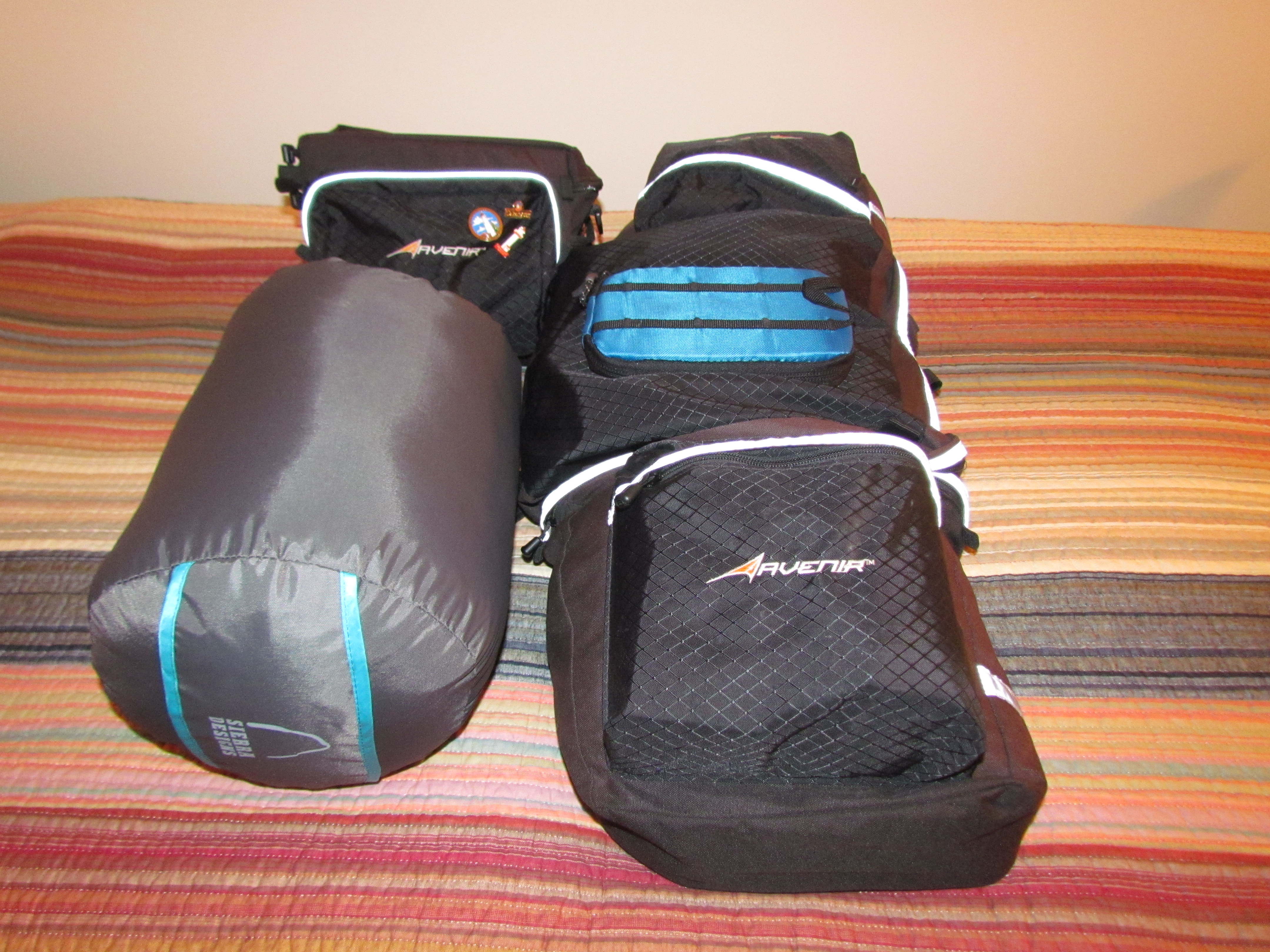
for 4-5 weeks of travel fits on a single size mattress.

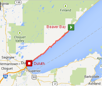
From there, it is a simple matter of stuffing the works into those ziplock bags, squeezing out every last ounce of air and fitting them into my panniers.  If I have any doubt as to where certain items belong, I have only to refer back to an old blog post.  Who knew that blogging would come in so handy?wpid-Photo-Sep-15-2013-902-PM.jpg
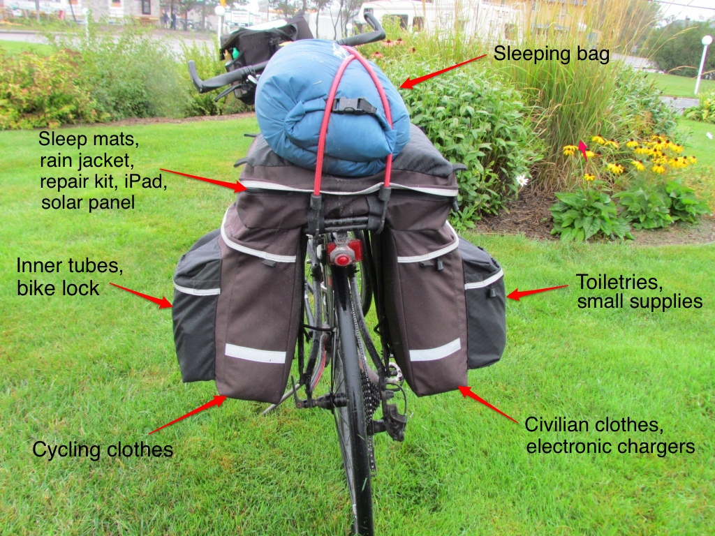
Honestly, it’s a lot harder to pack for the road trip out to Glacier where we will start our Glaciers to the Sea cycling tour.  After all, I have a whole car at my disposal.  There are endless things I can bring, especially as my cycling gear takes so little room.  And I don’t even need any ziplock bags.

Announcing Glaciers to the Sea

Glaciers-to-the-Sea-LogoA year has already gone by since our last cycling trip, so it’s time to push our pedals again and wheel our way through some scenic countryside. After considering numerous different options for our itinerary, we finally chose a trip through the Northwestern states. And as always, we have a name and a logo for our tour.  This one has been dubbed Glaciers to the Sea.

Rich has been plotting our route for months, carefully checking other cyclists’ trip reports, scouting out lesser traveled roads, and going to the greatest level of detail by viewing actual roads and shoulders on Google Street View.  He doesn’t leave anything to chance.  If our route looks a bit windy and twisty, there’s a good reason for it.  The straightest route is not always the best approach when traveling by bicycle.

Map-Glaciers-to-the-Sea-Route

Our route from the glaciers in Montana to the coast of Oregon and Washington

We start off in Whitefish, Montana which is just outside of Glacier National Park.  Rich took great care in selecting our starting point, making sure that we were already over the continental divide before we began cycling.  No climbing up mountain passes if he can help it.  We know there will still be plenty of ups and downs, but we hope the highest ones will already be behind us.  From there we will follow the Clark Fork River.  We learned on last year’s trip that staying in river valleys is the perfect way to minimize altitude changes – as long as we don’t stray far from the water.  After traveling through Spokane, Washington we will cross the high plateau.  That brings us to the next major waterway, the Columbia River, which takes us all the way to Portland, Oregon.

Rich’s brother and his wife live in Eugene, Oregon so we will dip down to visit them.  We’re planning a 3-night stay to rest up, enjoy a few luxuries and spend time catching up.  The final leg will be along the Oregon and Washington coasts, which promise some spectacular views.  After visiting my friend, Anne, in Olympia we will finish up in Seattle. There we will be hosted by some Warm Showers cyclists who stayed with us last summer on their cross-country cycling trip.  Amtrak will then deliver us back to our car in Whitefish.

In total, we expect to cycle about 1,400 miles over 4-5 weeks.  We’ve left it intentionally vague, which allows us to take advantage of opportunities that present themselves along the way.

Friends have asked what we are most looking forward to.  I think we both have the same answer.  The simplicity of the journey.  Traveling by bicycle trims everything down to the Rich and Molly in Jerseysbare necessities.  There are no decisions to make about what to wear – out of two sets of cycling clothes, we put on the clean ones.  Our possessions are few – tablets are our best friends, providing reading material, contact with family and blogging tools.  It’s just us, our bicycles and the scenery.  Oh yes, and our cameras.

We’re excited for this trip, from the glaciers to the deep blue sea.  And everything in between.

Our very own Mountain

It’s not every family that has a mountain named for them.  But that was one of the legacies my great-grandfather left for us.  For the record, this is no piddly little peak.  Mt. Brewer rises 13,576 feet high in the Sierra Nevada Range in California.

William Henry Brewer March 19 1902

William Henry Brewer, 1902

Back in 1860, Josiah Whitney headed up the first Geological Survey of the State of California.  He selected fellow Yale graduate William Henry Brewer to lead the field survey.  Over the next four years, my great-grandfather Brewer traveled over 14,000 miles mapping California’s topography as well as cataloging and collecting geological and botanical samples.

On July 2, 1864 Brewer and his team made the first ascent of Mt. Brewer.  The found the final climb to be much harder and higher than expected, traveling over steep rocks.  But once at the top they were amazed at the view – “Such a landscape!” Brewer exclaimed in his journal, surrounded by a hundred peaks over 13,000 feet.  In fact, from the summit Brewer’s survey party was the first to identify the highest peak in the range, Mt. Whitney.

GMBE 1970

The Great Mount Brewer Expedition, 1970

Over 100 years and three generations later, my older brother, my sister and her boyfriend (now husband) made the second family trek up Mt. Brewer.  Somehow it seemed fitting, as my brother is named after William Henry Brewer.  They boldly named their trip the Great Mount Brewer Expedition, and spent five days backpacking up the mountain and back.  They left the following entry in the log at the top:  “William Henry Brewer and party climbed this peak 106 years after our great-grandfather, William Henry Brewer.”  I was in awe of my siblings’ accomplishment, especially after they were featured in a big newspaper story when they returned.

Mt. Brewer Map

Carl and Erik’s planned route to the top

Now 150 years since Brewer’s first ascent, two of his great-great-grandsons are making the same trip.  My sons Carl and Erik leave this week to scale our family mountain.  If all goes as planned, they expect to complete their journey in three days, but have allowed four just in case.  Since they have planned a circular route, it means carrying all their gear to the summit.   I’ve been informed that only about half the route is on established trails.  Getting to the top requires finding their way off-trail.  They assure me that they are good with maps and a compass.

I’m thrilled that my sons care enough about our family history to carry out this challenge.  I’m excited to think about their new entry in that log at the top.  It’s an adventure I’ve dreamed of doing, but realistically will resort to living vicariously through their anecdotes and tales.  I’m sure there will be plenty to tell.  That’s a lot of mountain to claim and to climb.

Mount Brewer from South Guard Lake

Mount Brewer from South Guard Lake

Restoring Seven Bridges Road

We are about to lose our private cycling and walking trail.  It’s been nice while it’s lasted, but we knew it wouldn’t be forever.  And to be honest, Seven Bridges Road is such a treasure that the citizens of Duluth and our visitors ought to have access to this beautiful drive again.

For over two years, the road has been closed.  Contrary to popular belief, the major damage predates the flood of June 2012 by a couple of months.  The steep banks of Amity Creek became seriously eroded, carving away the land next to the road.  With the landslide area just inches from the roadbed, it became too dangerous for vehicles.  The flood added to the problems, causing a cave-in over a culvert a little further up the road, and further impairing bridge supports for the 3rd bridge.  Since no one lives on that portion of the road, it was a low priority for repairs.

IMG_5150All that changed this summer.  As soon as spring hit, the work began.  Trucks rumbled back and forth in front of our house all summer long as serious reconstruction took place.  Since the land next to the problem area rose steeply alongside the road, it required carving out the hill to move the road inland.  In addition, it meant relocating the cross-country ski trails as well (a project near and dear to our hearts, as we spend many hours on those trails).  We were anxious to see just how they were going to navigate that terrain.  I’ll admit, a few summer evenings we ambled up that way to take a sneak peak, and marveled at the huge mounds of dirt that would eventually transform the landscape.

Recently there has been an uptick in activity.  Longer work hours and even bigger trucks hauling.  Then it happened almost without our noticing it.  The absence of noise.  The lack of truck traffic.  Sure enough, a day or more went by without a single construction vehicle.  Did that mean the road was completed?  We just had to find out.

IMG_5152To our amazement, the pavement was complete and work was progressing nicely on  landscaping the area.  Where the road once went straight along the creek, it now safely curves inland with a berm between it and the edge of the drop-off.  Adjacent to the road, the ski trails follow a new path inland which is strikingly similar to the old route through the woods.IMG_5157

There is a hefty new culvert to replace the old one, and enough heavy duty drainage rocks to handle the worse rains.  All with a new roadbed over it.IMG_5156

The 3rd bridge is still undergoing repairs.  The footings have been replaced, and where the road was falling away from the bridge, a new concrete extension is in the works.  Soon it will be rocked in to look like the rest of the bridge.  A nice touch.

It’s getting close.  I hear the goal is to open the road by the end of the month.  I’d put my money on them making it.

I’ll miss being able to cycle up the road knowing there will be no cars.  It will undoubtedly mean more traffic going past our house.  And I dread the day the motorcyclists rediscover the road, noisily revving their engines as they roar by.  But it’s good to see the road restored.  Just in time for leaf season, when Seven Bridges is in its glory.  Then I can look forward to winter when the steepest sections of the road are closed for the season.  And we will have our private trail once again.

A Century on the Mesabi Trail

Mesabi Trail Century Ride

Our 100-mile route out-and-back on the Mesabi Trail

Three times must make an annual tradition.  With two century rides behind us, Myra and I couldn’t let the summer go by without adding to the count.

After cycling part of the Mesabi Trail on the North Shore Cycling Tour, I thought it would make an excellent choice for our annual outing.  Although it would mean doing an out-and-back ride, it had the advantage of allowing us to cycle side-by-side and chat all along the way – a signature feature of our rides.  Somehow we never run out of things to talk about.  And it sure makes the miles fly by.  All 100 of them.  It didn’t take long for Myra to buy into the idea, and as soon as we could agree on a date, it was set.

wpid-Photo-20140728212925.jpgWe were greatly impressed with the Mesabi Trail. The last time I rode it was years ago, and it was largely discontinuous – more a hopeful concept than a reality.  That has now been reversed, with 115 miles of trail stretching eastward from Grand Rapids toward Ely.  Only short sections, mostly in towns, left us on city streets or country roads.  Each of those sections, as well as the rest of the trail was well marked.  Between their signature Mesabi Trail sign posts and directions on the roads at all turns, we had no opportunity to make a wrong turn or mistake in following the trail.  That was significant!

We started our journey at Eveleth and followed the Trail west just short of Keewatin, then turned around and returned.  That allowed us to use the most complete portion of the trail.  Unlike “rails to trails” paths that follow a relatively flat and straight course, the Mesabi Trail winds through mining territory, skirting open pits that are now lakes and winding over and around mounds of tailings.  There were plenty of ups and downs in the rolling terrain, which kept things interesting without being too taxing.  It was fascinating to see how the land is transforming with new growth.  And there were frequent towns along the way to keep things interesting.

Just as we were nearing our turn around point, the dark clouds that we were trying to ignore began to drip.  Then rain came in earnest, and within a few miles we were in a serious downpour.  With the gusting winds, it cooled us down rapidly, but didn’t dampen our spirits.  It was all part of the experience we figured.  But we would be happy to see it stop.  After taking cover 15 miles later under a trail shelter near Hibbing to add layers under our inadequate light jackets (who thought we’d need real rain gear?) and snarf down a snack in hopes of fueling some warmth, we continued our journey.  It wasn’t long afterwards that the rain dribbled to a stop, improving our outlook significantly.

The return trip didn’t feel like covering the same old ground at all.  Somehow things look different coming from the opposite direction, and we often remarked on things we’d missed seeing on the first pass.  Before long we had dried out and were counting down the miles to the end.  Those last 20 miles are always the hardest, but we had no problem conquering them.

IMG_1423I didn’t have much appetite for taking pictures once the rain hit.  So we will have only mental images of the fun that we had, the beauty of the trail, and the soggy mess we presented under that shelter.  Perhaps that’s for the best.  But I couldn’t resist a final shot at the end of the day – victorious after our 3rd Century Ride.

Soon we will have to start planning next year’s Century.


Thimble Berry Jam

There is something irresistible about berries.  Especially those growing of their own free will, just steps from our doorway.  Begging to be picked.

IMG_1416
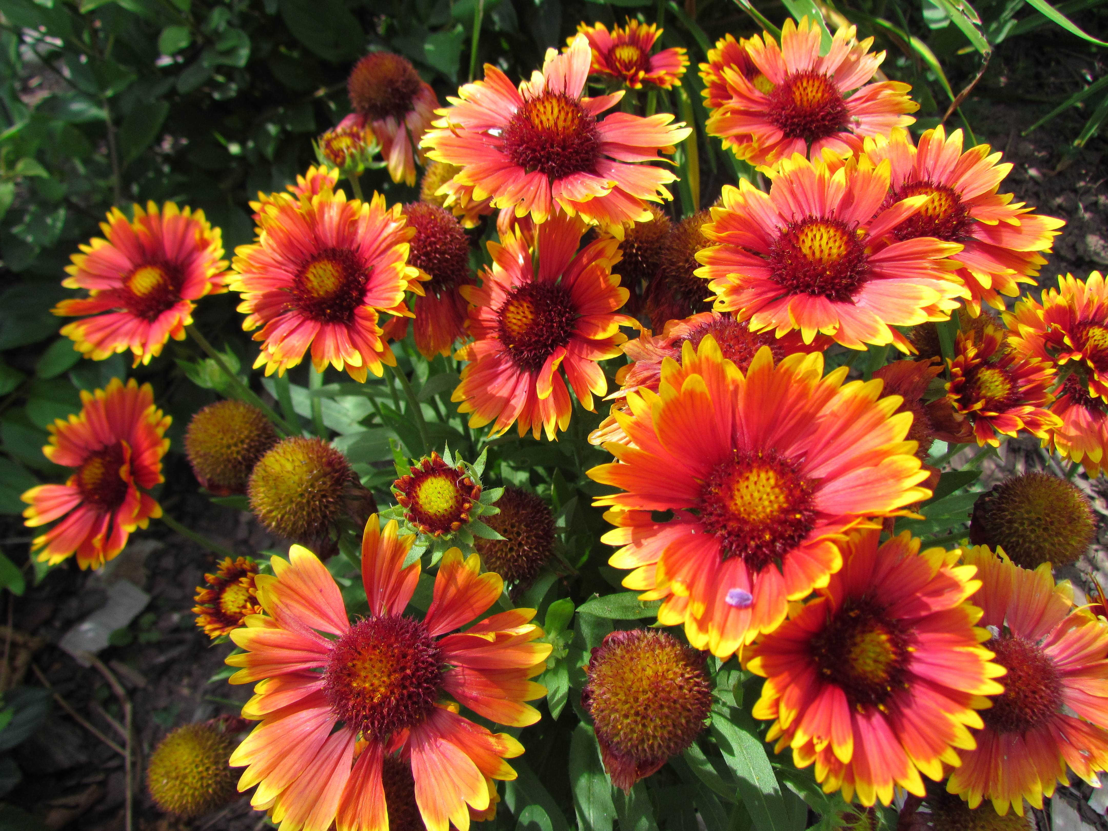
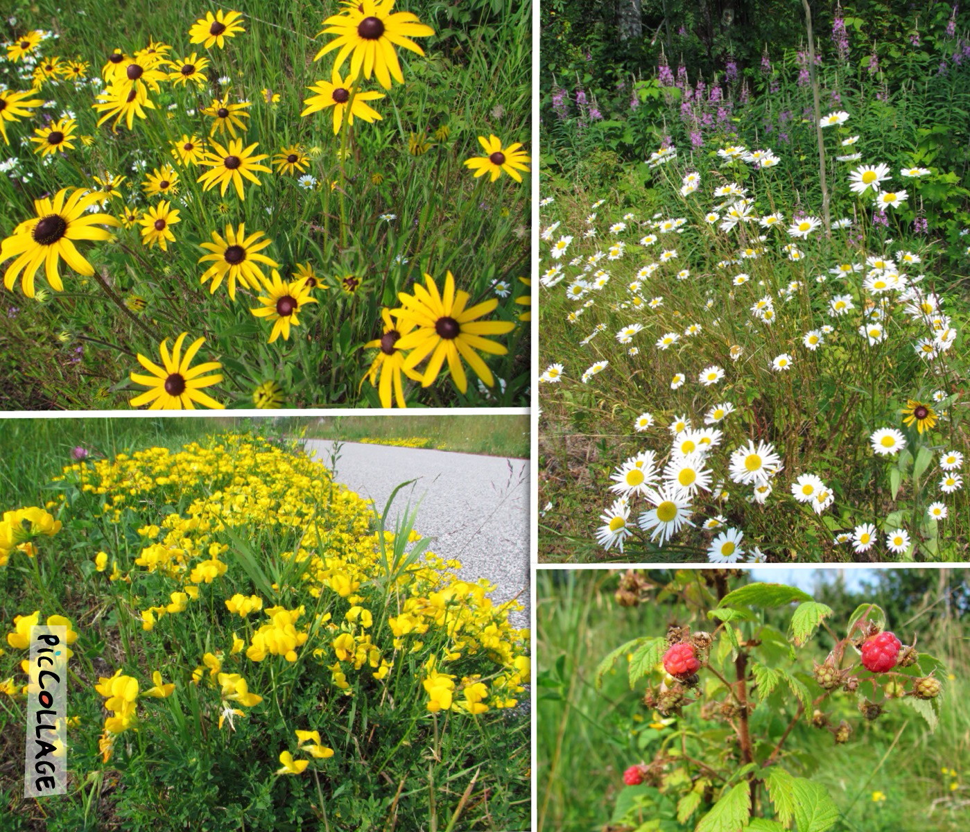
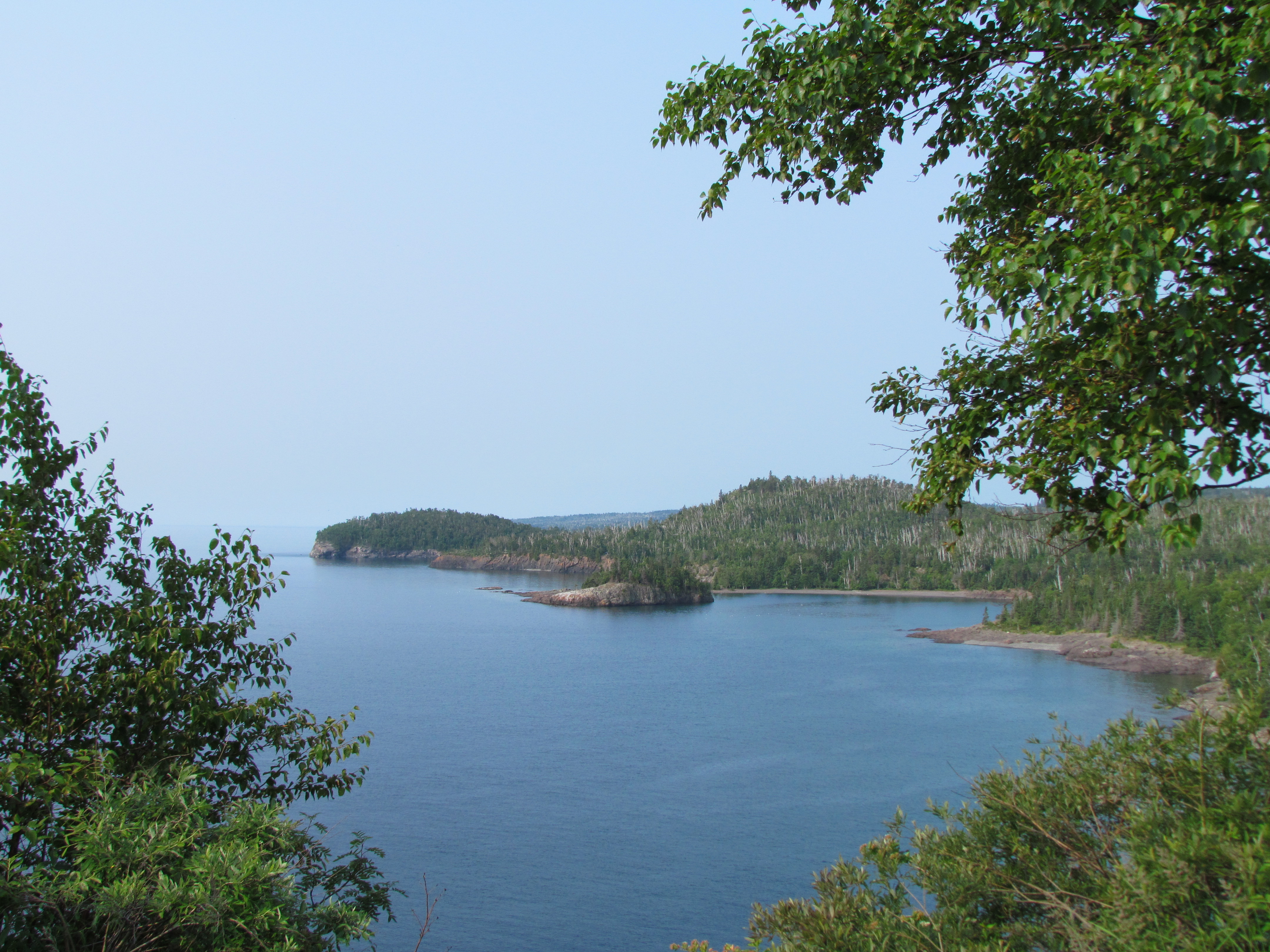
We’ve seen the thickets of thimble berries growing in “our woods” every summer.  And each year the birds, critters and perhaps other berry lovers have gotten to them first.  This year appears to be a bumper crop.  Loads of big red berries hang from the branches, with many more promising to follow.  We promised ourselves that this year we’d pick them and make jam.

Thimble berries take me way back.  Julie, one of my best friends in school, went blueberry picking each year with her family, and I went along.  Not being a real lover of blueberries at the time, I was lured away by the sight of huge red raspberries not far away – something I truly adored.  I picked and picked and returned to the others quite smug and victorious.  That is until I was informed that I had picked thimble berries, not raspberries.  I’d never even heard of them before.  I quickly learned that they were not so tasty for eating.  But to make up for it, Julie’s mom turned my cache of non-raspberries into a delicious jam.

IMG_1411A few days ago it became clear that the time was NOW.  At least for the first round of picking.  Each bush had one or more perfectly ripe berries.  So Rich and I ventured out to see what we could gather.  Although it meant only a berry here and a berry there, the bushes were plentiful enough to make it a worthwhile hunt.  Moving across the road, we reaped even more berries – enough to come up with 4 1/2 cups between us.  And judging by the remaining unripe berries, we could easily duplicate that several times if we keep diligent watch.

IMG_5146I had to hunt down a recipe for jam, and was surprised just how simple it was.  Only two ingredients in equal quantities – thimble berries and sugar.  It also warned that cleaning the berries was as time consuming as picking them.  I won’t argue that point.  And picking was a lot more fun.

I dug out my canning supplies, bought more canning jars and IMG_5149reacquainted myself with the process.  Then I dug in.  (Notice “we” became “I” at this point…)  Soon the house was redolent with sweet berry smell as the mixture simmered on the stove.  It wasn’t long before it began to thicken and resemble jam, and filled more jars than I expected.

Somehow getting something that good from free fruit is deeply gratifying.  Now I suppose I’ll be expected to share it.  And why not – there’s more where that came from.

My Memory Garden

IMG_5091IMG_5097 IMG_5096IMG_5092 IMG_5094 IMG_5093 The blooms are gorgeous. Brilliant reds, oranges, yellows and purples populate the garden. For someone who knows next to nothing about gardening, it is a recurring summer miracle to watch the perennials grow and burst into color. It lifts my spirits each time I walk up the front steps and take it all in.

With time, the plants have grown and now compete for space, trying to crowd out nearby blossoms vying for attention. I have learned how to sow the seeds in the fall to spread the plants, thereby contributing to the confusion of color and congestion. But I love it that way. The more the merrier.

In a yard that’s left “natural” with long waving grasses and otherwise filled with trees, the garden can’t help but be a focal point. It’s the only spot in the yard we have cultivated.  It’s special.  In more ways than one.

It’s memory that brought this garden about. When my mother lost hers to Alzheimer’s, one of her loving caregivers gardened her back yard into a symphony of color. It was a delight to Mom, who loved both flowers and bright colors. It was a constant in her diminishing ability to understand. Flowers were still flowers, and a never ending source of joy to her.

So when we built our house, the first person we turned to for developing our garden was Mary Jane, the caregiver. She brought all her gardening skills to bear on the project, and left us with a beauty reminiscent of Mom’s back yard. She has become the caregiver of memories for me. Preserving a piece of Mom along with beautifying our front steps.

I know Mom would love our garden. I think of her whenever I look at the flowers.  I smile at the brilliant colors. And my heart is filled with warm memories.

Sharing the North Shore

NShore Day 5

Day 5 – Beaver Bay to Duluth MN, 52 miles

It seemed most appropriate that we spent this final day of the Minnesota North Shore Tour with Bike Tour Vacations following the tour’s namesake.  It’s a stretch I’ve done many times, and is very familiar.  But cycling with a group who had never been on the North Shore before gave it a whole new twist.  It was fun to re-experience the sights and lake views through the eyes of those seeing it for the first time.

Starting in Beaver Bay was a treat as we had immediate access to the longest completed section of Gitchi-Gami State Trail, a wonderful bike trail on the North Shore.  It afforded us hassle-free cycling away from the highway.  In addition, it was lined with wildflowers blossoming in brilliant colors.  It was interesting to note the difference in season compared to inland from the lake.  Berries were just beginning to ripen, and we still found fireweed and a few remaining lupine due to the cooler climate.

Photo Aug 01, 6 54 02 PMIt’s also worth nothing that our numbers swelled to 13 for this portion of the tour as we were joined by Jim’s sister, her husband and another couple.  They were a welcome addition to our lively group.IMG_5052

We had many stops today due to the numerous sights on that stretch of the North Shore.  First was Split Rock Lighthouse – a must-see for any tourist.  Personally, I enjoy being there before the park opens for tours to beat the crowds.

IMG_5055 IMG_5057 IMG_5058Next up was Gooseberry Falls.  I’ve taken so many photos of the iconic falls that I felt compelled to try a different view.  This is how it looked from the bike path below the highway bridge.

IMG_5083Everyone was required to stop at Silver Cliffs, to take in the view and imagine the original highway that clung to the cliffs on this stretch of the North Shore.  I never realized before reading the signs that it has the longest views on the Minnesota portion of the North Shore.

IMG_5087IMG_5089 All day long we leapfrogged each other, collected at sights and exclaimed over the beautiful weather.  Our final stopping point was for refreshment at the Mocha Moose on Scenic 61.  Then we pushed on to the end, finishing up on the Duluth Lakewalk.  It was a glorious end to our 5-day tour.  And I was ever so pleased that the other guests found the North Shore to be as special as I do.  Sharing with them was a fitting finish to the trip.