Cycling with Mother Nature

We operate by our body clocks. We were up at the usual early hour, but lost an hour to the Michigan time change. It seemed strange that the sunrise was just after 7am, but we enjoyed watching it from our beach just the same.

Today we cycled coast-to-coast across the Keweenaw Peninsula and then up the eastern shore to Houghton. There is not a lot of population on the peninsula, so I decided to focus my camera on the beauty of the nature we encountered along the way.

Sunrise over the western shore of the peninsula at Ontonagon.

We have been enamored with the windflowers blooming along the roadside throughout our trip. My favorite are the purple blossoms.

Fall colors are definitely beginning to show in the maple trees.

Fantastic clouds formulate over pastoral farmland in the interior of the peninsula.

Tall pine trees line the road going north from Baraga to Houghton.

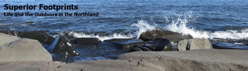
The eastern shore, cycling along Keweenaw Bay.

We experienced another aspect of Mother Nature as well today. After having been blessed with sunshine throughout our trip so far, our luck ran out less than 20 miles short of our final destination. We thought we had out-biked the rain, leaving a few thin showers behind us, but that was nothing in comparison to the squall that slammed into our path. Within a matter of minutes, the temperature plummeted, sheets of rain came pouring down and gusts of wind blew right into us. Fortunately, Rich spotted a thick grove of pine trees across the road. We dashed over there and huddled in the relative protection of the trees waiting for the rain to subside. I was amazed at how well sheltered we were in comparison to the torrents falling on the road. The rain did indeed abate allowing us to resume our ride, although it was wet and chilly cycling (Rich called it “miserable”) and semis showered us with roadspray. Then just as suddenly the sun returned. The amazing warming power of the sun was such that when an ice cream stand materialized on the side of the road, we didn’t hesitate to stop. Two huge blackberry smoothies were happily consumed as we parked ourselves on a picnic bench and basked in the sunshine. Mother Nature wooed us back into her good graces that easily.

Wilderness Cycling

I have to compliment my tour planner and co-cyclist, Rich, on today’s route. It was stunning! If you like wilderness and quiet scenery, this is the itinerary for you. And I think even Rich was awed by the perfection of today’s ride. In fact I know so – he said as much!

After a necessary 10 miles on Highway 2, we turned away from traffic and civilization and headed into the wilderness. The first 15 miles were on a road leading to the Porcupine Mountains Wilderness State Park. It could have been a bike path. We shared the road with only a few passing cars and traveled undisturbed down the tree-lined lane as mile after mile of smooth pavement uncurled in front of us. We were prepared to find hills, which we did, but most were reasonable grades alternating between up and down.

We then turned onto South Boundary Road, which traverses the perimeter of the park. Our near-solitude continued as did our appreciation of the sun, the trees, the rivers and the wilderness. Having hiked in the area, we had vivid memories of clambering down and up the steep sides of the ravines in our path. We were relieved to find that road construction techniques alleviated such dips. Nevertheless, the road began to climb steadily, and looking into the distance we could see the high ridge of trees defining the summit – a sobering sight. It was a solid 10 miles uphill, mostly a gentle grade, but a challenging pitch at times. It gave us great pleasure to top the hill and begin our descent, which lasted 15 miles. We faced a strong headwind as we neared Lake Superior, but had no complaints mixing that with our downhill rush.

We rejoiced to see Lake Superior in the distance, and the view upon arrival was impressive. The pristine sand beach was enhanced by trees and white crested waves rolling into shore. What a difference from the rocky coastline we are accustomed to on the North Shore, yet beautiful in its uniqueness. Our final 15 miles closely followed the shore. Our view of the lake disappeared when private land intervened, but the water was close enough that we could get a glimpse of it down the driveways and periodically between properties. For us it was enough to know the great lake was there. Traveling lakeside also had the advantage of being blessedly flat. This time at the end of the day we left the hard work behind us and glided up to our motel near Ontonagon.

This trip just keeps getting better.

Cycling sights – a purple cow?

It felt a lot milder when we set off from Bayfield this morning, and indeed at 52 degrees was nearly 10 degrees above yesterday’s start. We saw a beautiful sunrise over Lake Superior and enjoyed a quiet ride alongside the lake down to Ashland. It was a good start to day 2 of our Trans-Superior Cycling Tour.

Not even the early morning hours can deter Rich from his tourist stops. This morning as we passed what appeared to me to be a junkyard, he shouted out, “Look! A purple cow!”. Surely he wasn’t going to stop for that? I should have known better. He eagerly dragged me back to see this creature, which stood among other large scale wood carvings, and required a picture. Before we could make our retreat, we were scrutinized by a man who materialized in the drive. Once he determined that we were harmless, he offered to show us around his father’s studio. He led us back to a fairy tale-like set of buildings in a garden setting, and a workshop full of intricate carvings. Who would have guessed? Perhaps Rich’s weird taste has merit now and then.

Along our way we discovered a distinct phenomenon. Each rise brought us nice warm air, and on each downhill the temperature plummeted. Soon I felt as chilled as yesterday! I eagerly anticipated the hot breakfast that awaited us somewhere in Ashland, and was ultimately rewarded with hot coffee and pancakes. We exited the restaurant to an entirely different day. The looming clouds overhead had dissipated, leaving sunshine in their wake. Once we turned inland, away from the lake, the temperatures rose quickly and we cycled through a real summer day. We had a solid tale wind, which provided little relief from the warmth, but we readily traded that for the extra boost it gave us.

I have decided that each day’s cycling on this trip poses a unique challenge. Today’s was highway miles. I knew we had 40 miles of cycling along Highway 2, which is a main thoroughfare, and was apprehensive about the traffic. It then became 50 miles when our alternate route to avoid a section of highway was torn up for repair. Thankfully, my fears were for naught. A large portion of the distance was on new pavement with wide shoulders, the traffic was very reasonable, and trucks gave us a wide berth whenever possible. Probably the larger downside was that it was a long, straight road with little diversion in scenery. Woods dominated over farms this time, and we passed few sights that gave us reason to pause our ride. We did find the Hanka Finnish Homestead Museum outside of Ironwood to be a pretty and peaceful park with a fun giftshop of Scandinavian goods.

Today’s destination was the Black River Crossing B&B outside of Bessemer. We’d been there last winter, and enjoyed it so much we were eager to return. Our hosts Sue and Stan greeted us like old friends and saw to our every need, as before. We spent a peaceful afternoon in the lovely garden surroundings, with the sounds of waterfalls, light breezes, and sunshine playing on the beautiful plantings and flowers. We’ve already been invited to their evening barbecue with friends, so we needn’t even venture out for dinner. And we’re more than happy to be pampered. We feel we’ve earned it.

First Day Cycling – Idyllic

We could not have asked for a better day to start our Trans-Superior Cycling Tour! Well, okay, I readily admit that it was a might chilly when we set off. A bank temperature reading confirmed that it was only 43 degrees. And I shivered and stiffened up during those initial miles. But the sun rose quickly and warmed our bodies and my attitude.

Traveling along highway 13 to Bayfield was a cyclist’s dream. The road surface was excellent, there was a good shoulder, and traffic was light. Add to that a perfectly sunny day, the wind mostly at our backs, and pastoral farmland scenery interspersed with forest and views of Lake Superior and you have a ride that can’t be beat. I might not have chosen to have the hilliest portion of the route in the last 20 miles, but even that could not detract from the experience. Probably the biggest drawback to the day was knowing that we could never replicate its perfection.

True to the nature of this tour, we made several stops along the way. An historical site with a Finnish homestead and windmill caught our attention, and proved to be beautifully cared for and well preserved. The first wayside rest with a view of Lake Superior demanded a visit. We couldn’t pass up the “Best Food on the Circle Tour” so we paused at Ruxy’s Cottage Cafe in Port Wing for a fresh cinnamon roll. The harbor in Cornocopia was a scenic diversion, with picturesque boats and little shops. And everything was enhanced by the beautiful sunny weather. Probably our most interesting stop came about completely by accident. I happened to spot the Lake Superior Binational Forum Symbol – the same one that adorns our cycling shirts – on the door or a roadside building. Returning to investigate, Bruce Lindgren stepped outside, and we soon learned that he is a member and co-chair of the Forum! He was pleased to learn of our association with the Forum and a lively conversation ensued, fueled by our mutual care for Lake Superior.

Arriving at our destination, the descent into Bayfield was a picturesque (and welcome) sight. Sailboats and other vessels dotted the deep blue waters of Lake Superior as the quaint buildings of this pretty town came into view. At the first available cafe, we deserted our bikes and emerged with lake berry breeze smoothies and consumed them in the warmth of the sunshine. Oh, were they good.

I would have to say that this was a most successful start to our trip. We’ve enjoyed a delicious and ample dinner and are now resting in our motel with a lovely view of the lake and the setting sun. We’re tired, but happily so. And tomorrow’s another day on the Tour.

Cycling Tour – Poised and Ready

Tomorrow’s the day.  Finally!  I hate to think of it as wishing the summer away, but I have been looking forward to our Trans-Superior Cycling Tour all summer long, and now it’s here.  So how do I feel?

Ready – I’ve done the training.  We’ll see if it’s enough, but I’m confident I can handle the 500 miles of the trip.  I suspect my bottom will be more sore than my legs.  Our bikes are tuned up and we’re prepared for basic repairs, but hoping we won’t need those skills  much.

Excited – I can’t wait to be outdoors, do the cycling, meet people, see things along the way and stop for ice cream or coffee – depending on the weather.  And it’s vacation after all. It may not be everyone’s dream vacation, but to us it’s a great adventure.

Anxious – Weather probably holds the greatest unknown for me.  Now that the heat has broken, it looks like we will have chilly mornings, comfortable days and cool evenings.  Did I pack the right layers to be warm enough?  This is beginning to feel like the night before a marathon.  Only it’s a lot harder to predict 9 days than 4 hours.

Practical – I think I can take pride in my packing.  We’re talking bare bones – two sets of cycling clothes on the “wear one, wash one” plan.  Little in the way of civilian clothes.  And my iPad, of course.  I still have excess room in my panniers.  How did that happen?  The trick will be not to fill them up before our departure.

Curious – What will it really be like, cycling all day every day for 8 of the 9 days?  Will it really be “500 Miles of Love” as it says on our shirts?  Time will tell.  Starting tomorrow.

Cycle Tour Statistics

We have had our route for the Trans-Superior Cycling Tour planned for months.  And Rich has mapped it out mile by mile.  “What about the elevations?”  I ask.  I’m curious.  We’ll be going through the Porcupine Mountains – doesn’t that imply some pretty impressive hills?  I kind of like to know what I’m getting into.  Not Rich.  “It is what it is” he says.  I agree that knowing ahead of time won’t change anything, but I’m still unable to leave it alone.  Gmaps-pedometer will calculate that data, so here it is:

Interesting.  The day in the Porcupines has one of the least elevations gains, and it is a net loss in elevation for the day.  It looks like Day 5 heading up to Copper Harbor is where I’d better be prepared for those hills.  Particularly since it is a shorter day’s ride – check out the average gain per mile, a measure of my own calculation.  Good thing we have a rest day following that leg of the trip.

So far these are just abstract numbers.  Pretty meaningless, really.  Best to look at some of my training rides.  I’ve been doing hills, right?  Average gain per mile should be a good way to compare.  Hmmm…   Even my hilliest routes are below the “easiest” day of our tour.  This may be more challenging than I realized!  At least I know beforehand.  Just don’t tell Rich.

Cycling Trip Final Preparations

We’re in the home stretch! The Trans-Superior Cycling Tour is  just 10 days away and we are checking off our final tasks in preparation for our trip.

We made a costly but necessary trip to the bike shop to get our bicycles tuned up and replace worn parts. It’s amazing how all those training miles can add up and cause wear and tear. I only bought my bike in February, but I have logged 2,500 miles on it already! While we were there, we found some additional gear we needed. Can you hear it? Ka-ching, ka-ching. A new foot pump, a traveling pump, repair supplies and a new pair of biking shorts all came home with us. I also invested in a rear-view mirror for my helmet. I find I just can’t look behind me without swerving into the road. So that expense was in the name of safety. I hope it works.

We have made our initial transport arrangements. True confessions, we are starting in Superior not Duluth. That saves us the tedious extra miles required to travel over the Bong Bridge and get back to our route. So our friends will ferry us and our bikes over to the Bong Museum and provide us with a proper send off. They have to be very good friends, as we requested a 6:15am pick-up.

True to form, I have a detailed packing list. I can’t go anywhere without a list. Space is very limited, so at this stage I’m more likely to strike items than add more. But I shouldn’t forget anything – assuming I do a final check on that list before concluding my packing.

Rich has created a 59 page PDF file with detailed maps of our route. It is annotated with daily mile markers courtesy of gmaps-pedometer, and he has drilled in to capture detail where we need to take turns. The idea is that we can review it before each day’s ride, and if we’re really in need, we will stop and pull up a copy already stored on an iPad.

Now it’s just a matter of time.  10 days to go, and it’s so hard to wait.

Cycle Touring

I admit I tend to be a bit hard core. Put a goal out in front of me and I develop tunnel vision.  It becomes a mission.  I push to the max to reach that target or higher.

Preparing for our Trans-Superior Cycling Tour has been a bit like that. I’d never done long distance cycling before, but as soon as the snow melted I was out there training day after day, increasing my distances in rapid succession. Just like in marathon training, I like to press on. Mile after mile, no stops.

So when my husband, Rich, and I set out for a bike ride this weekend, I found my style challenged. Why does he keep stopping, I kept asking myself? Time for a photograph. Time for water. Time to take in a nice view. Time to slow down and look around while we cycle. Harumph – let’s get going!

We had selected a new route that would take us over roads we’d never traveled before. It’s always nice to see new territory, and we had a gorgeous sunny day on which to do so. We cycled inland from Two Harbors and around to Beaver Bay surrounded by beautiful farms and forest. Road surfaces were good, and the lack of cars made any lack of shoulder a non-issue. Not even the eight miles of unexpected dirt road in the middle could spoil the route. If only we could just keeping going. But I was informed in no uncertain terms that on our upcoming cycling trip, Rich had every intention of sightseeing and stopping along the way. Just get used to it.

Upon our arrival in Beaver Bay, Rich headed straight for The Big Dipper. Ice cream in the middle of the morning? Didn’t seem too outrageous to me – weren’t we cycling 50 miles on a hot day? The smoothies on the menu instantly appealed to us, and they were the best tasting ever! Hmmm, I began to feel my attitude shifting slightly. Perhaps this stopping thing had some merit? The remaining miles took us down the North Shore, largely on the Gitchi-Gami State Trail which kept us blissfully separate from the car traffic. Lake Superior was at its best, brilliant blue and sparkling in the sunshine. It was a glorious sight and eased my resistance to this new leisurely pace. Silver Cliffs provided a terrific view, and yes, we stopped, got off our bikes and took pictures. I even took the time to read the information boards. And enjoyed it.

I think I get it. The Tour in Trans-Superior Cycling Tour. I hope the scenery is good.

Trans-Superior Cycling Tour Update

It’s just one month away! After all these months of planning and training, we are in the final countdown to the Trans-Superior Cycling Tour. Mentally, I’m ready – I’d be happy if we were leaving tomorrow. Well, except for the packing. I haven’t even started that list yet. The trick there will be what not to bring, as we have only 2 paniers each to fill for 9 days’ worth of travel. But since we are not camping, we need only fit in our clothes and a few personal items. Simple enough, right?

I’m feeling good about my preparations so far. I’ve logged over 2,000 miles of cycling this year. I cycle nearly every day of the week (okay, I still consider myself a runner and can’t resist running now and then). I’ve done a number of 50+ mile distance rides, and have been out in cold and rain as well as hot humid weather.

As far as logistics go, our itinerary is set and we have made all of our lodging reservations. We did discover one important detail – the ferries between Isle Royale and Grand Portage only run on certain days of the week. So we had to shift our start date by one day in order to make it work. It pays to do one’s homework on these things. There is no wiggle room on this trip – hotel rooms and ferries are not flexible! We’re in for the distance each day, no matter what the conditions.

So, what’s next? I think it’s time to attach and fill my paniers to get used to riding with the extra weight on my back wheel. That will be entirely new to me. And I have signed up for a bicycle maintenance class at Erik’s bike shop. This week I will spend two evenings in the Novice Class working on my own bike learning to do basic repairs. I figured it was time I learned more about my bike and how to take care of it. Not to mention recovering from the inevitable breakdown on one of my rides.

The only thing remaining between now and our trip is time. And more training miles!

The Best of the Canadian Rockies

After spending a week in the Canadian Rockies with our son, Erik, we have compiled our list of Bests. As a point of reference, our focus was on hiking and the outdoors, which has a clear influence on our choice of categories.

  • Best Drive – Highway 93 (Icefields Parkway) entering Jasper, for all the wildlife we saw in a short span
  • Best View – Wilcox Pass, with snowbound mountains in all directions
  • Best Lake – Glacier Lake, for its blue-green coloring, mountain and forest surroundings, and absence of people. (We gave this the Best Campsite vote also.)
  • Best Hike – Plain of Six Glaciers, for the uniqueness of traversing snow, wildlife sightings, views and avalanche!
  • Best Waterfall – Stanley Falls on Beauty Creek, for being tucked away, unimpeded by railings and extensive length
  • Best Wildflowers – Calypso Orchid, for it’s delicate purple shape and Indian Paintbrush, for it’s brilliant red color
  • Best Wildlife Sighting – Mama Bear and three cubs
  • Best Boating – The illicit rowboat on Fifth Lake
  • Best Meal – Hearty soup and slices of thick homemade bread at the Teahouse at the top of the Plain of Six Glaciers
  • Best Restaurant – Earl’s in Jasper, for the view, outdoor patio and good food  (Erik gave their Albino Rhino the Best Beer vote too.)
  • Best Lodging – Paradise Lodge and Bungalows in Lake Louise, for the impeccably maintained log cabins, cozy interiors, gracious innkeepers and the breakfast treats and coffee in the lodge
  • Best Coffee Shop – Bear’s Paw in Jasper, for the superb pastries and local ambiance

We also compiled a few fun statistics from our trip:

  • Total distance driven = 600 miles
  • Total kilometers hiked = 100 km  (62 miles)
  • Longest Hike = 15 km  Glacier Lake Trail
  • Most Elevation Gained = 2,276 ft  Glacier Lake Trail
  • Highest Elevation Reached = 7,750 ft  Wilcox Pass Trail
  • Steepest Hike (most elevation gained per km) = Wilcox Pass Trail
  • Usual morning temperature = 45 F
  • Usual afternoon temperature = 58 F
  • Highest afternoon temperature = 70 F
  • Wildlife seen: bears (4 grizzly, 11 black bears), elk, gray wolf, marmot, porcupine, mountain goats, mule deer, chipmunks, Clark’s Nutcracker, grouse, woodpecker

There is very little that is second-best in the Canadian Rockies!