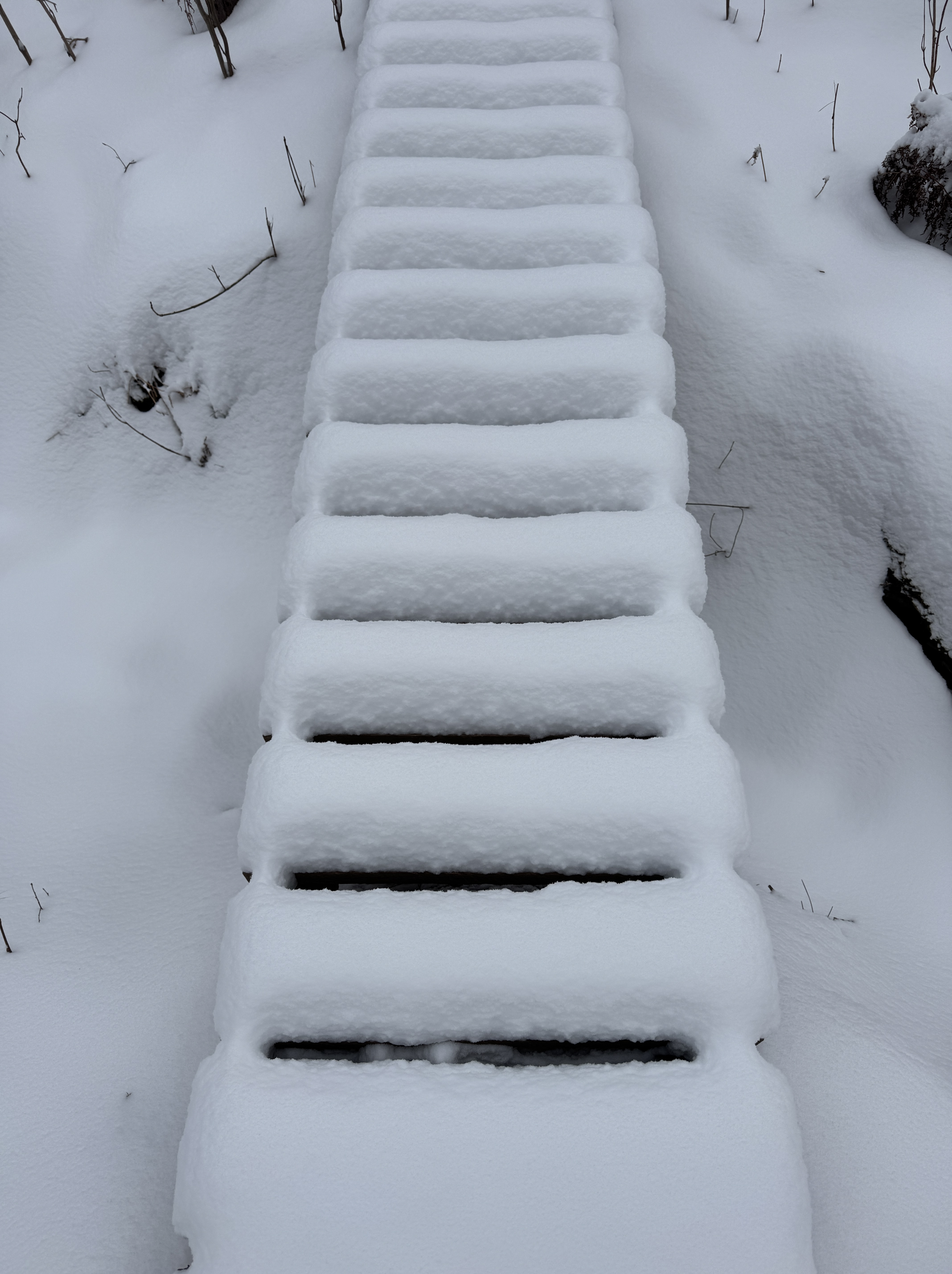
We thought we’d timed it well, spending almost three weeks in Costa Rica to miss winter’s ugly exit. But the weather gods proved us wrong. We arrived home to dry streets and walkways, accumulations of snow only in the shadows. Then winter returned. The sharp contrast initially left me irritated, bracing myself to face strong winds laced with icy snow, a crusty glaze accumulating on my running path. This morning, however, awaking to a winter wonderland with sunshine glinting off at least six inches of pristine fresh snow outside my door, my attitude did a 180!
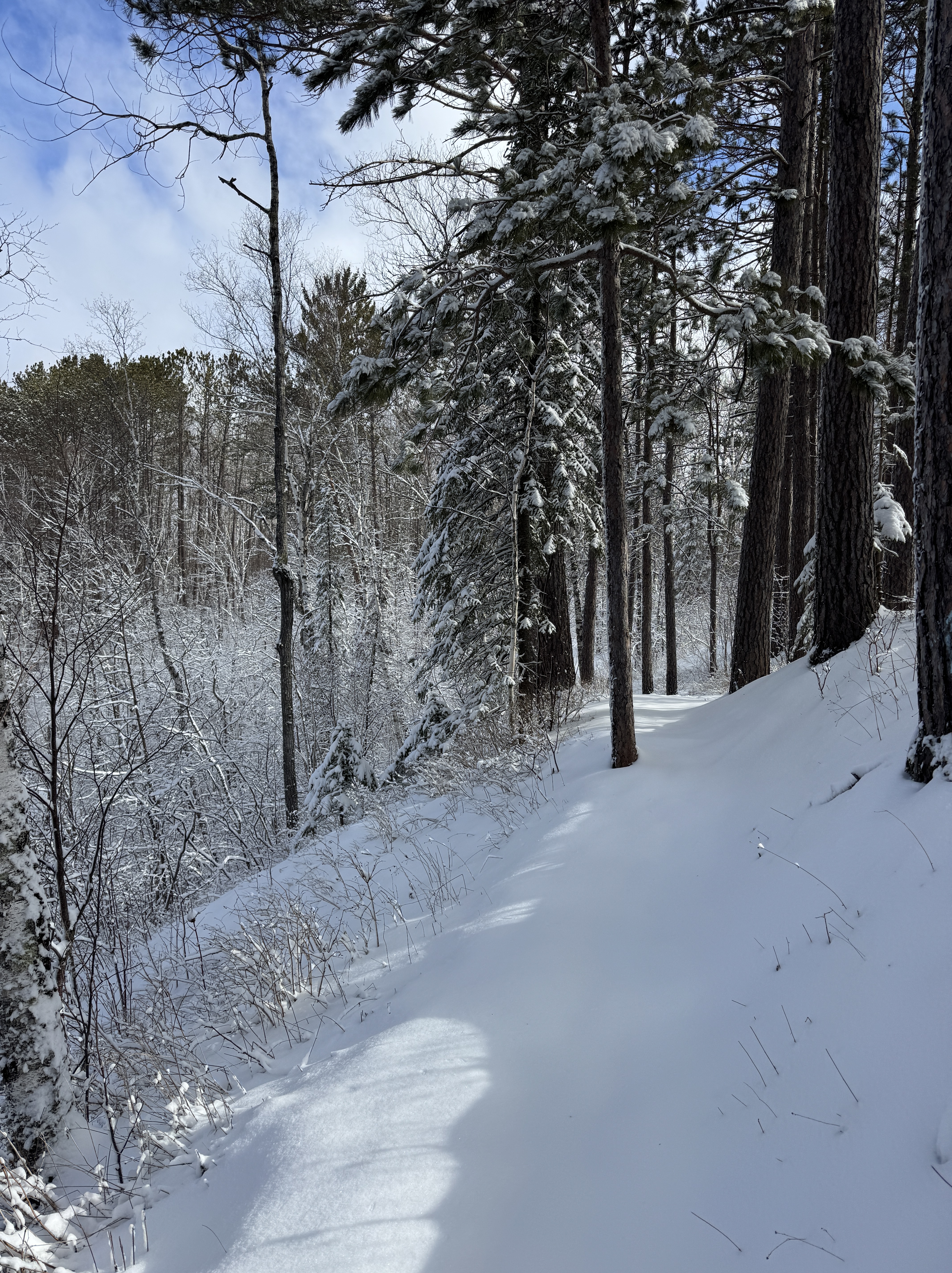
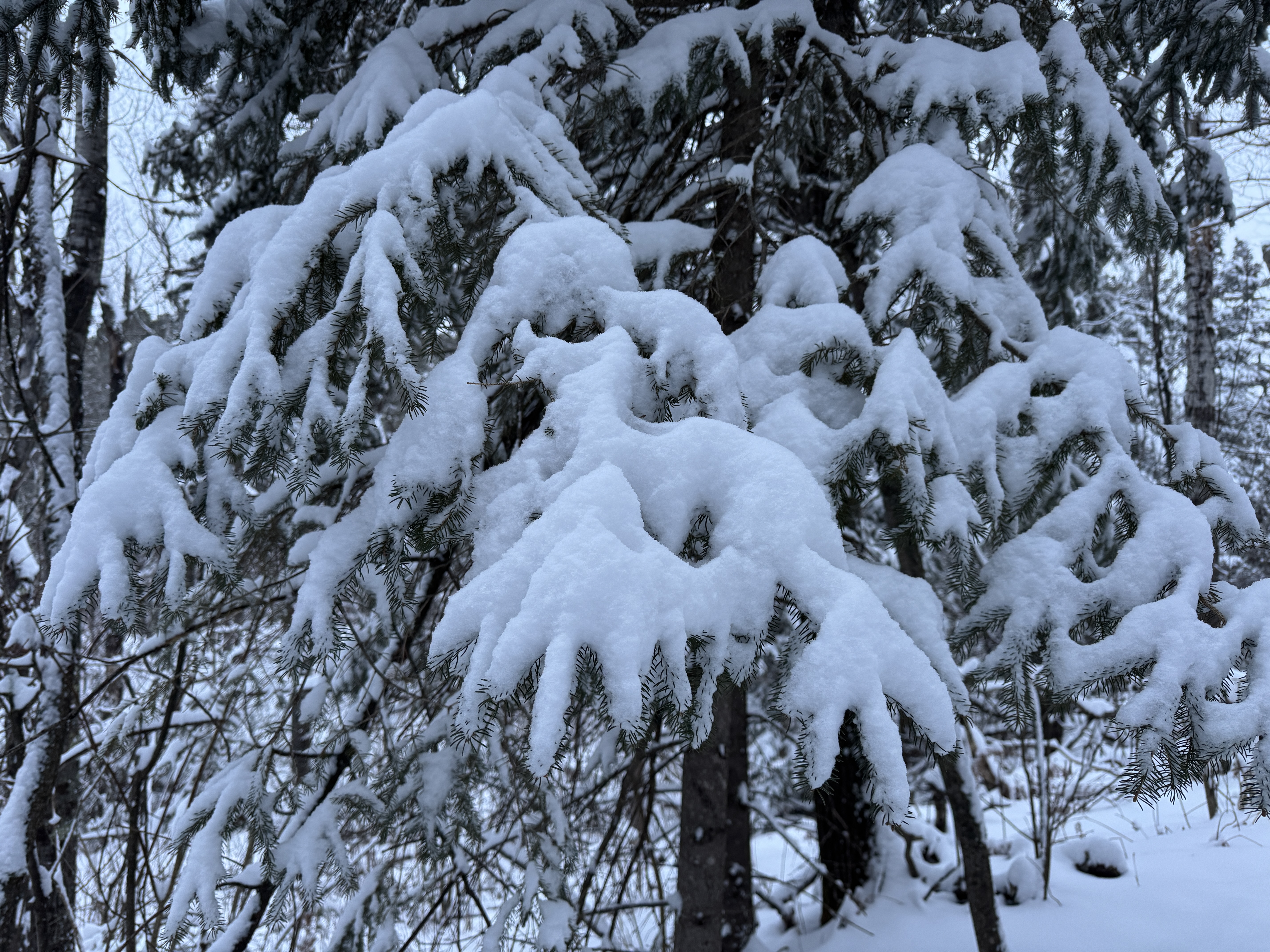
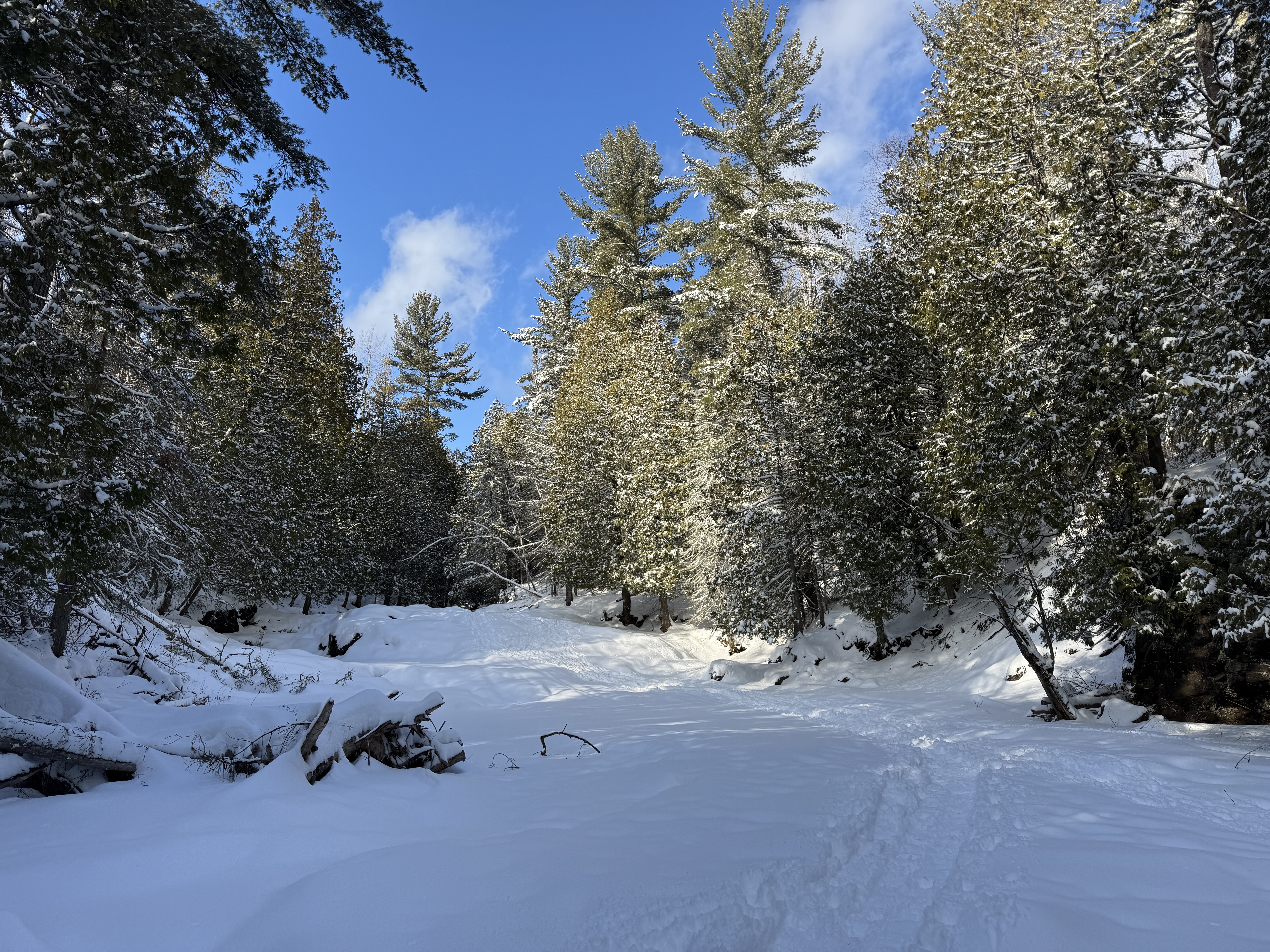
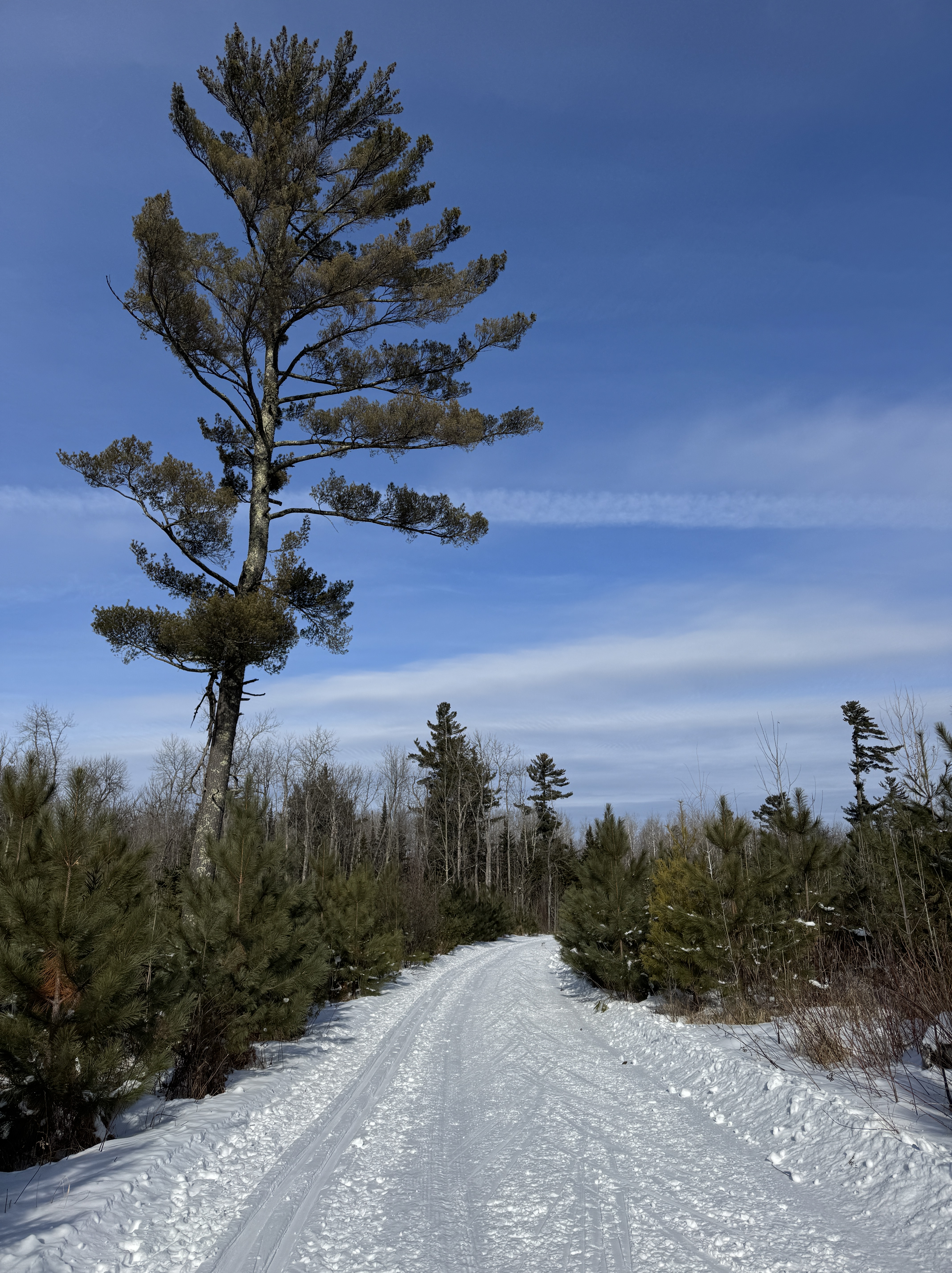
Abandoning my plans to avoid the outdoors and head to the Y to swim laps, I quickly donned jacket and boots and went out to enjoy this gift – regardless of the date on the calendar. It started out as a walk, going up 7 Bridges Road following snow covered tire tracks. The trees were flocked with snow and it muffled all the surrounding sounds. Breathing in the cool air, my senses heightened, I couldn’t help but relax into the scene.
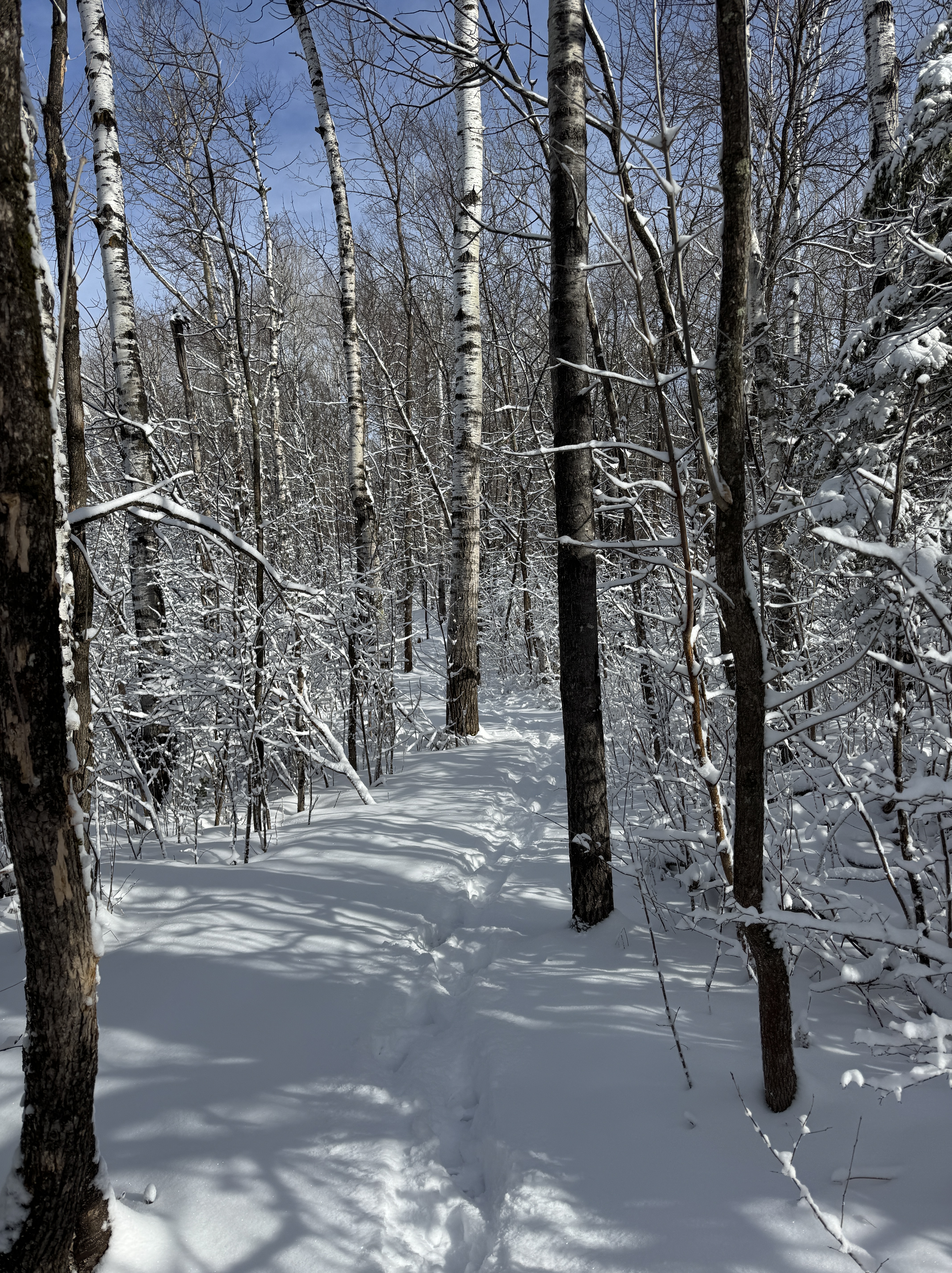
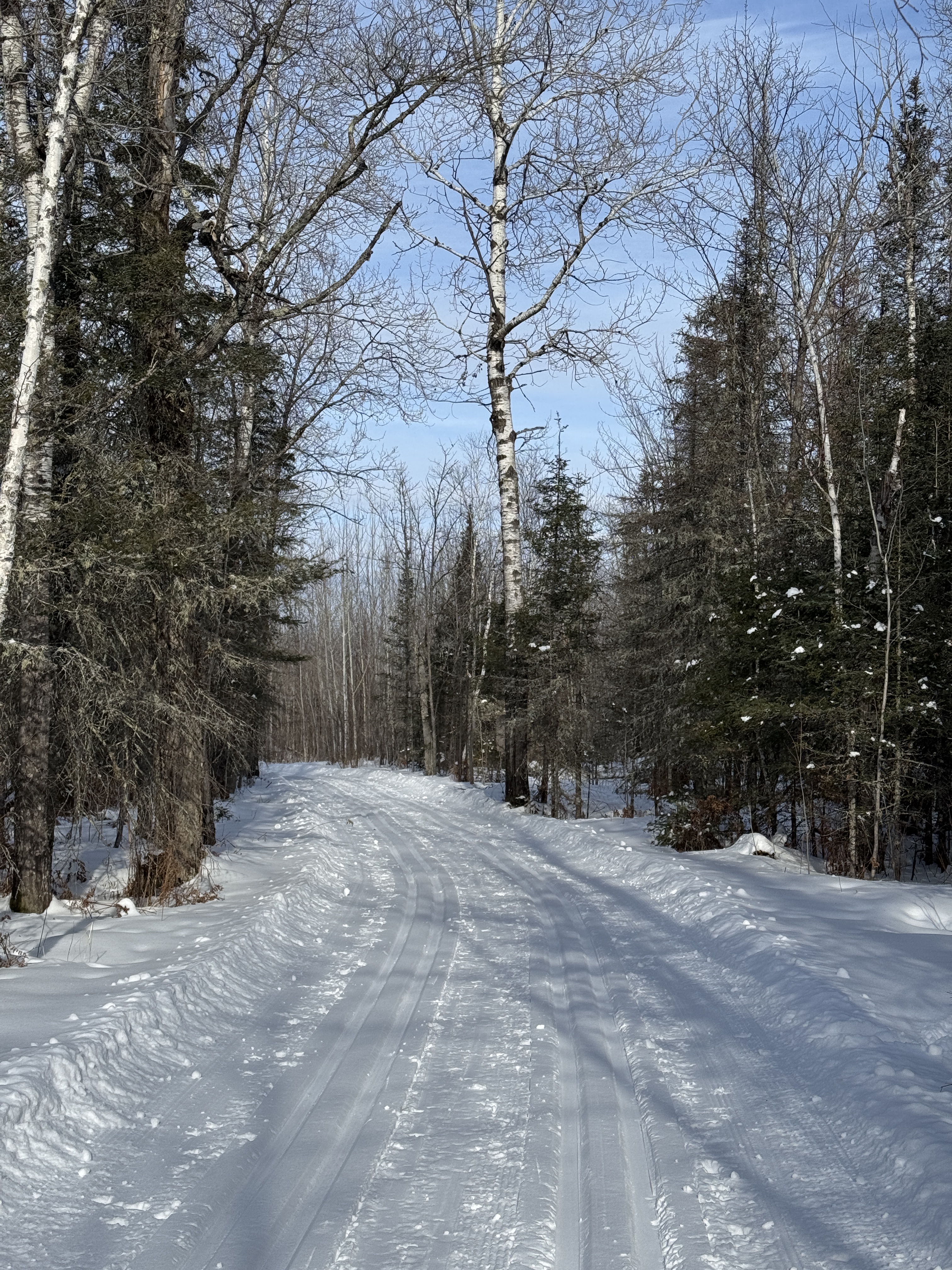
When it became apparent there was a lot more snow than I realized, I returned home to do what I should have done in the first place – don snowshoes. One of my favorite things to do is plod down the mountain bike trails while they are still pristine, before they groom them. And this was my chance. Crossing over Amity Creek, I headed into the woods.
The narrow trail with trees in close proximity was a far more intimate experience. It reminded me of all the best things about winter. About what it feels like to lose track of time and just put one foot in front of the other. To live in the moment. To appreciate the snow.
I know it’s a fleeting moment. April snow soon turns to slush and we’ll be back to mud season. Which is why it’s so important to embrace it when it happens.
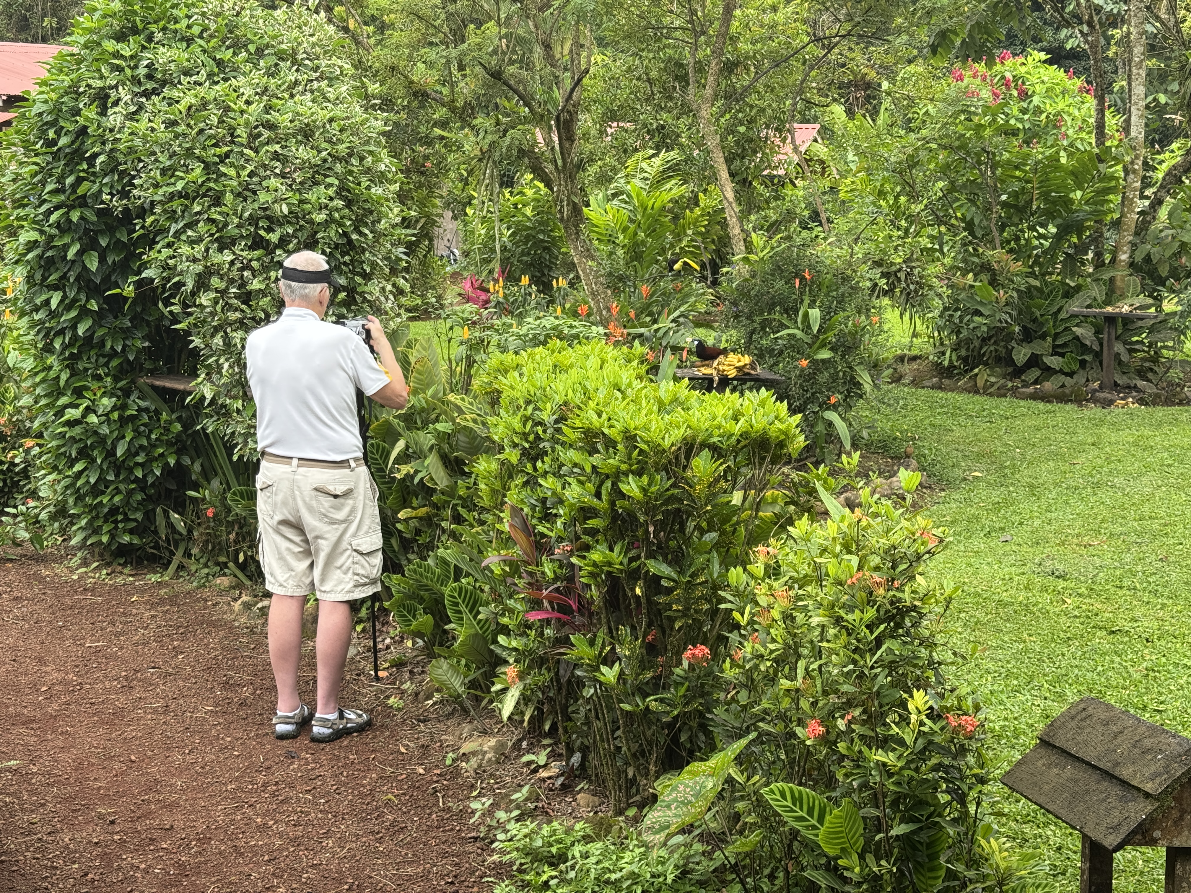
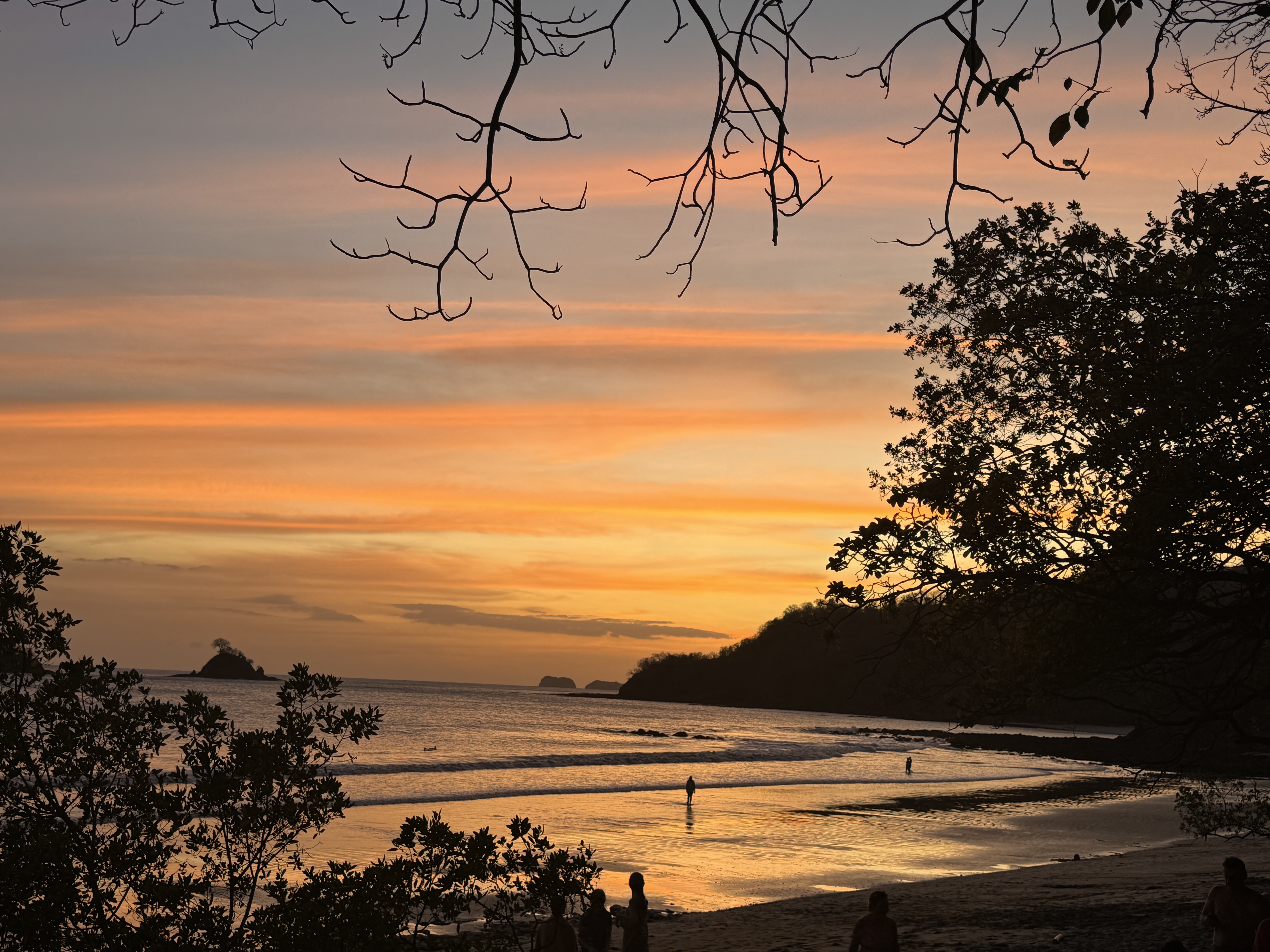
In contrast, our time in Costa Rica was marked by consistently clear and sunny skies, temps ranging from the 70s to mid-90s every day. We relished our time in Las Catalinas, a beautiful pedestrian village on the Pacific coast built around a pristine beach and surrounded by hills cross-crossed by mountain bike trails. Early mornings were best for being active. For Rich that meant birding, and a bounty of beautiful tropical species for him to photograph. For me it was hiking the trails, kayaking and swimming laps in the outdoor pool.
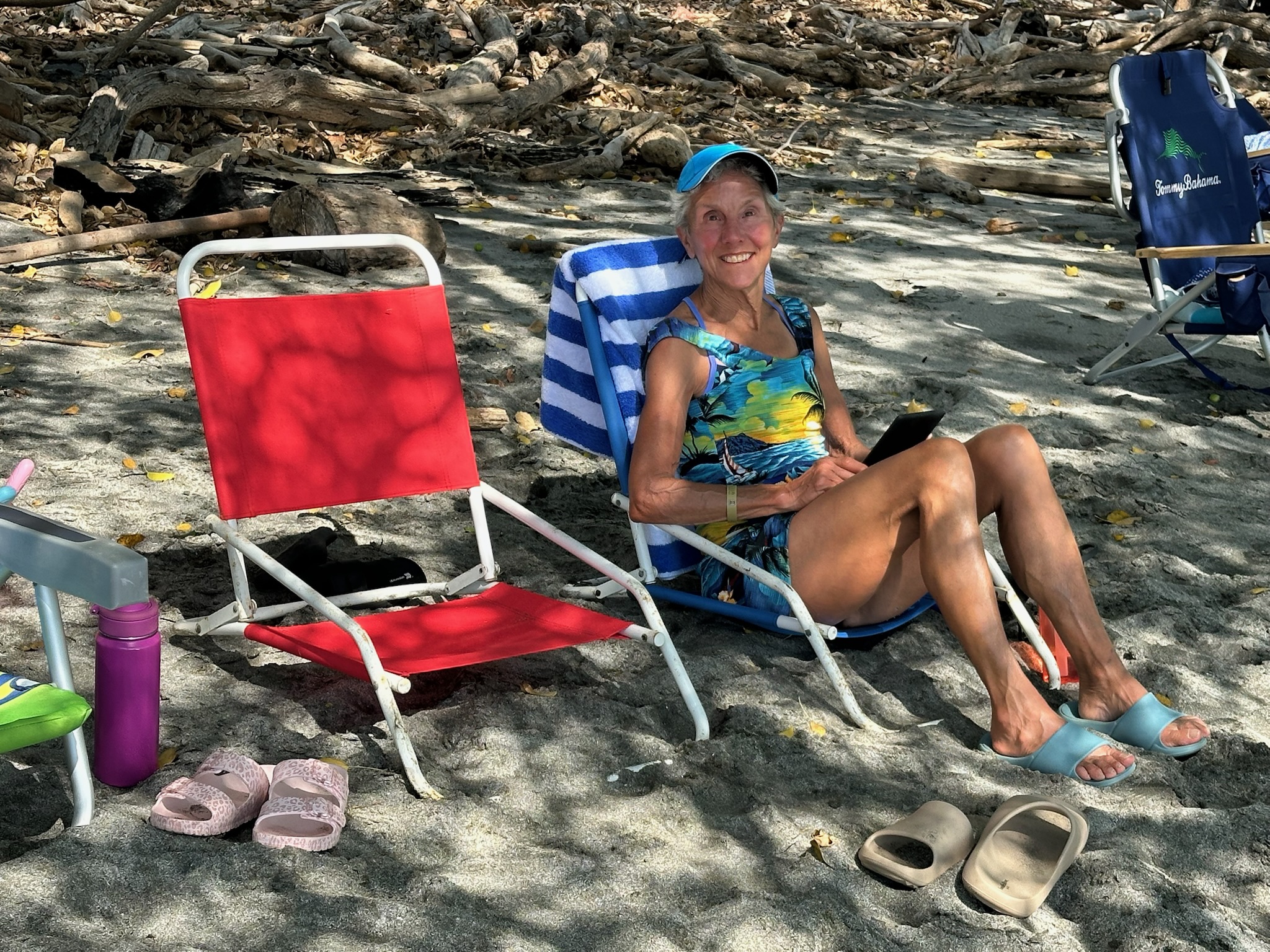
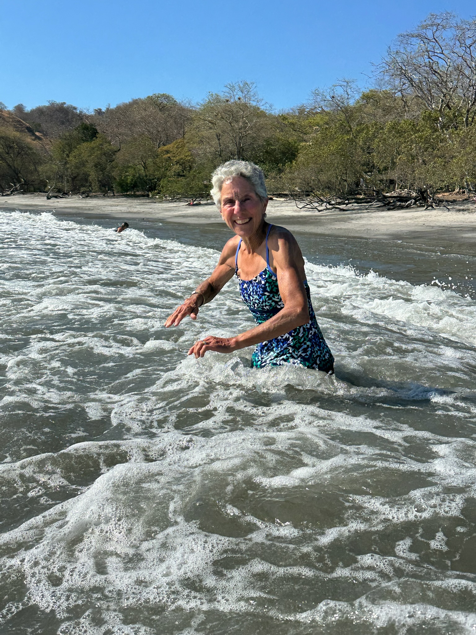
In the intense afternoon heat, Rich retreated to the air conditioned house to process his photos. I often took a book to the beach to read in the shade and run into the waves to cool off.
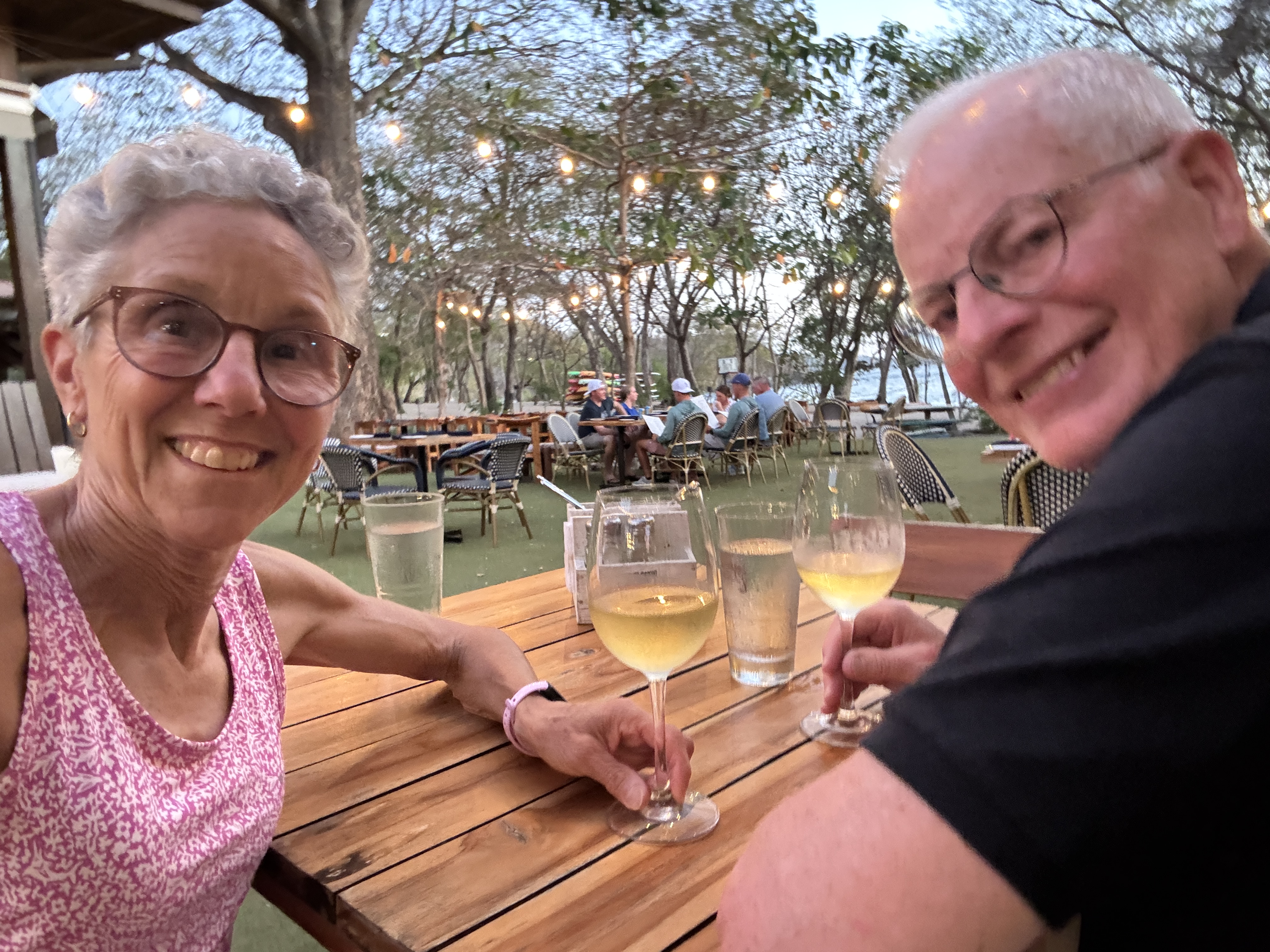
Evenings were delightful. The soft air kissed my skin as we watched the sunset, ate at beach-front restaurants or had dinner out on the balcony overlooking the ocean. Reading outside in that soft warmth always completed my day.
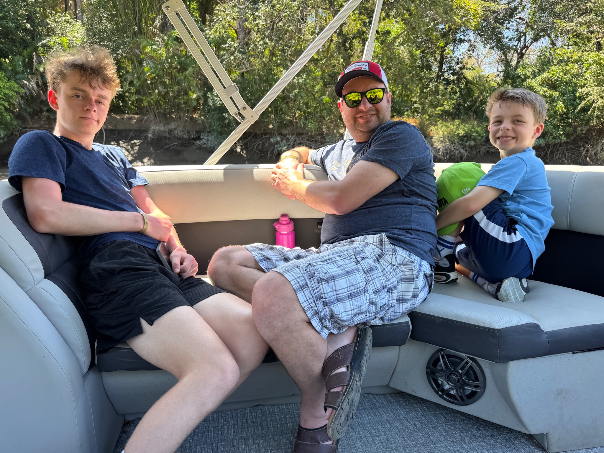
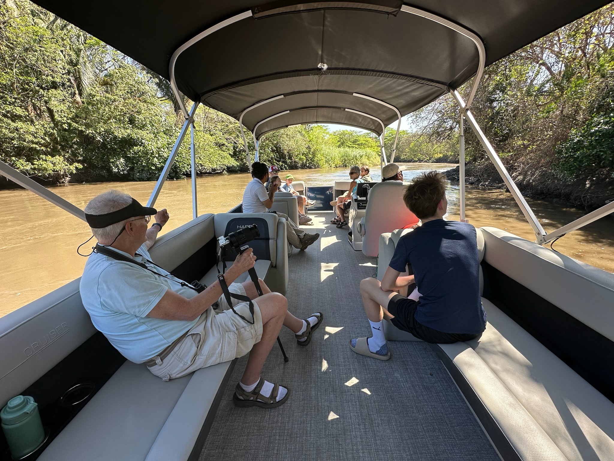
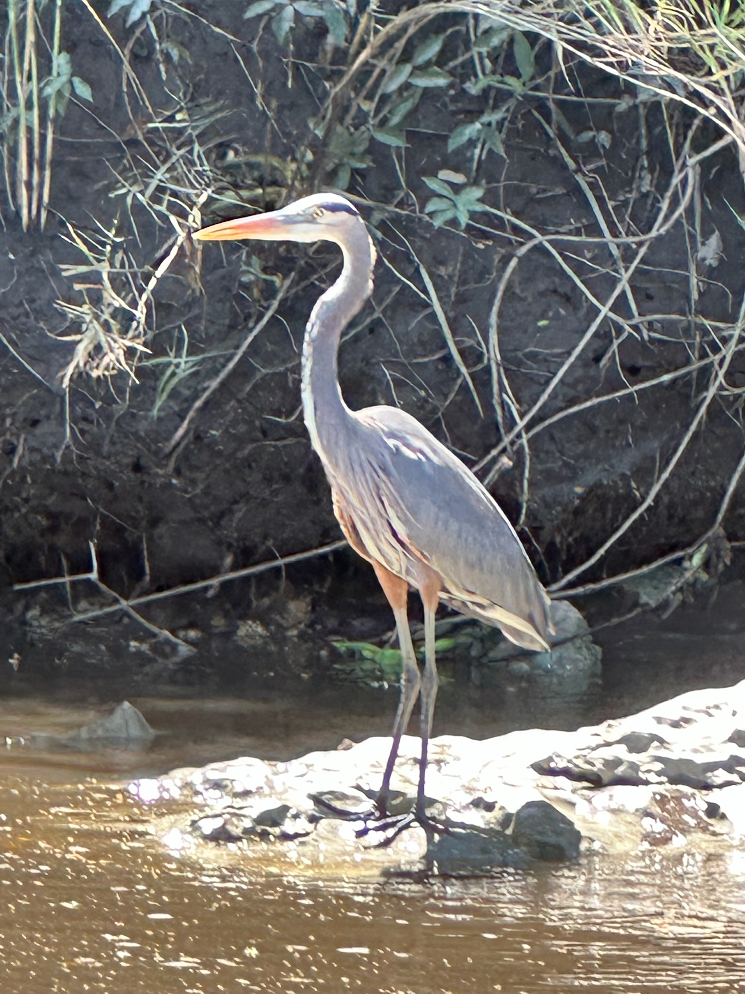
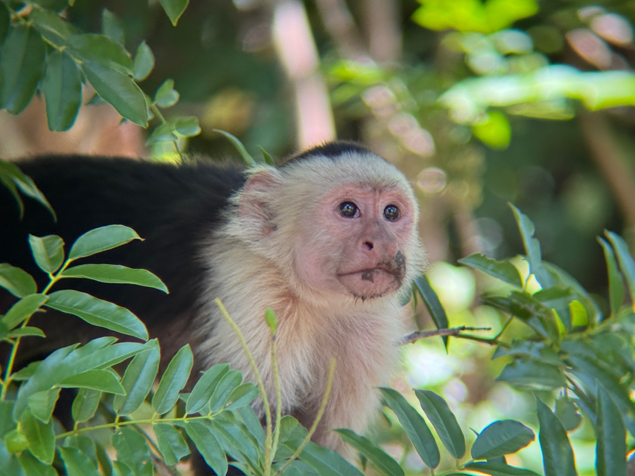
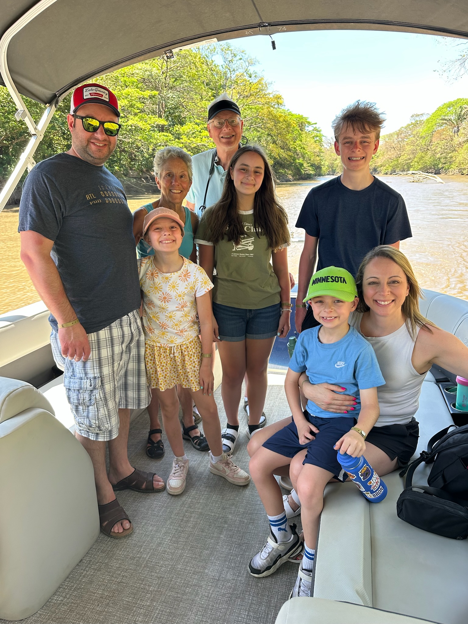
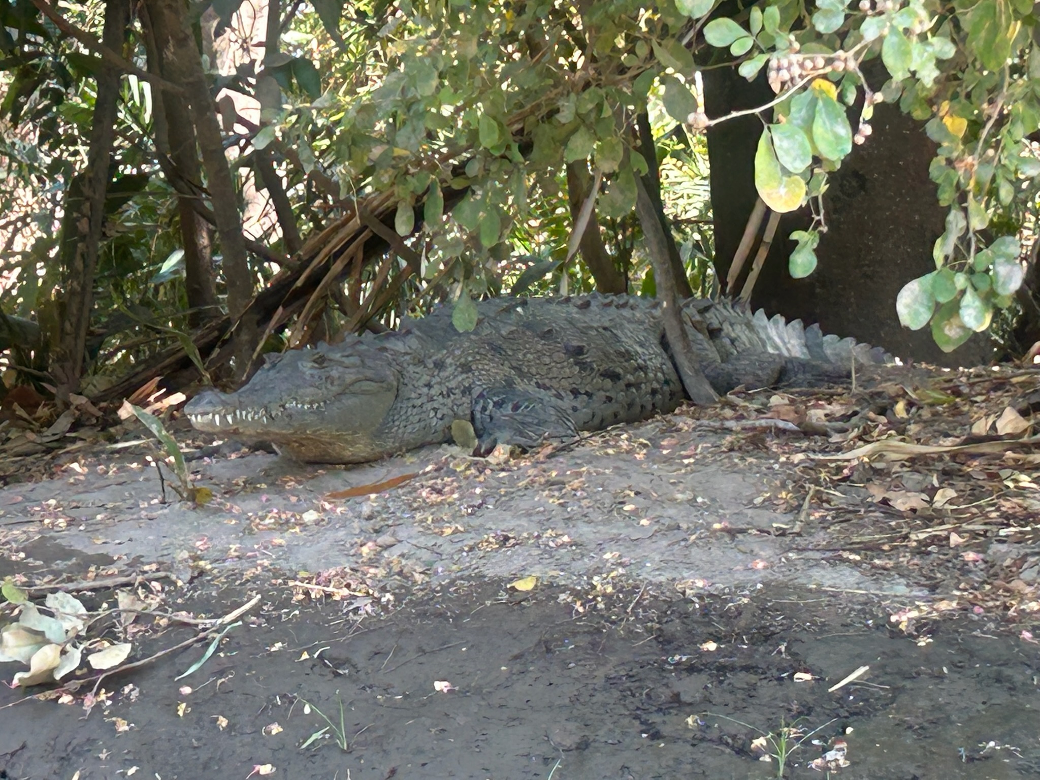
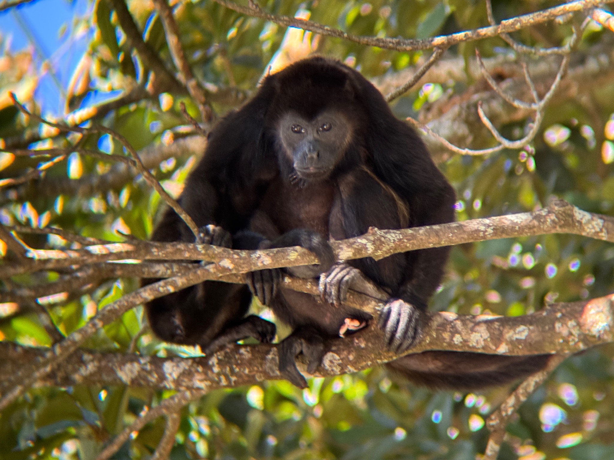
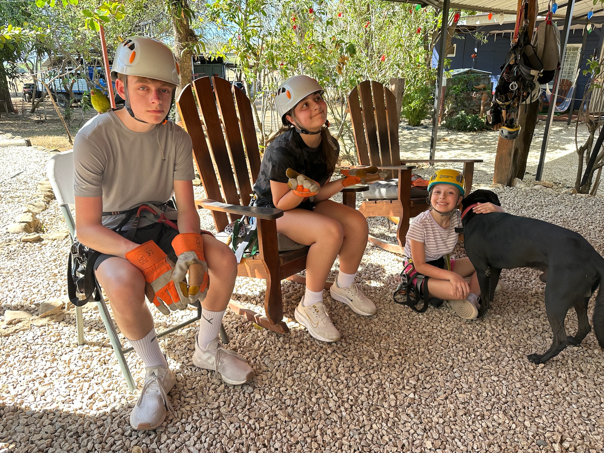
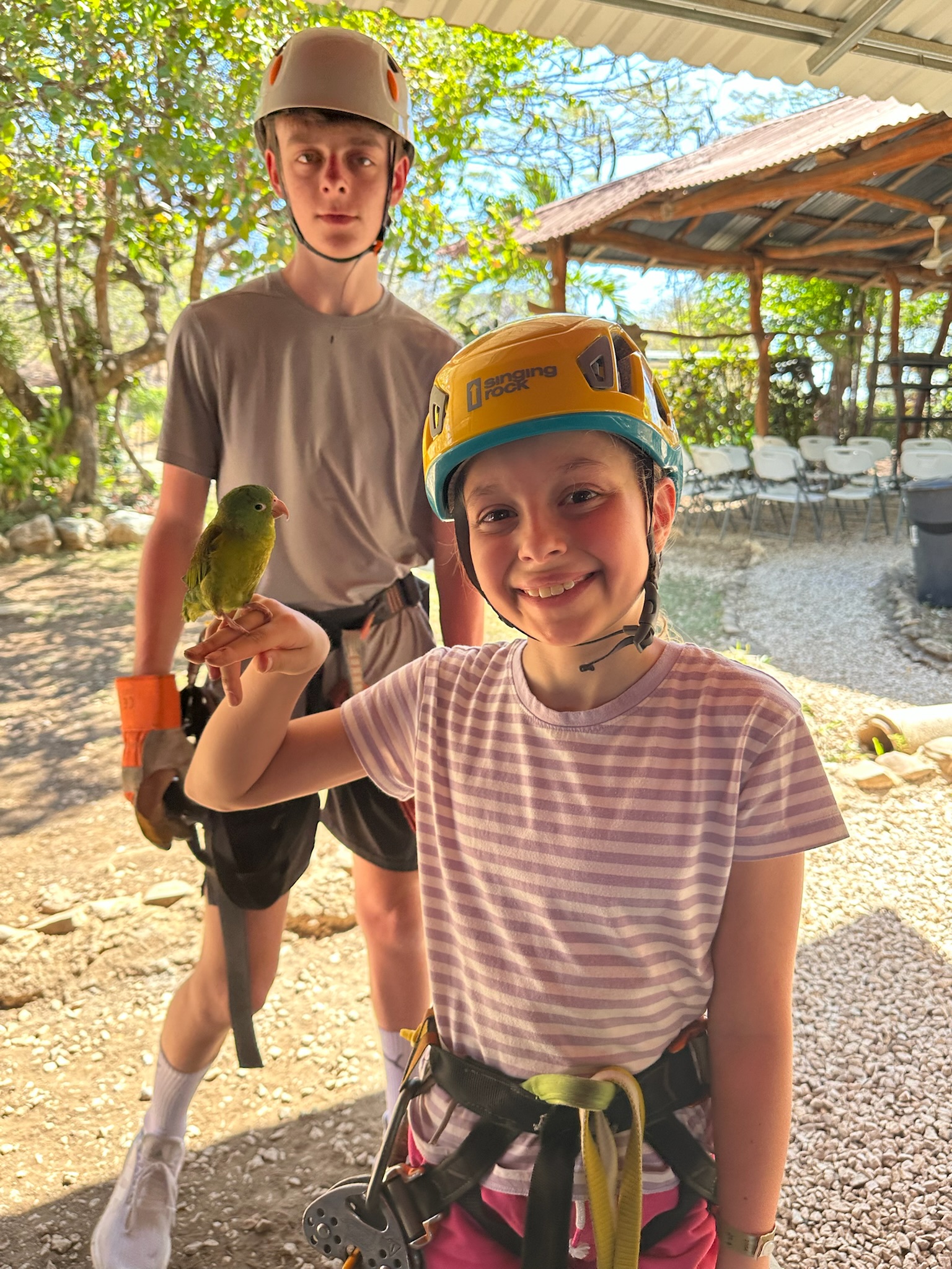
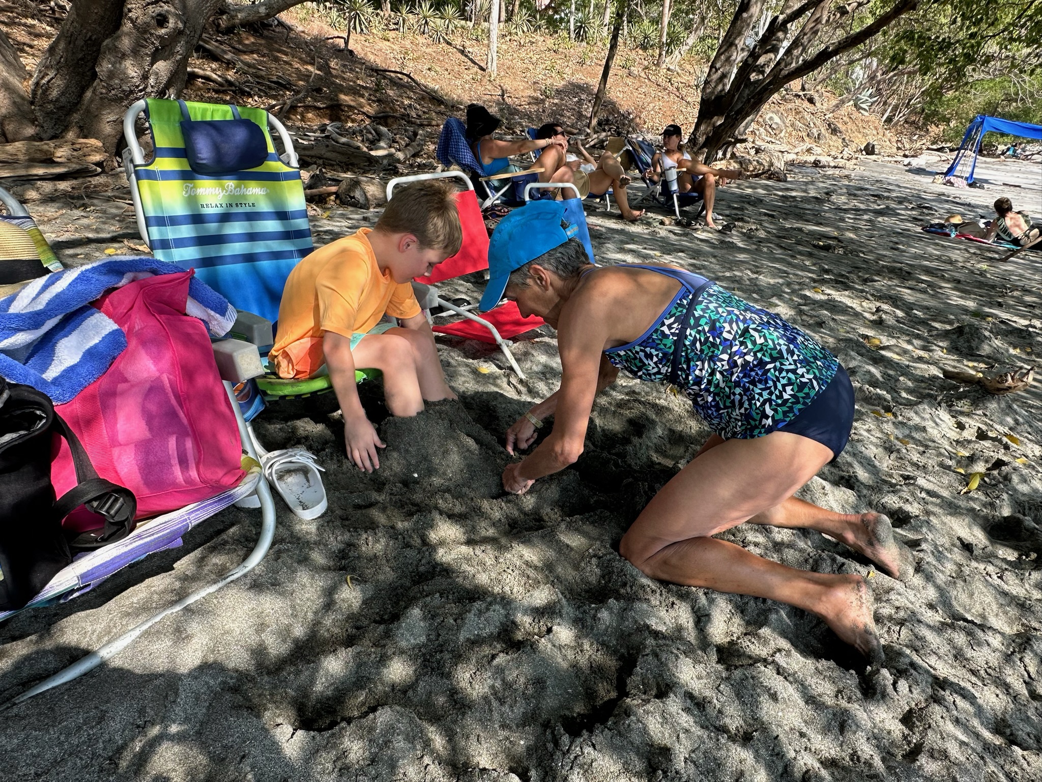
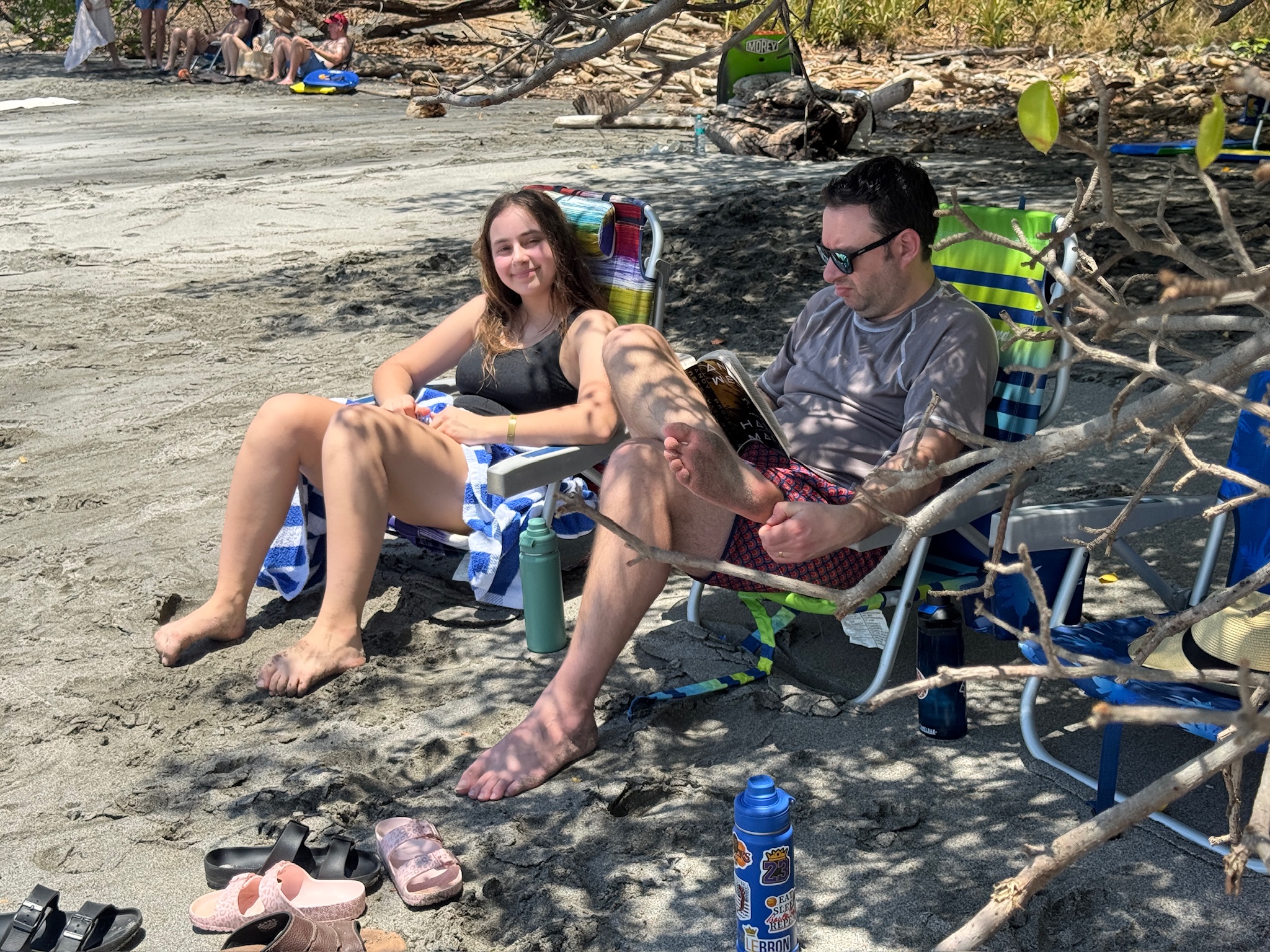
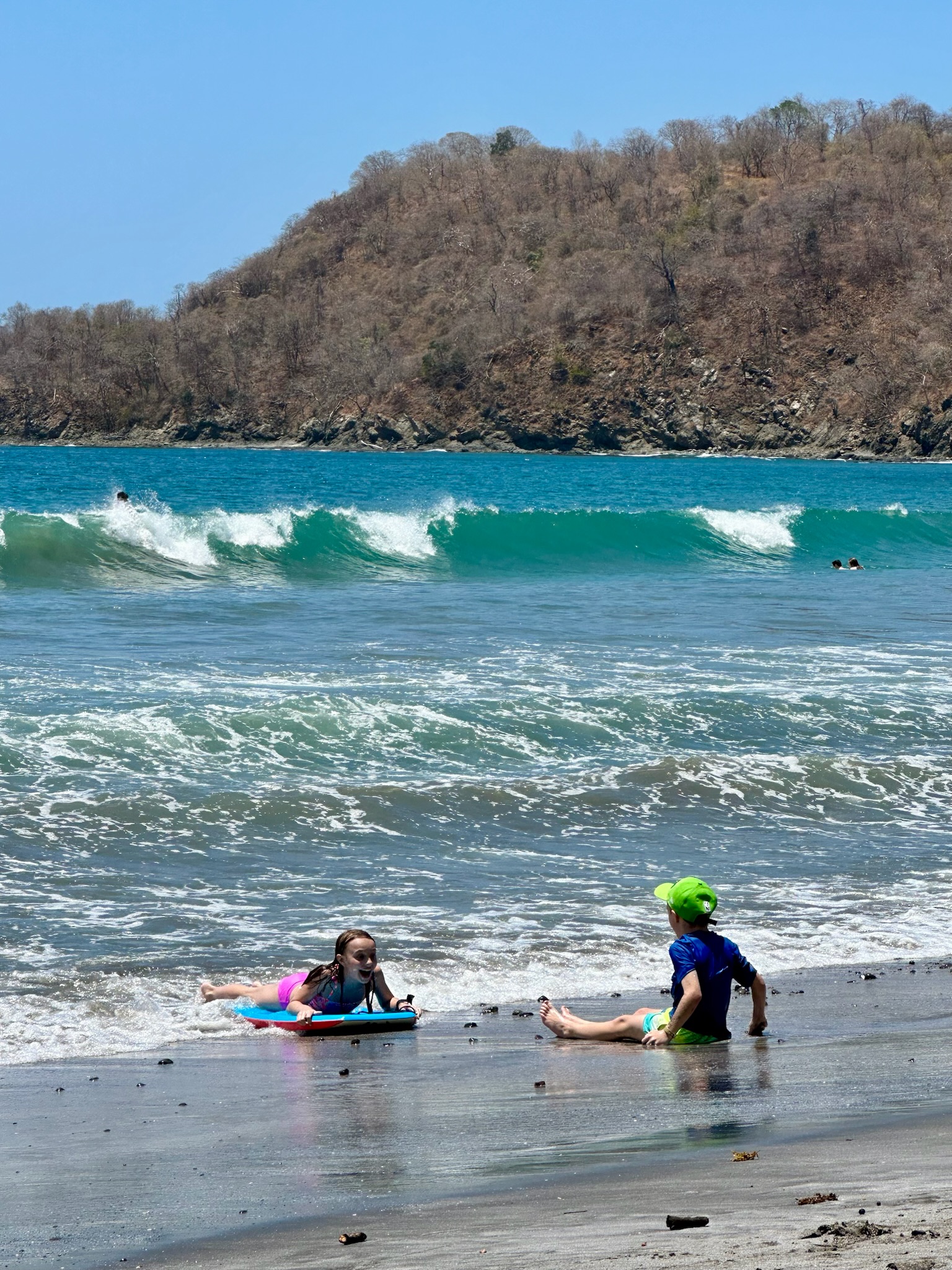
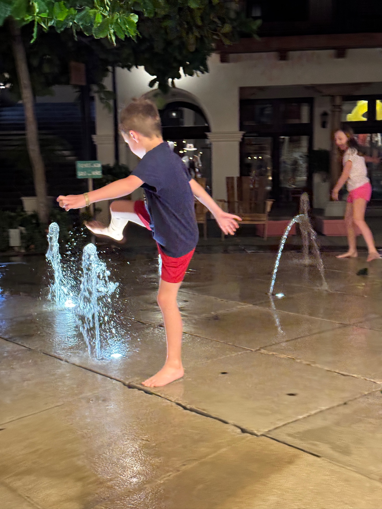
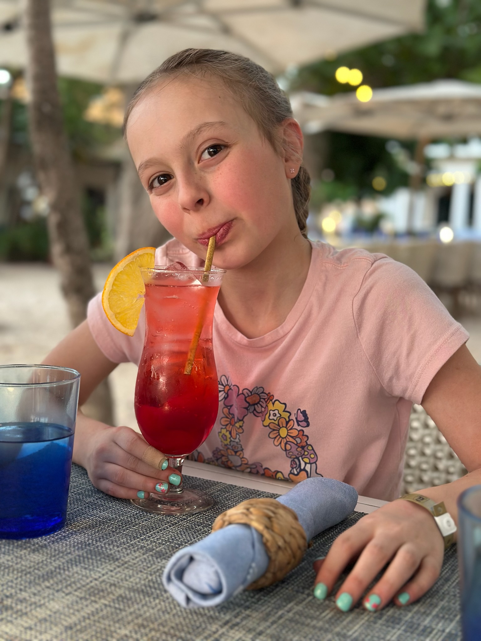
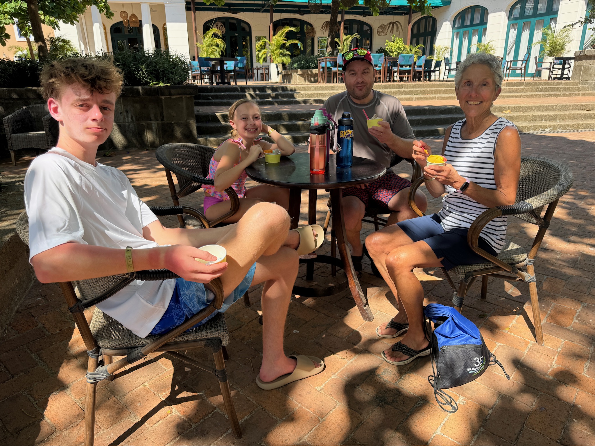
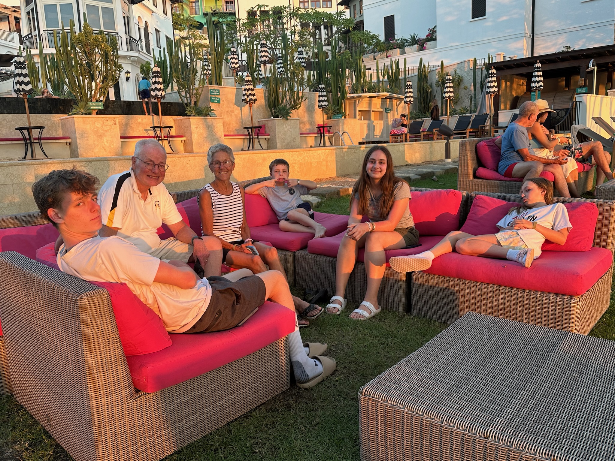
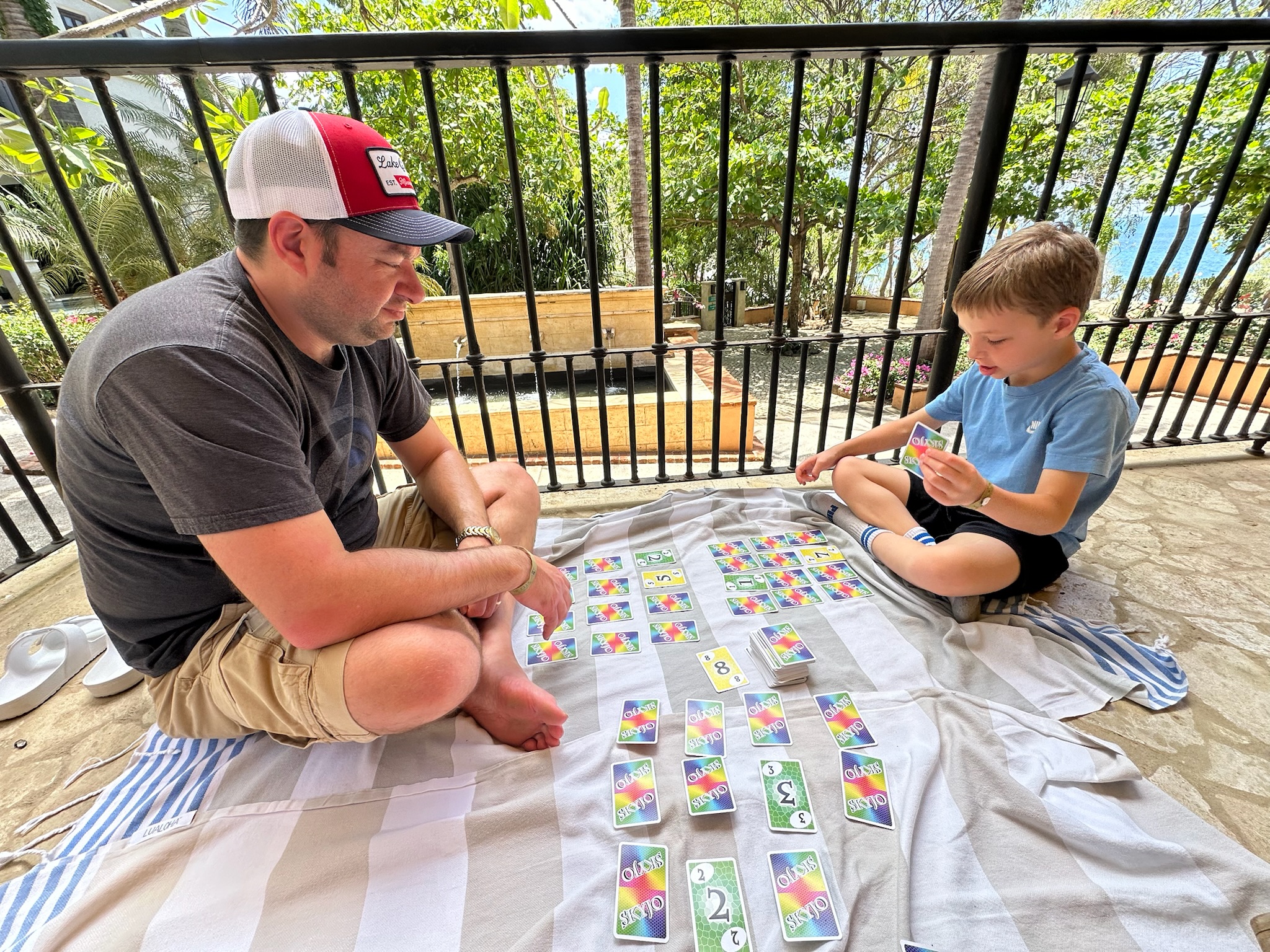
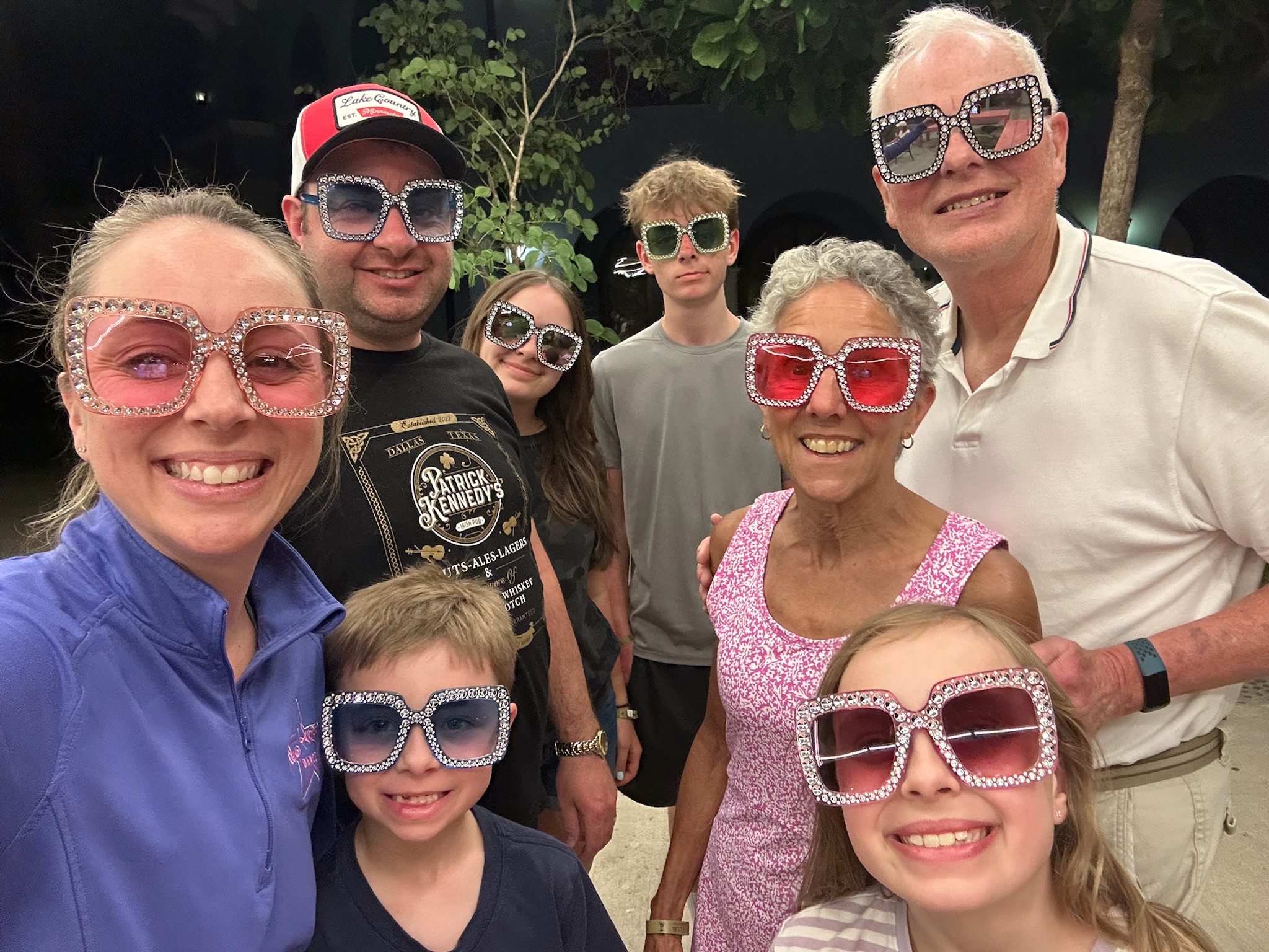
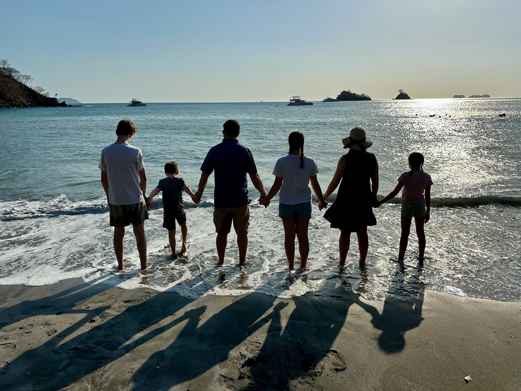
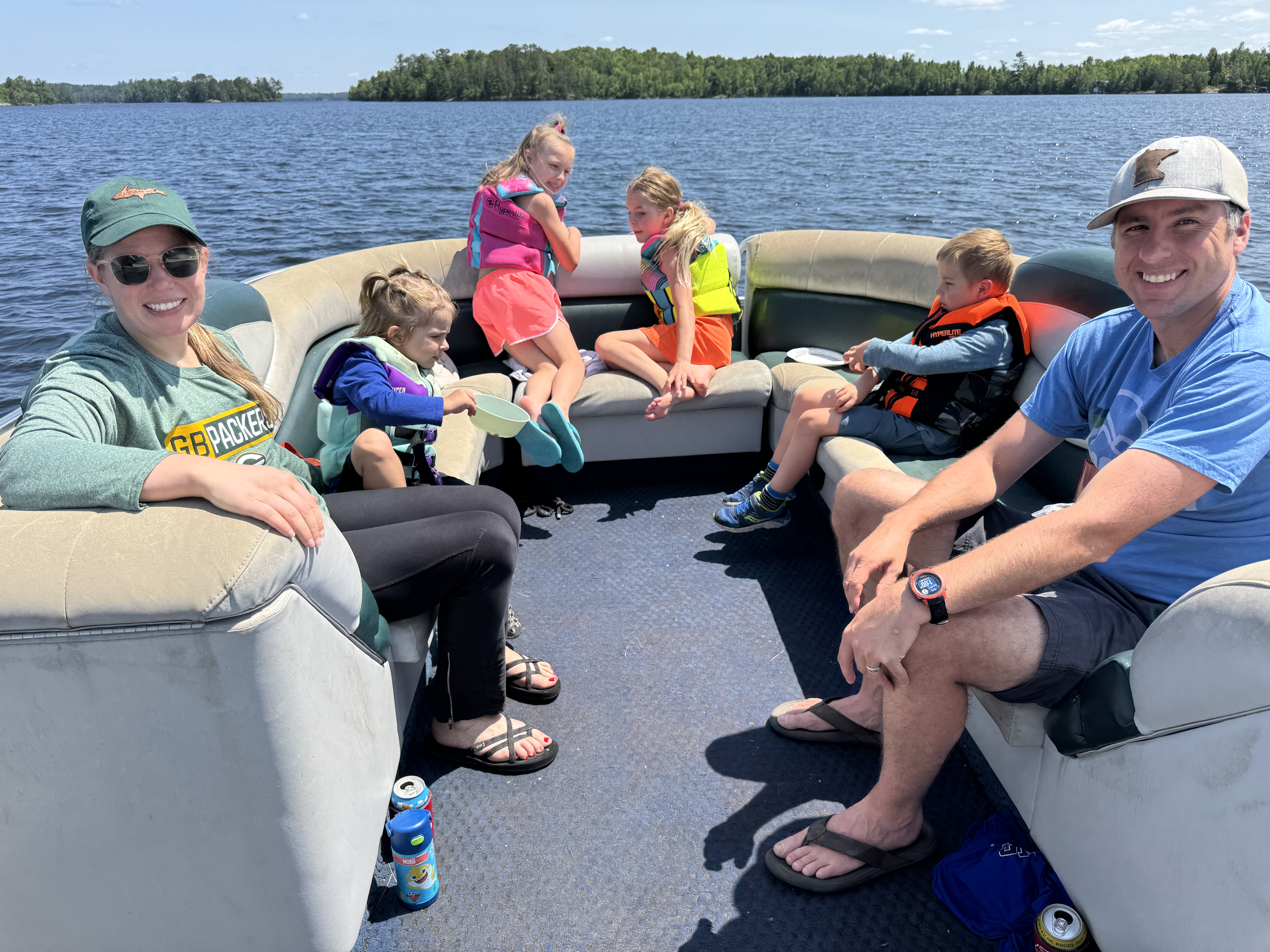
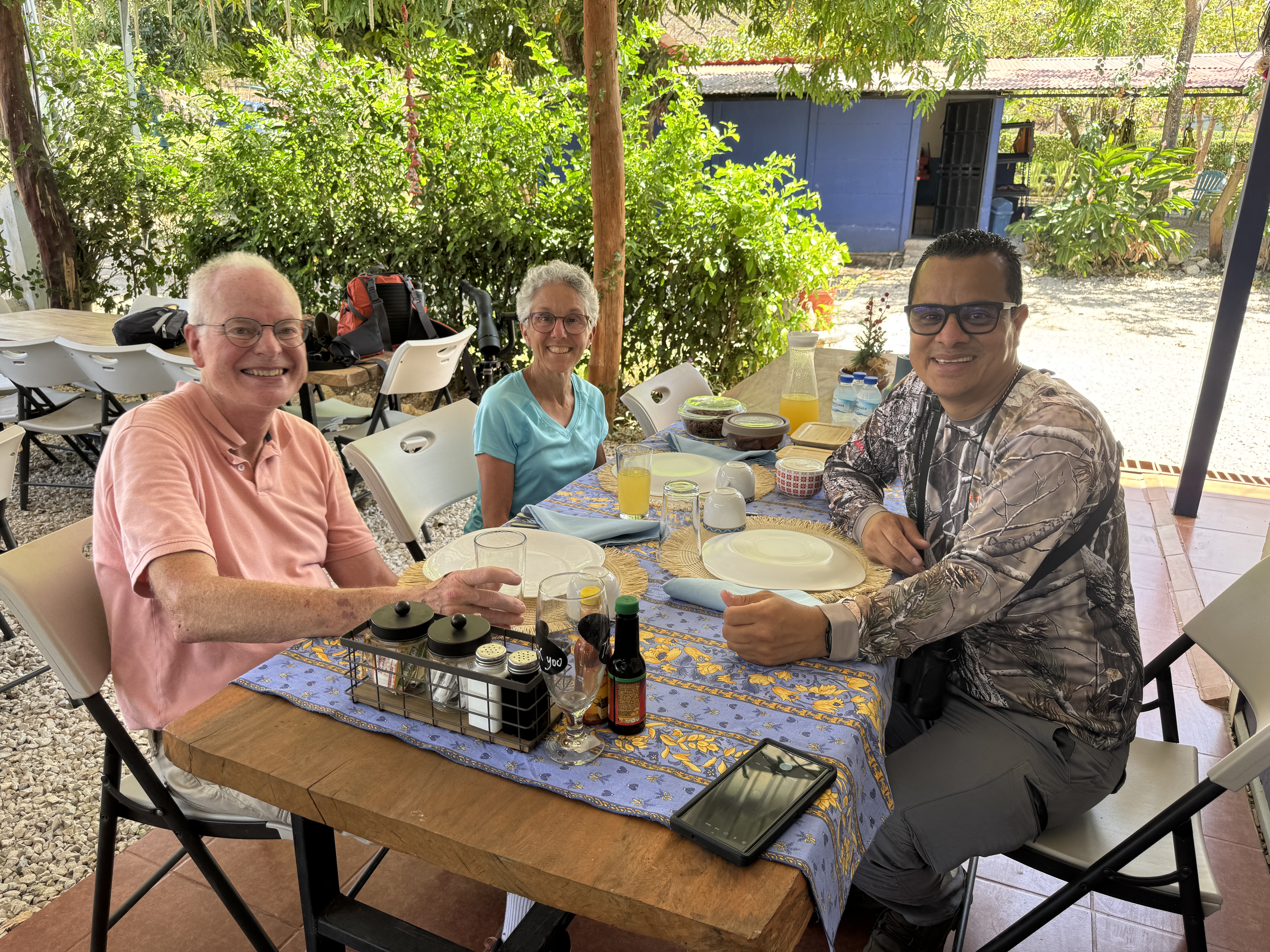
But the highlight of our stay was sharing that paradise with our daughter Karen, her husband, Matt and their four children. Ranging from age eight to 15, there was something for everyone, and they were game to try it all! We took them on a boat trip with a guide on a river in a nature preserve. They loved seeing crocodiles, monkeys and birds up close!
Karen and Ben rode the mountain bike trails. And the bravest of them went ziplining through the treetops.
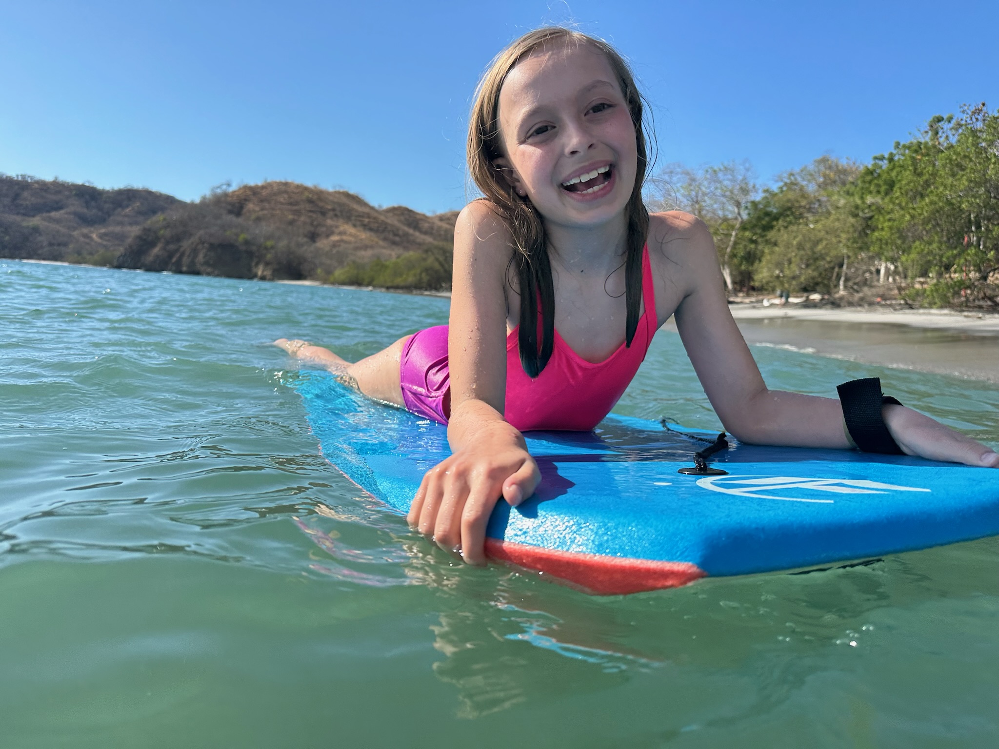
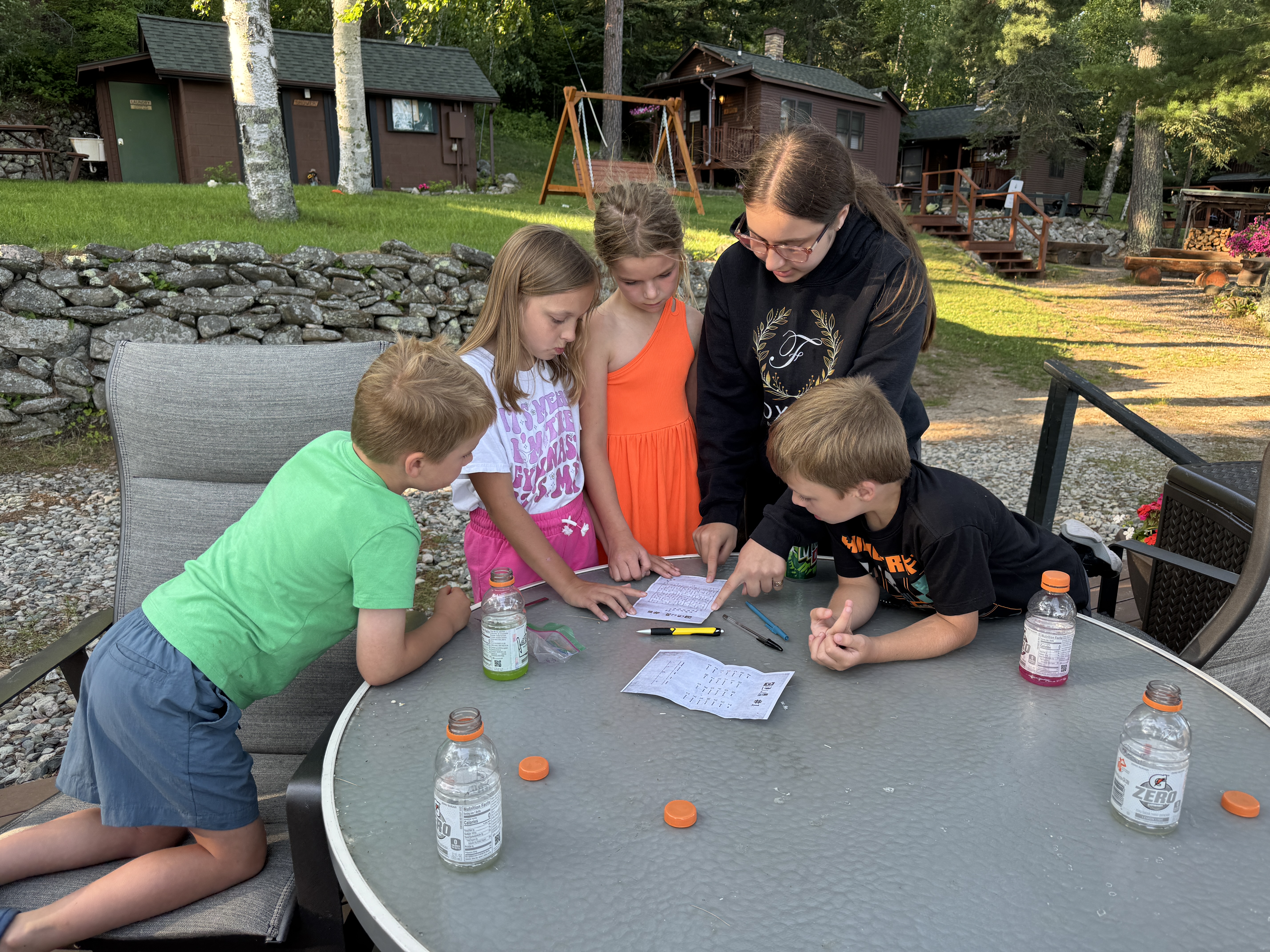
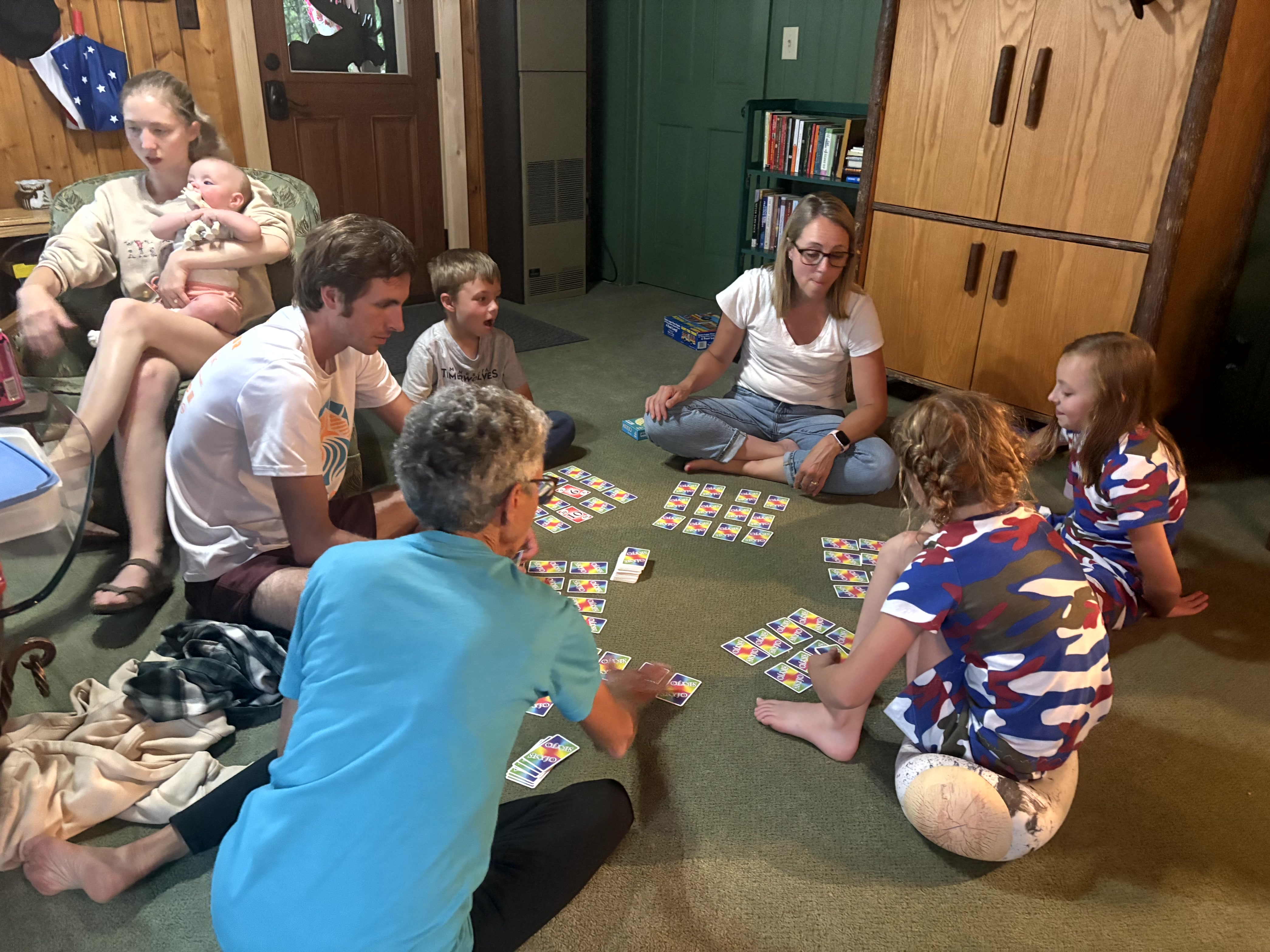
But most of all, they enjoyed just hanging around – boogie board and playing at the beach, cooling off in the pools, eating ice cream on a hot afternoon, paddleboarding, reading, chasing the water spouts on the splash pad, playing cards, watching sunsets and just being silly. And I loved every minute with them!
The best things in life are those we share with others. Precious moments. Fond memories. Strengthening bonds. And love.
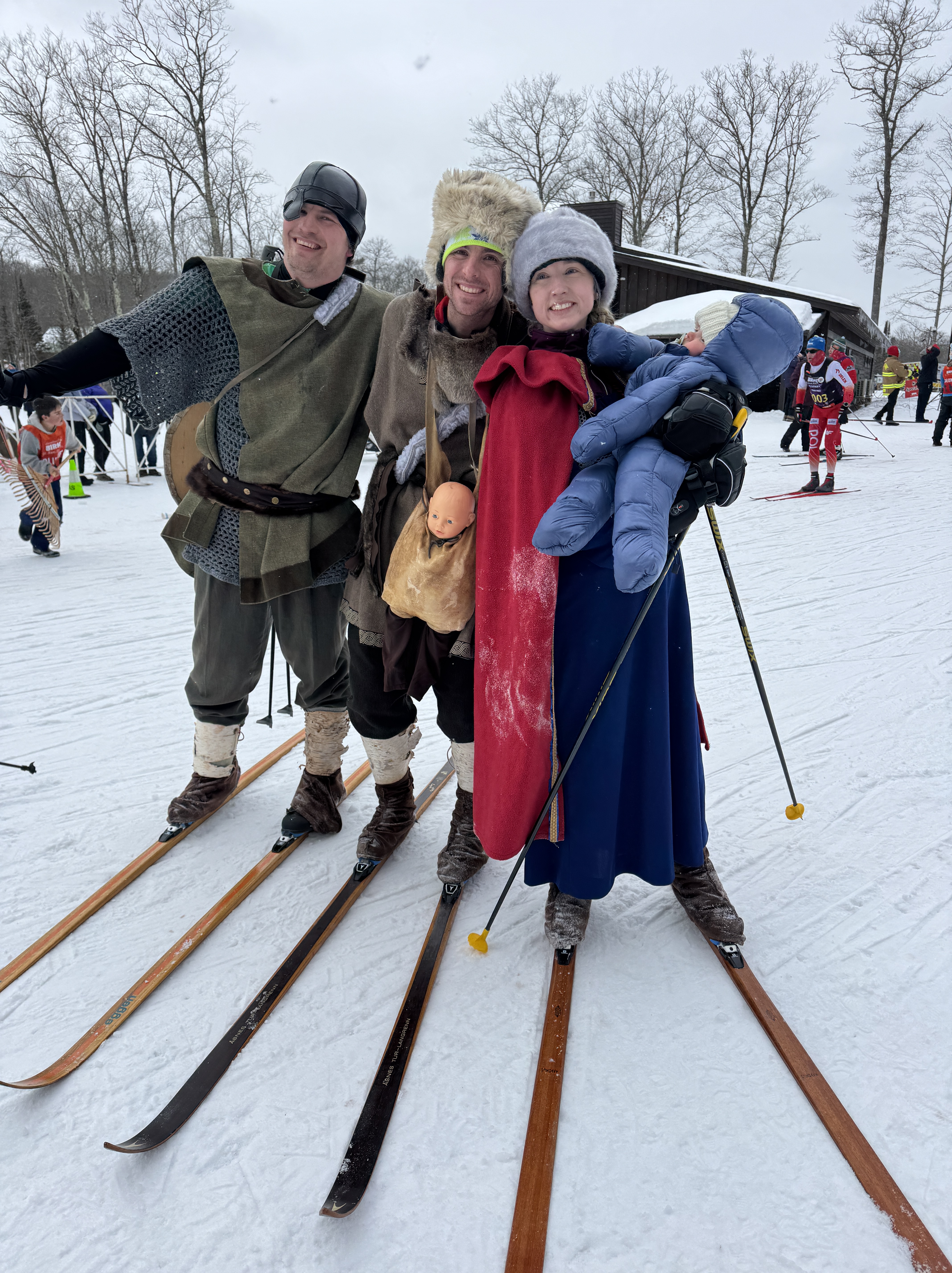
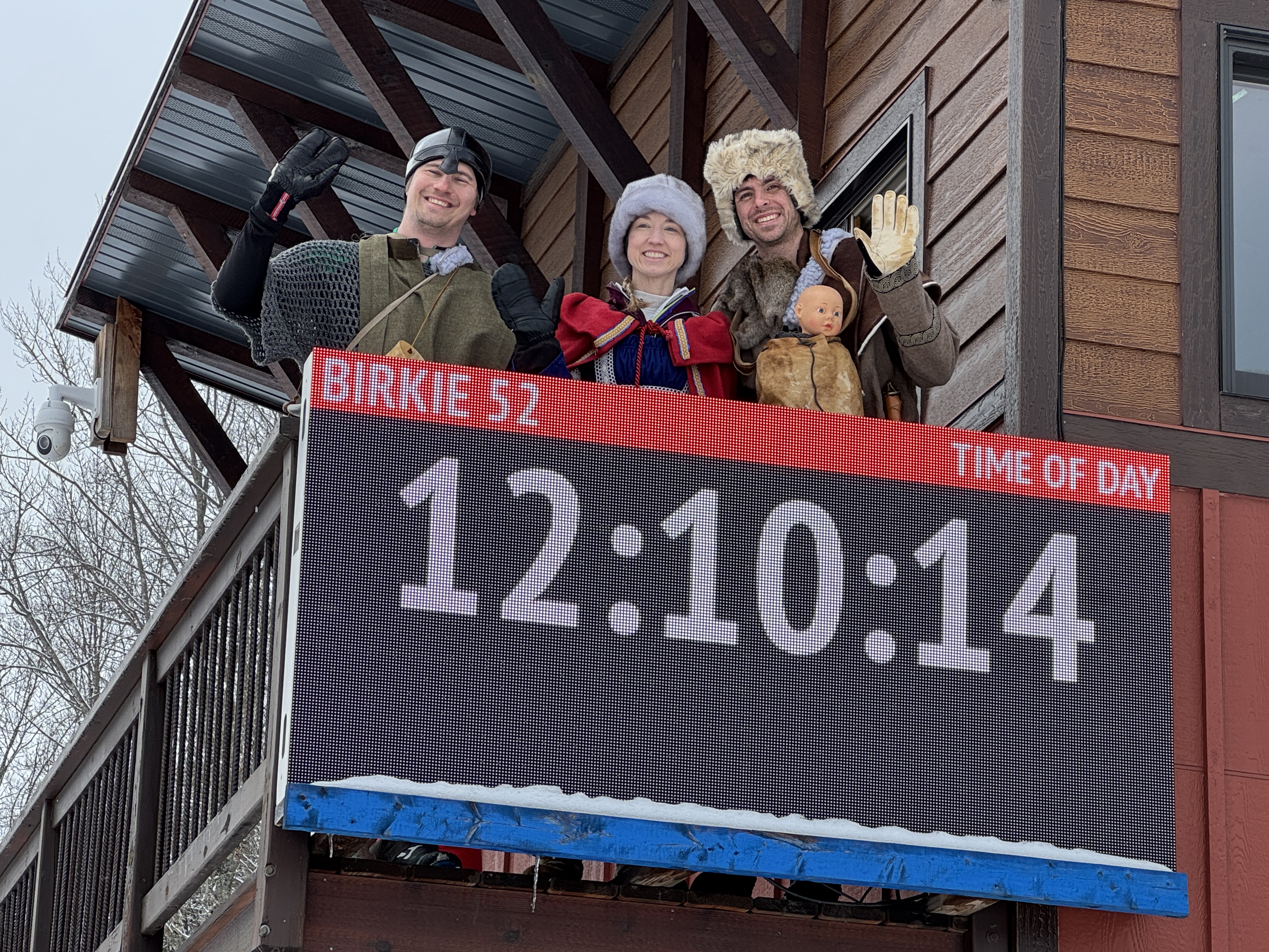
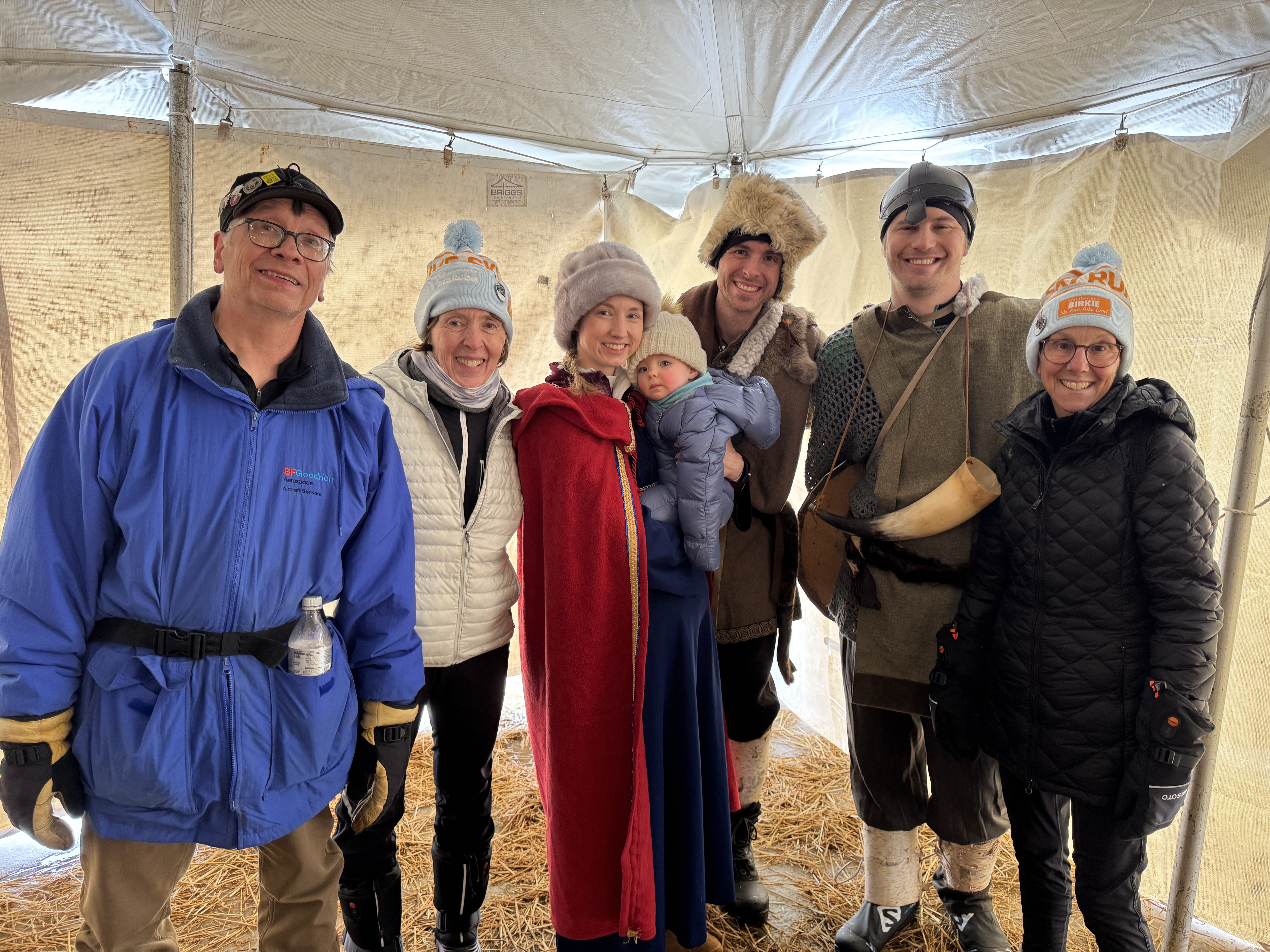
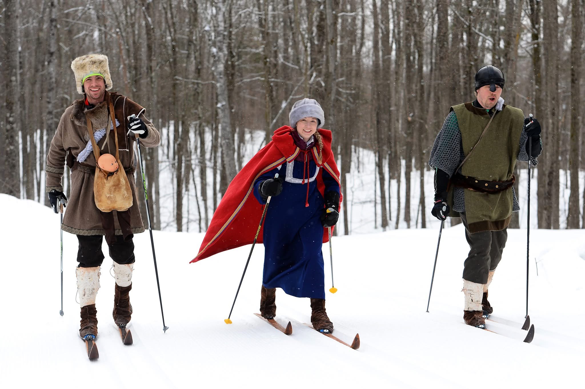
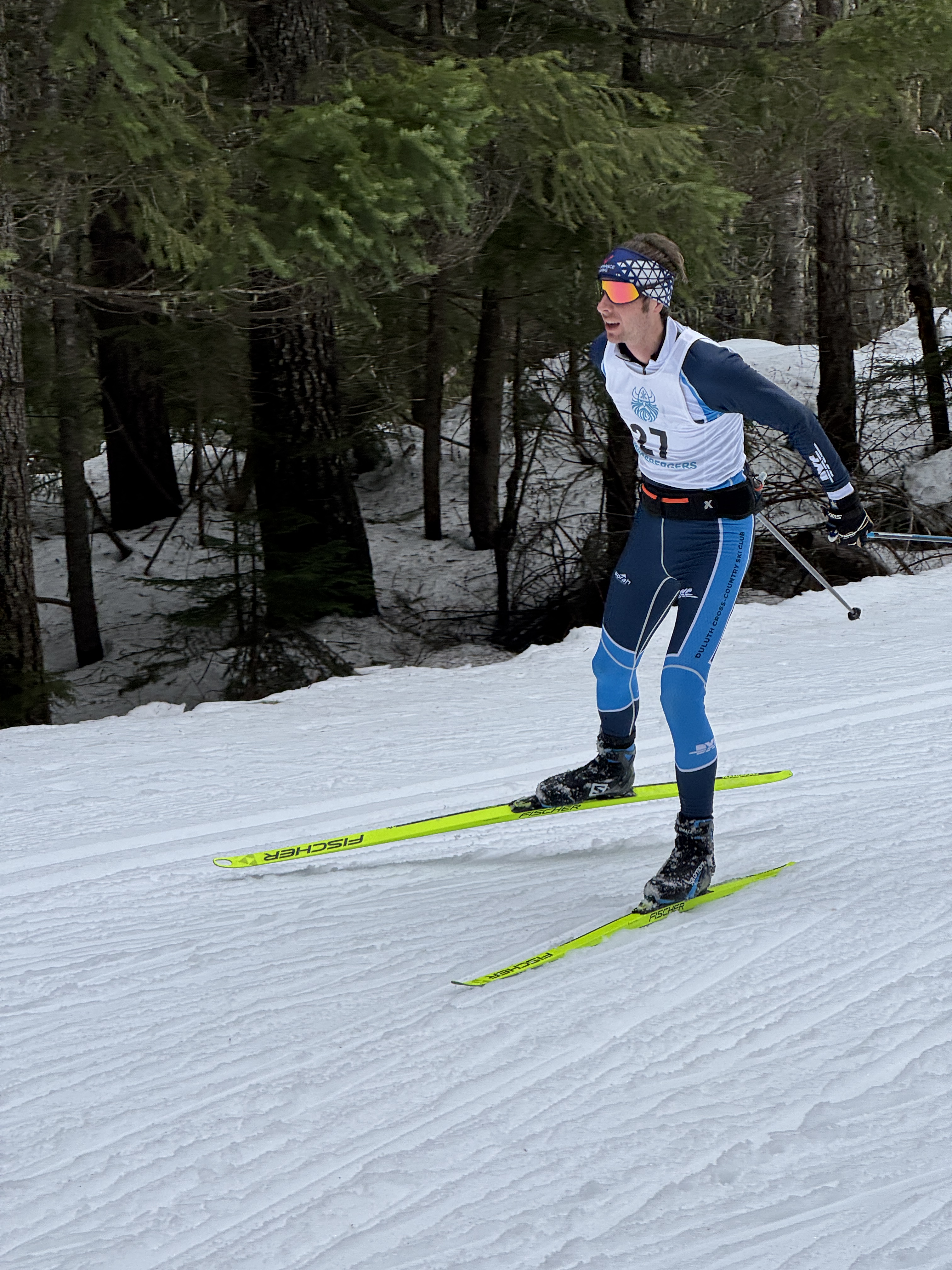
It’s not every parent who can claim their child rose to royalty, but this year we became part of that elite group! In this case our son Erik, his wife Katie and one-year old daughter Saige along with friend Peter Enz assumed the roles of the Birkie Warriors for the American Birkebeiner long-distance cross-country ski race!
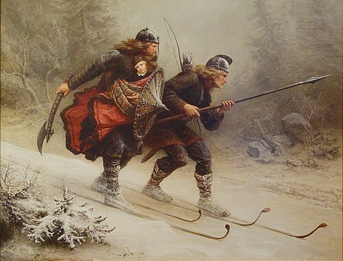
. Painting by Knud Bergslien located at Holmenkollen Ski Museum, Oslo, Norway.
It all started in 1206 when Norway was in the midst of a Civil War. The Birkebeiner Warriors were a rebel faction who protected Prince Haakon, heir to throne. Two of them, Torstein Skevla and Skjervald Skrukka, skied with the prince over treacherous and mountainous terrain from Lillehammer to Trondheim to bring him to safety. He ultimately became King Haakon IV.
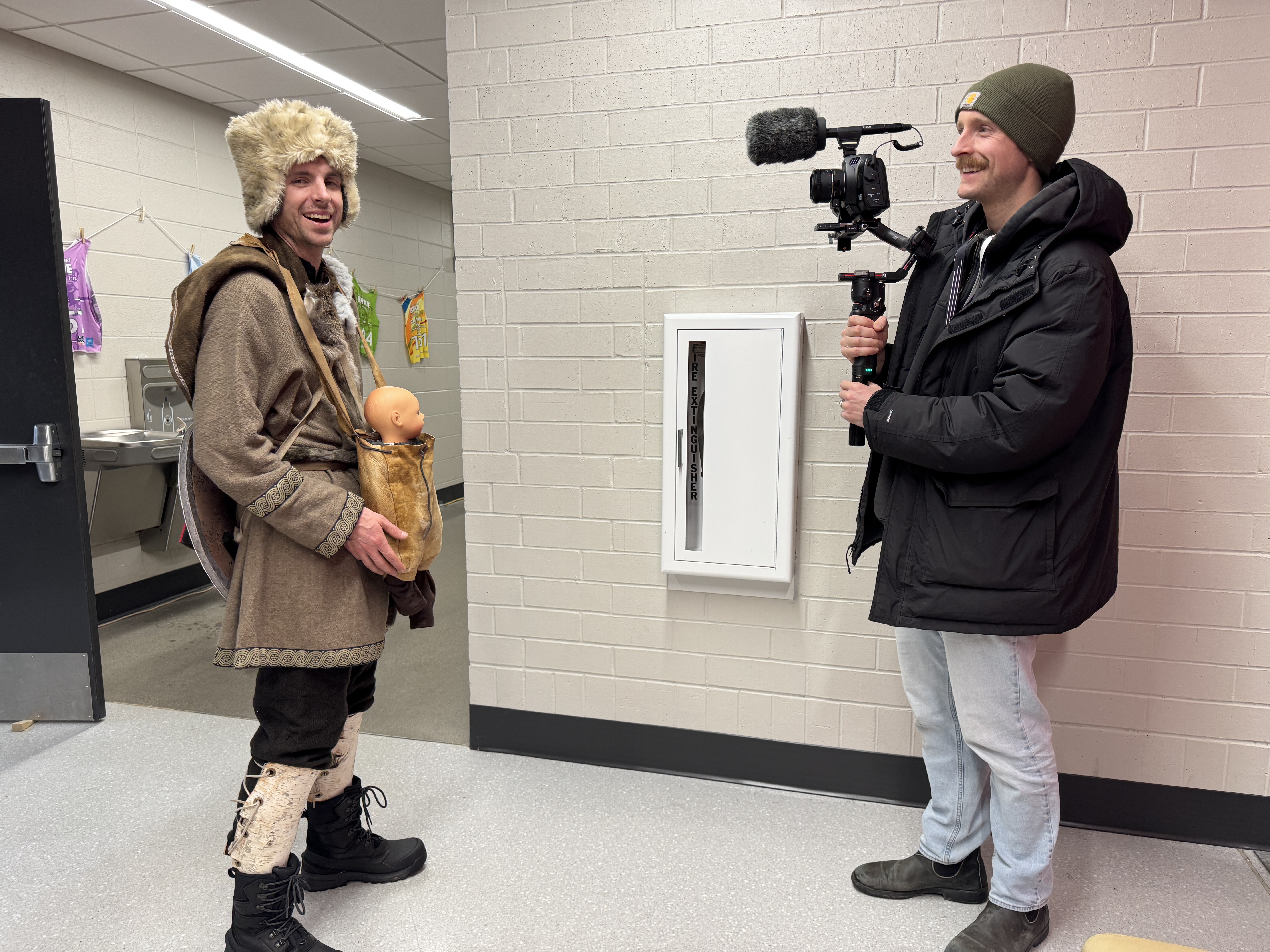
The American Birkebeiner selects three skiers each year to recreate the Warriors’ journey. They are the mascots of the 5-day Birkie event schedule, culminating with skiing the 53k Classic Race in costume and on wooden skis with either a real baby or a doll.
A year ago, having completed 12 Classic Birkie races (mostly in the elite wave), my son Erik decided he, Katie, Peter and Saige were going to be the next Warriors – Skjervald, Inga and Torstein along with Prince Haakon. It requires submitting an application which highly encourages a video to win the coveted spots. After collecting childhood, high school and adult photos of their skiing lives, Erik complied their video which was convincing enough to win them the honor! You can see the announcement and video here – it’s worth watching!
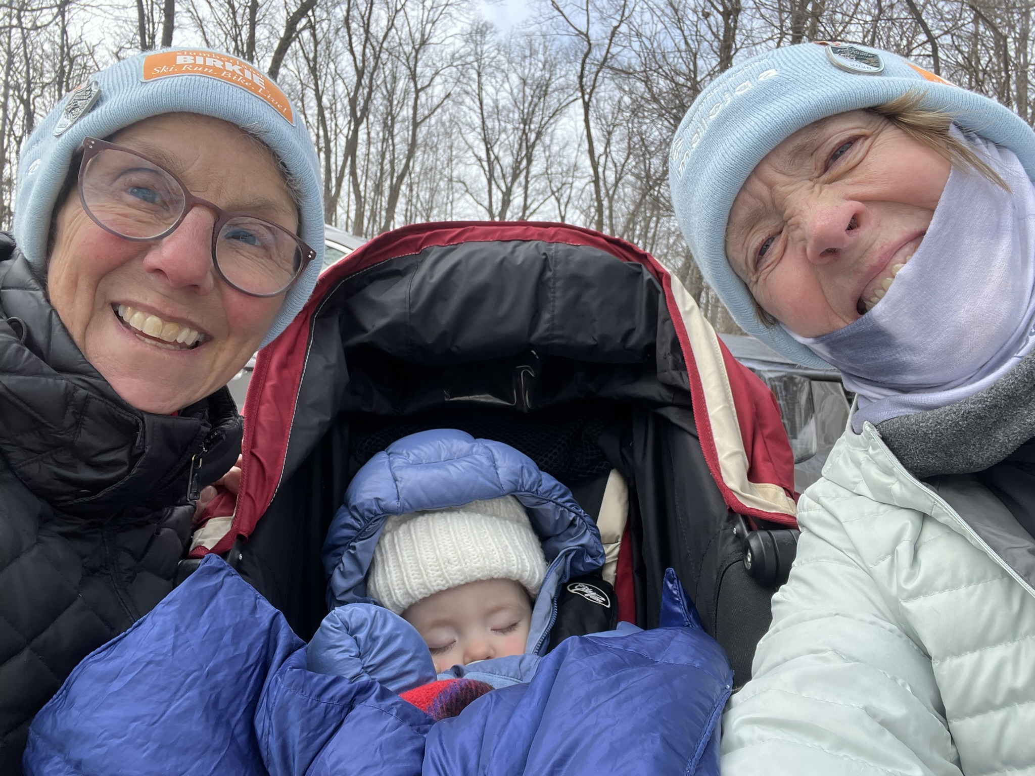
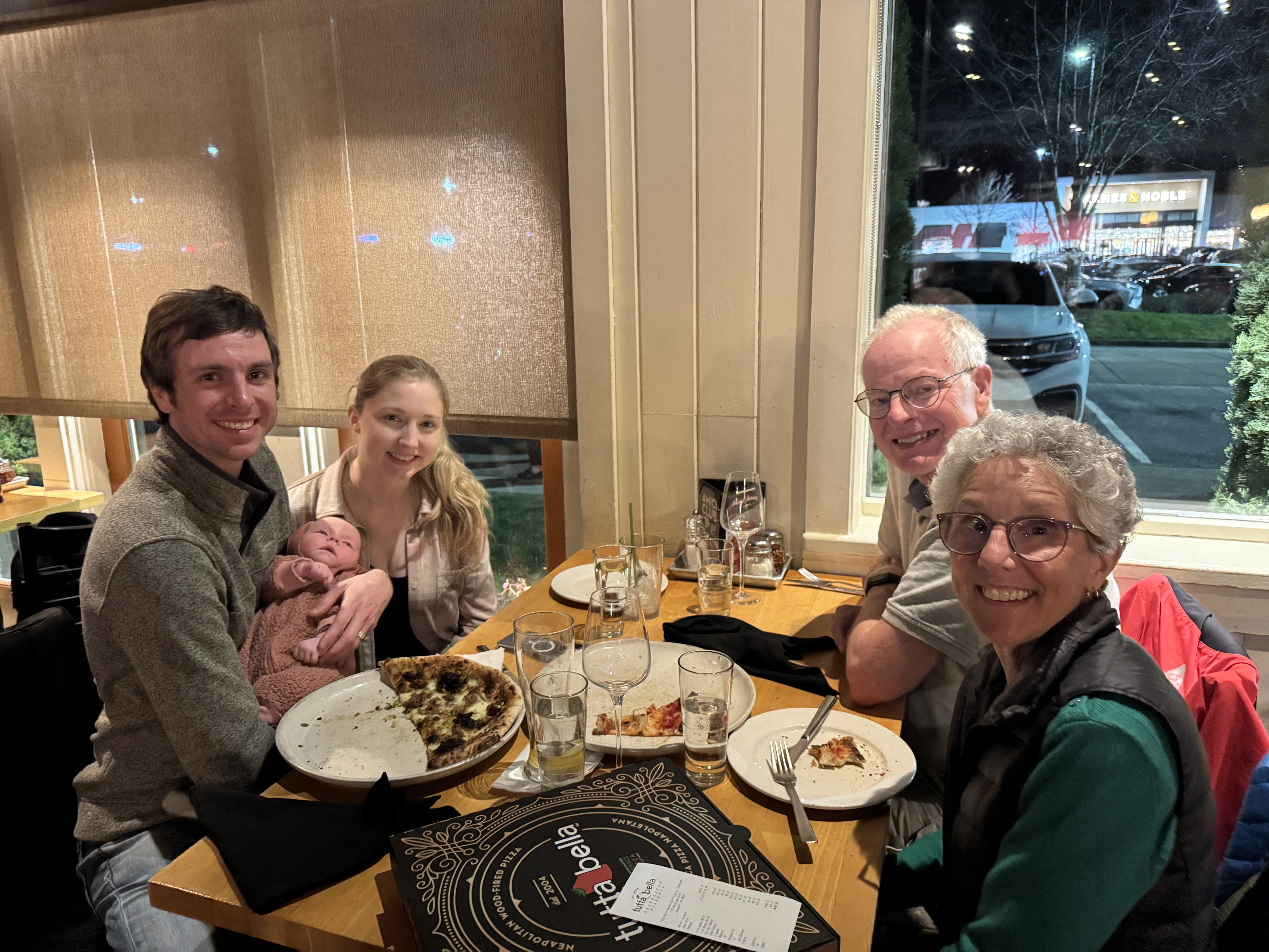
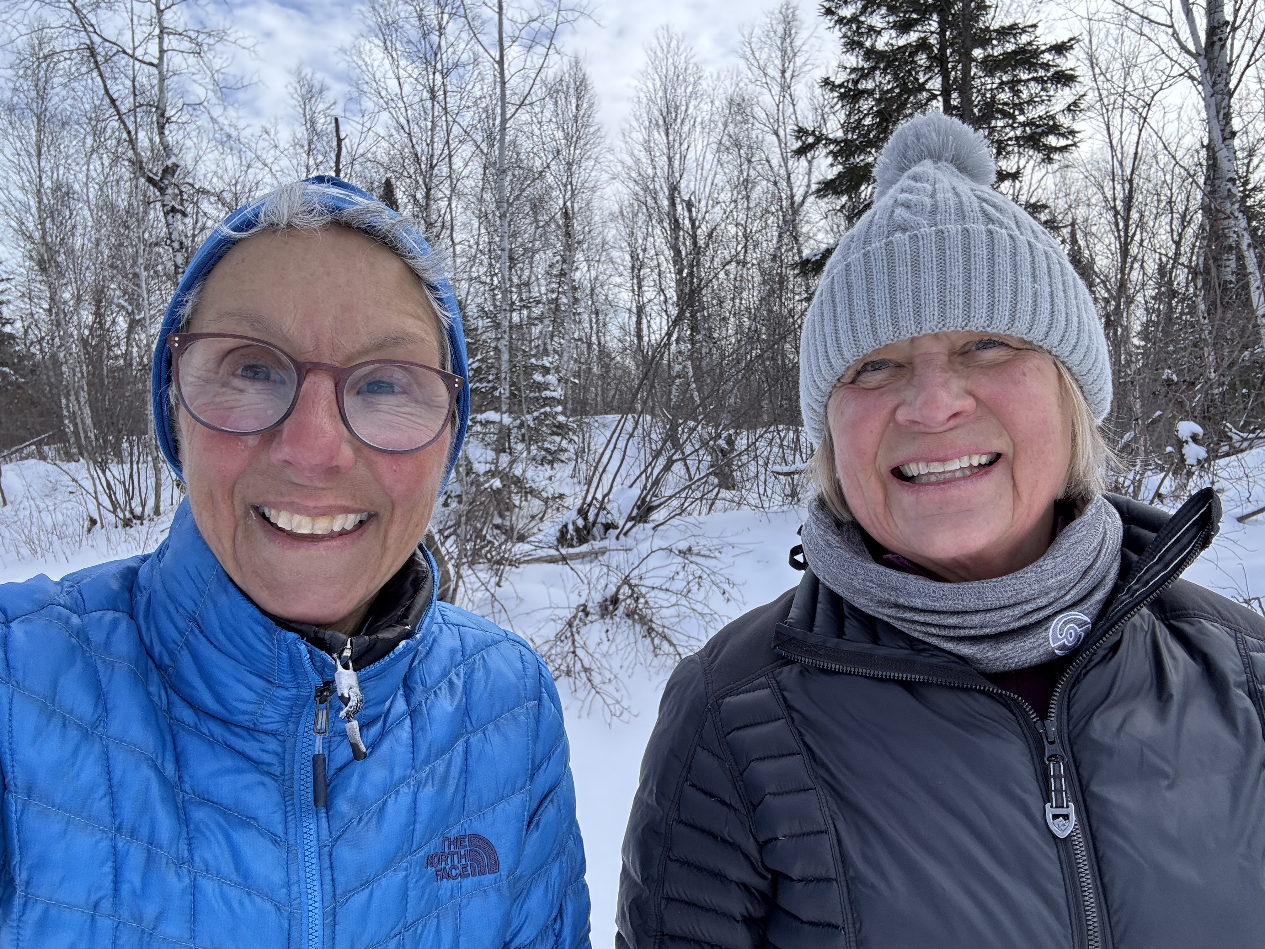
As the Warriors, they were required to appear at various events from Wednesday through Saturday. Katie’s mom, Betsy, and I were thrilled to be able to stay for the duration at the “ski cabin” where Erik and fellow skiers have gathered for years of Birkie races. We tagged along at the events, and formed a double-grandma team to watch Saige. For our efforts, we were gifted Birkie Volunteer hats – we earned them gladly!
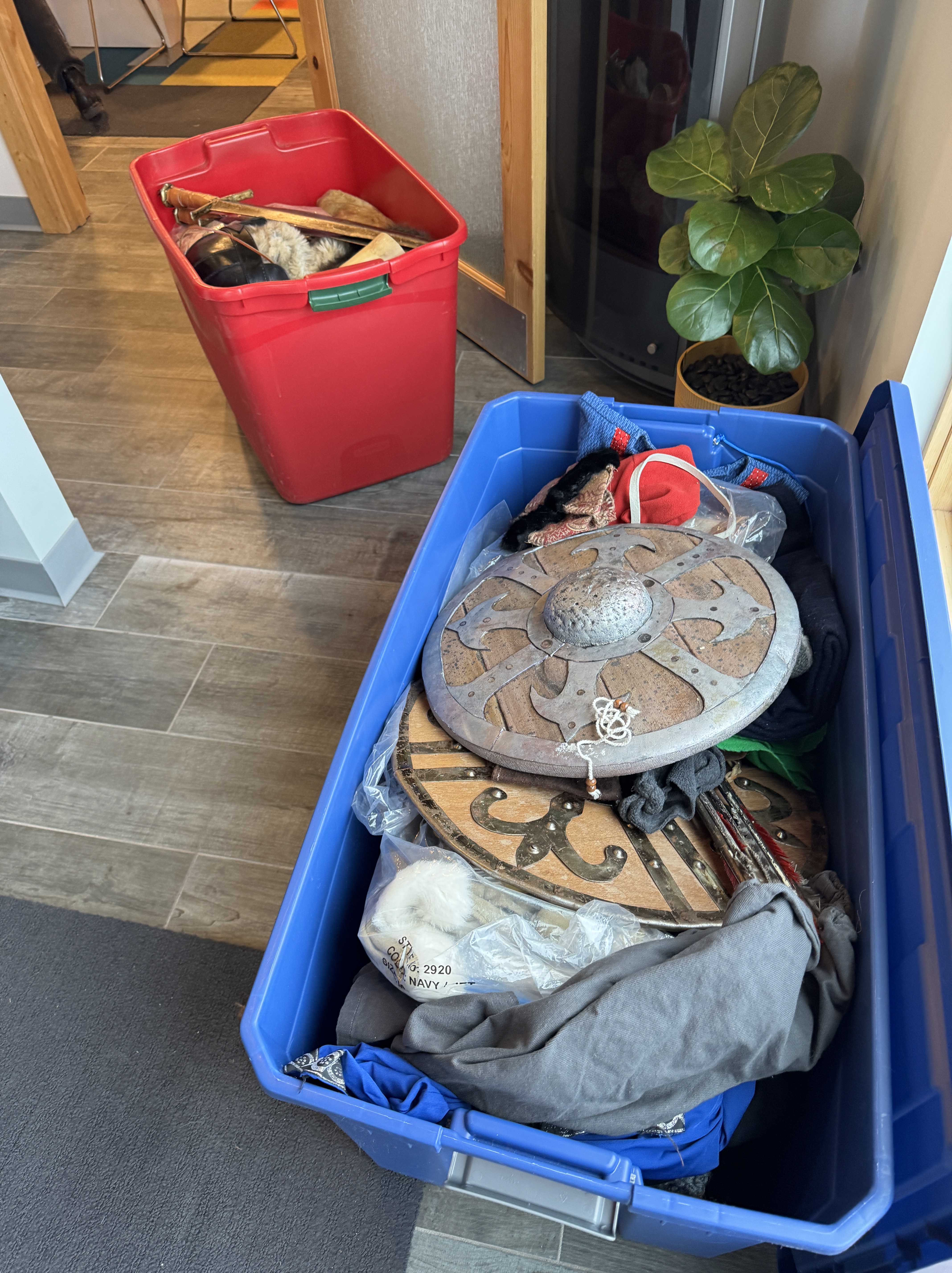
The first task was assembling costumes. They were required to furnish their own wooden skis for the race, which they borrowed from ski collector friends or old family skis. A party ensued to coat the bottoms with pine tar, using a blow torch to melt it in. The Birkie has an assortment of clothing pieces in three big tubs, and after sifting through the jumbled contents they put together convincing Warrior garb.
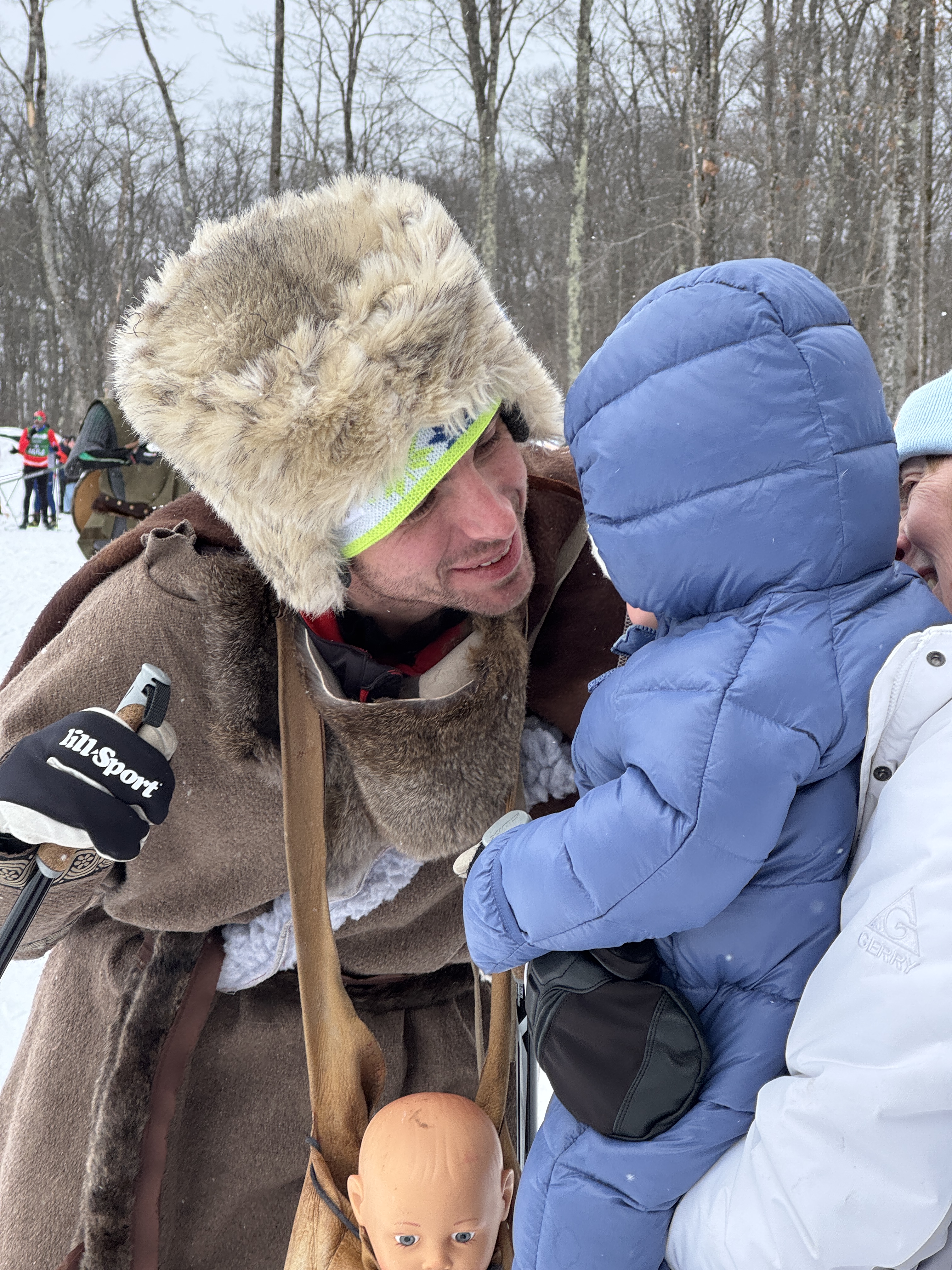
Their first appearance was at the Barnebirkie race for young children. The little skiers loved having their picture taken with the warriors – it was their first taste of fame. Peter’s Dad, Dick, Betsy and I couldn’t resist doing the same!
The media was also very interested in these celebrities!
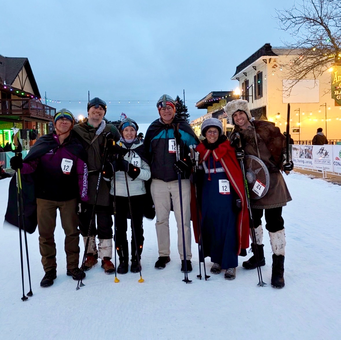
On Thursday night we entered team “Haakon’s Entourage” in the Giant Ski race, along with Rich and Dick, all in warrior costumes. With Katie back at the cabin attending to Saige, I was drafted to be Inga for the night. Half the fun was seeing the silly costumes on other teams.
The race involved all six team members strapped onto two giant skis, competing against one other team skiing down Hayward’s Main Street. We happened to be in the last heat, and watching highly proficient teams along with those who stumbled along gave us some perspective on the difficulty and hilarity involved. When our turn came, we started out all right. But as the team unwittingly picked up the pace and lengthened the strides, my short legs could not keep up! It was a strange feeling to have the skis move under my feet, totally out of my control! I felt myself wobble out of control and finally crumbled to the ground about half-way down the course. With help from a friendly volunteer who helped me back up, we managed to make it to the finish line without further incident. We were far from being in contention for the four finalist spots (out of 30 starting teams), but we fully accomplished our goal of having fun!
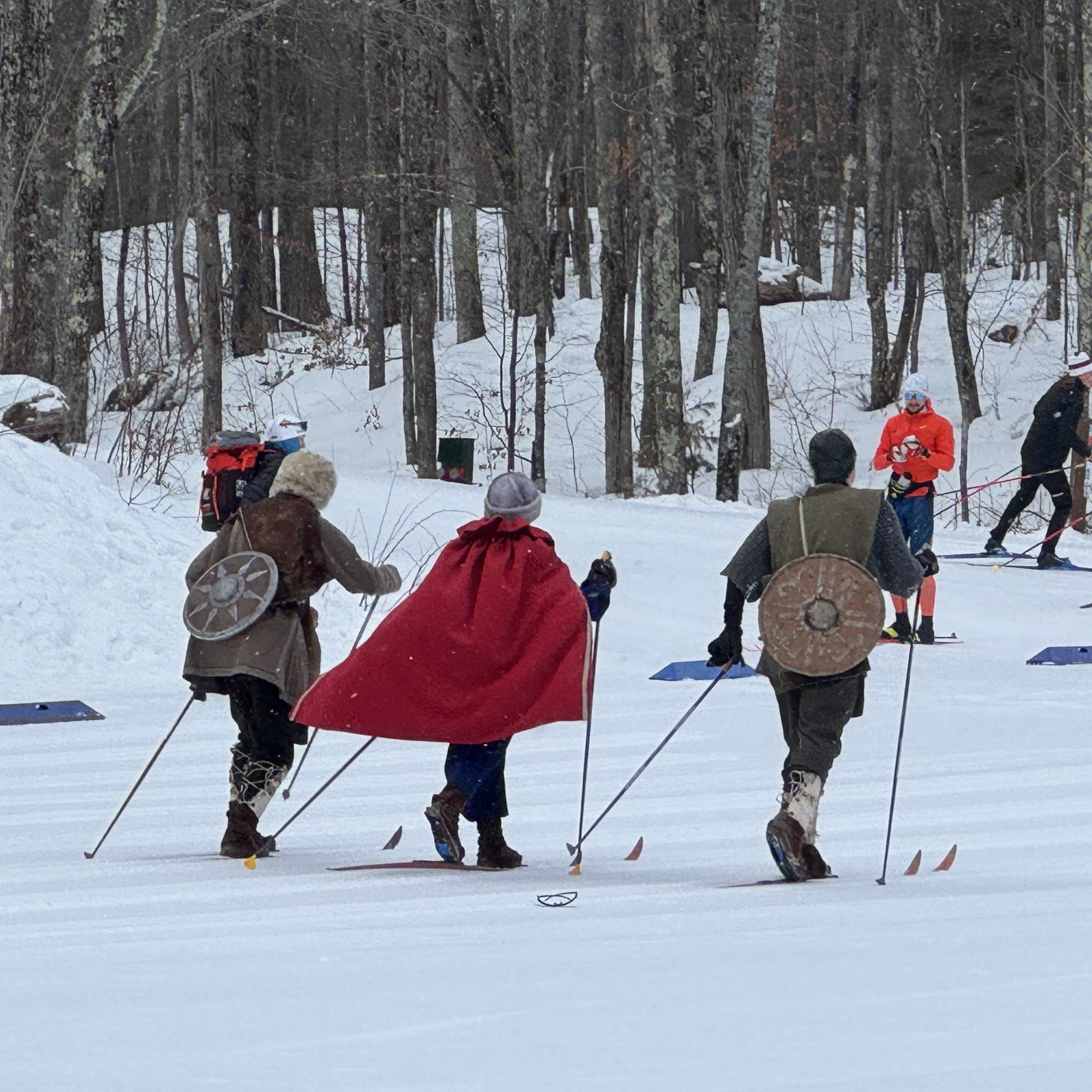
The big event was on Saturday, skiing the full Birkie course along with thousands of racers. In the early morning hours, I delivered the Warriors to the race course where they lined up at the start line in front of all the other skiers and headed off down the trail! It was far too early for baby Saige to be up, so they skied with a baby doll as a stand-in for Prince Hakkon.
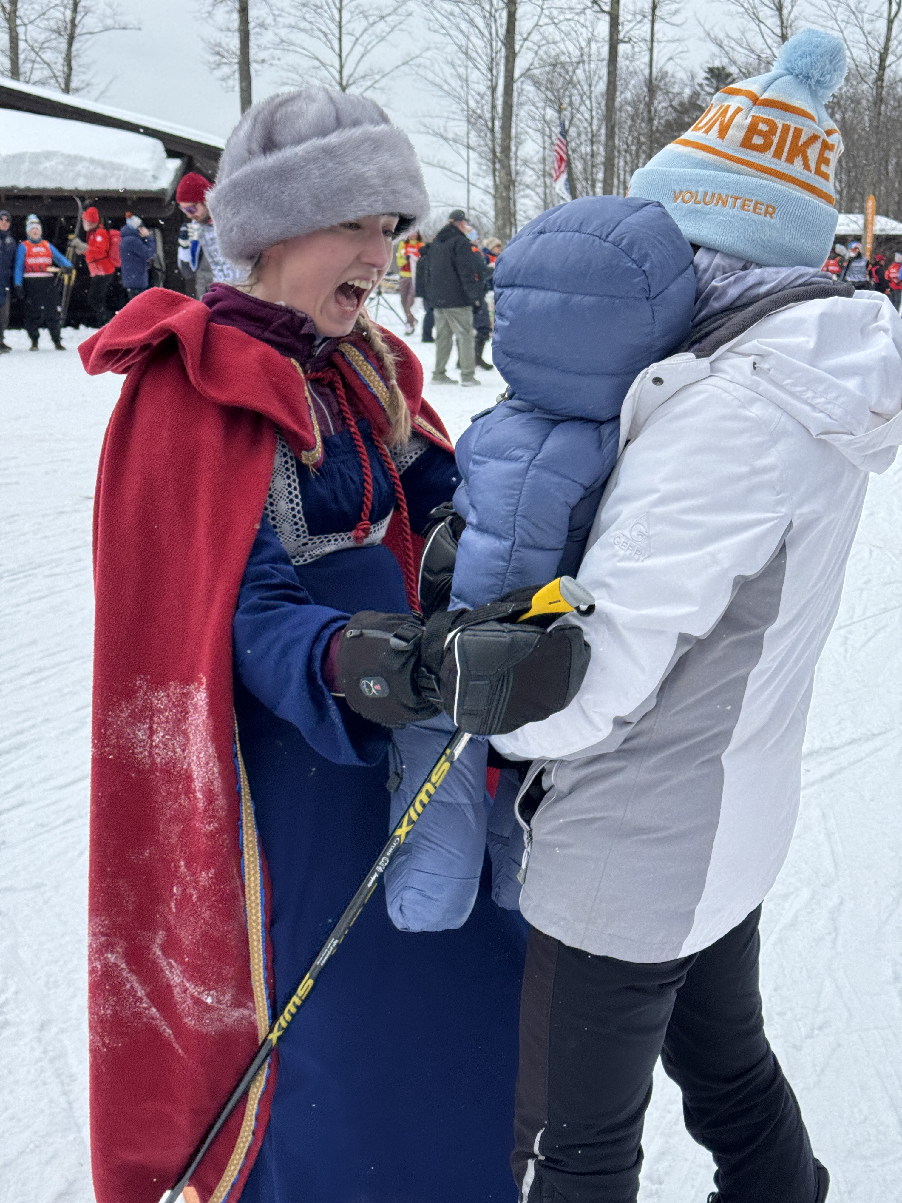
My next stop was at highway OO, midpoint of the race. Meeting up with Betsy and Saige, and our husbands, we eagerly awaited the arrival of the Warriors. They were faring well and found that all the competitive skiers cheered them on throughout the race. It was a touching reunion with Saige at that stop!
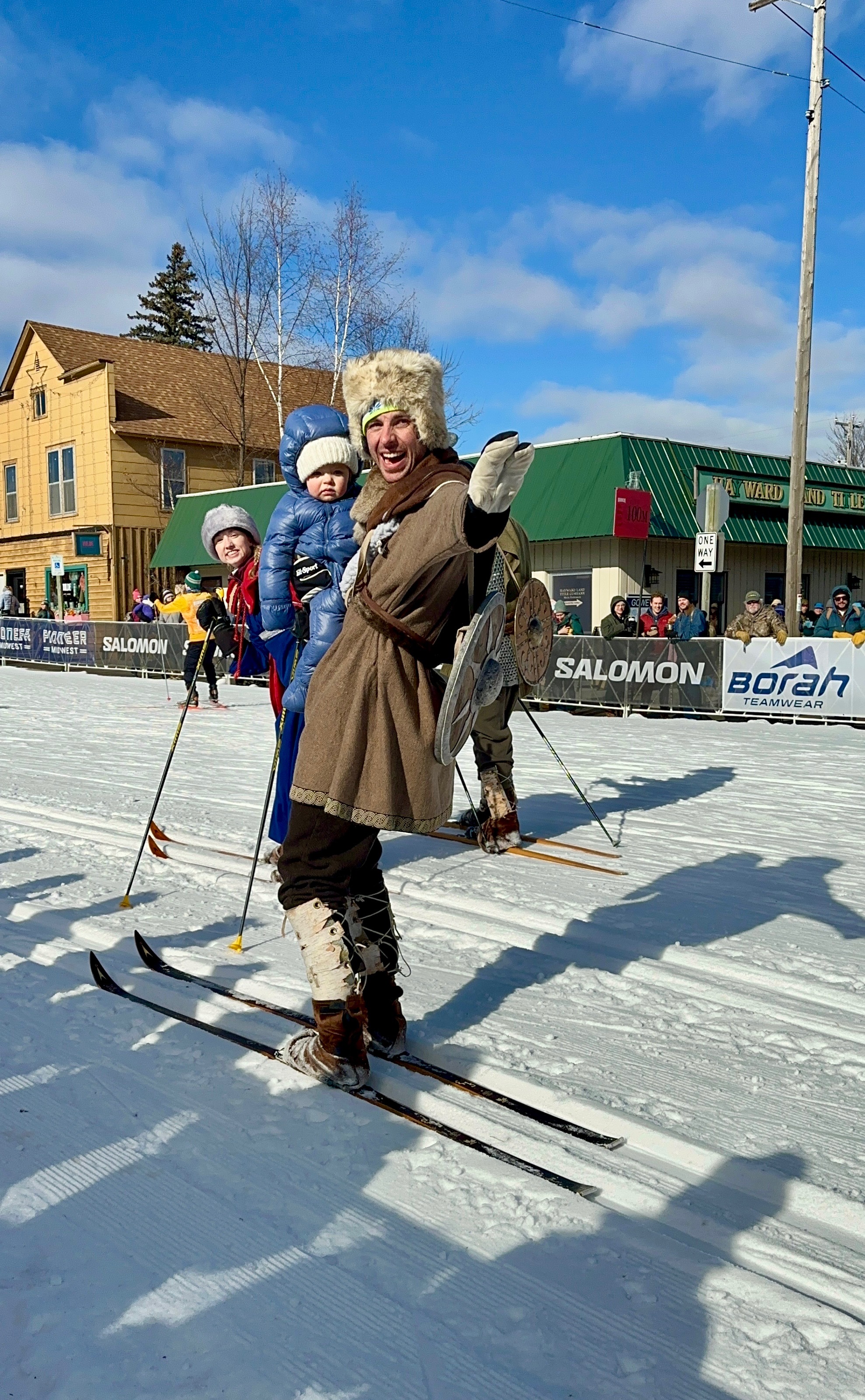
Betsy handed Saige off to Rich and me and from there it was a dash to the finish line. We knew that parking in crowded downtown Hayward would be a challenge, but we made our way to the fence lining Main Street in plenty of time. Our other kids, Karen and Carl, were also there with nearly all of their family members to cheer on the Warriors as well! Surrounded by excited fans we peered down the course, and finally after six hours of skiing they reached the top of the bridge at the start of Main Street. There they were announced and cheered for their final stretch of the race!
My job was to hand over Saige at the bottom of the hill, in exchange for the baby doll. The trio triumphantly skied with their own baby to the finish line!
It was Katie and Saige’s first Birkie, so they both received medals! Erik and Peter racked up another Birkie pin in their long string of races.
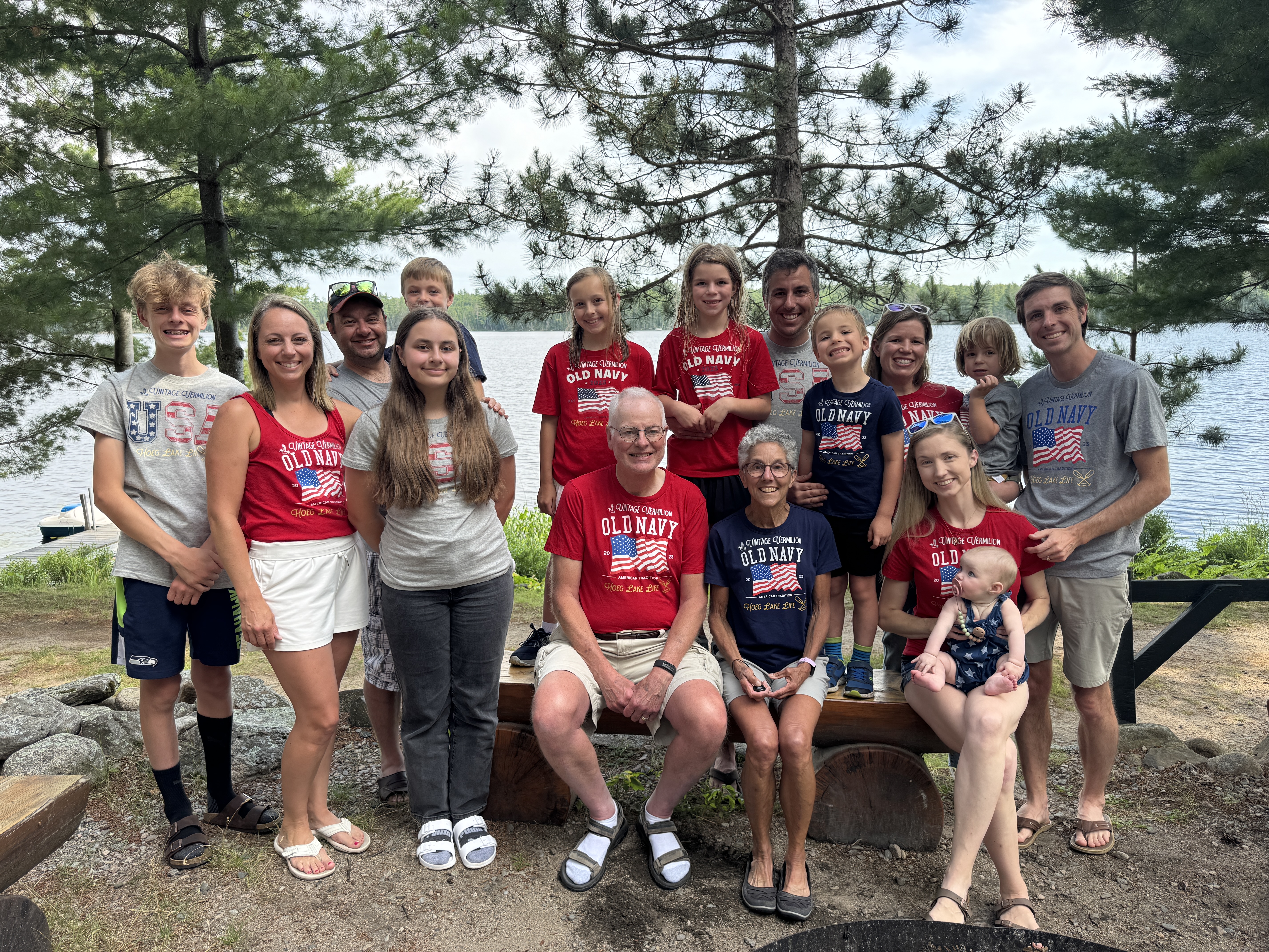
The grand finale – gathering our family in honor of our Warriors. Such a great honor for all of us!
And the final bonus for me – having extended special time with “princess Haakon,” our royal granddaughter.
It’s been a long time since I was in Ireland. Throughout my junior year of college studying abroad I took every opportunity to travel, using a rail pass, hopping from country to country, staying in youth hostels and seeing all the sights. Ireland was the last country I visited, traveling by bus, discovering they did not run every day, and vivid memories of walking down a narrow lane bordered by hedge rows, being told “just a little piece further” to lodgings that felt miles away. Ah, such youthful energy. Rich and I have traveled a lot over the years, and our style has gradually changed. Our favored mode now is to pick one spot and explore intensively from that base. It’s more about absorbing the culture and feel of the place than hitting all the spots in a guide book. So that’s exactly what we did on this trip to Ireland.
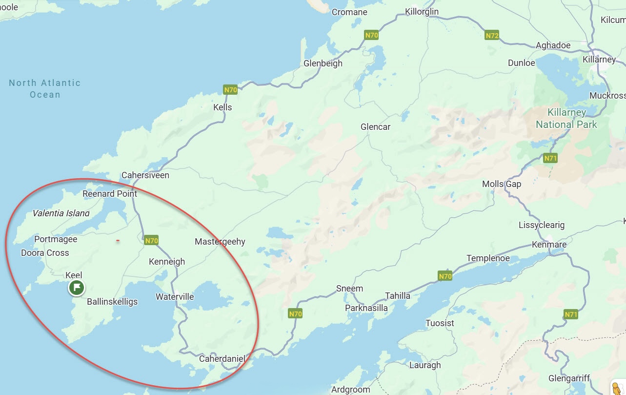
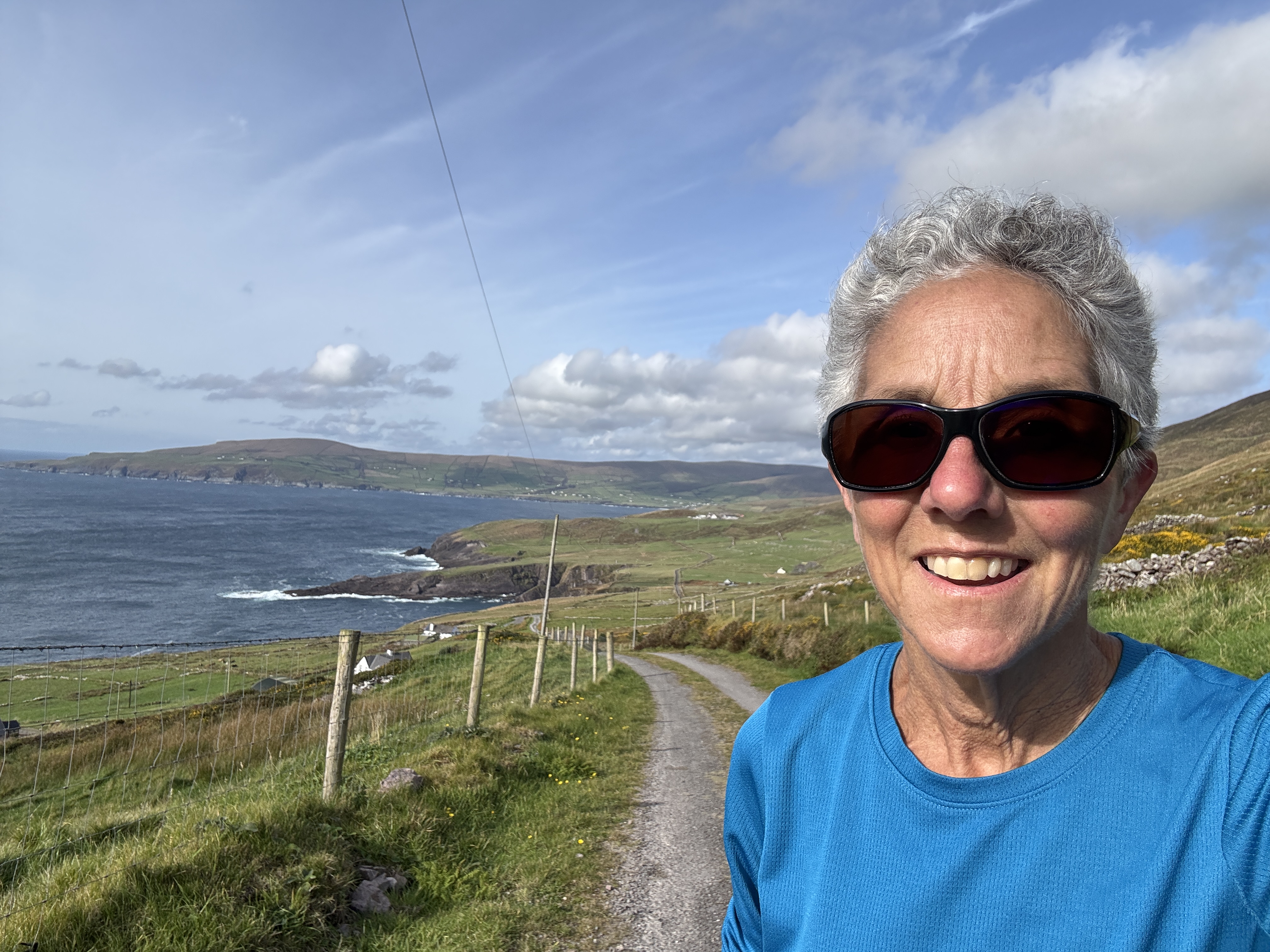
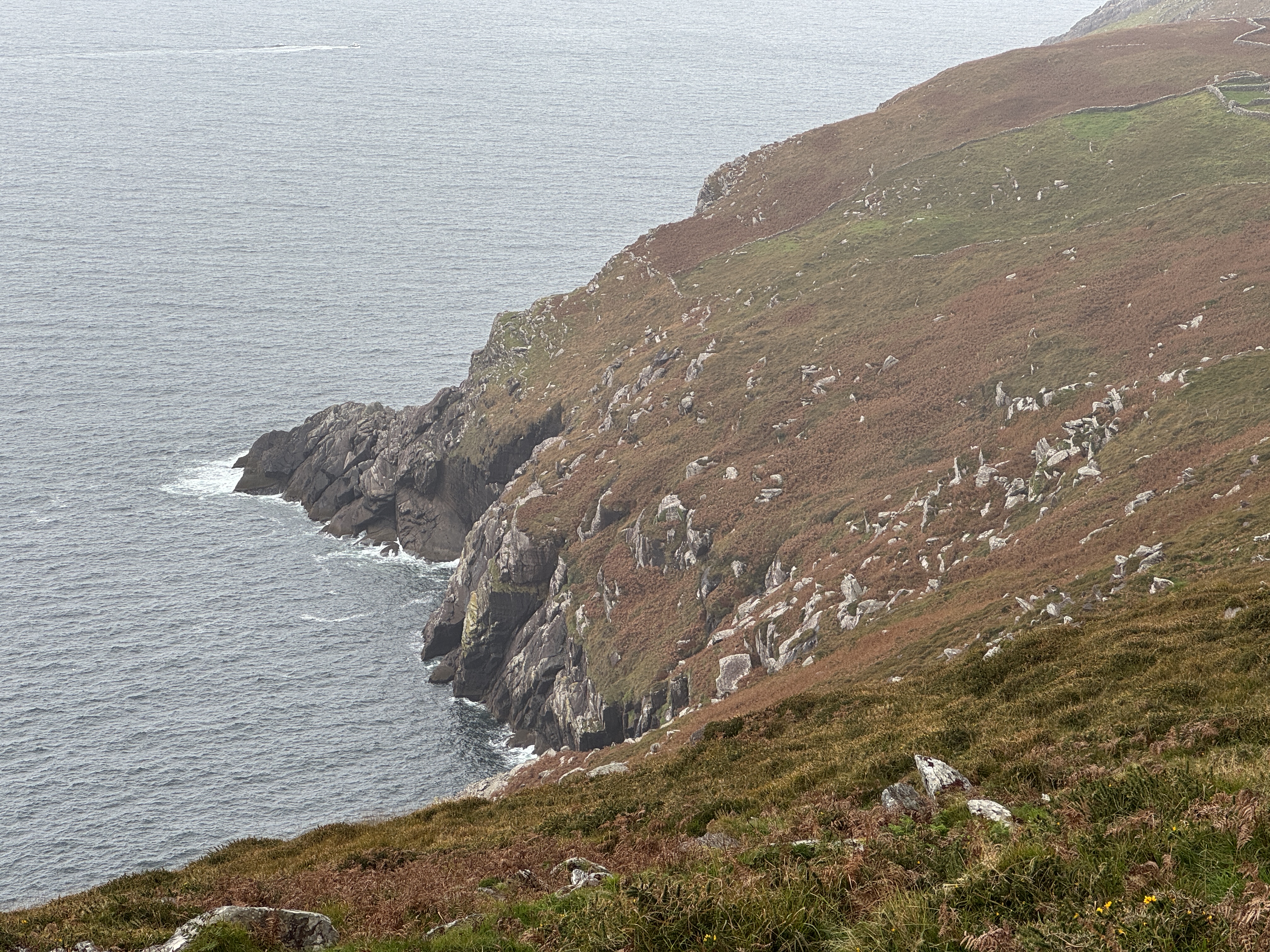
Rich had never been to Ireland, and I let him choose the location. I was thrilled when he zeroed in on the Ring of Kerry as I remembered it as being scenic. In this case, we were even further removed, in an AirBnB on the Ring of Skelligs – below the Ring of Kerry – and right on the coast. It was a delightful old farmhouse, and through texts to our host we learned it was “Grandad’s House,” nearing 100 years old on land that’s been in the family for generations. From there we could see the jagged coastline, soaring cliffs and waves crashing in. It was Ireland at its rugged best.
The location of the farmhouse on the map did not prepare me for its remoteness nor the time and stress of driving on the left on narrow one-lane roads. Restaurants and grocery stores were a good distance away, as were many of the places I’d hoped to go. But fortunately, we have always enjoyed mixing cooking simple meals for ourselves with going out to eat. And by narrowing our field of range to “very local” we soon became resourceful at finding interesting out-of-the way places to go and reveling in the scenery.
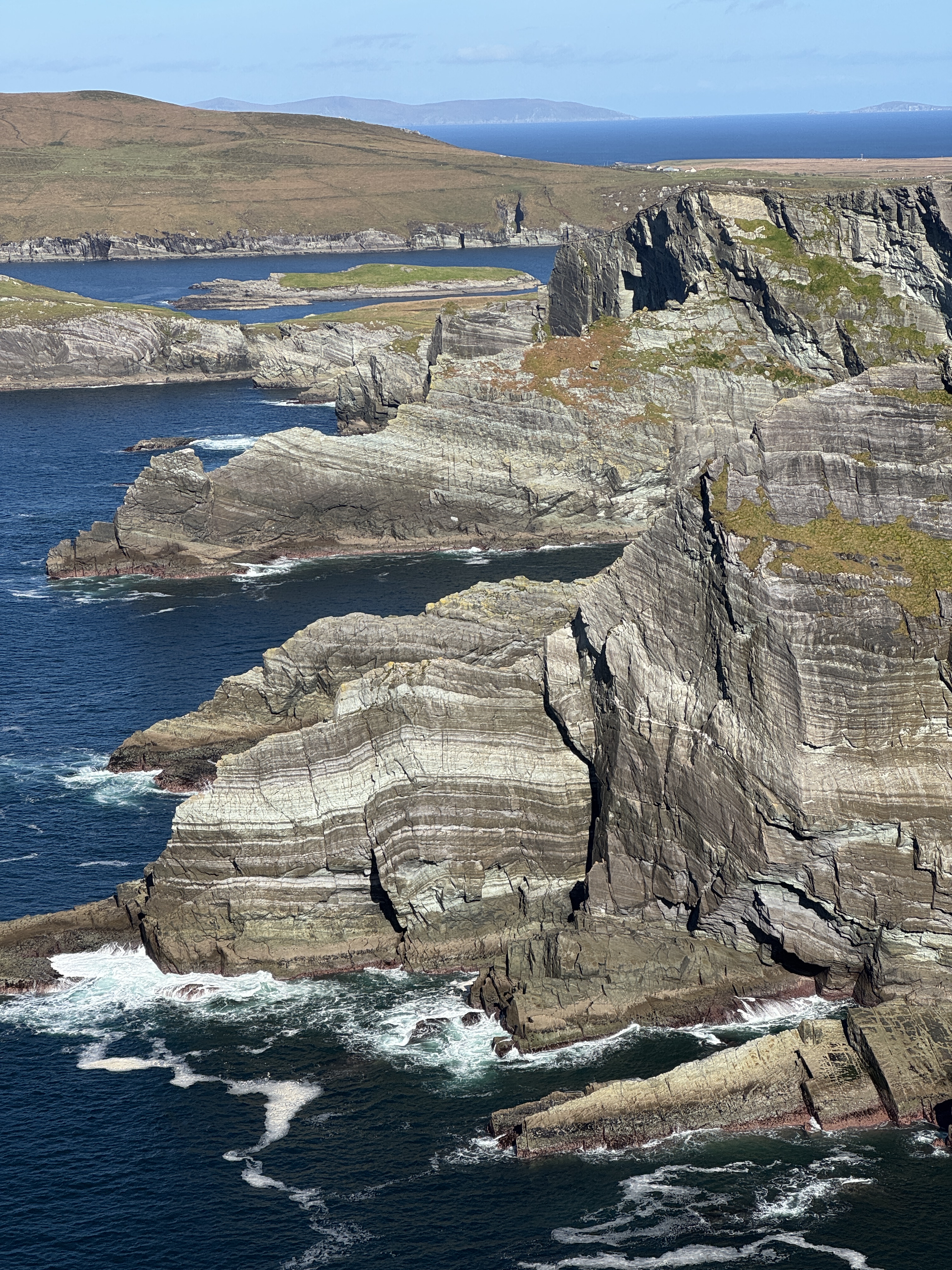
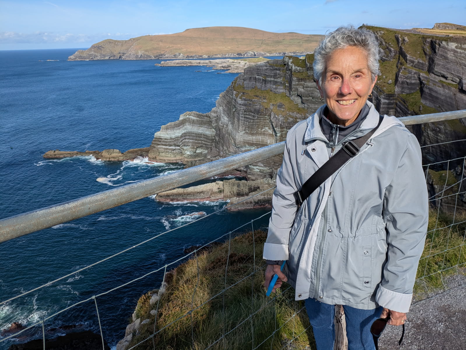
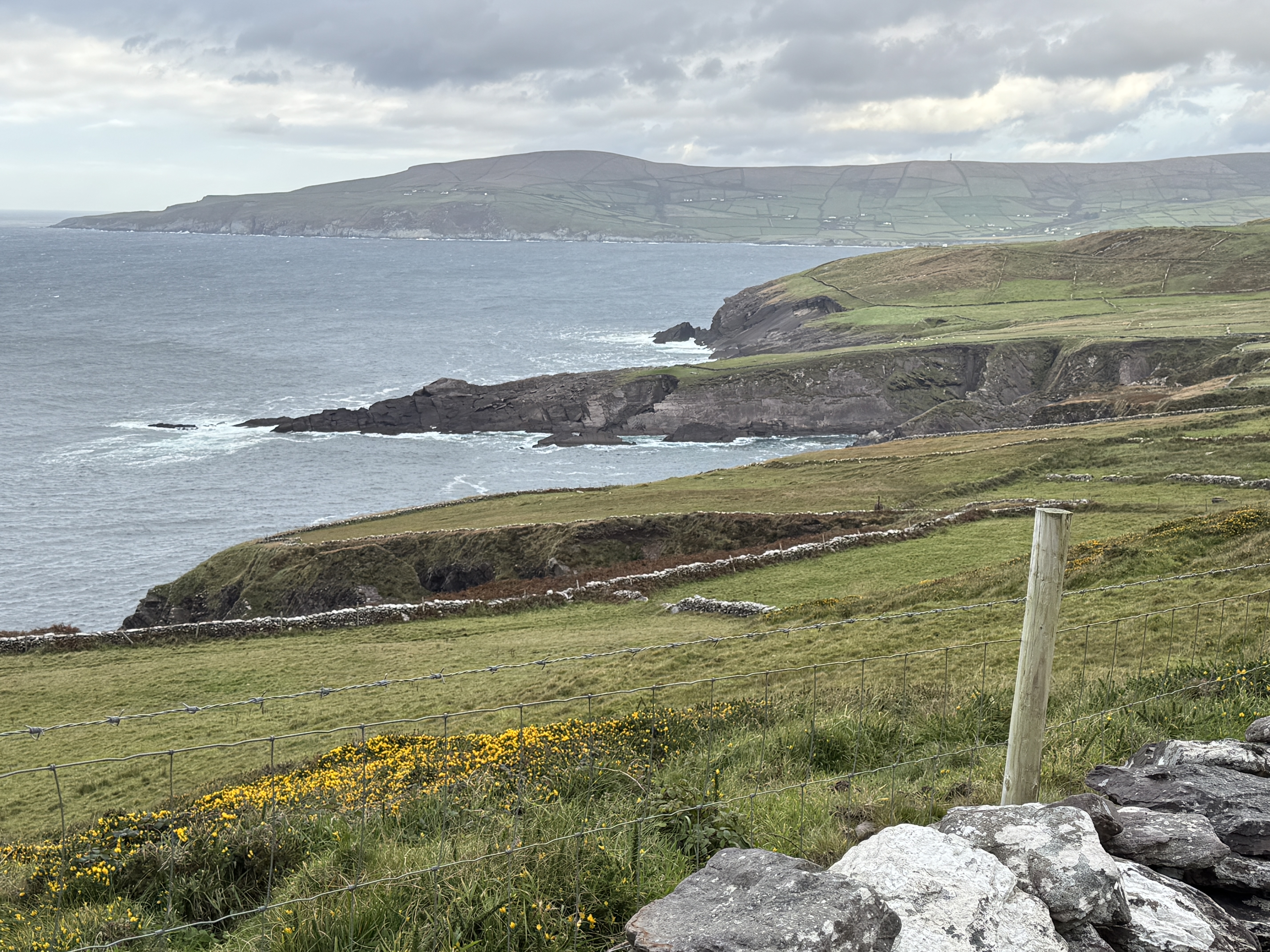
In our first few days, we did visit some of the tourist sights within our range. The Kerry Cliffs were just down the road, where we followed a simple trail up to two viewing spots atop the famed cliffs. We enjoyed the fact that it was all very low-key, with a small number of visitors and such easy access where we could wander at will. At 1,000 feet high against a sunny clear blue sky, they did not disappoint. Neither did the birds, which were perhaps even more interesting to Rich.
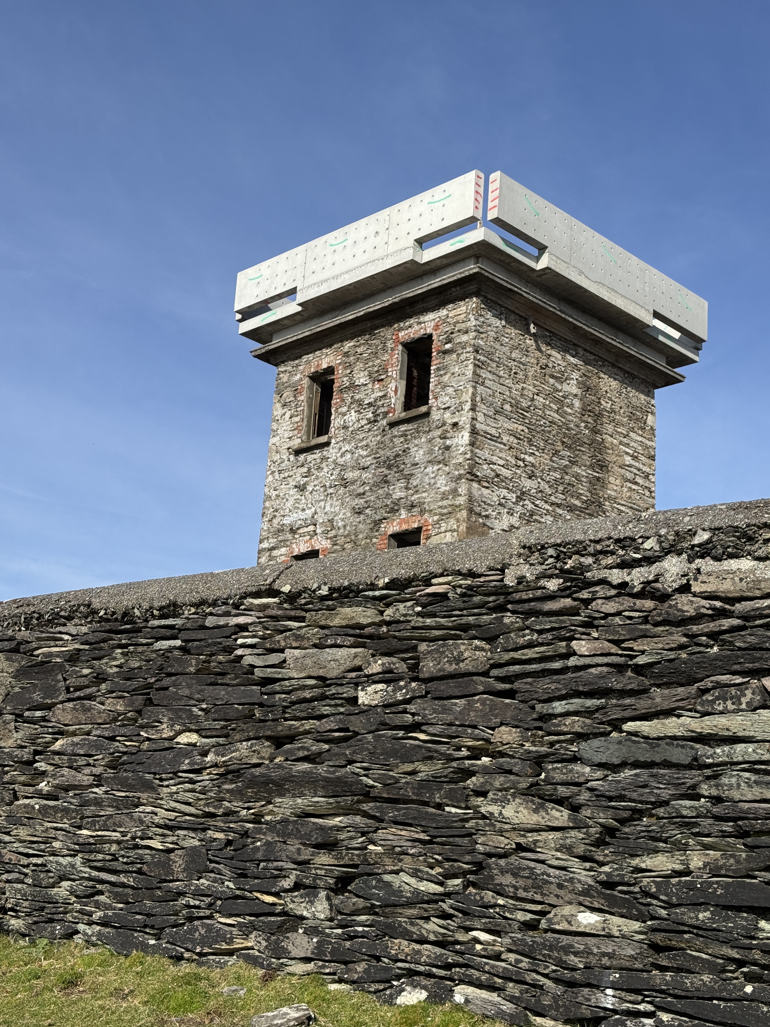
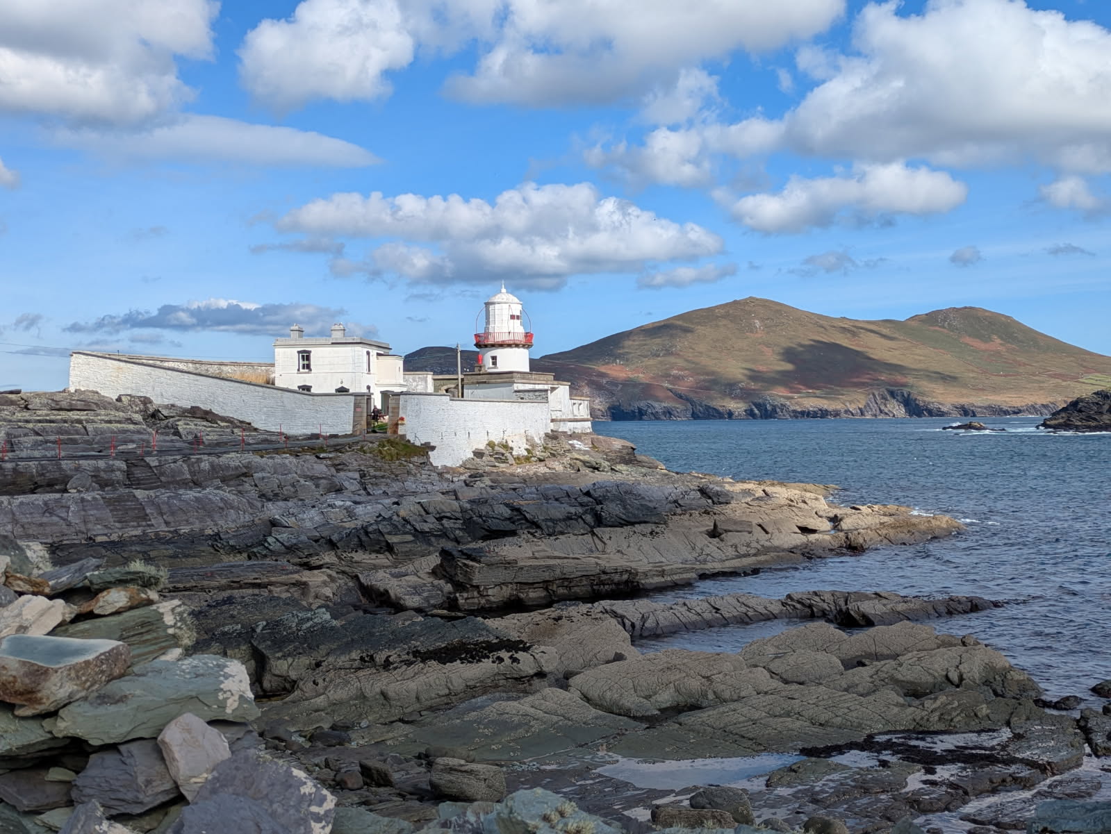
The long narrow peninsula we could see in the distance was the south end of Valentia Island, which turned out to be a good place for outings. I was particularly interested in doing the Bray Head Loop Walk, which was a wide path up the long hill to get to the old signal tower near the end. The trail was open to the wind, and grew increasingly steep as we approached the end. By the time we reached the tower (which was being reconstructed) the wind was howling and swirling around us. I didn’t dare venture near the edge! But there was a great view of Puffin Island and the Skellig Islands (famous for where some of the later Star Wars movies were filmed). While on the island, we also took in the lighthouse, which was perched on sheer rock
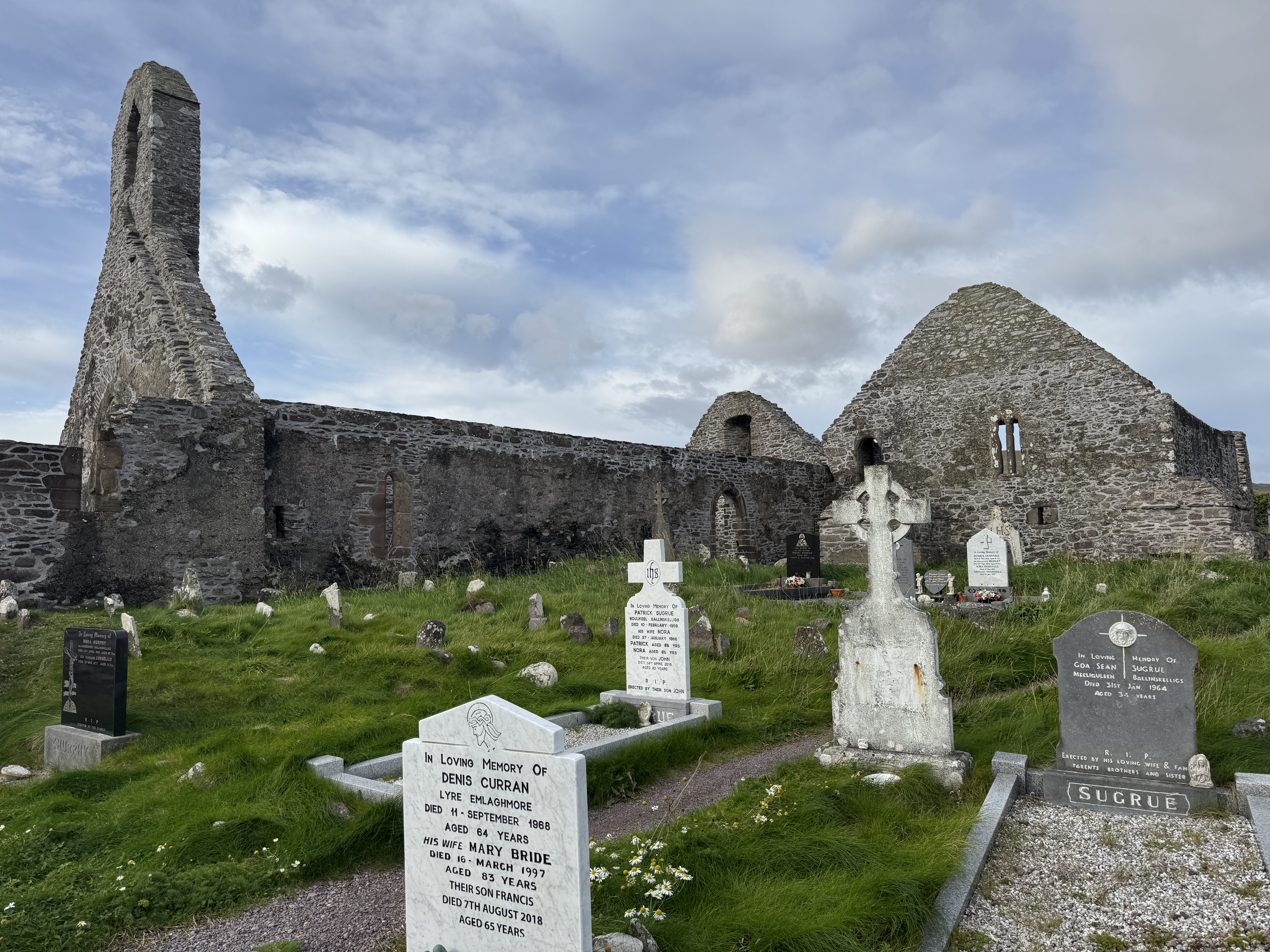
As the week wore on, we each developed favorite spots and activities. Rich’s was Ballinskelligs Beach. It was a mere 9 minute drive away, and had the added attraction of hosting ruins of a castle and an abbey. On our first visit Rich was immediately drawn to the birds that were feasting on the exposed shoreline at low tide, while I walked the beach and explored the ruins. He began returning frequently for the birding success.
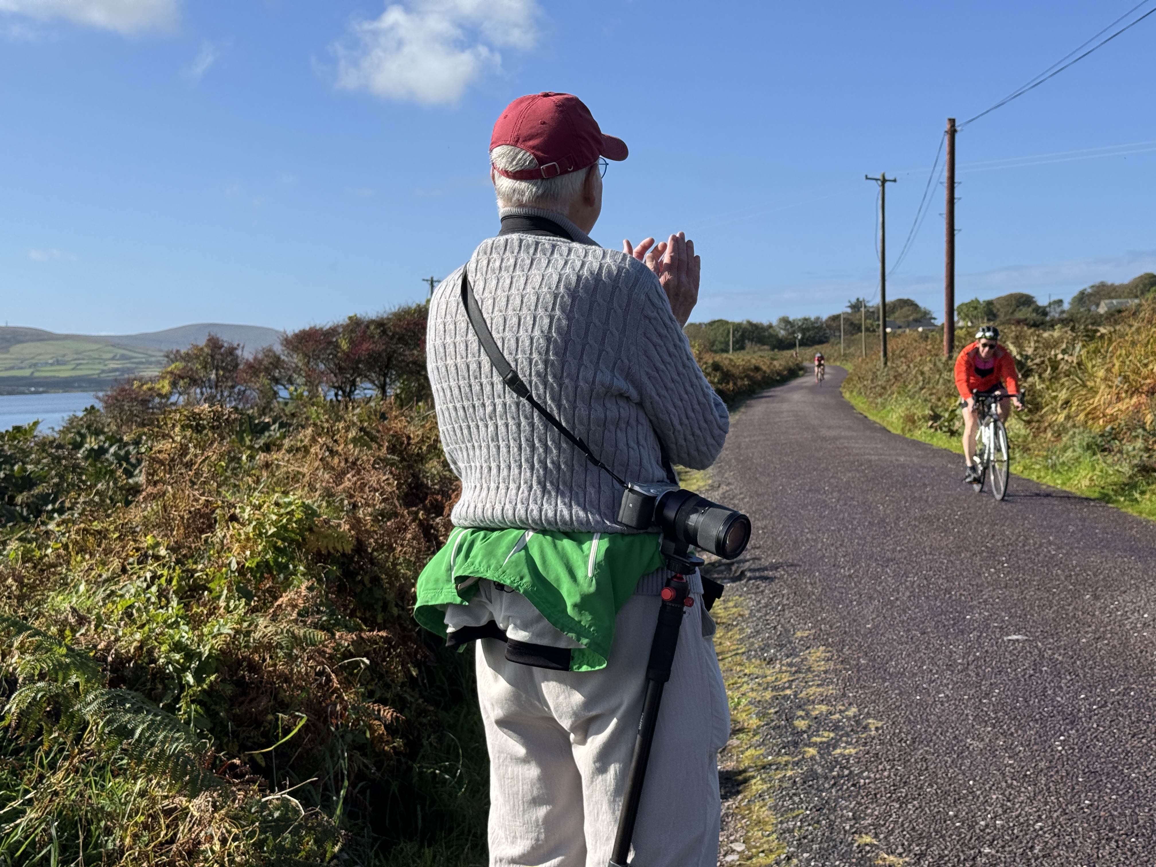
He also came up with the idea of walking the harbor and shoreline at the town of Knightstown on the northern end of Valentia Island. While it was a pleasant walk, the big surprise was finding a triathlon about to begin! We watched as the participants marched onto a ferry to the tunes of a bagpipe, and be ferried to the mainland to begin their swim back. Our walking route took us down the same road where the cyclists were racing to the finish, so we cheered them on in our best American accents! We returned to town to see runners crossing the finish line at the end of the race. Quite the excitement, for a simple walk.
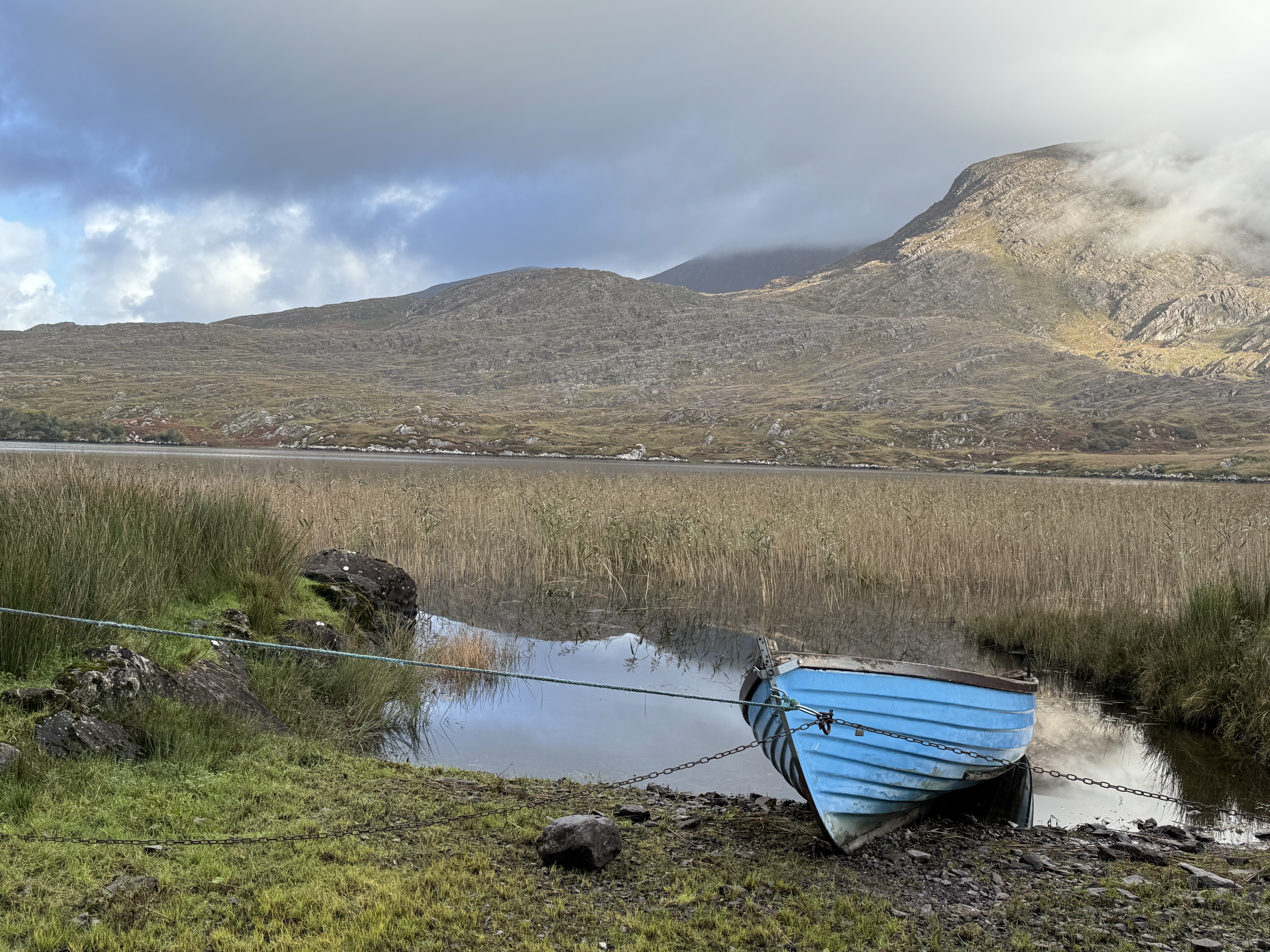
One of our favorite walks was one that Rich dreamed up merely by scrutinizing Google Maps. Behind the town of Waterville he noticed two lakes with a small country road alongside. We drove down a narrow lane covered in trees to the far end of Lough Currane. From there we walked to a pretty stream then on to smaller Isknagahiny Lough and along its shoreline. It was early in the morning, so peaceful and undisturbed – just a beautiful spot to be out in nature. And it had the added attraction of allowing me to re-visit a favorite spot afterwards for coffee and scones in Waterville!
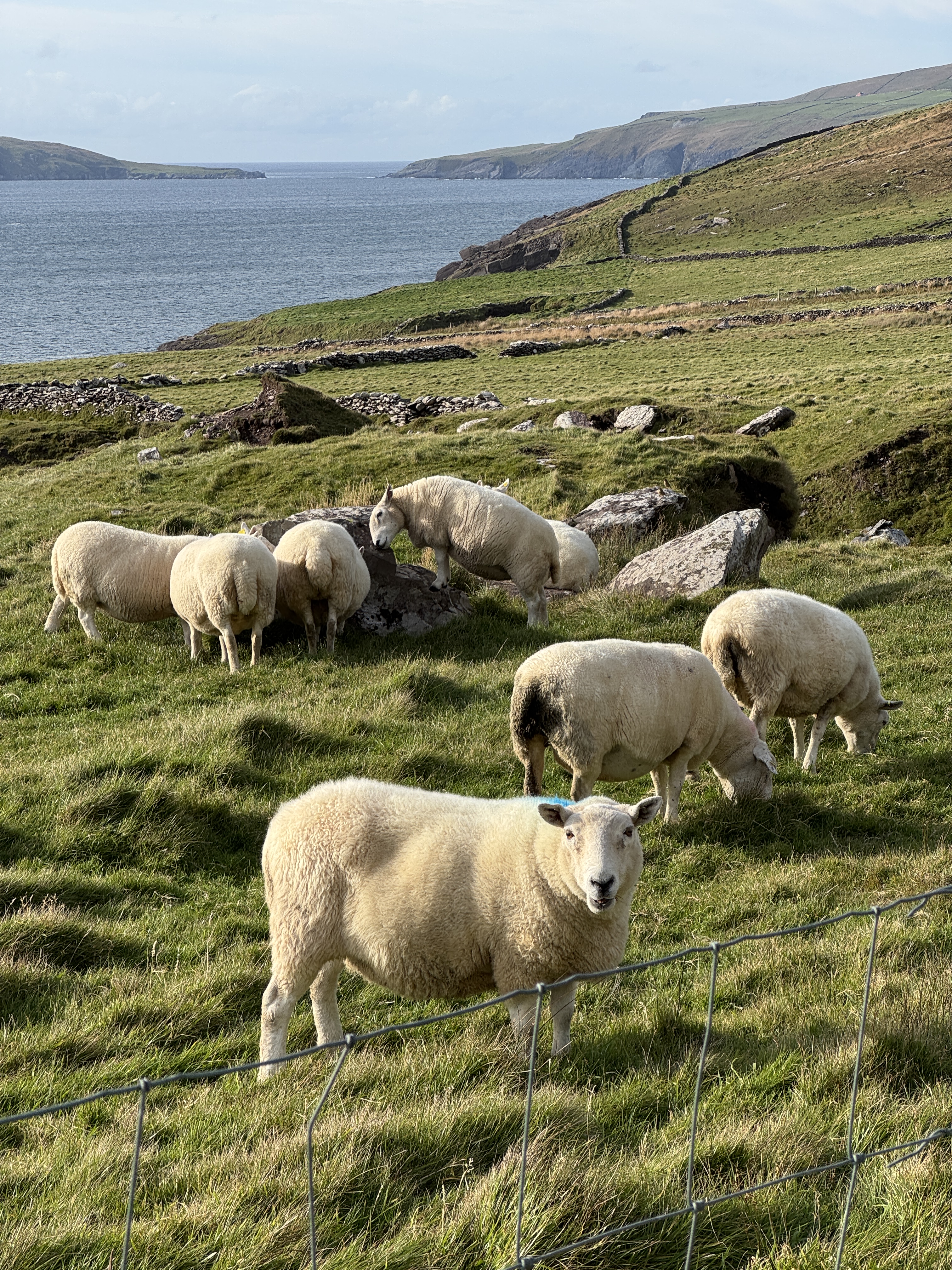
My focus was walking and hiking by the coast. There was a small farming road just a short distance down the road, which I started walking or running on a regular basis. There the farm fields and grazing land was carved into neat rectangles by stone walls, and they reached down to a coastline that featured the same jagged outline and rugged cliffs I’d seen all along the coast. That became “my farm road” and I never tired of passing by that scene, in awe at the majesty of those cliffs and the sound of the waves. They didn’t need a fancy tourist sign, they were part of the natural landscape. My landscape.
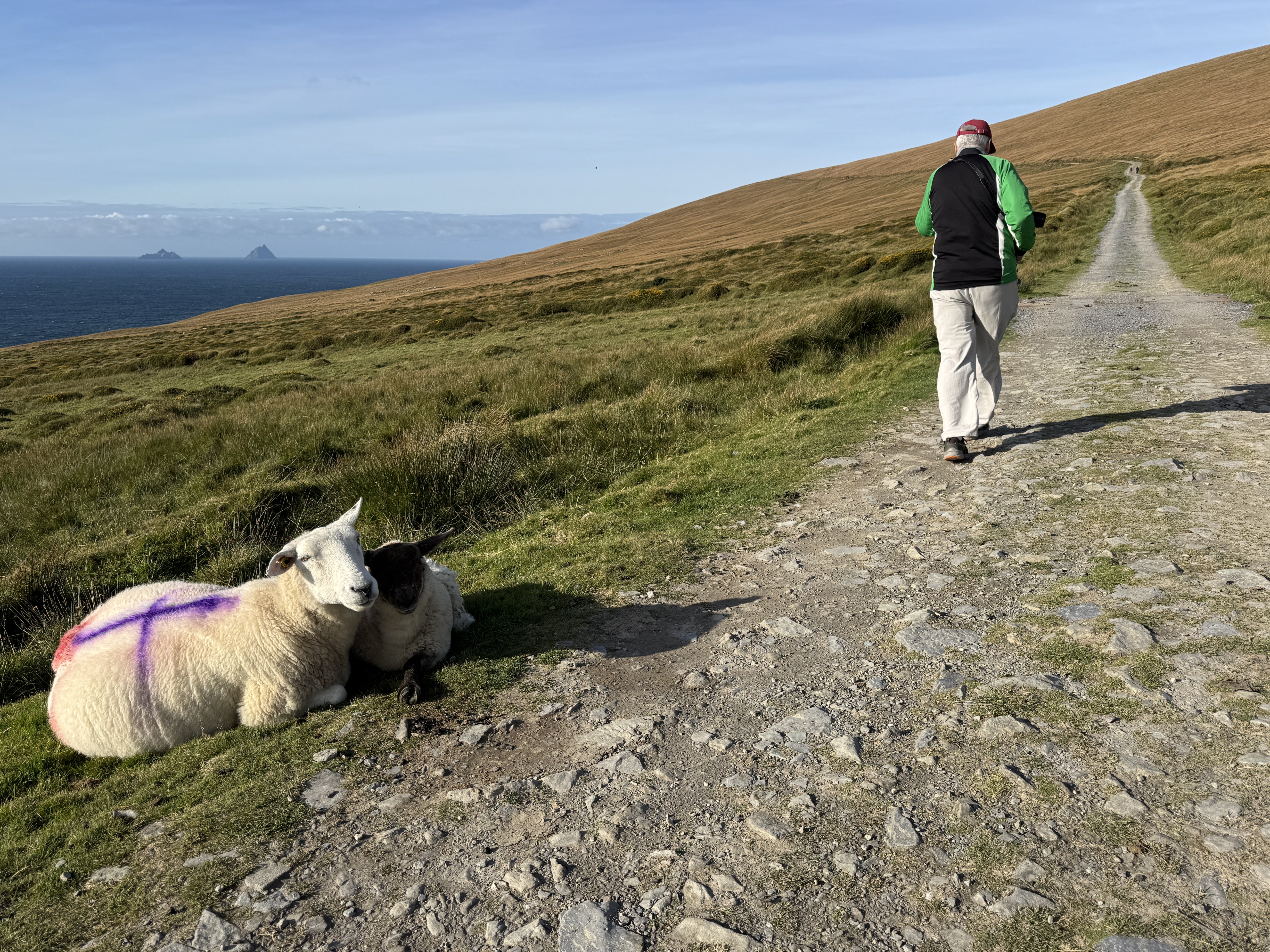
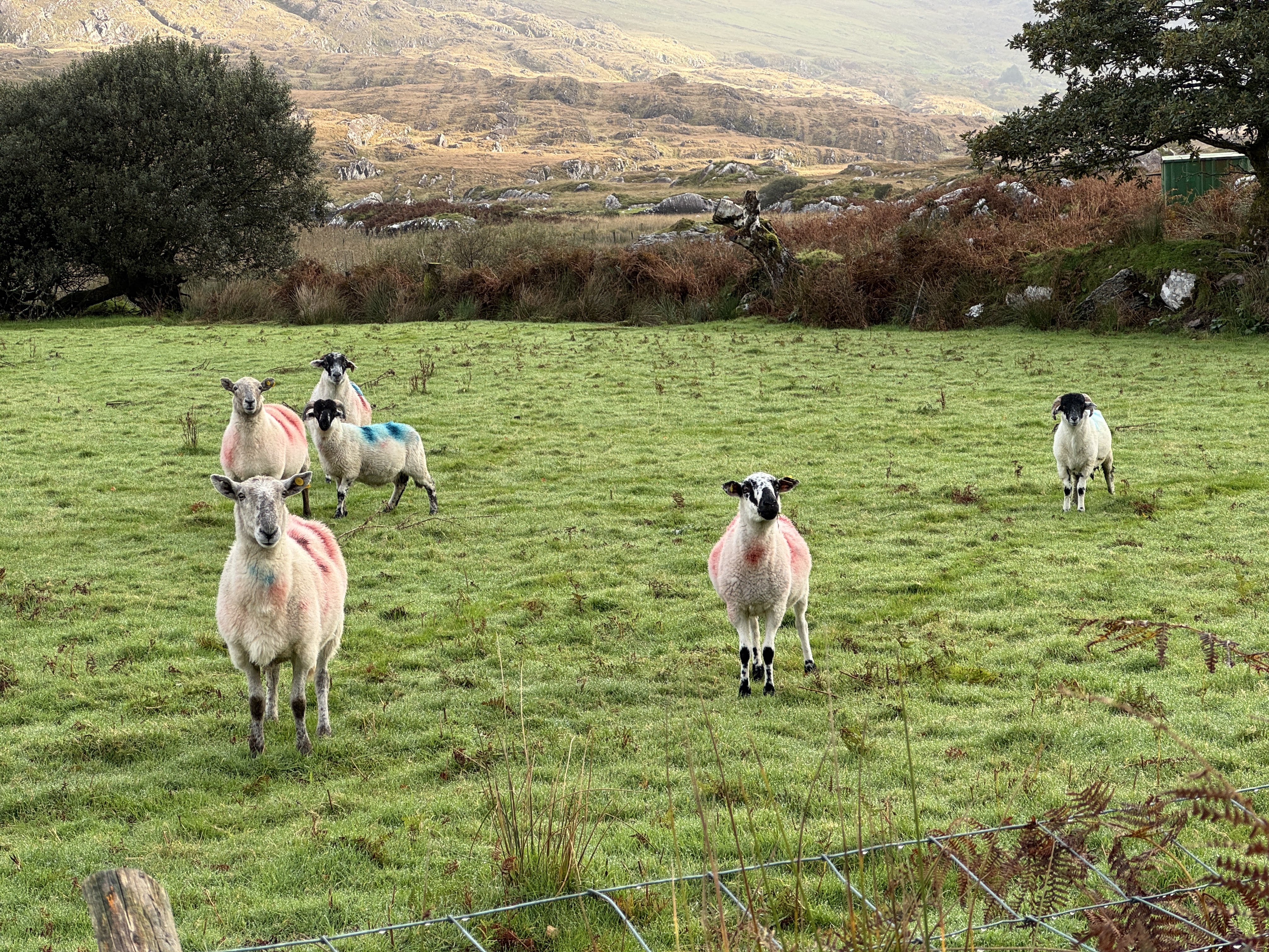
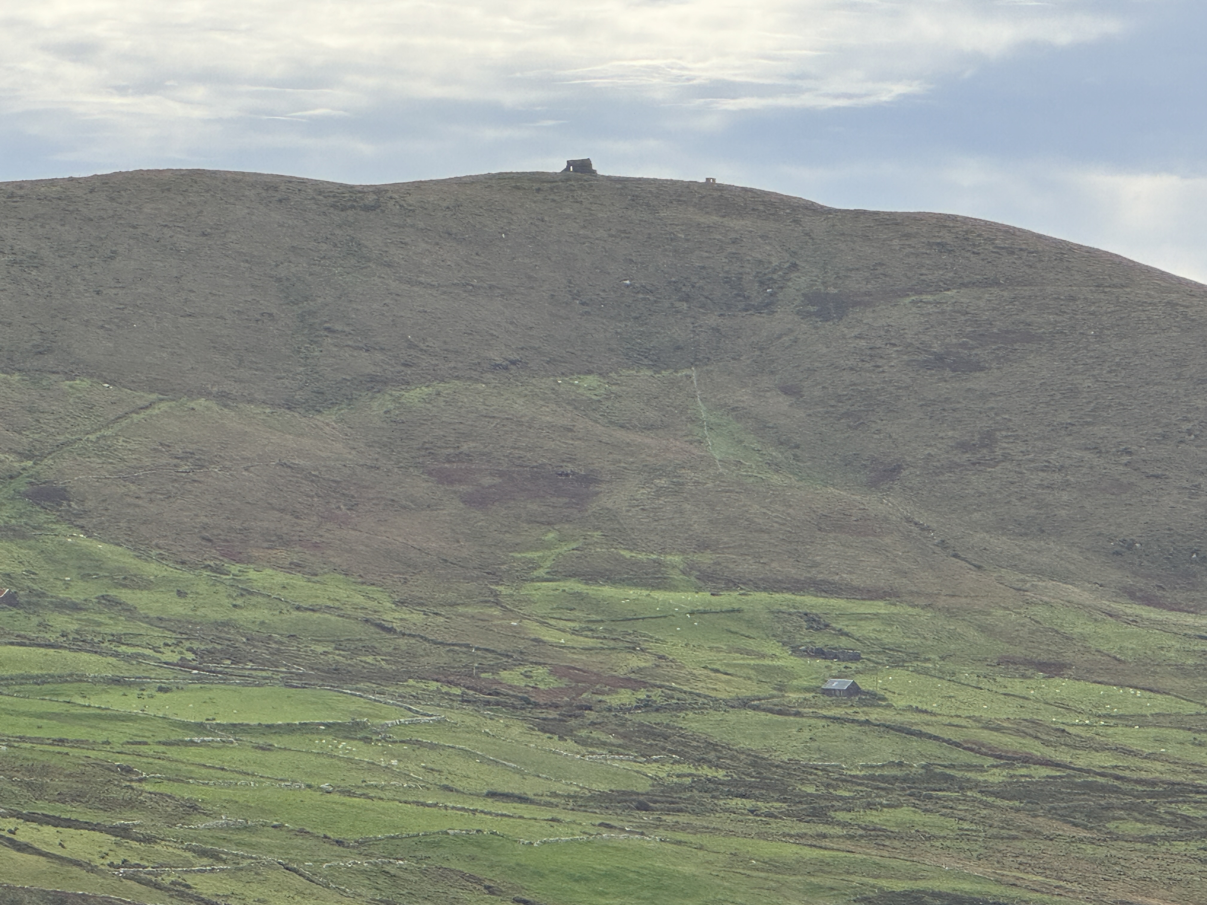
The trailhead for the Bolus Barracks Loop was on that walk, which naturally drew my attention. So I returned to hike the trail around the top of the peninsula and back again. The way up led through grazing land, where the sheep ignored me and at times the trail eluded me. But I found my way to the spine of the hill (it felt like a mountain) and straight up the steep incline. The closer I got to the top, the rougher the trail with dirt and rocks to climb up and I found I had to concentrate entirely on the trail and where I was going to place my feet and hoist myself up. I pushed aside the thought of having to come down such steep terrain. In addition, the persistent wind batted me around, but head down I passed the ruins of the barracks and made it to the signal towel. I didn’t spend long lingering as it was so windy. To my surprise and delight, the return side of the loop trail was wide and grassy with a gentle slope all the way down! It was far shorter and once past a few switchbacks I was back on my farm road and an easy, triumphant walk home.
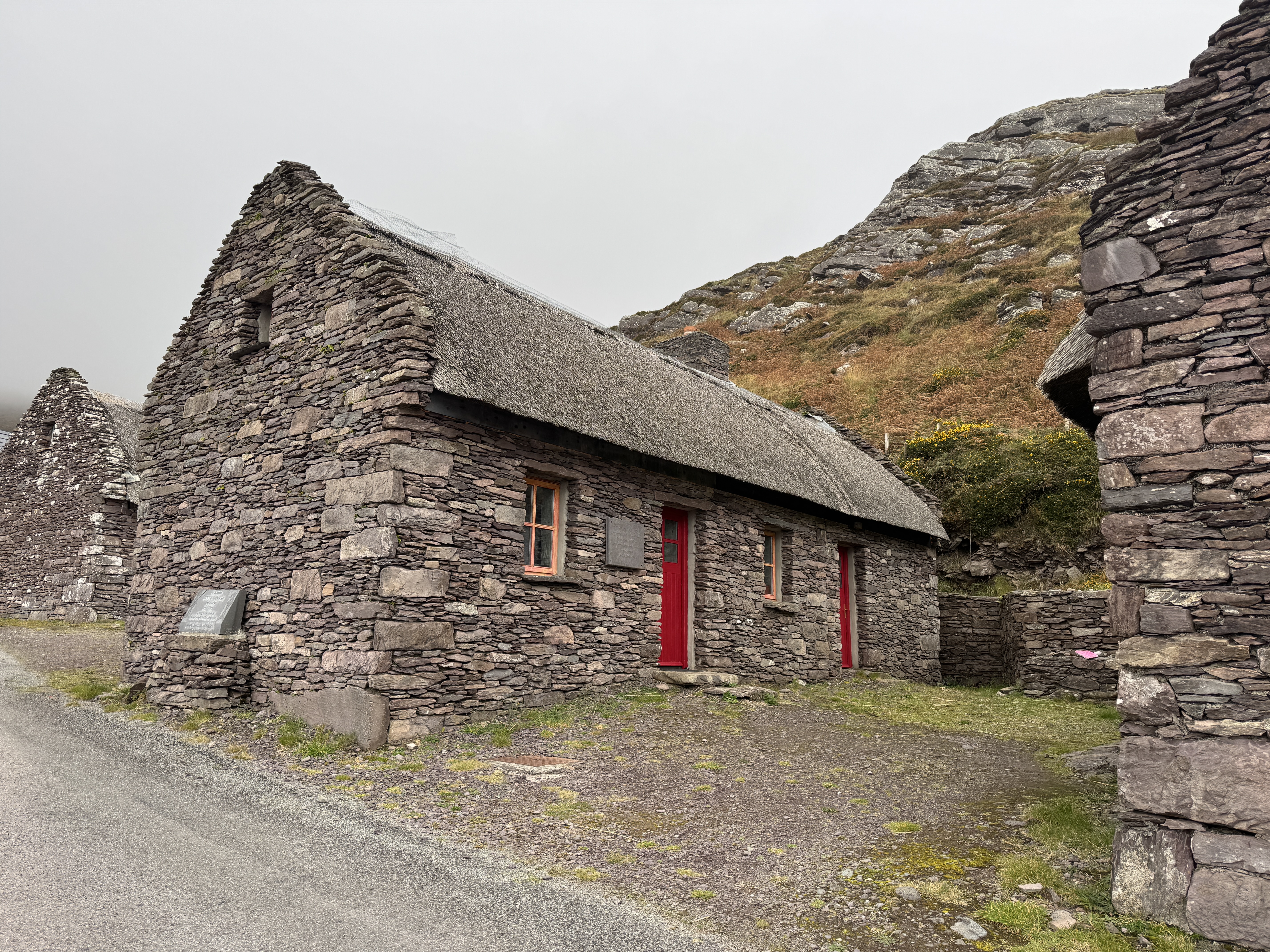
I met a lady and her daughter on that hike who planted an idea in my head. They had hiked up and over the peninsula from the other side. So another day I had Rich drop me off at Ballinskelligs Beach and I did the same. That route traveled on a tiny farm road that gradually angled up the hill for miles, making the ascent easy. Even as the road became more remote there continued to be fields of sheep and patchwork farm fields. I passed a number of old house ruins along the way, often covered in vines and moss with no roof but you could still make out the structure of the house. Other houses looked equally old, yet were still occupied. In the area called Cill Rialaig a cluster of old stone houses had been restored to become an active arts center. It seemed amazing for being so remote, but what a unique location!
By the time the route turned off the road to head up through the fields, it was only half a mile to the top! That day it was gray and cloudy, and the top was totally in the clouds! No view that day, but I’d already seen it and rather enjoyed the different perspective. From there I took the “easy” side of the loop down and back to the house. The sun even came out to celebrate my finish.
If it’s not apparent from the photos, I must comment on the weather. We packed for Ireland prepared for chilly and wet, plenty of rain. Instead, we had an unprecedented run of 10 days of sunshine and mostly blue skies! On the last day, we woke up to pouring rain – clearly it was time to go home.
Despite narrowing our radius to our own peninsula, we were never at a loss for areas to explore and unique natural beauty which surrounded us. We were well rewarded for staying local in our small corner of Ireland.
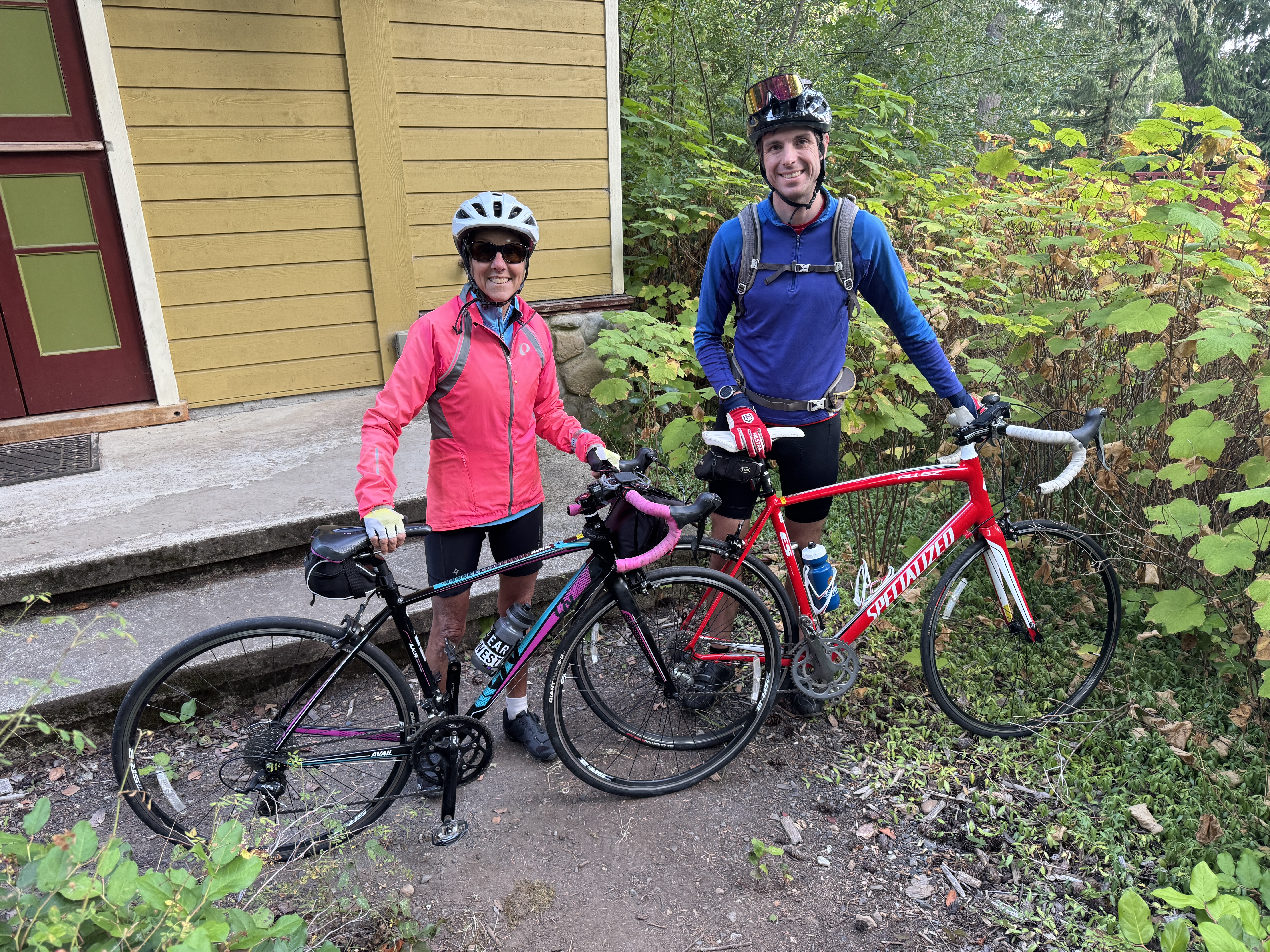
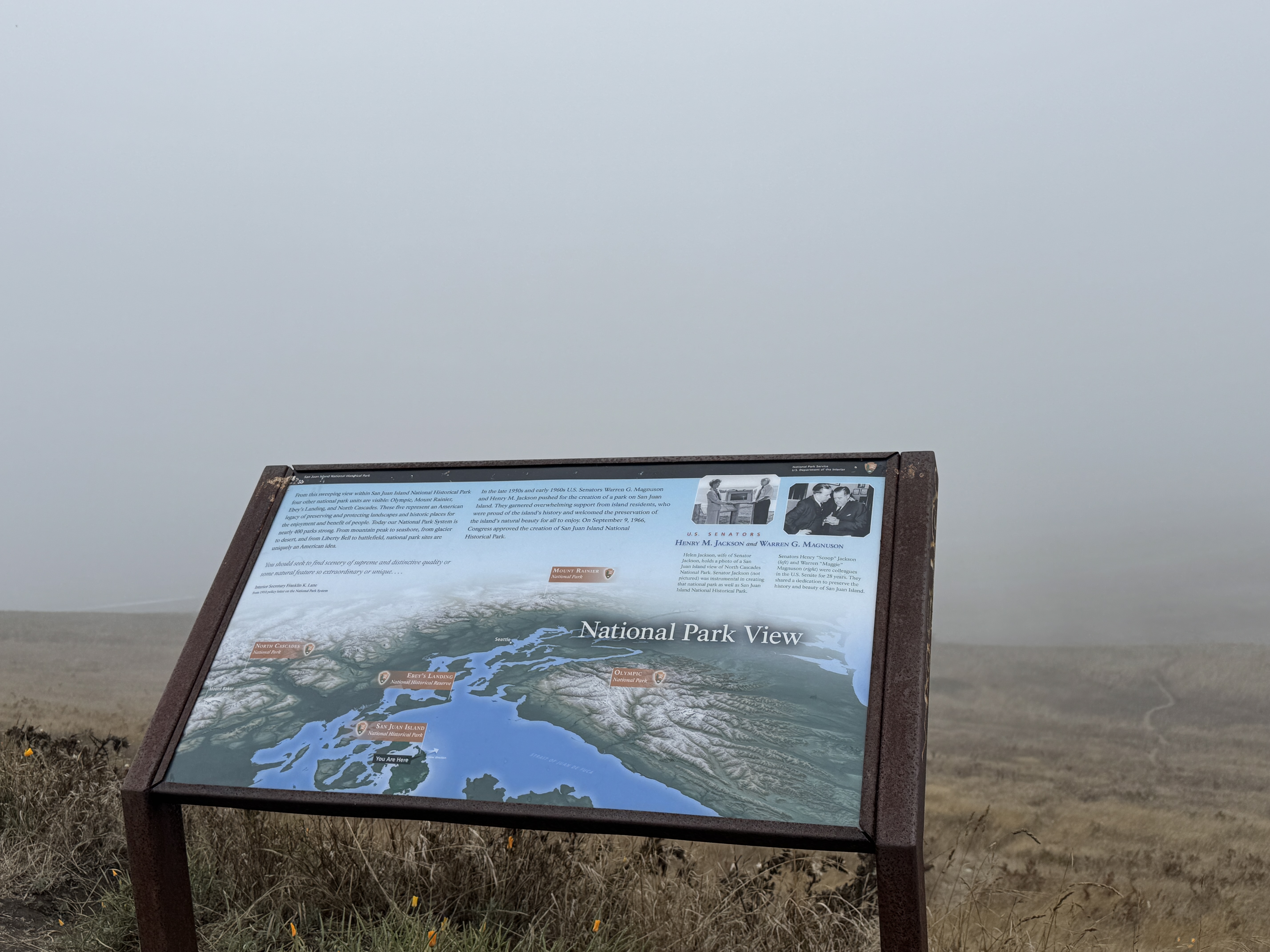
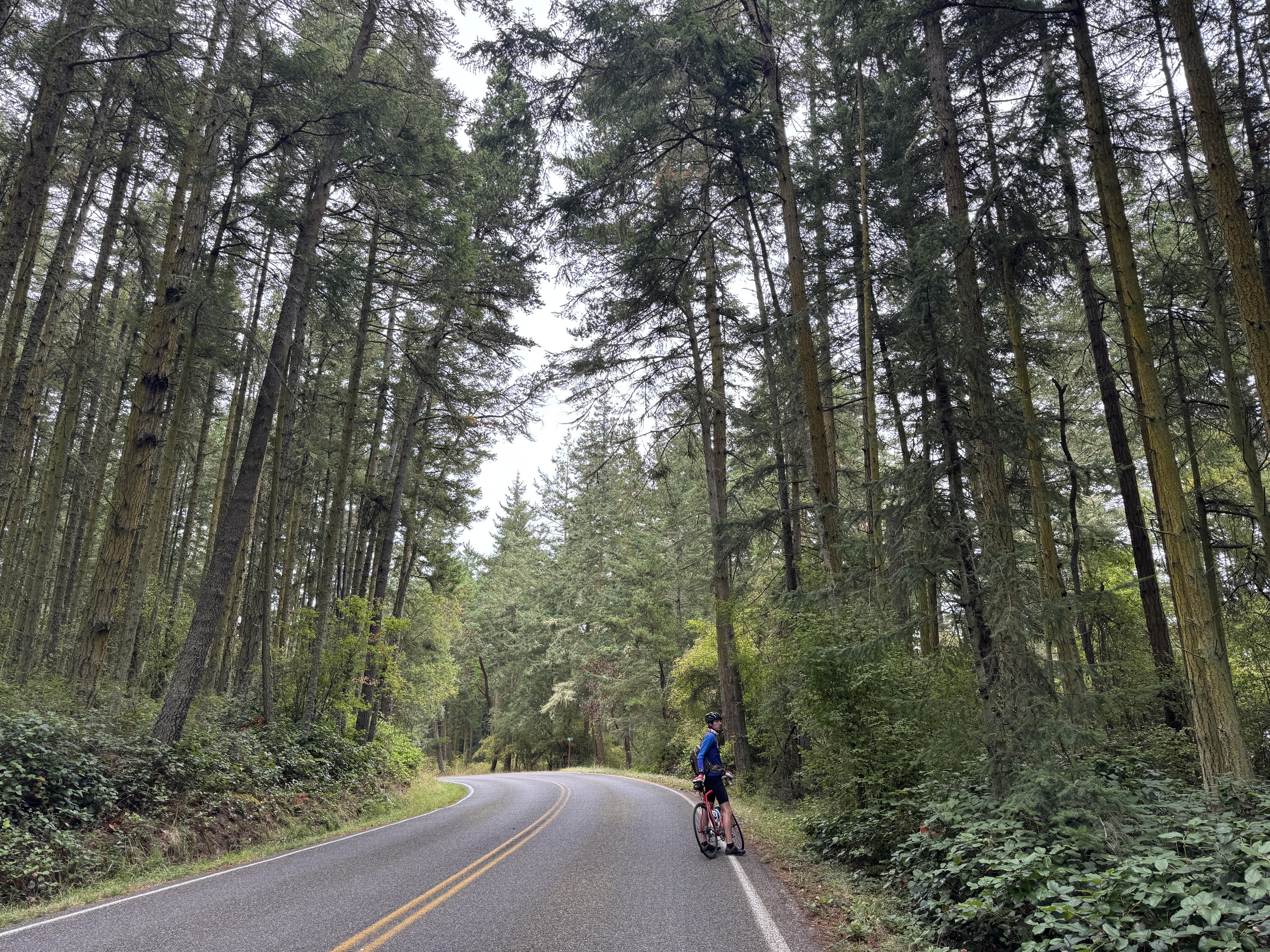
Only three of the San Juan Islands have enough roads to make it work biking. After covering Orcas Island and Lopez Island in the last two years, Erik and I set out to conquer the third, San Juan Island. This year we brought along an entourage – Rich, Katie and baby Saige came and we made a weekend of it staying in a VRBO cottage surrounded by prolific gardens with flowers, vegetables and fruit trees. Our hostess is also an artist. Her colorful paintings covered the walls of our cottage, and we were able to peer into her studio adjacent to the pond in the back yard. Such delightful surroundings!
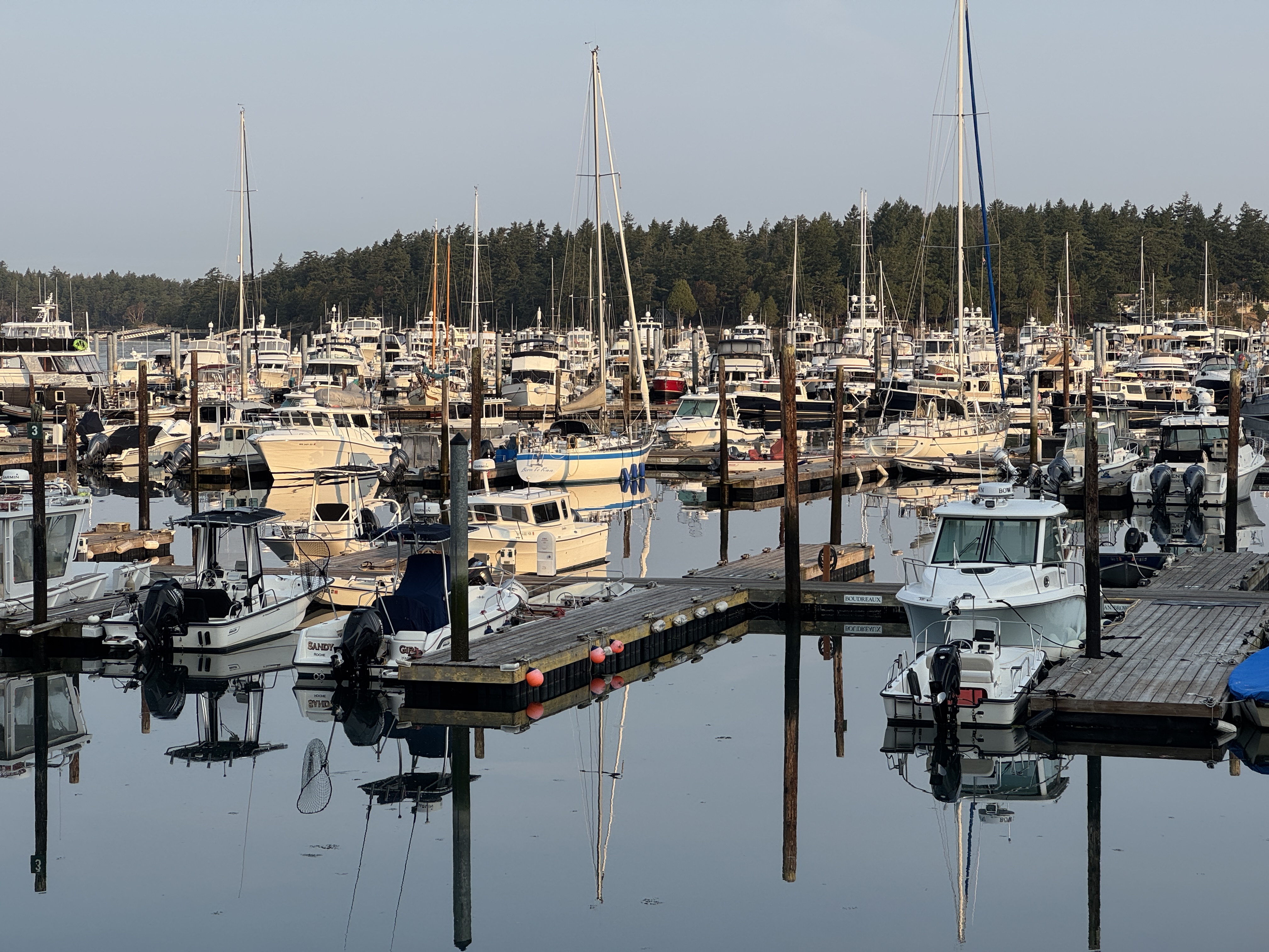
The day started out with better than expected weather – not too cold, little wind and a bit of sunshine. We headed north first to Roche Harbor which is home to an elegant resort, posh little shops, and yachts galore in the harbor. We coasted down the steep road to get closer to the shore and ogle the immaculate landscaping and fancy yachts and sailboats.
A quiet narrow loop road beckoned on the other side of town so we followed it around a point. Fancy condos and houses perched on the shore, interspersed with stretches of tall woods. Those little lanes would be my favorite rides throughout the day.
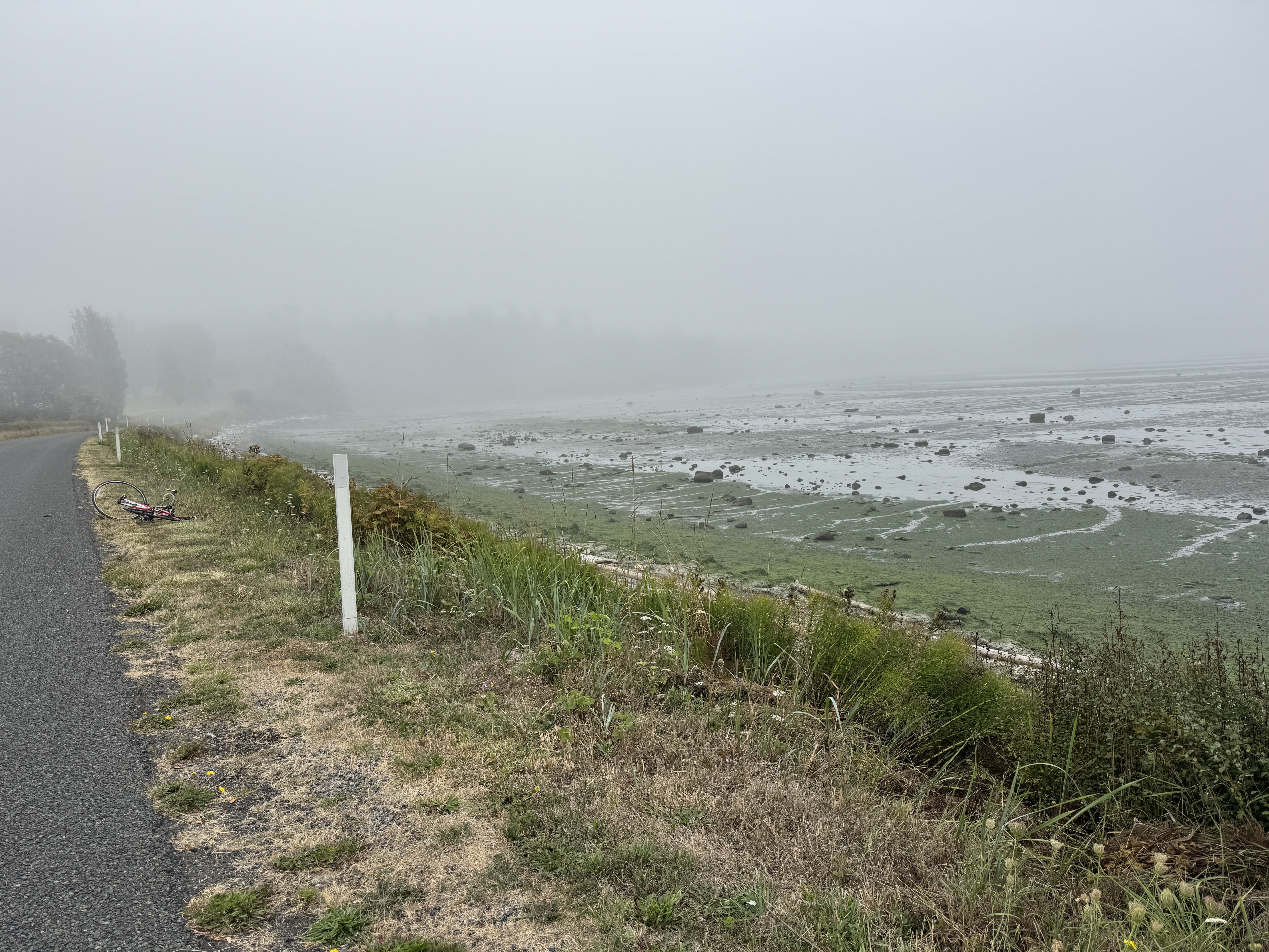
Moving down the west side of the island we had plenty of water views, and one very steep hill. It snuck up on us, its pitch increasing as we progressed. As I pumped up that monster I knew I’d hit my limit when I resorted to sashaying back and forth across the lane to make it to the top! Fortunately, it proved to be the worst we encountered all day. Midway down that coast we stopped to admire the view and could see a long thick bank of fog stretching out diagonally across the water. We watched a sailboat heading toward it, then thought better of the idea and turned around. It obliterated everything behind it, and we knew for sure we would soon enter it ourselves.
Turning the corner and heading east, we found another smaller road that led to False Bay Tidelands. A sign informed us that the big round bay was home to a variety of tidal species and was a protected area. We weren’t sure if the water was always that low, or if it was low tide. But the fog was definitely rolling in.
Sure enough, at the next scenic spot we were able to admire the sign that labeled all the islands we could see from there, but in reality our view was just a wall of fog!
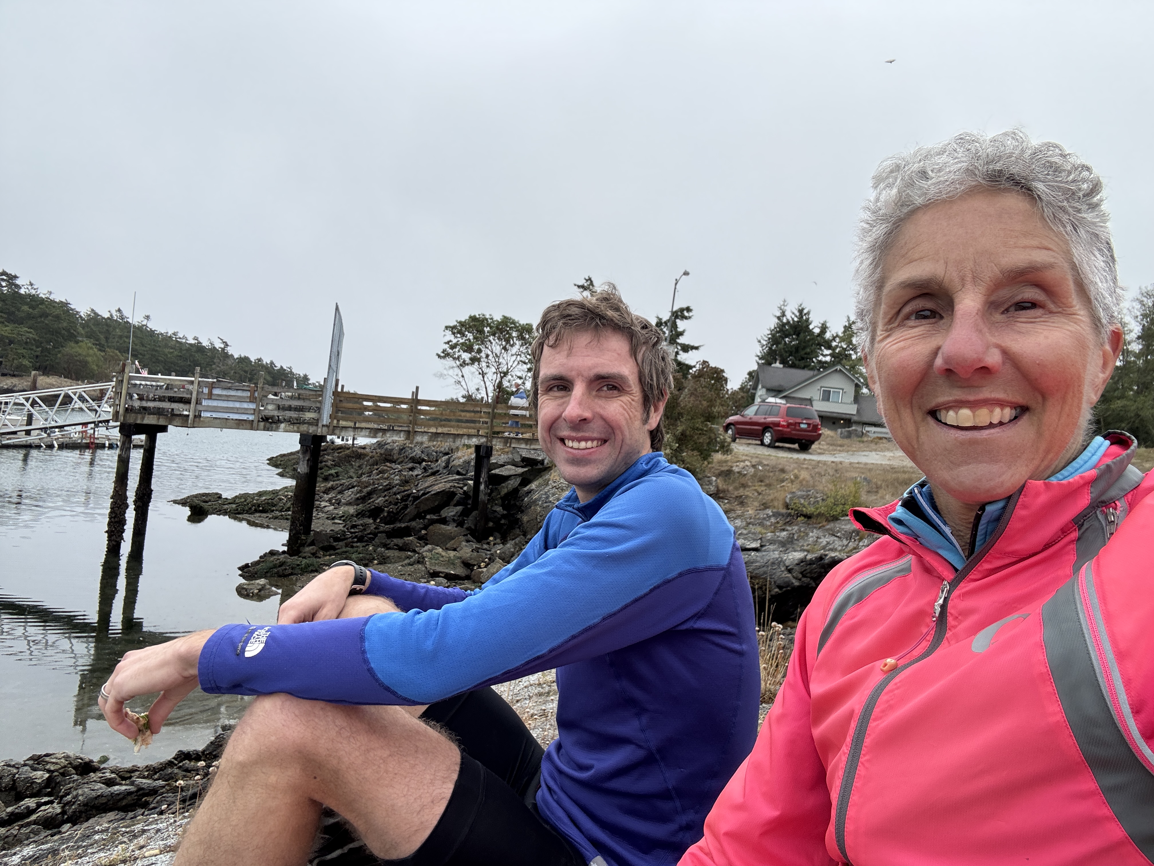
We continued on to the very tip of the island called Cattle Point. Beyond the interpretive area another small lane led us to Fish Creek, a narrow natural harbor with a small marina on the other side of the point. It was clear of fog, and we deemed it a good lunch spot. Settling down on a rocky ledge we had a nice view of the dock, boats and houses on the opposite side. It was quiet and unassuming with a bit of activity – folks going to or from their boats, one couple taking out their sailboat, and some movement across the way where the island homes had their own private docks. Under those circumstances, our sandwiches and fruit tasted exceptionally good.
Our trip out to the point had felt like miles and miles of downhill, and knowing we had to retrace that stretch we both secretly dreaded the prospect of all that uphill work. However, it proved to be so gradual that we pedaled up it almost without realizing it!
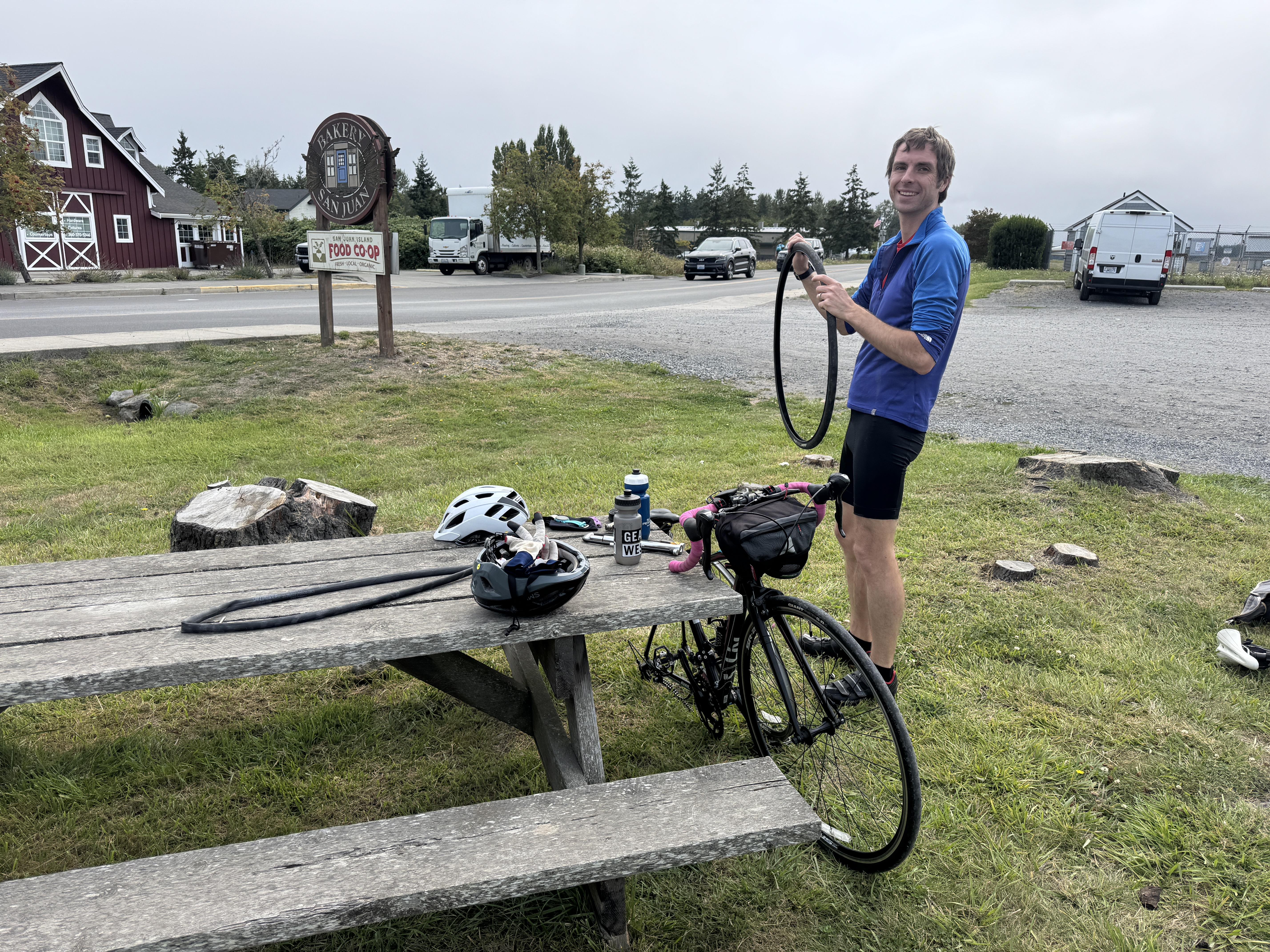
We were heading up the east side of the island back towards Friday Harbor, which is the island’s only town and the location of the ferry landing, when Erik realized my back tire was decidedly low. Pumping it back up proved to be a futile solution, so we sought a parking lot on the outskirts of town where Erik changed the tire. (I’m always very thankful to bike with someone more skilled at bike maintenance than I am!) We thought it was a most fortuitous spot when we turned in at the sign for the San Juan Bakery, only to be disappointed to learn it was closed on weekends. Sigh.
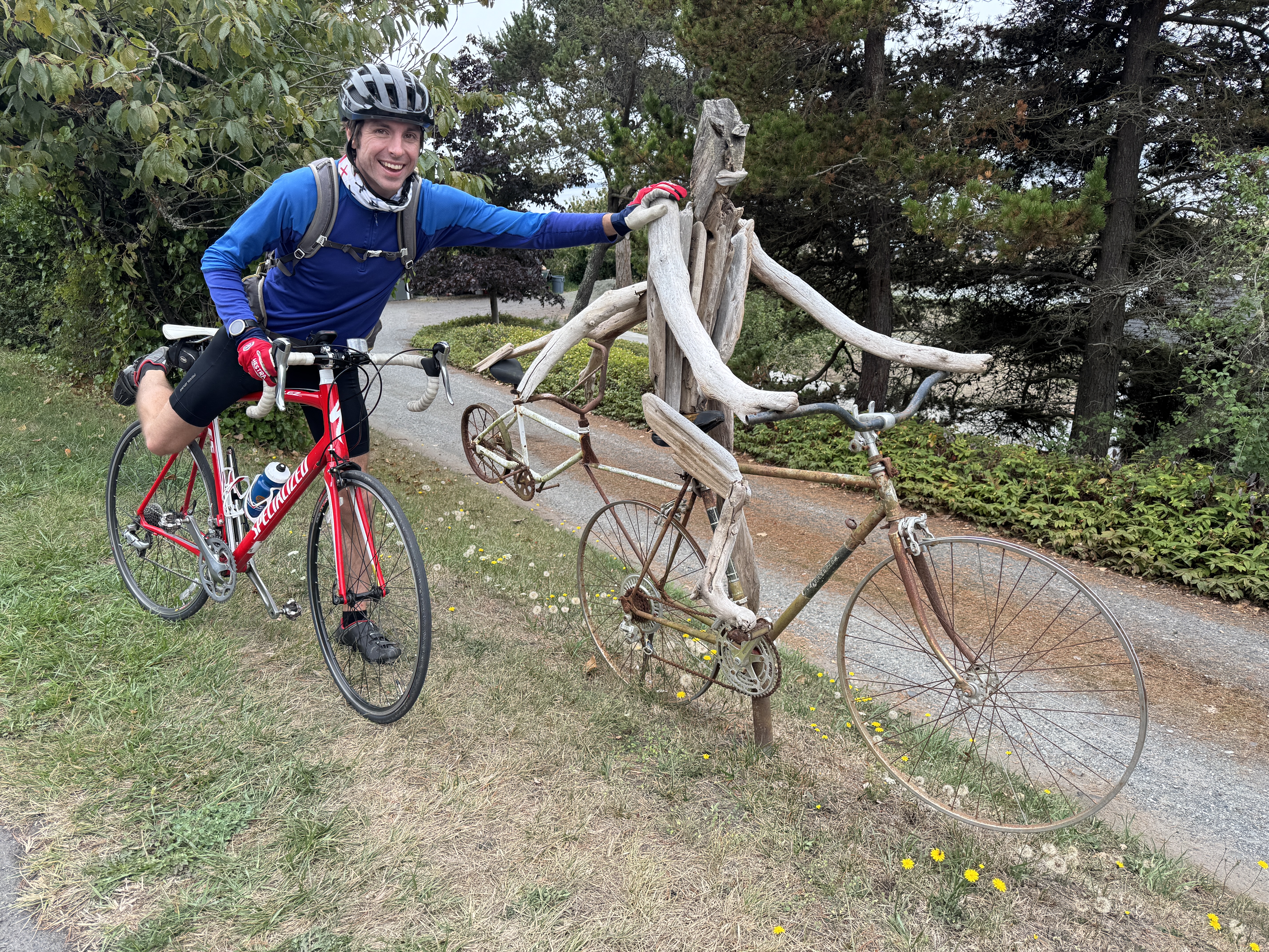
Back on the road, we chose another quiet lane called Pear Point Road which wound around a peninsula just outside Friday Harbor. It provided a bit of fun and whimsy when we stopped to admire a cycling sculpture!
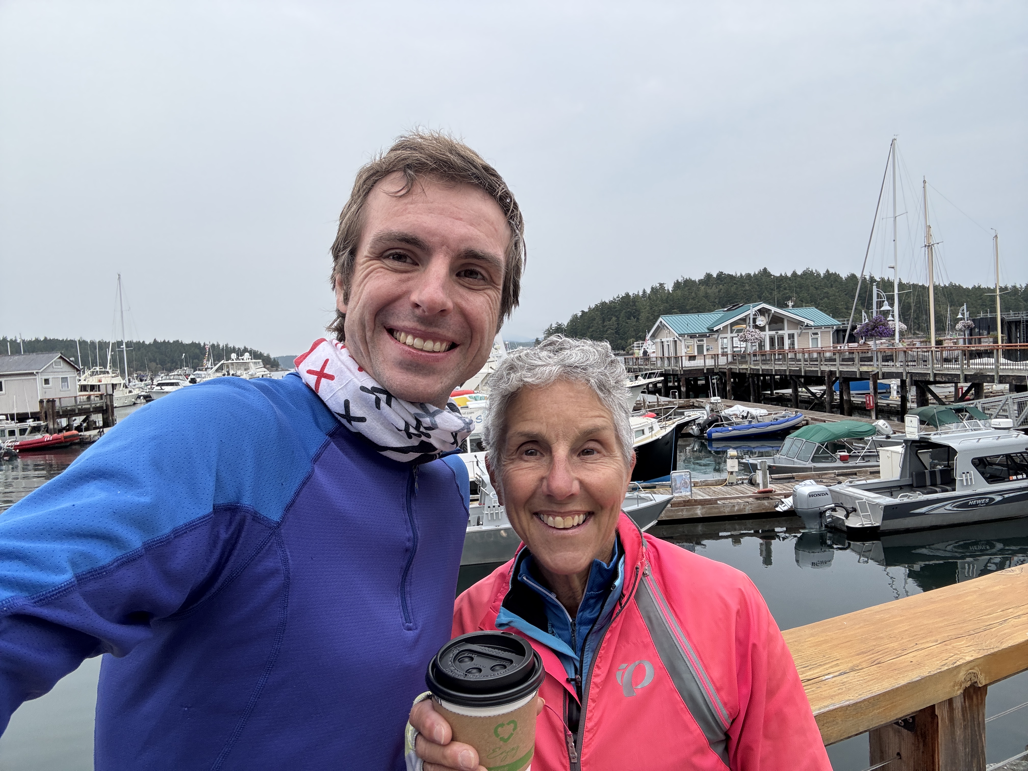
Entering town, the idea of a treat lingered. Deciding that it was too cold for ice cream, and finding bakeries closed for the day, we headed to a coffee shop opposite the marina. Sipping our hot brews and savoring a raspberry pastry, we watched the tour boats departing for whale watching tours, float planes taking off and landing at regular intervals, and ferries coming and going.
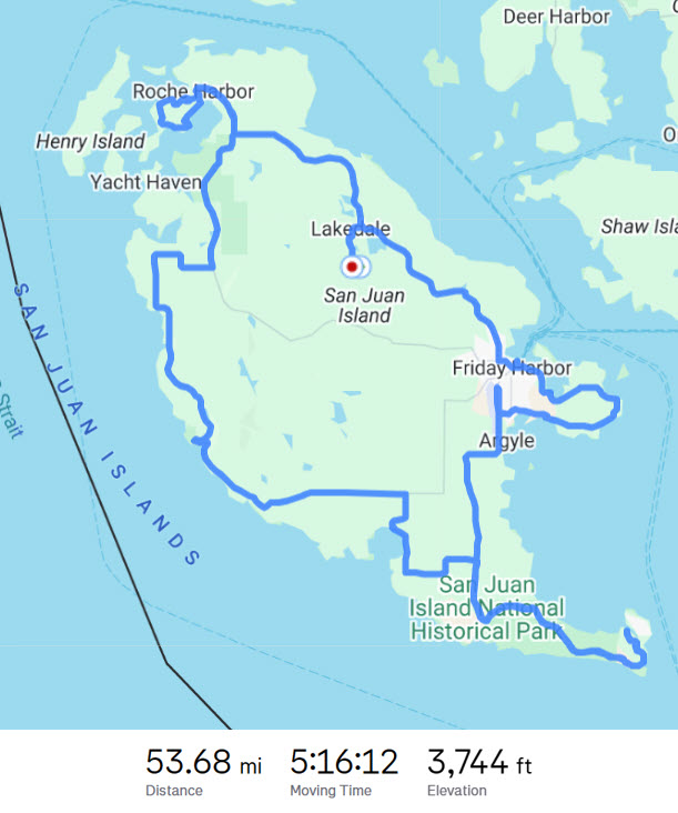
Our final stretch took us up the remainder of the northern side of the island to Egg Lake Lane and our cottage. Just as we reached the driveway, raindrops began to fall which quickly became serious. We made it back just in time! In all, we cycled over 53 miles with 3,744 ft of elevation. Not bad for a day’s outing!
There was just enough time to relax and share our stories before we all headed out for a celebratory dinner at a restaurant on the harbor.
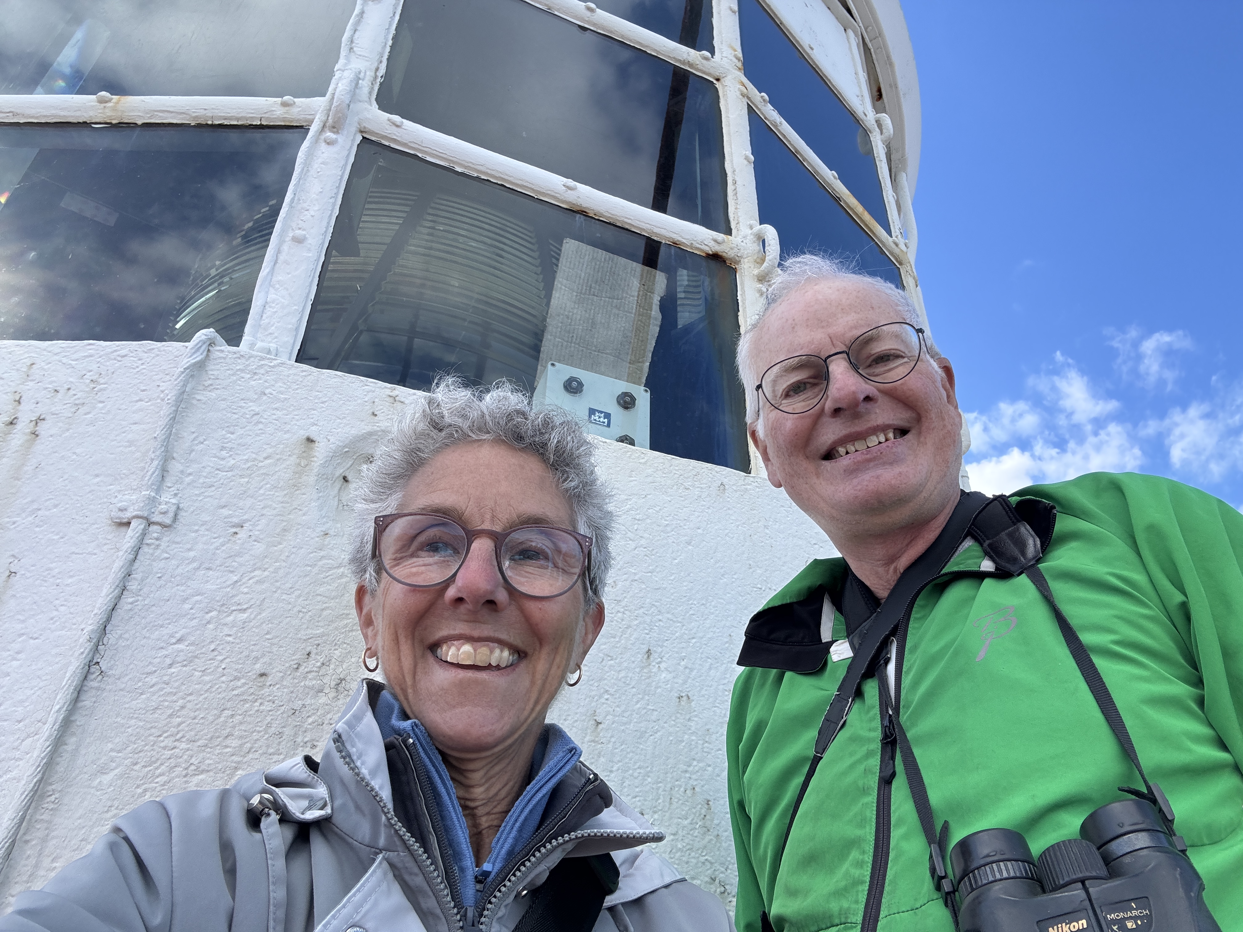
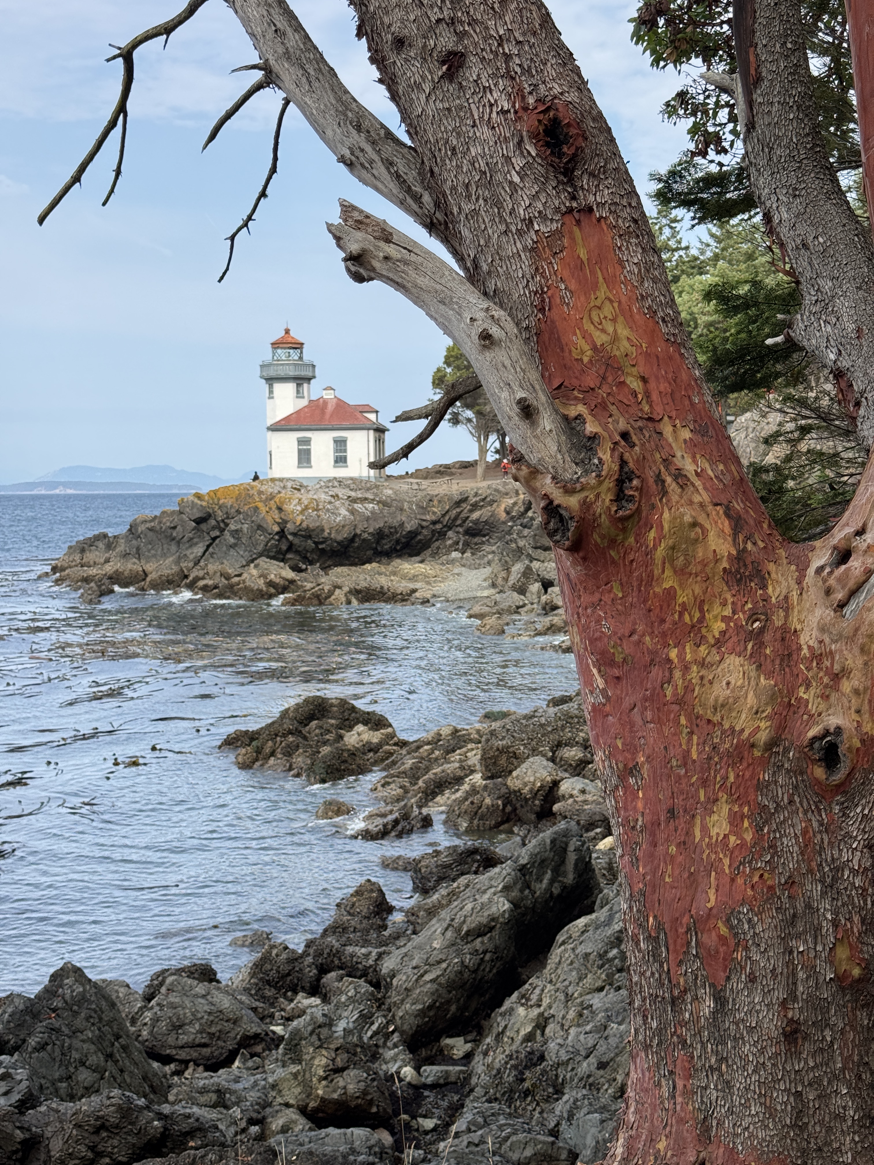
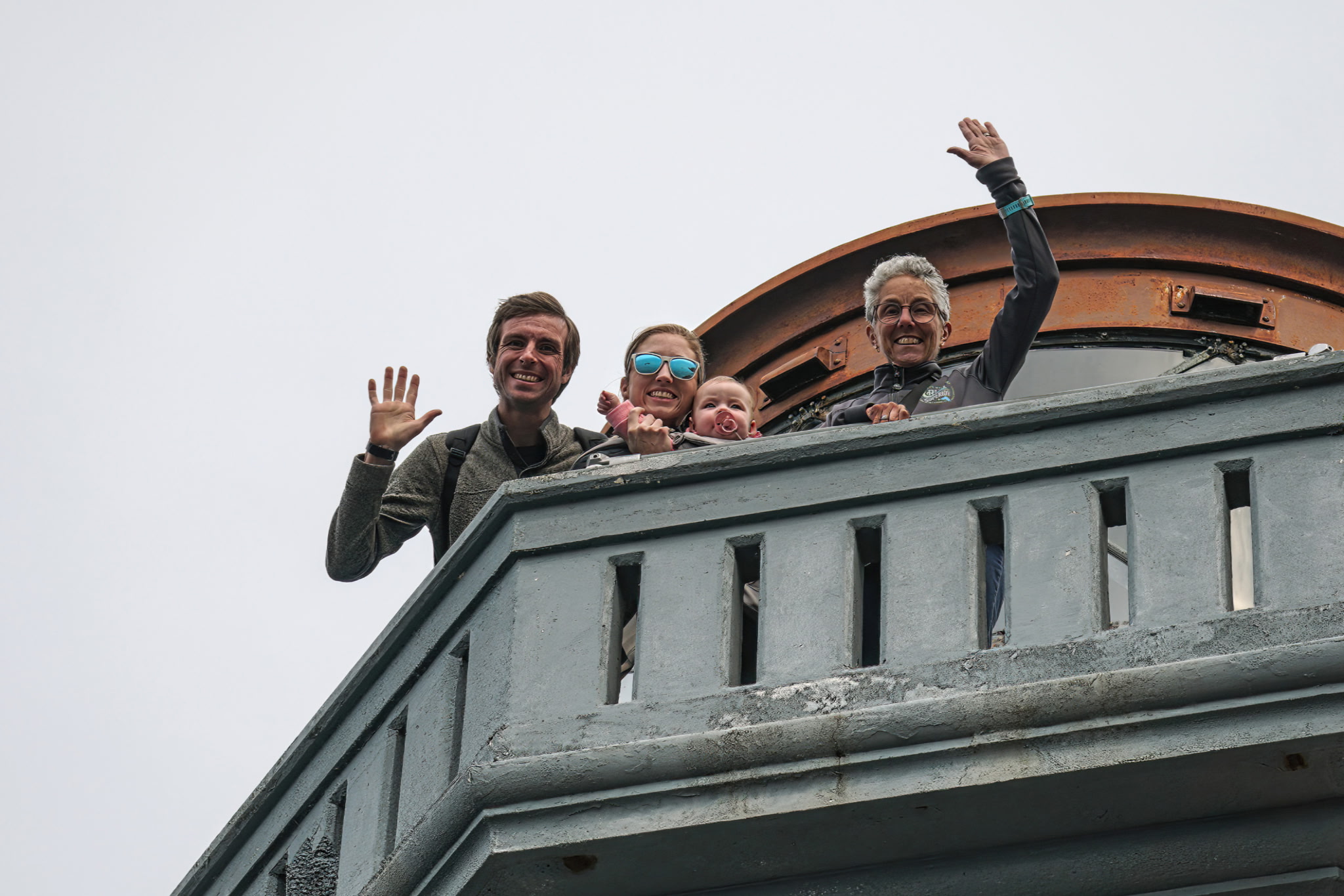
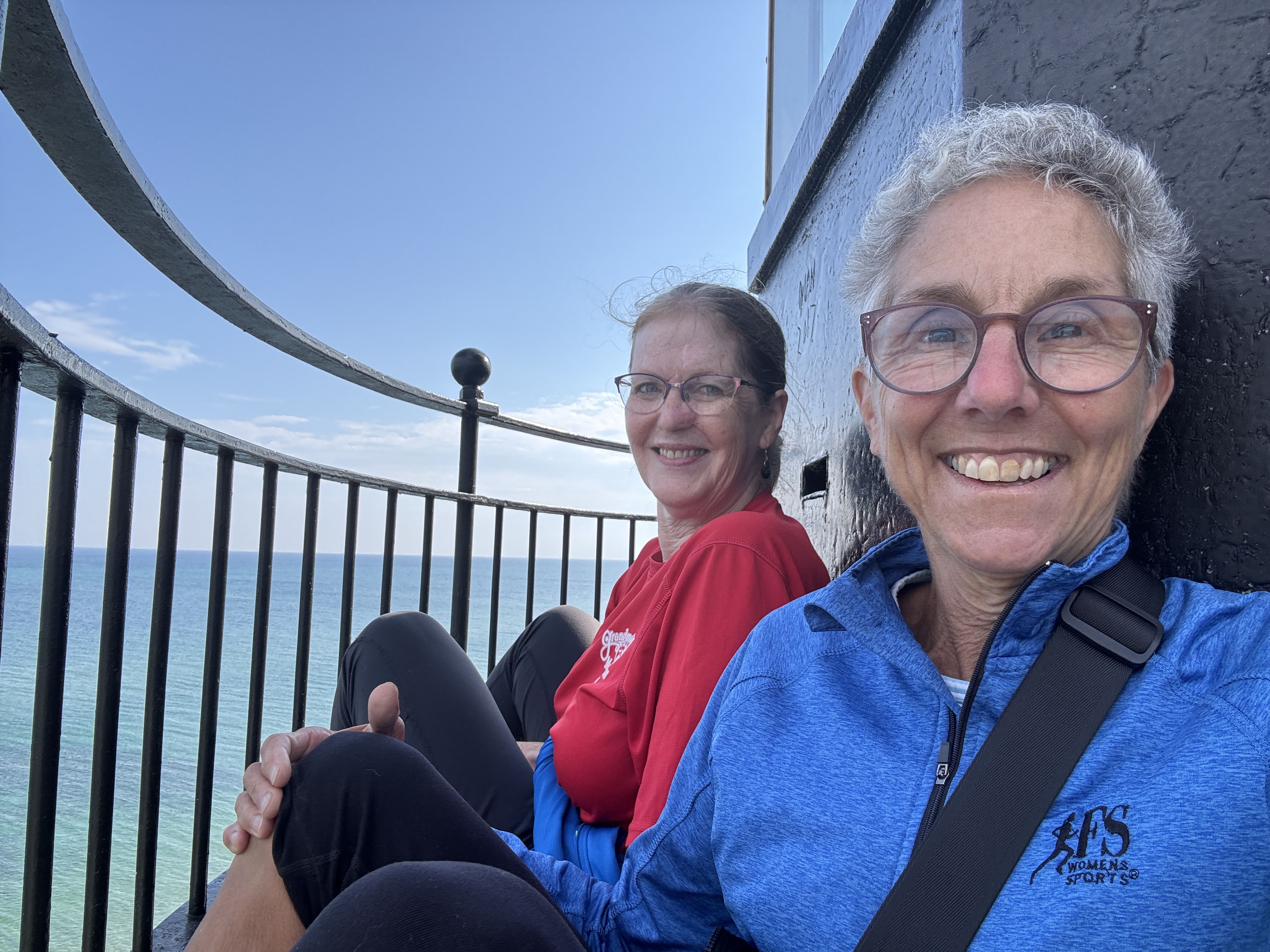
We rounded out the weekend with a visit to Lime Kiln Point Lighthouse where we took a path along the shore to the tower. It opened shortly after we got there, and we were able to go up the tower! Rich was below photographing black oystercatchers, and captured us out on the catwalk. As lighthouse keepers ourselves, we especially enjoyed seeing a very different lighthouse and talking to the volunteer there. That park is known to be a good viewpoint for viewing orca whales, but none made an appearance during our visit.
With the ferry ride back to Seattle, we successfully closed the chapter on our series of San Juan Island cycling tours. Our next job is to come up with a new cycling challenge. However, it’s going to be hard to beat this trifecta!
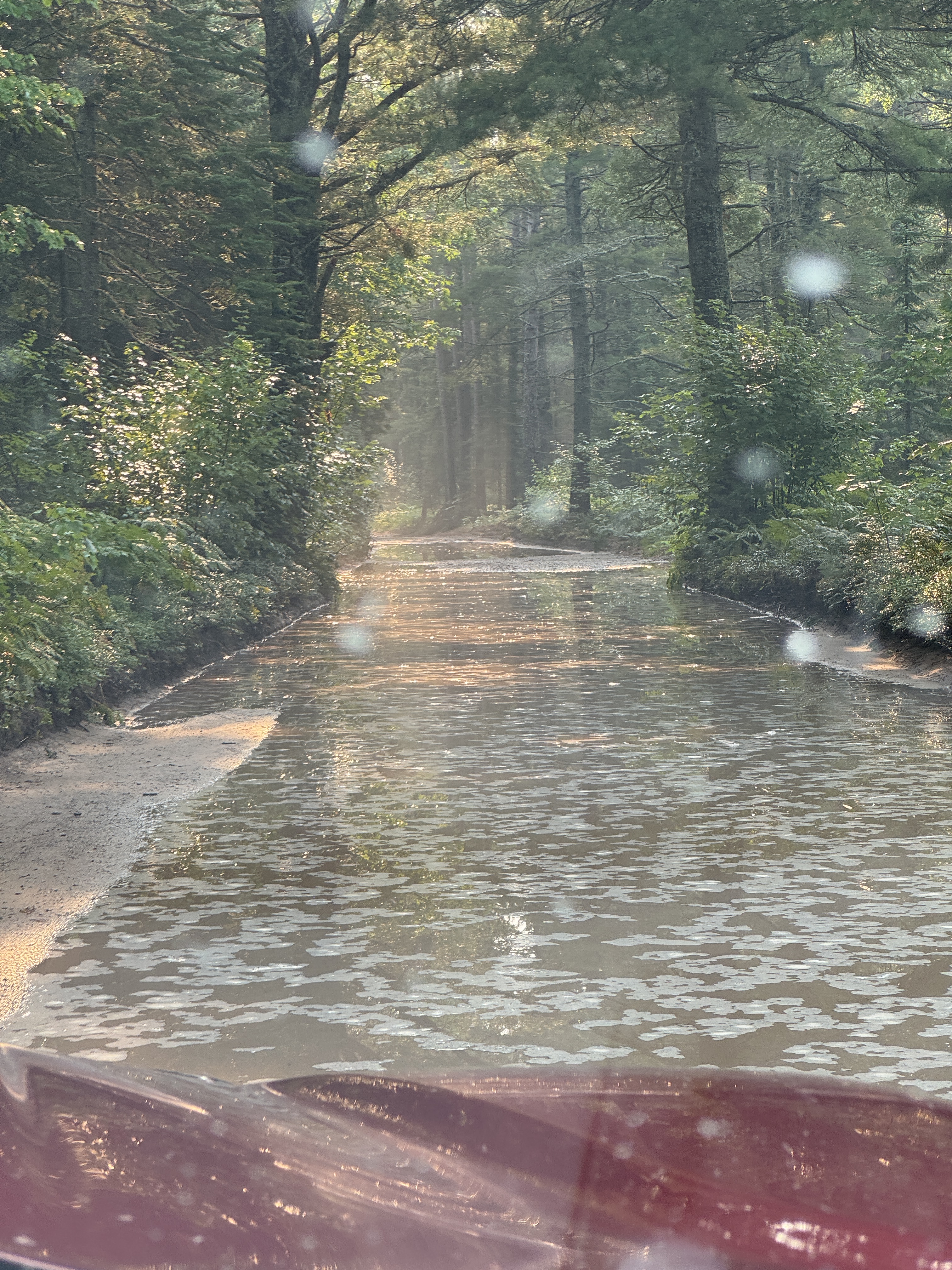
Timing is everything. After last year’s unfortunate mishap, we were so eager to get back to Crisp Point Lighthouse for our annual stint as keepers that we hadn’t paid close attention to the recent weather at that remote spot. It was only as we were en route that we noticed Facebook posts featuring the deeply flooded dirt road to the lighthouse. Jon and Beth, our friends and co-keepers, preceded us down that road pulling their big camper. They made it, moving slowly but surely, and it took them more than twice the time it usually takes for those 19 miles. We approached the next morning, to find it had receded only a little overnight. Since we are tent campers (the “keepers’ residence” is a campsite) we were unhampered by a trailer, and splashed our way through the long puddles that grew in size the closer we got to the lighthouse. It was an epic journey, to say the least!
Certainly the road was all the talk for our visitors the next few days, and we sold a record number of stickers that said “I survived the road to Crisp Point Lighthouse.” But they all took it in stride, part of the experience when visiting this remote gem.
Keepers for this lighthouse are volunteers who rotate throughout the season, staying 2-5 days. We always hope for the max 5 days, which we scored this year. Come to find out, the keepers that preceded us had 4 1/2 days of rain, with significant downpours. As luck would have it, we had 5 straight days of beautiful weather, with only one rainstorm during the night. We were very happy for this welcome back present!
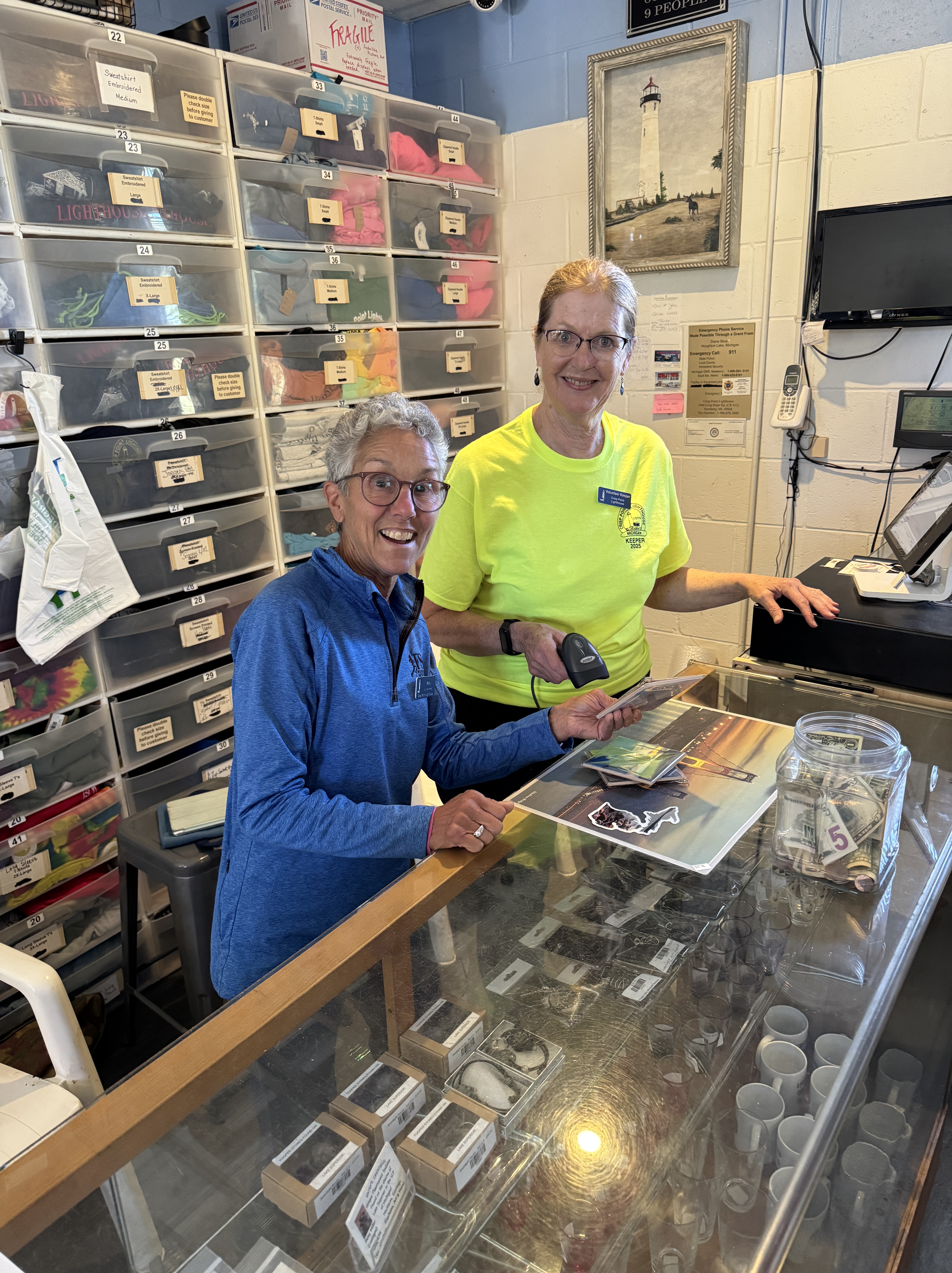
Despite the condition of the road, we had a steady stream of visitors, running 130-180 per day according to our count. It was probably higher. As usual, we had a mix of lighthouse aficionados, vacationers who included it in their itinerary, rock hounds searching for agates or Yooperlites, and a rare set of people who just happened to see the sign from the highway not knowing what they were getting into traveling that dirt road. They kept us busy manning the Visitor Center dishing out information or selling merchandise that helps fund the nonprofit that maintains the lighthouse.
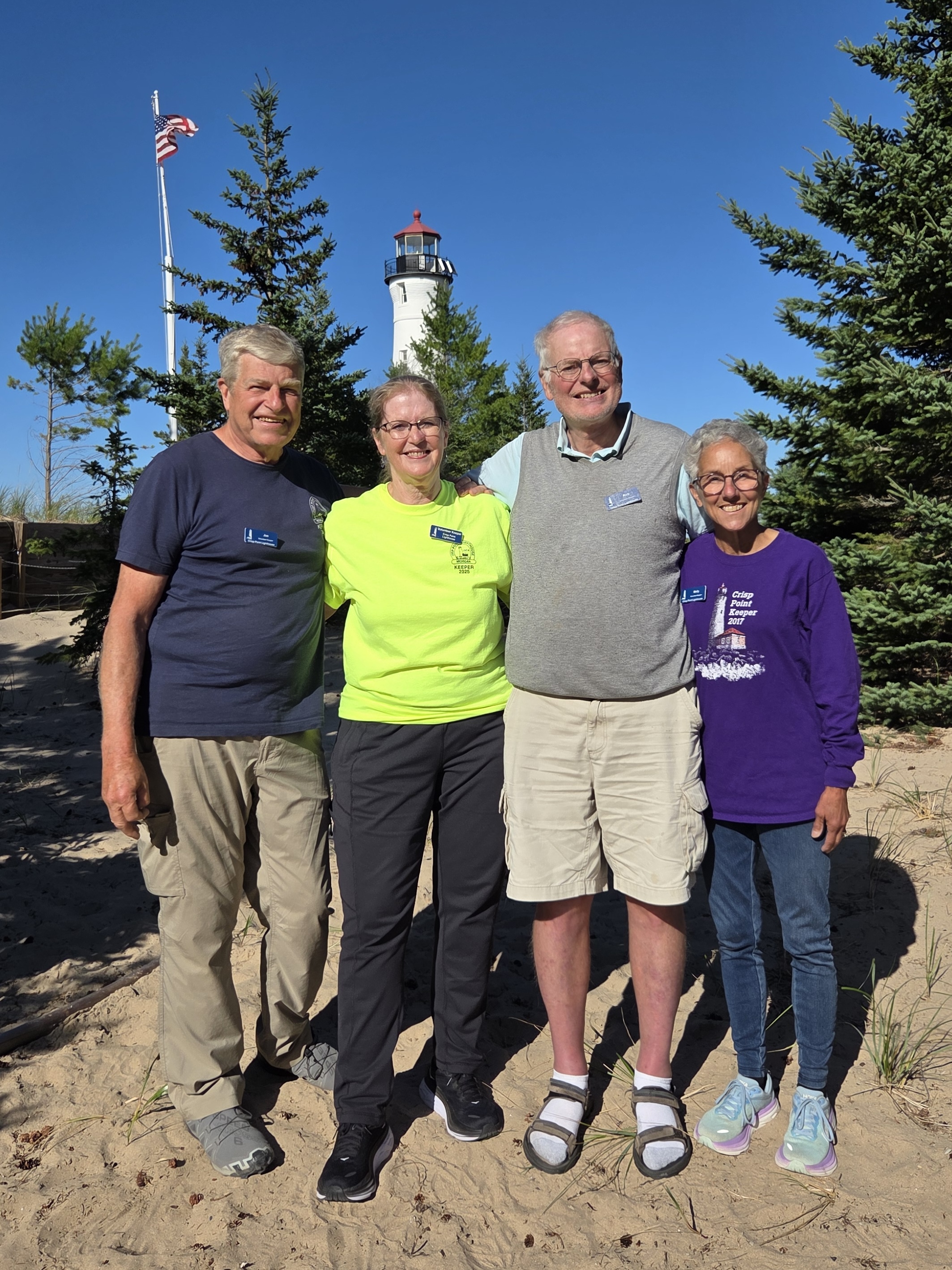
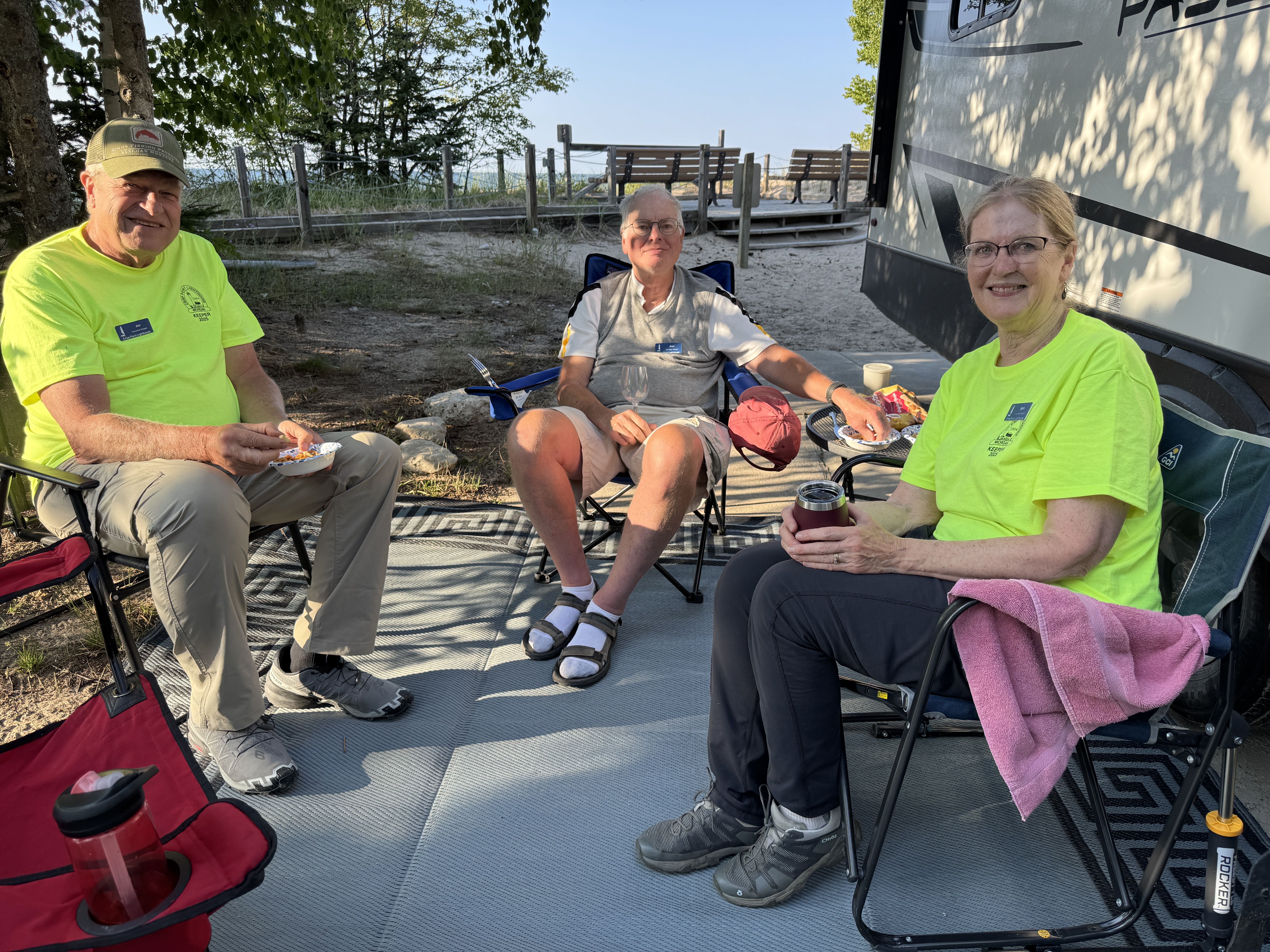
Jon and Beth were tireless ambassadors, greeting visitors, taking their picture in front of the lighthouse or just visiting with them. Managing the inventory kept us busy during any downtime, straightening up the stock on the shelves or refilling from storage. And of course we had the delightful chore of cleaning and restocking the bathrooms, sweeping the constant supply of sand that infiltrated the tower, Visitor Center and boardwalk, taking inventory and accounting for the cash and sales at the end of the day. It’s all part of being keepers and we are glad to do it for the unique experience of spending 5 days at the base of the light.
During Covid, the Crisp Point Light Historical Society which manages the lighthouse, recommended having four keepers due to extra duties required at that time. Adding Jon and Beth to our crew turned out to be the best thing ever. Not only is it nice to share the duties and be able to spell one another for a little free time during the day, but it is more fun spending time together in the early mornings and evenings when we are off duty.
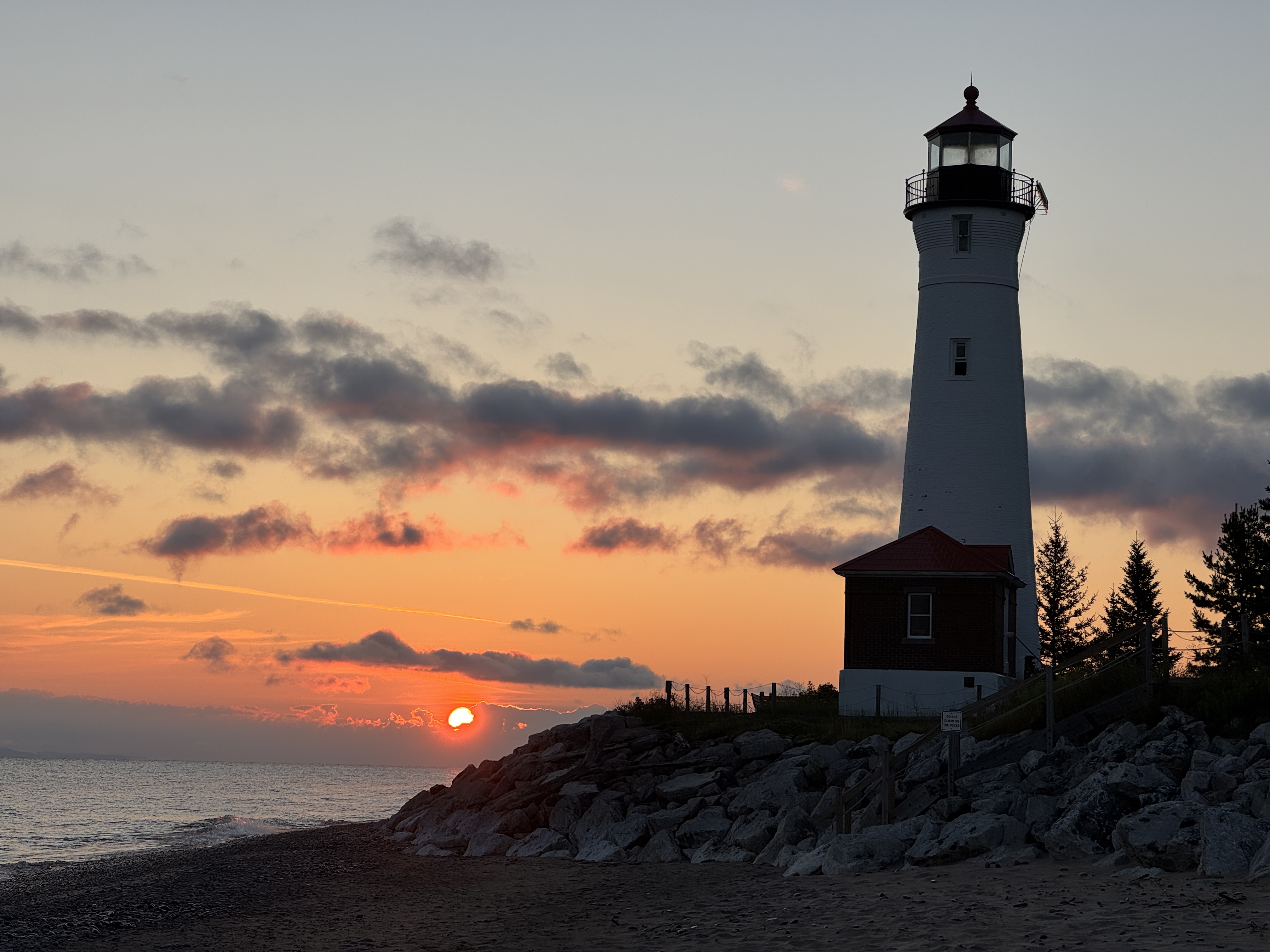
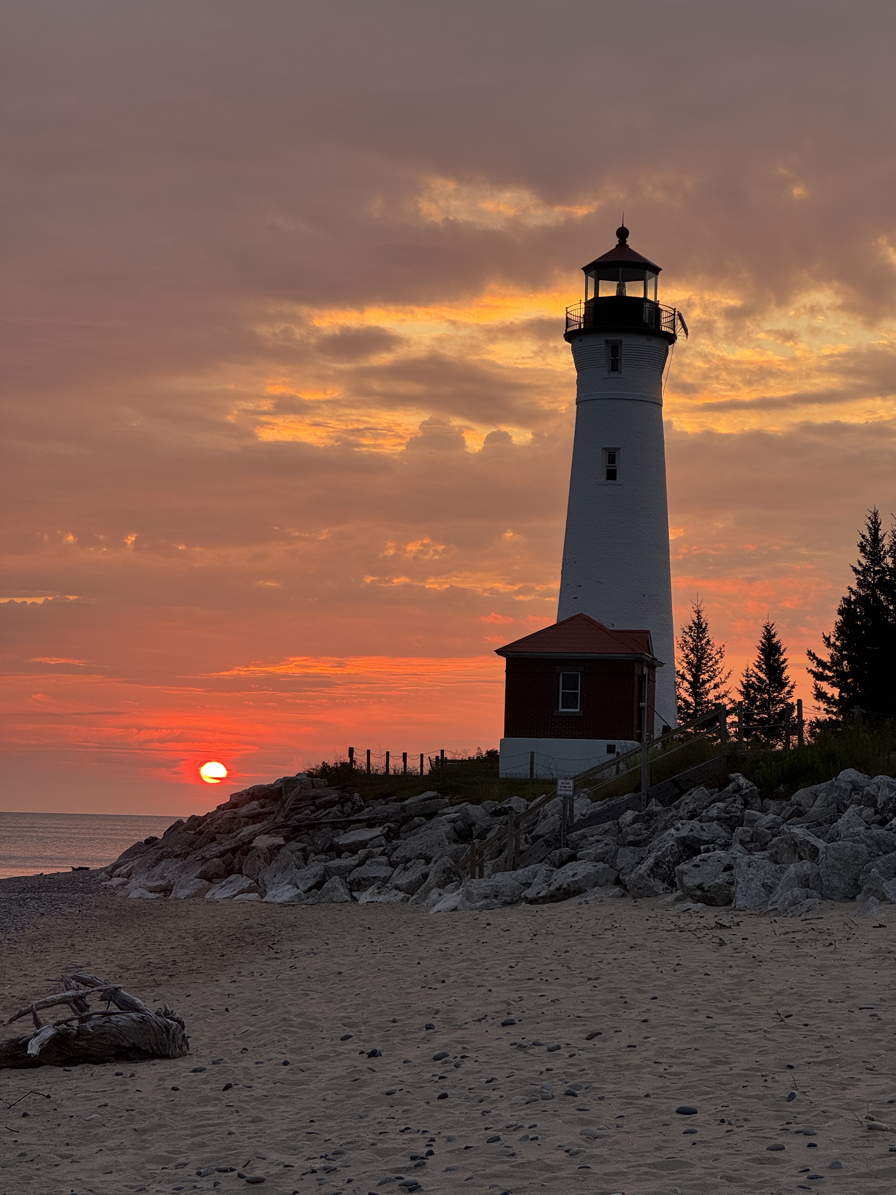
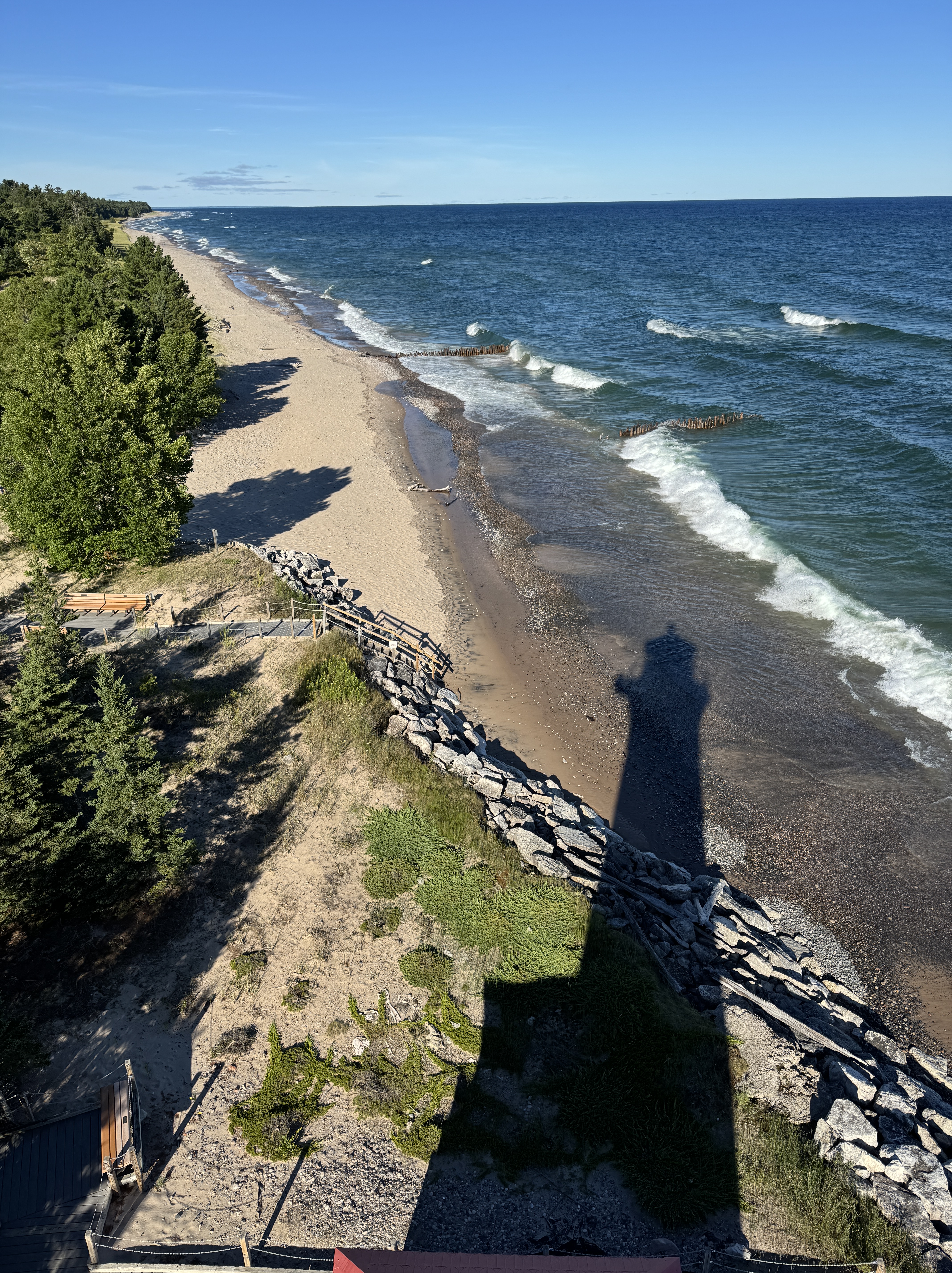
Mornings are my favorite, and I make an effort to be up in time to watch the sunrise unfold. It rarely fails to impress, and never looks the same twice. The site is quiet at that time of day, as are the miles of sand beach that stretch on either side of the lighthouse. Following sunrise I start my day with a brisk walk down the beach, which also changes from day to day. The lighthouse shrinks and recedes into the distance as I walk, then gradually grows again on my way back. We were surprised this year to discover that we could walk all the way around the lighthouse – never before since we started keeping in 2015 has there been beach between the tower and the water. I hadn’t realized Lake Superior’s water level was so low this year.
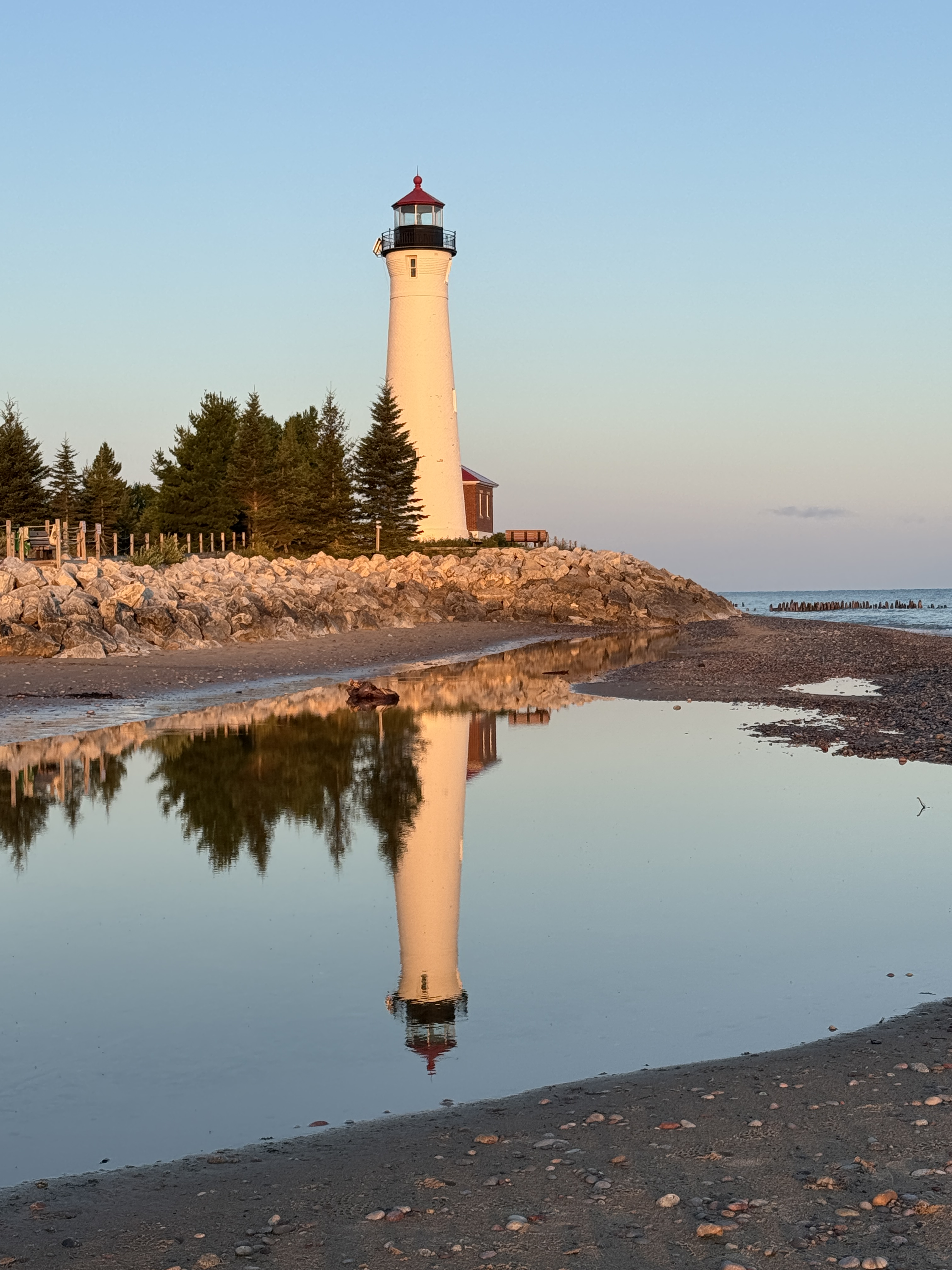
The rainfall brought us a gift in the form of a reflecting pool on the beach. It was perfectly positioned for doubling the view of the lighthouse in the early morning light. Rich took great advantage of it for his photography, and also practiced flying his drone for unique overhead shots of the property before visitors arrived.
Climbing the tower with our morning coffee, Beth and I relish the birds eye views and the movement of the waves. Above it all we drink in the solitude and peacefulness, removed from the activity below. We have to remind ourselves to descend and take up our posts for the day.
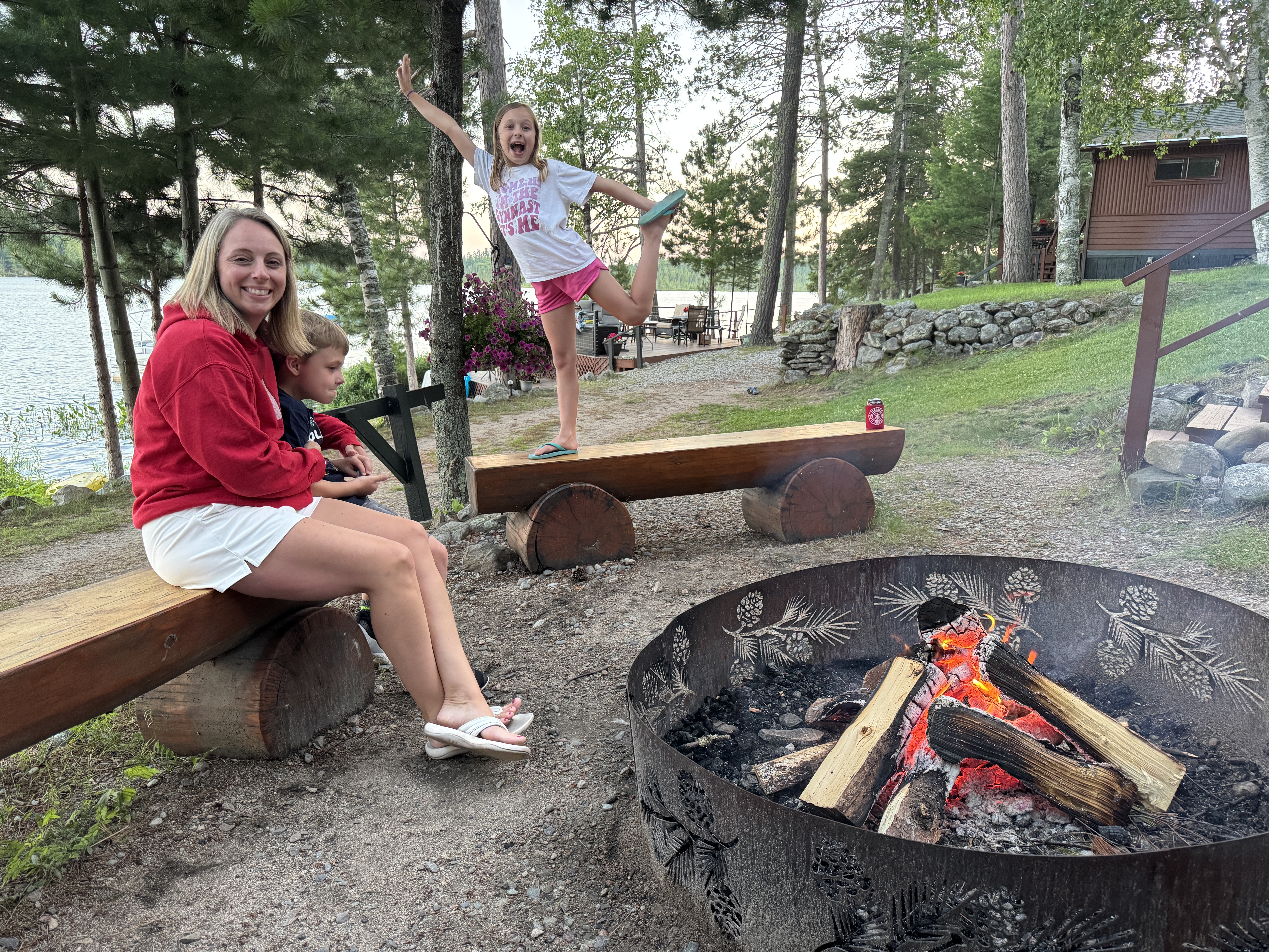
We all look forward to closing up shop for the day. Happy hour ensues in the shade of the camper, followed by taking turns making dinner, then dashing back to the shore for sunset. Visitors still roam the beach, but gradually we claim the site for our own. A good campfire is a mesmerizing way to finish out the day, accompanied by the rhythm of Lake Superior’s waves.
As if making up for our absence last year, Crisp Point delivered all my cherished moments in its shadow. We were so grateful to get back here again. And this year, our timing was impeccable.
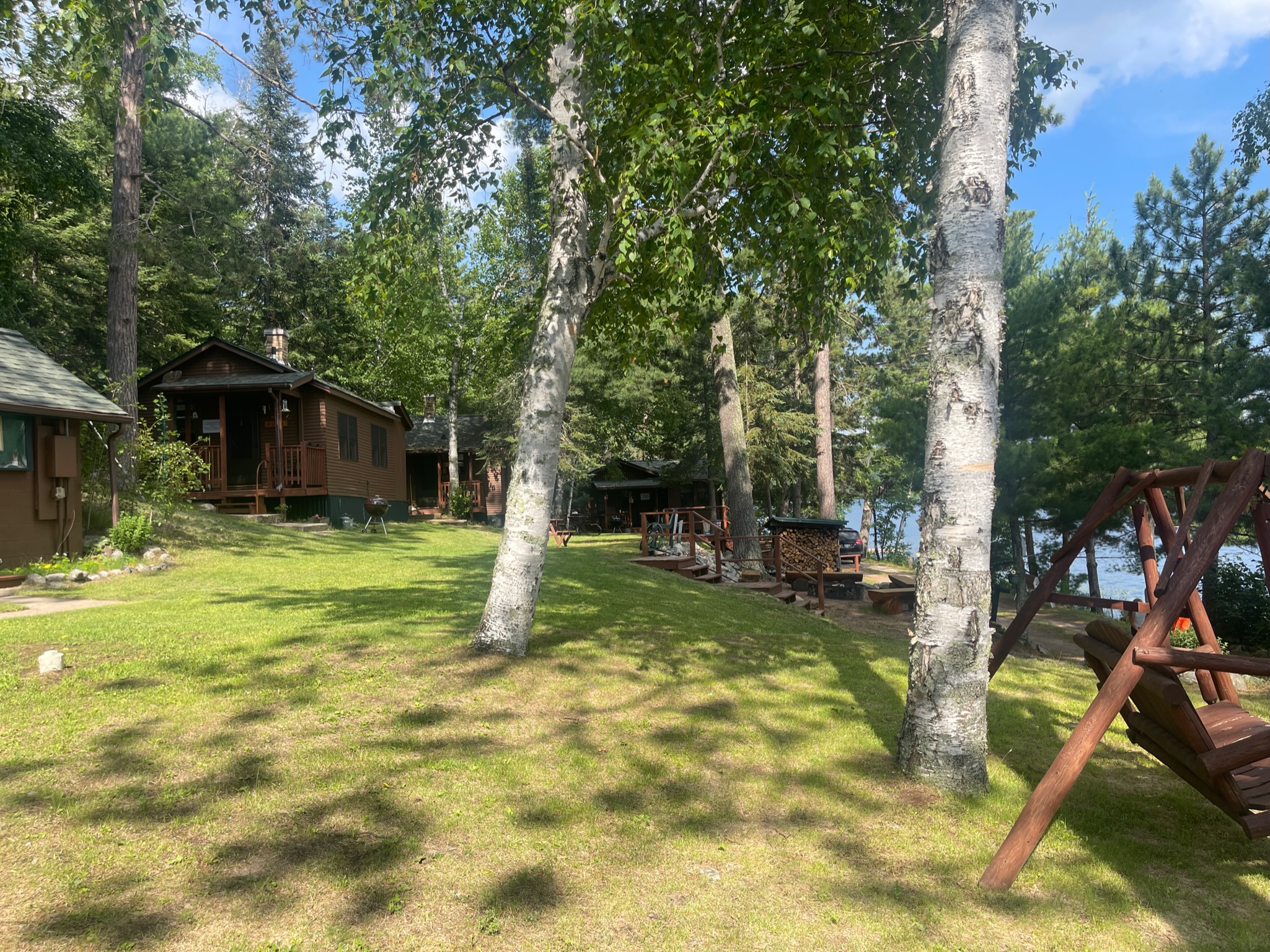
I often feel that repeating a treasured activity can be disappointing. It just doesn’t measure up to the memories or falls short of the same experience. But that wasn’t the case in our return stay at Vintage Vermilion. After our whole family – Rich and me, our kids and grandkids – took over this resort on Lake Vermilion for a week in 2023, there was a resounding “Yes” when we asked if they would like to do it again.
Once again we rented the whole resort. This allowed us and each family to have their own cabin – space to retreat, a spot for kids who still nap, the convenience of breakfast and lunch fixings, a needed time-out when being with cousins got too crazy. There was plenty of sleeping around – kids commandeered the extra cabin for a bunk house, took turns sleeping over in our extra bedroom plus feasting on Grammy’s pancakes in the morning, and slipped off to the “Retreat” building to read or sleep.
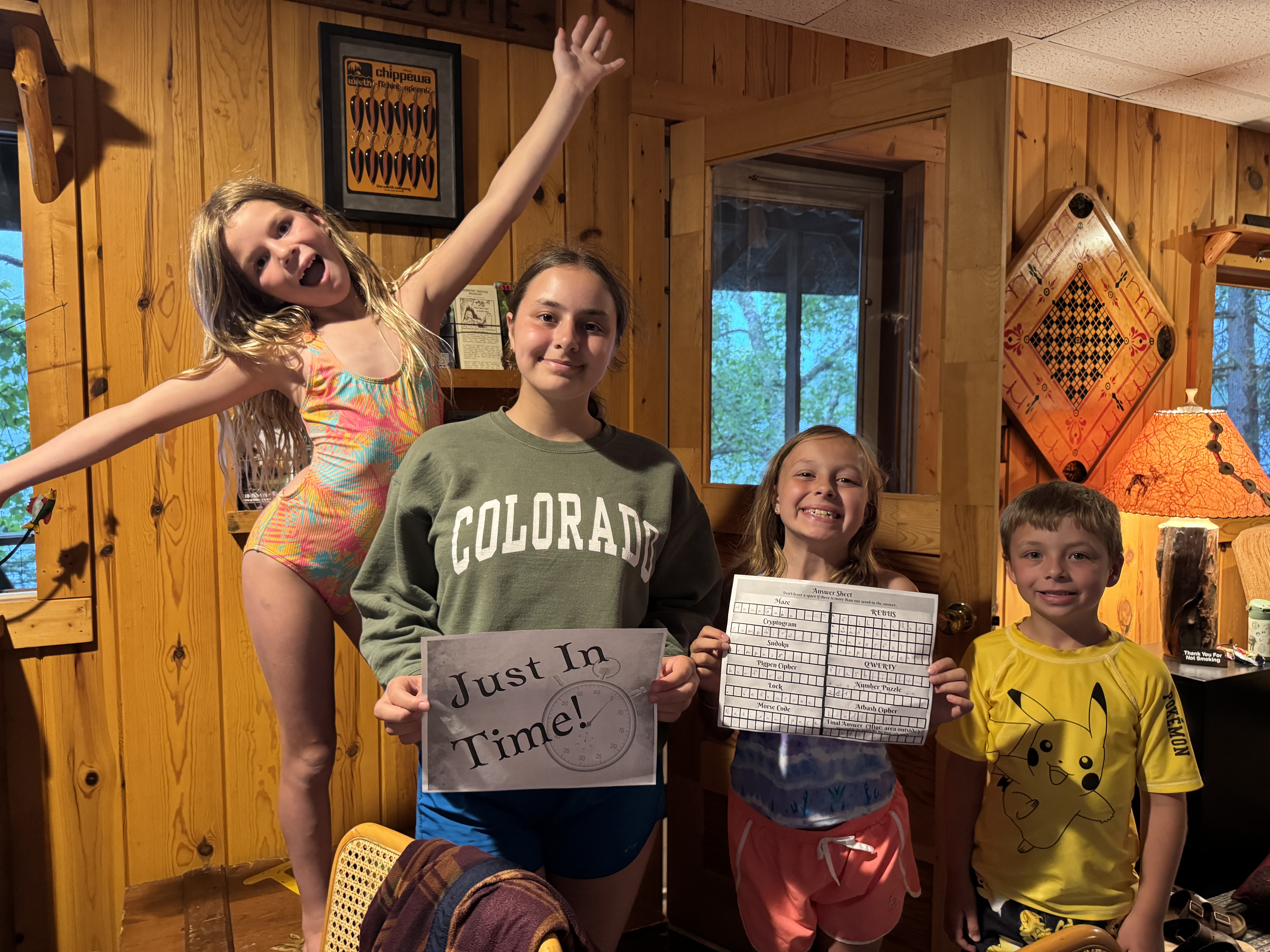
The other big benefit was that we had the run of the place. We took over the big deck overlooking the water, bringing down an extra table and having lakeside dinners. The lodge building was always available for playing games or reading on the screen porch. The big indoors was a mecca of activity and the center of Chelsea’s “escape room” challenge for the kids on our one rainy afternoon. The kids constantly ran around on the expansive lawn between cabins, and it was nice to have the small beach to ourselves for the little ones who still love to dig in the sand.
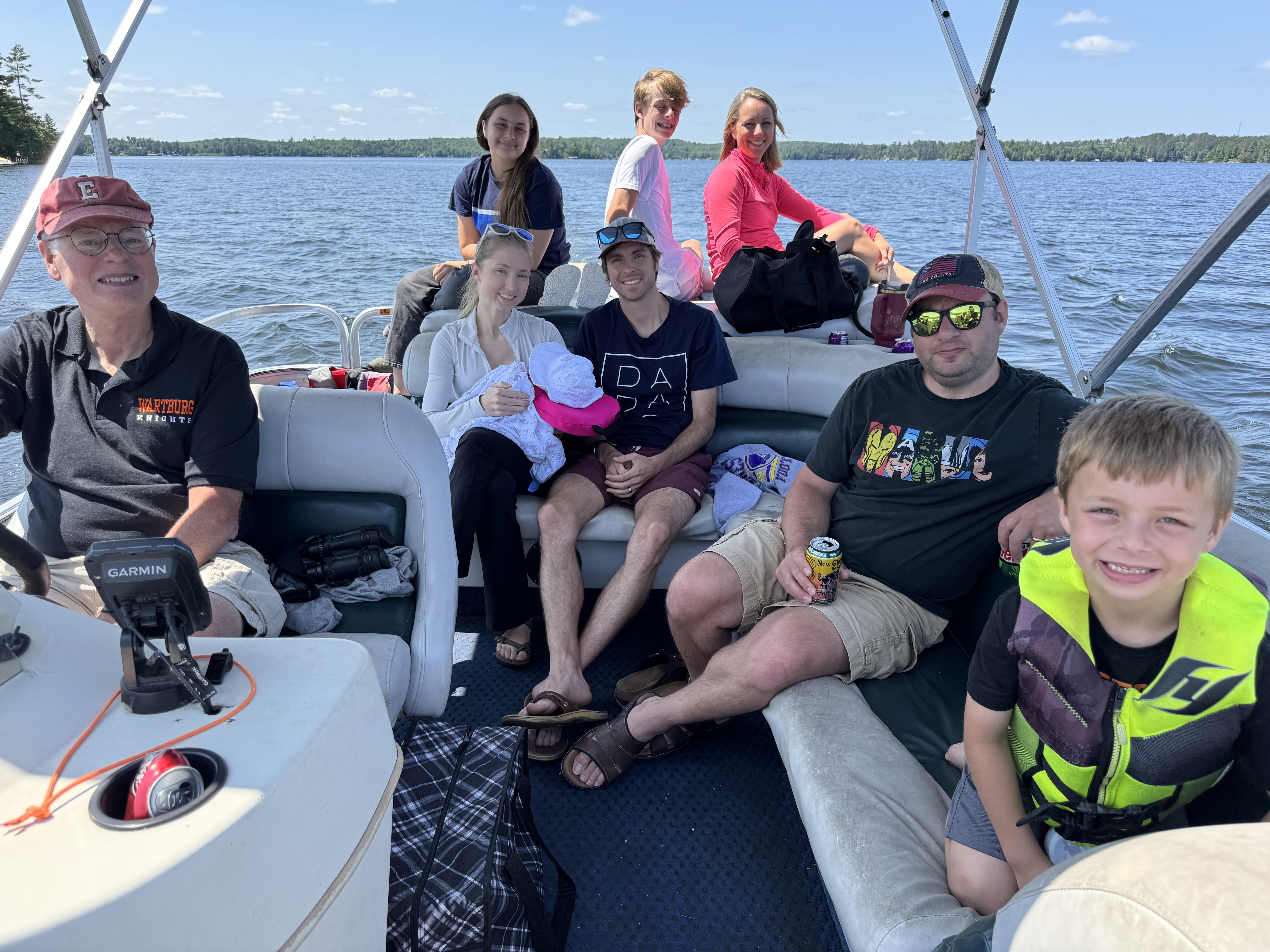
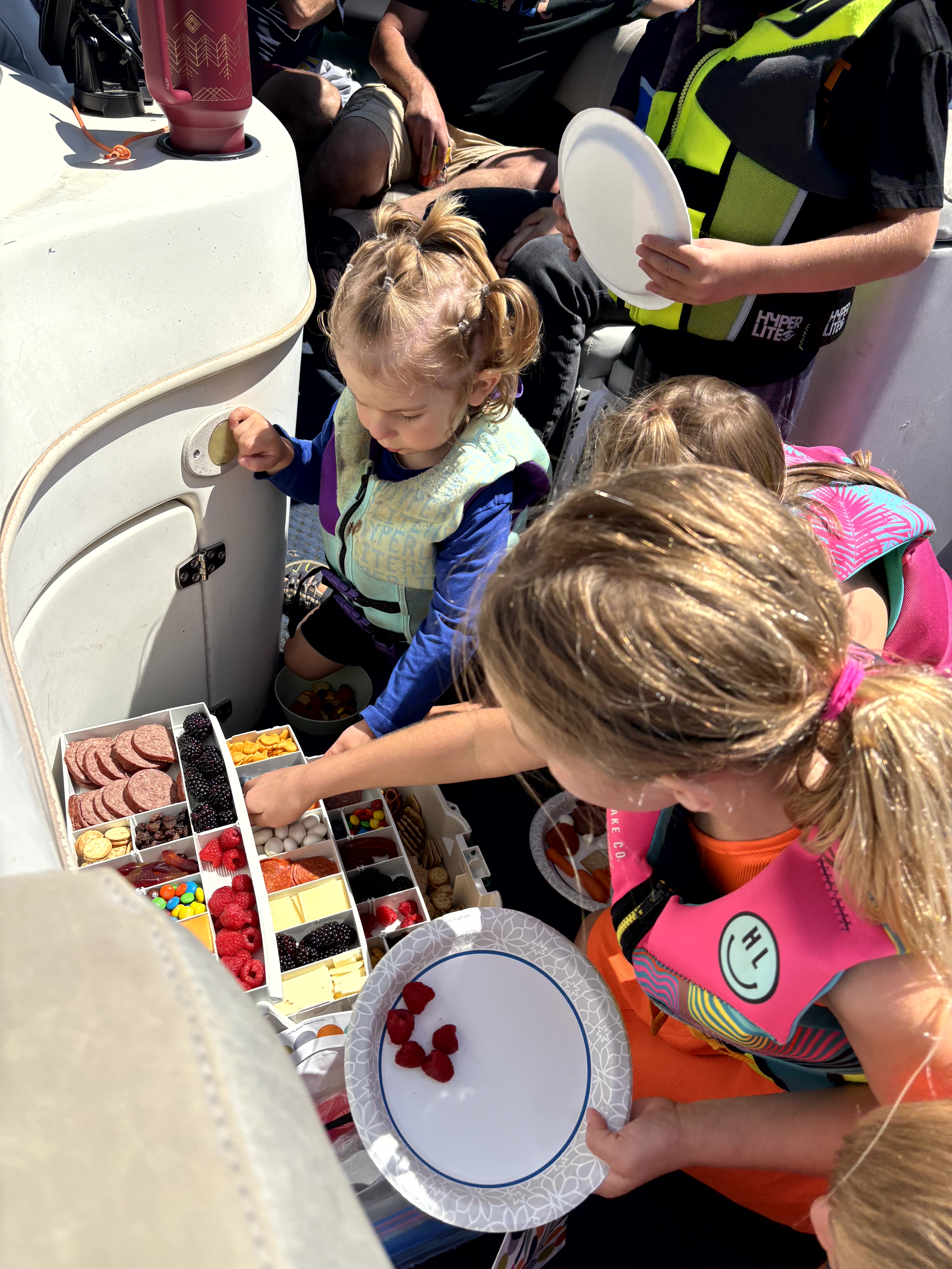
We rented both the large pontoon boat and the speed boat for the week. Pontoon rides were a favorite activity including a lunch cruise where my “tacklebox charcuterie” made a repeat appearance! We took it on a sightseeing cruise on the larger part of expansive Lake Vermilion, and found a nice bay where we could jump off and swim. And it transported all 16 of us to a restaurant on the lake for dinner – another favorite repeat activity by request.
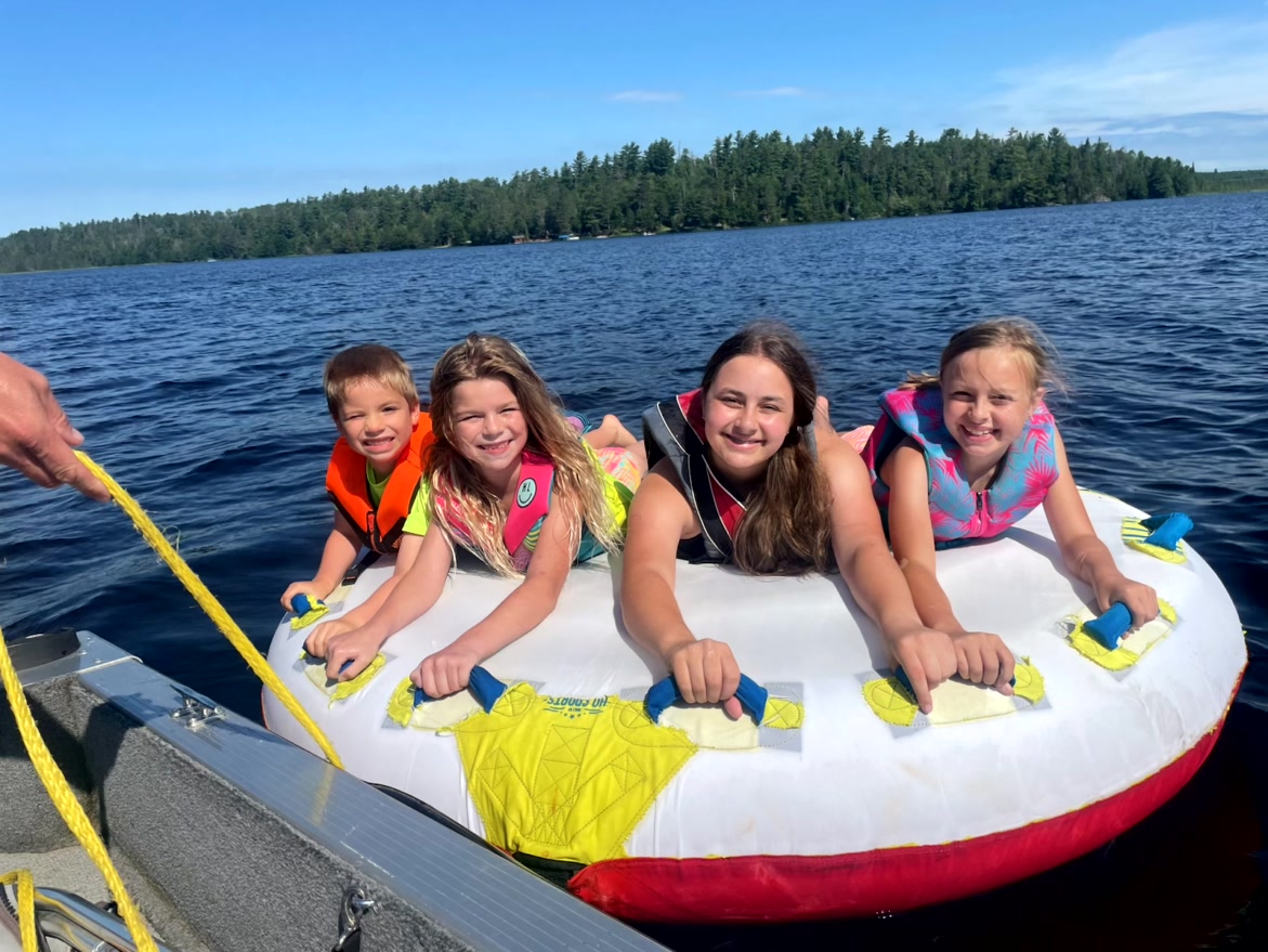
Of course the speed boat was a big attraction. Some of the little ones bravely went tubing for the first time. Older kids looking for a wild ride were gladly obliged by the dads who gleefully whipped them around the bay. Others just liked riding in the “fast boat.”
On quieter waters, the paddleboats, canoe and kayaks were popular, along with the stand-up paddleboard that one family brought. And of course, swimming was a part of every day.
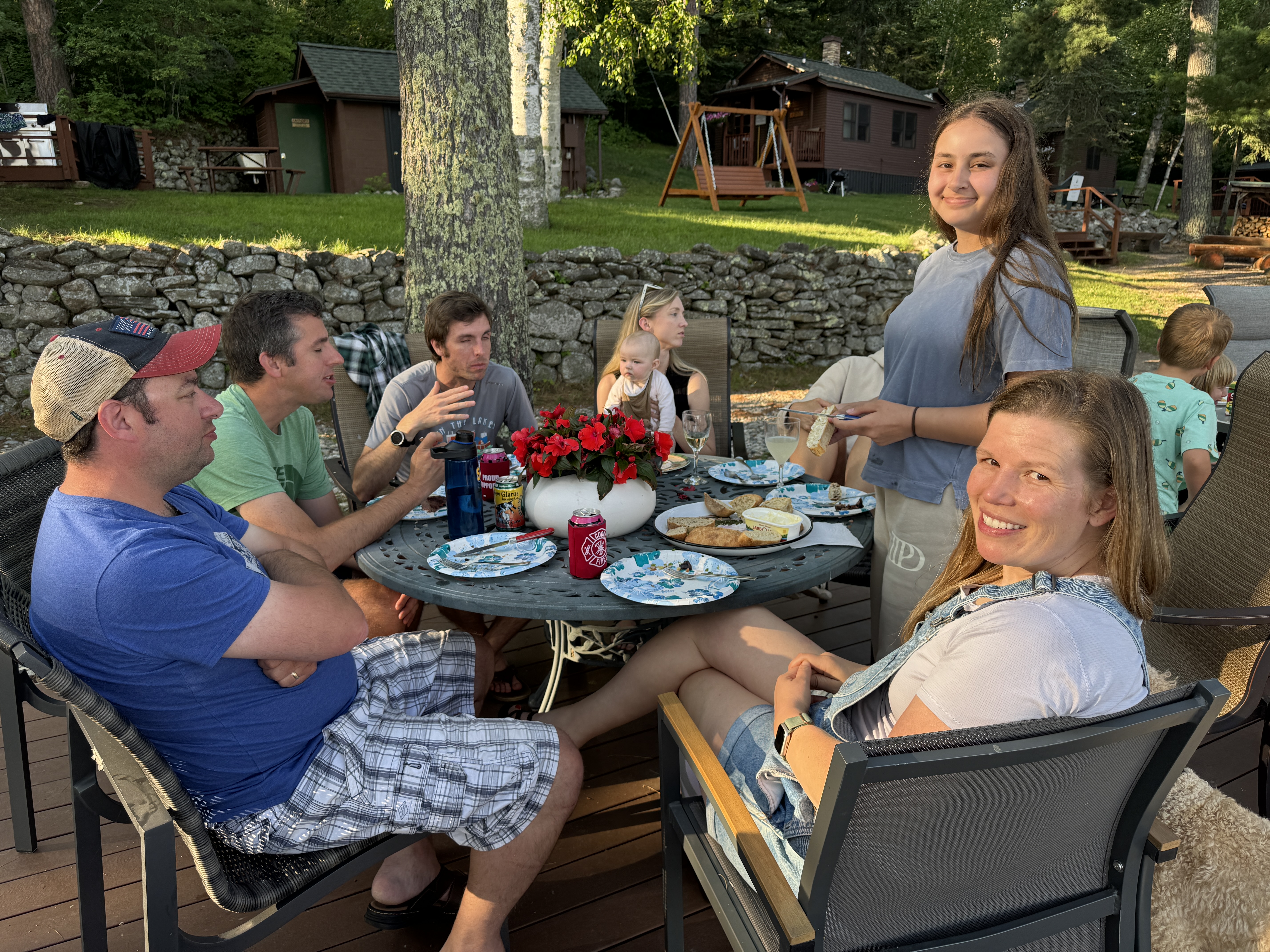
The fun of having a big family gathering was seeing different groups form and reform all week long. Carl and Chelsea took all the boy cousins to the Tower-Soudan Mine museum, which fascinated them all. A number of us went running each day. Karen, Erik and Ben gathered to do core strength workouts on beach towels. Chelsea organized a scavenger hunt for the kids, which drew in the older ones to help solve the word-game clues. Adults battled with kids playing various board or card games. Rich and Katie each took Ben driving, with his newly minted permit. He even scored ice cream with Katie!
It was a time to cherish being together. Cousins played endlessly with each other. Adults gathered after bedtime for card games. We sat out at the bonfire and watched the embers glow. Each family took turns preparing dinner and we all ate together every night. And of course, everyone scrambled to have a turn holding or playing with the newest family member, baby Saige. Sometimes we wandered over to others’ cabins just to hang out and have a good visit.
And there was one more memory to repeat. My summer Grammy Jammies made a second appearance, including a little onesie for Saige! They did not disappoint, and caused a great ruckus upon distribution. It was great fun to see them appear throughout the week.
A week is a good amount of time. It’s always hard to see it come to an end, and yet that’s a good way to leave. To close this chapter of family togetherness filled with fond memories and special moments. And hope to do it again. Indeed when asked, would you like to come back? Once again the answer was YES! Time will tell. Kids grow and get involved in activities. Families make their own plans for travel or vacations. But schedules willing, we hope for another rerun.
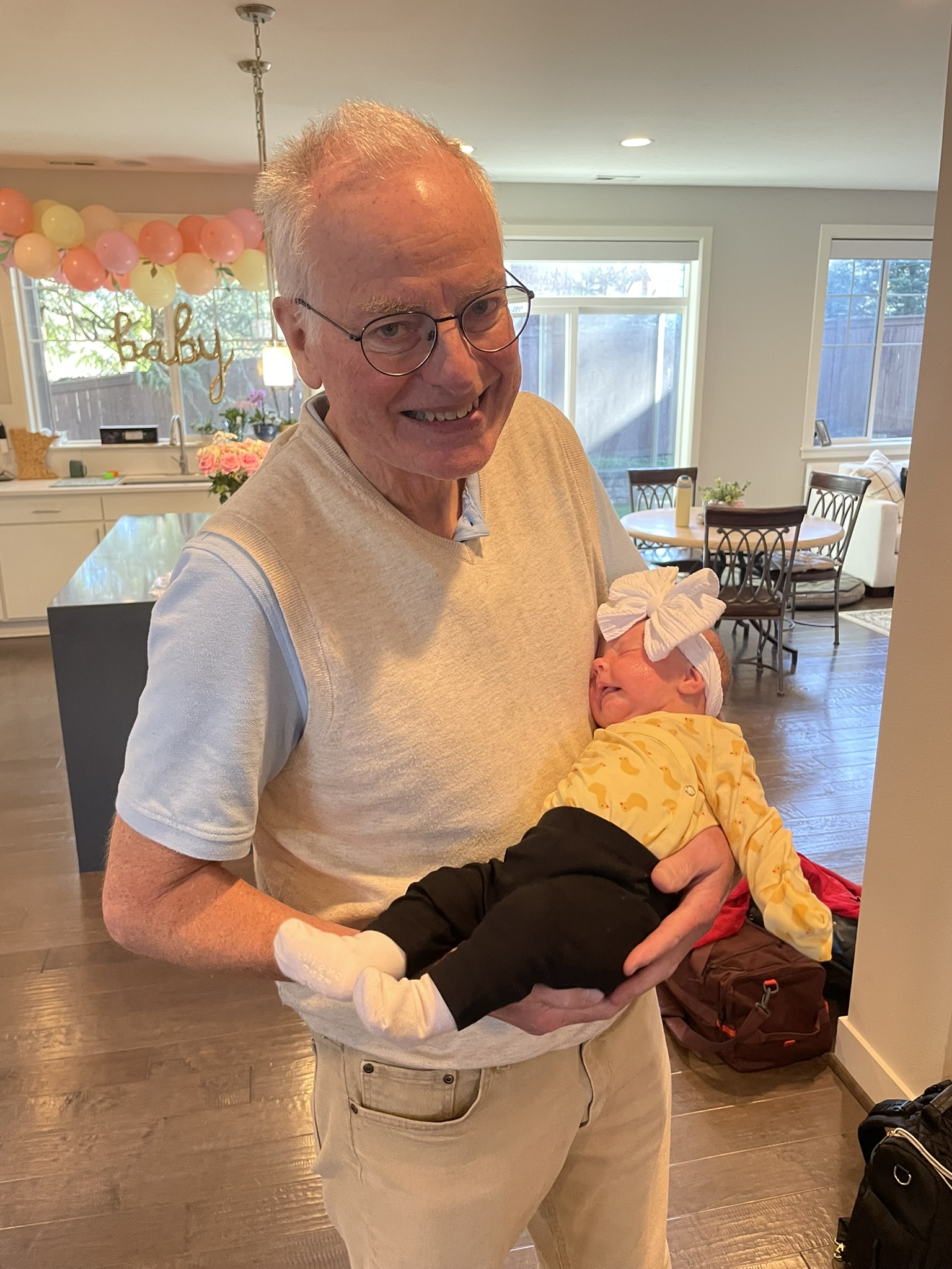
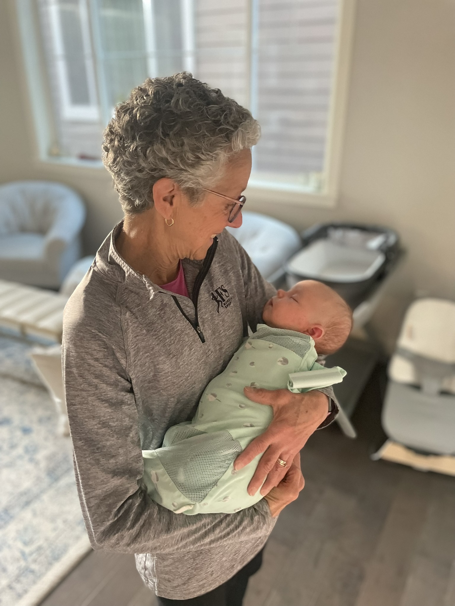
There is nothing like being a grandparent. Seeing your children become parents and cradling that precious newborn are some of life’s greatest pleasures.
This is our eighth time around, and it is every bit as special as the first. Our daughter, Karen, has four children ages 7 to almost 15. Son Carl has three, from 3 to 8. And this winter our son Erik and his wife Katie welcomed their first child, Saige Elizabeth. It was such a happy moment for the whole family, as we have long awaited this big event.
Our flight to Seattle couldn’t come soon enough, and I readied myself with knitting needles and yarn to knit a cap for Saige on the way. Anything to pass the time! As soon as Erik brought us home from the airport, Katie greeted us with Saige in her arms and promptly handed her over. It was heavenly, seeing her at last!
I had no expectations for our visit. My whole goal was to help in any way I could and just be part of their new lives. I’d brought meal plans and wanted to free up Erik and Katie to soak up time with Saige. We would be on Saige’s time, so I was prepared for everything to be low key and flexible.
Erik had returned to work, but we all had a nice weekend together, including Saige’s first dinner out at a restaurant. Rich returned home after that, but I was not even close to getting my Grammy fix. So I stayed on for 11 days as planned. Precious time.
I admit I felt a bit rusty and wanted to get the hang of Erik and Katie’s parenting style. Everyone is different, and there are always new approaches to handling a baby. I was pleased when I mastered the art of calming Saige (deep knee bends were the key!) and was glad when I could free Katie up to attend to her MBA studies when needed.
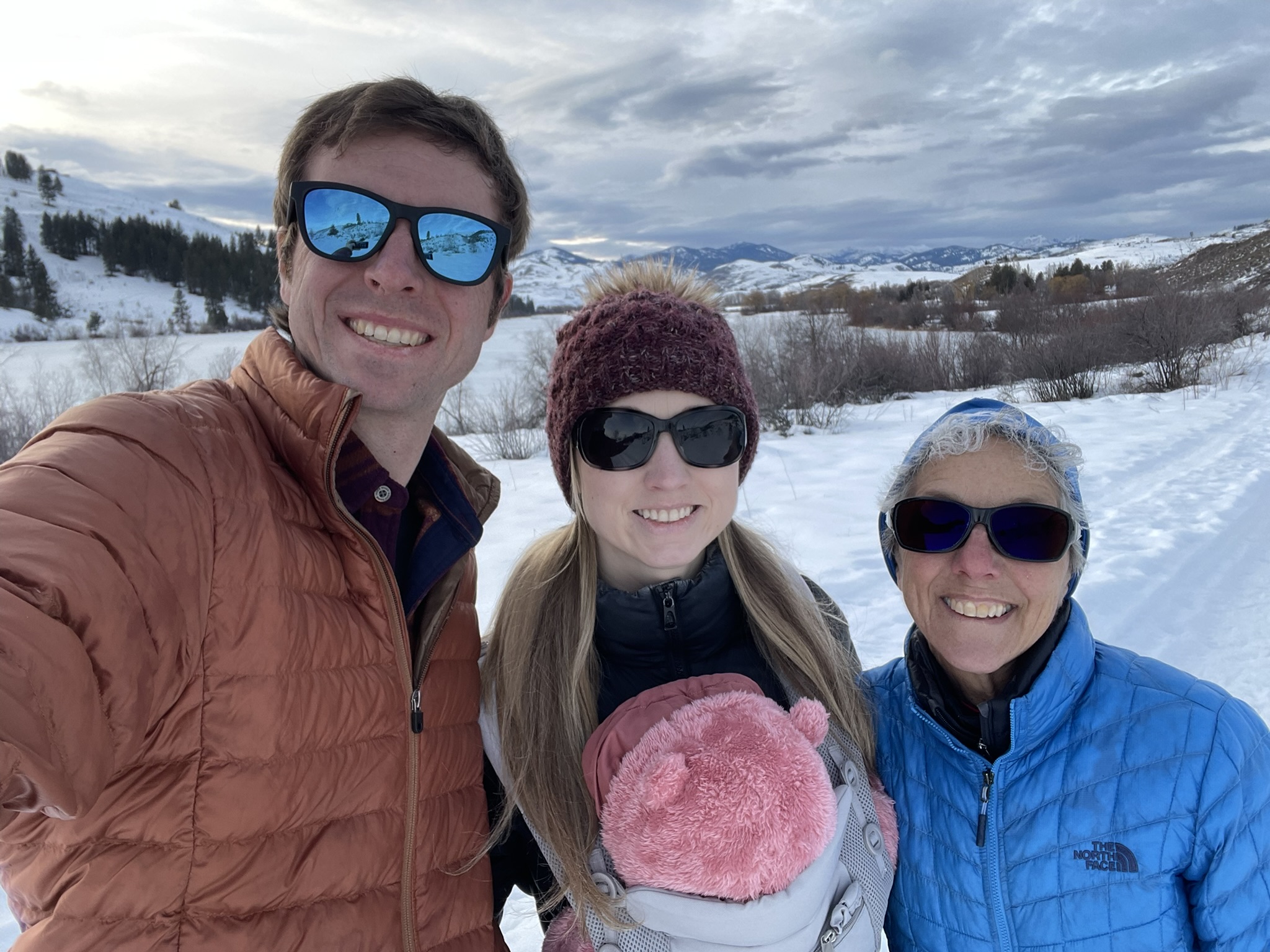
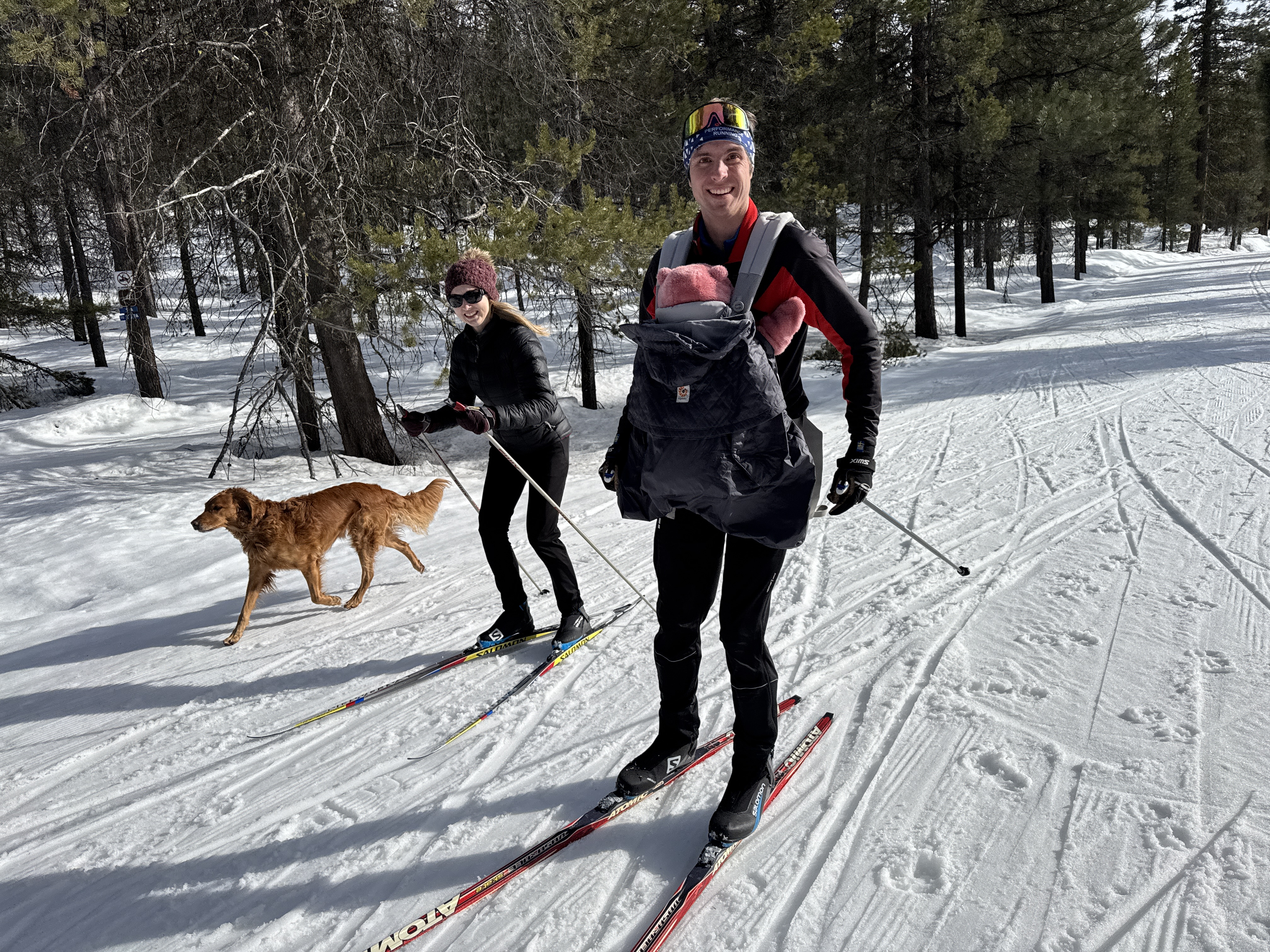
Being the outdoors people they are, Erik and Katie wasted no time introducing Saige to fresh air. Erik had a 50k cross-country ski race, so Katie bundled Saige into the front pack and the three of us cheered Erik on for a full morning!
Katie and I ventured out for walks with Saige every day. Given Seattle’s propensity to rain, they had all the necessary gear and we headed out no matter the weather!
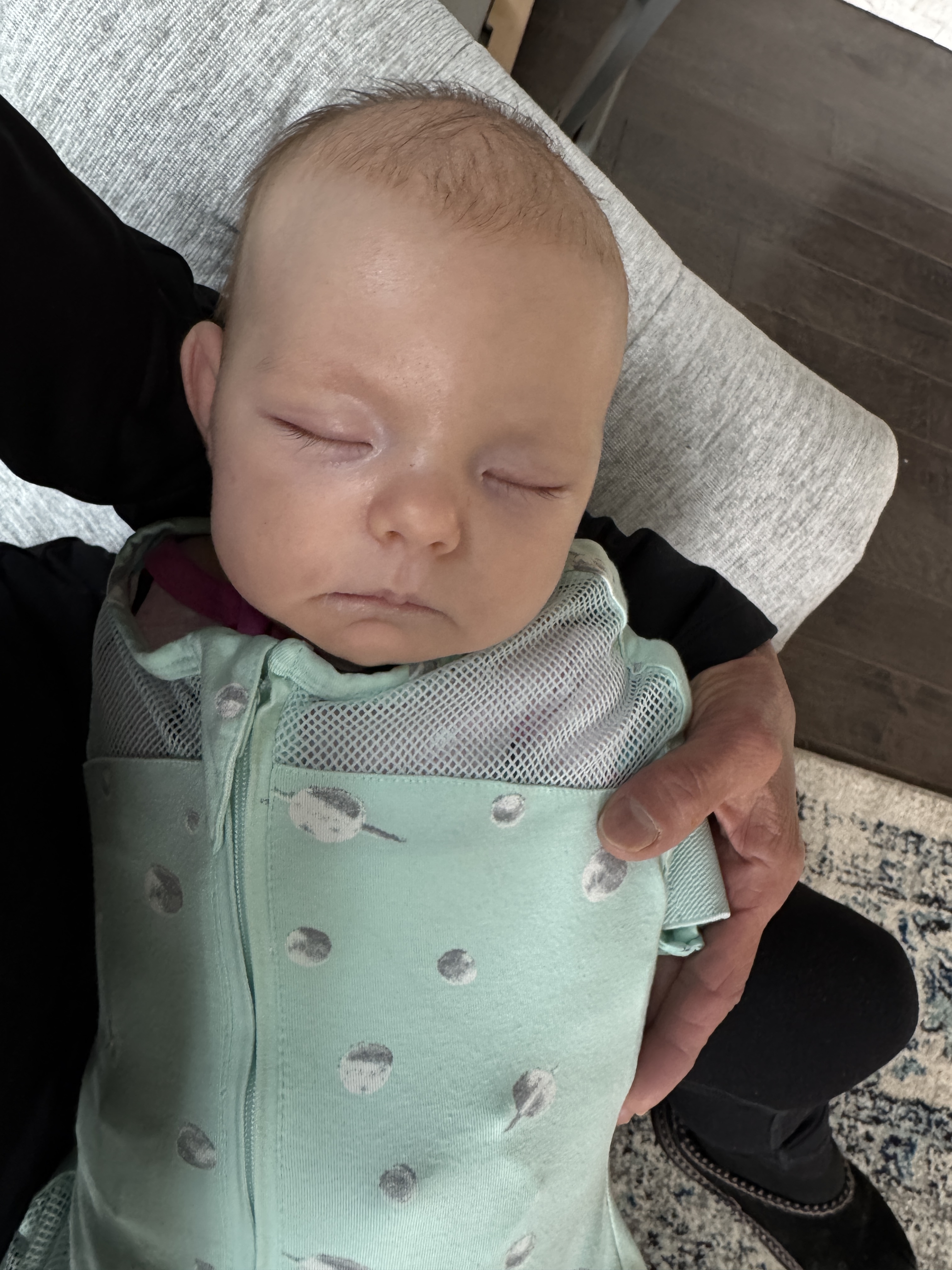
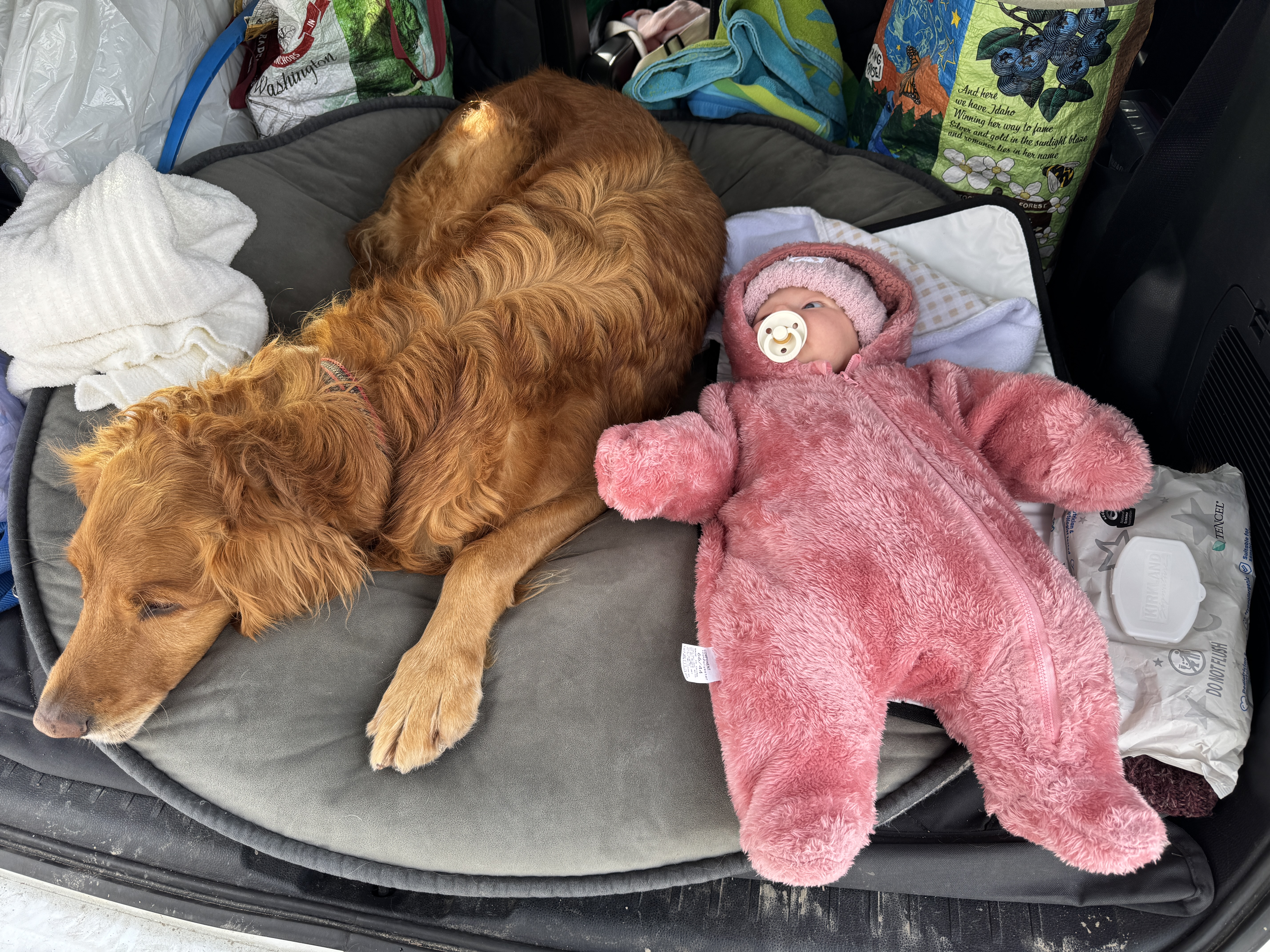
But the best times were snuggling with Saige. I could never get enough of her sweet face, and the tight bundle in her swaddle (something we never had!). Even in the time I was there she began to enjoy time on the floor, looking at the toys hanging overhead. I could never get enough of just sitting with her and watching.
The end of the week brought a real treat. For Erik’s birthday, Katie had made reservations at their favorite Bed and Breakfast in the Methow, a cross-country ski mecca in the Cascade Mountains. The four of us headed off for a weekend of snow and fun. I loved being part of several firsts for Saige, most notably snowshoeing and skiing! There is no doubt this little girl is going to be an outdoor sports enthusiast like her parents. Nestled snuggly in the front pack, she mostly slept through the adventures, while we relished the winter retreat including downtime in the BnB.
All that was over a month ago now, and I eagerly await photos, videos and FaceTime to see Saige grow and reach new milestones. No matter how many times I watch a grandchild grow, it never gets old.
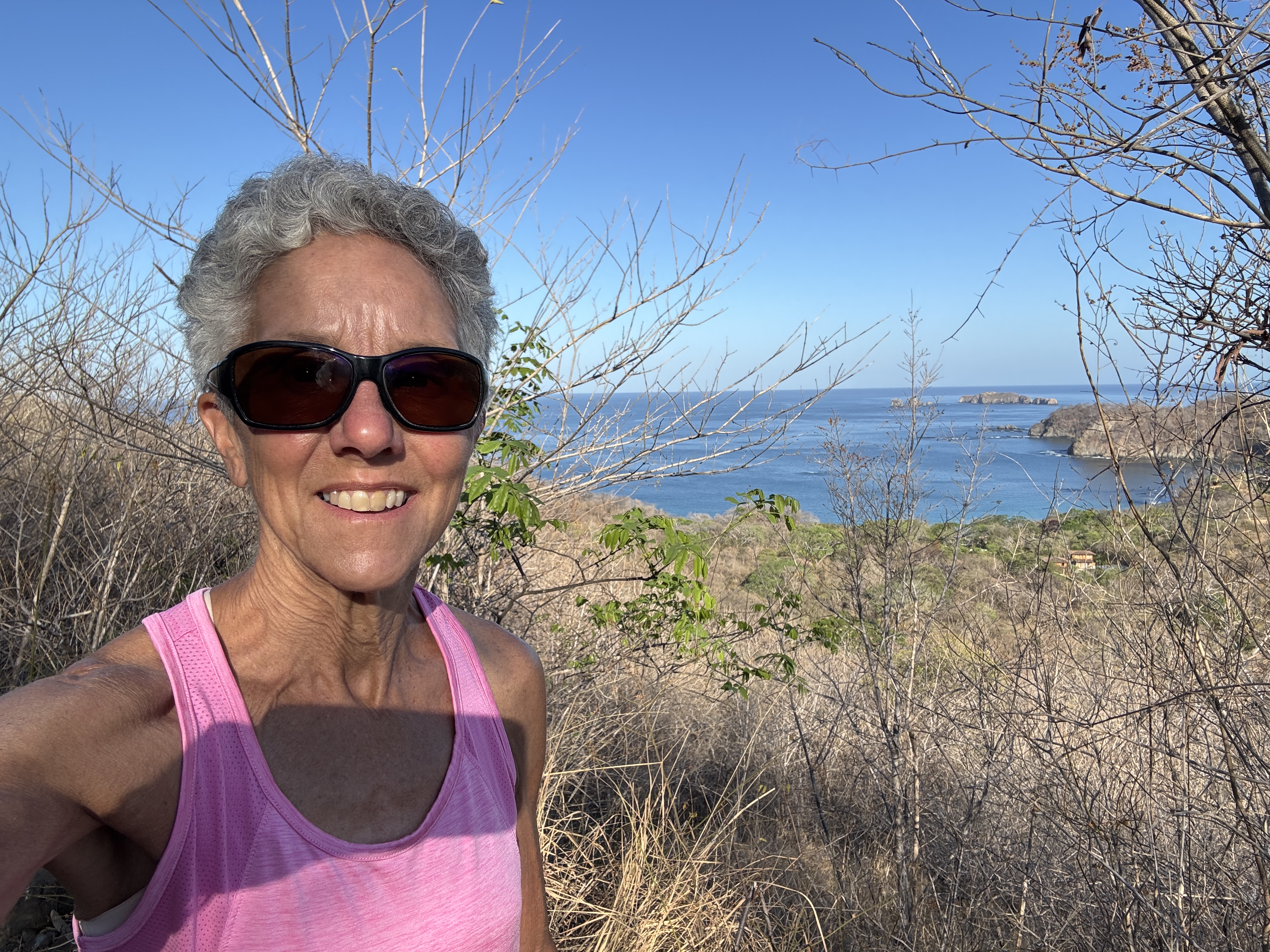
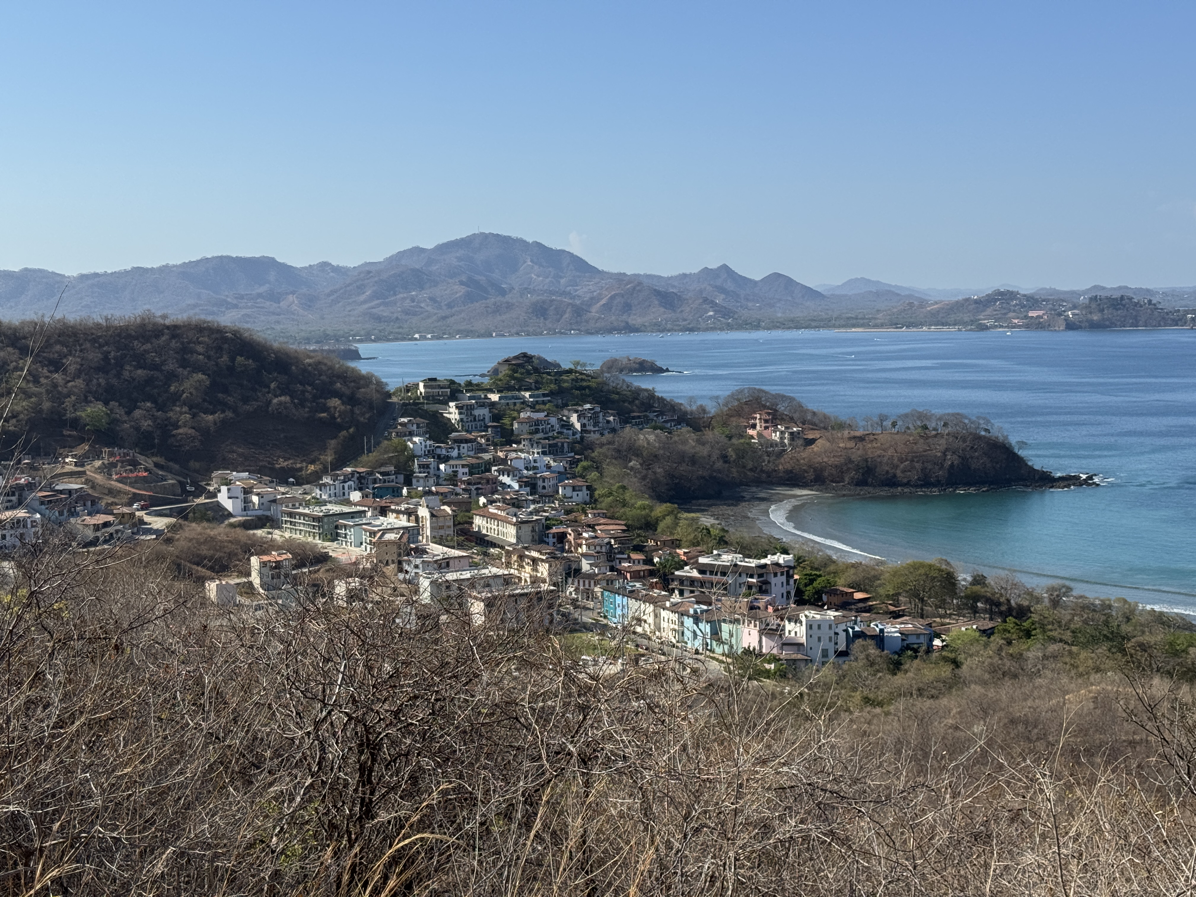
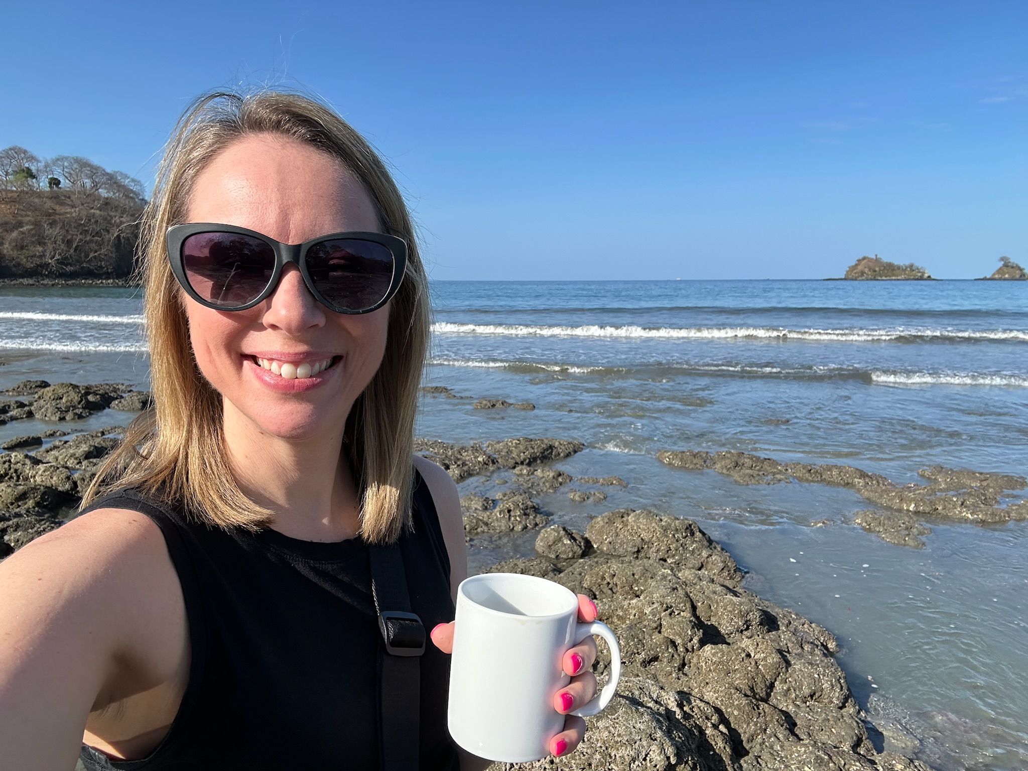
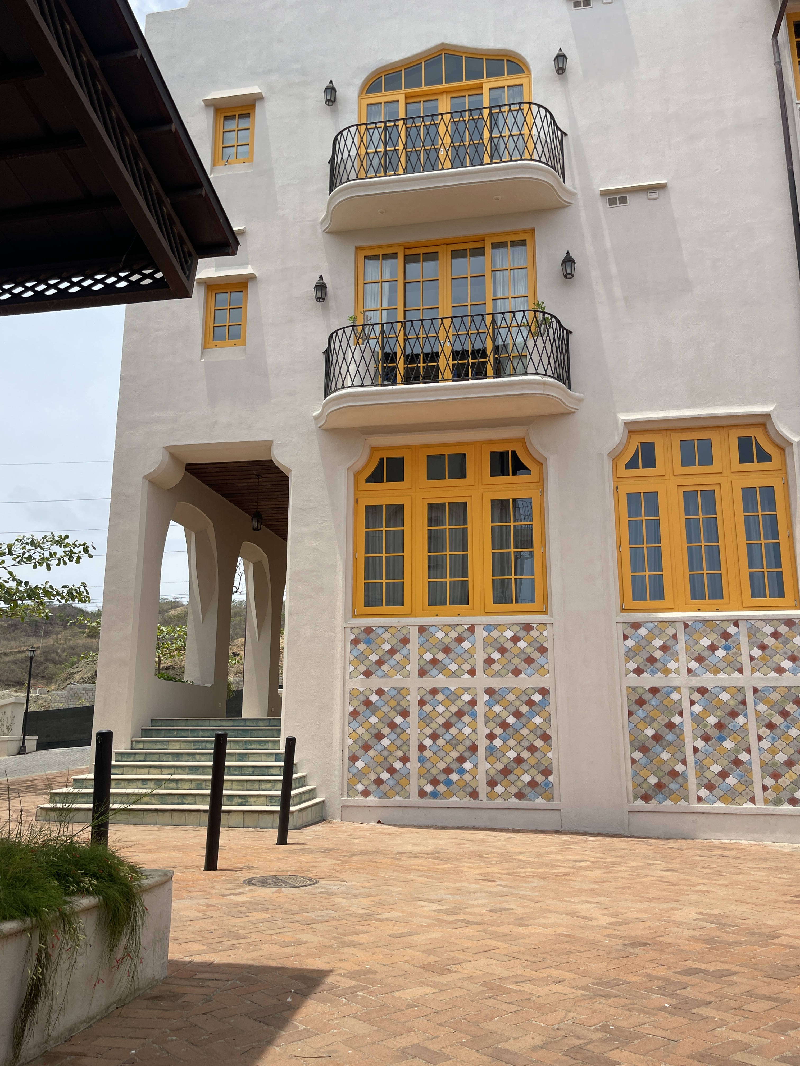
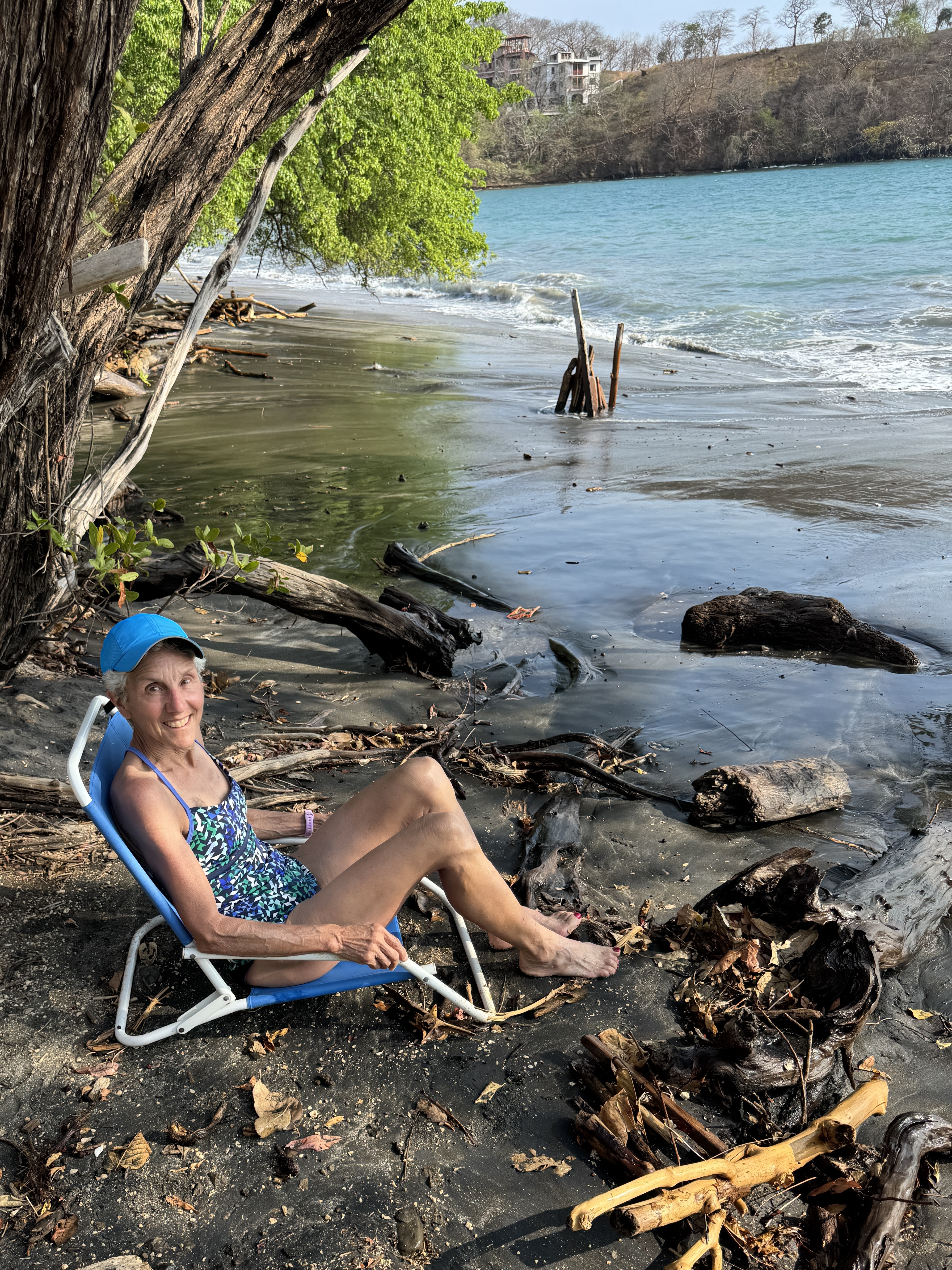
We’ve been to Las Catalinas three times now, and while I have blogged about the experiences we’ve had there, I realize I have never really done justice to the place itself. It is a totally unique town on the Pacific Coast of Costa Rica, and I will be the first to admit that it is not your typical Costa Rican experience. But it does resemble Paradise.
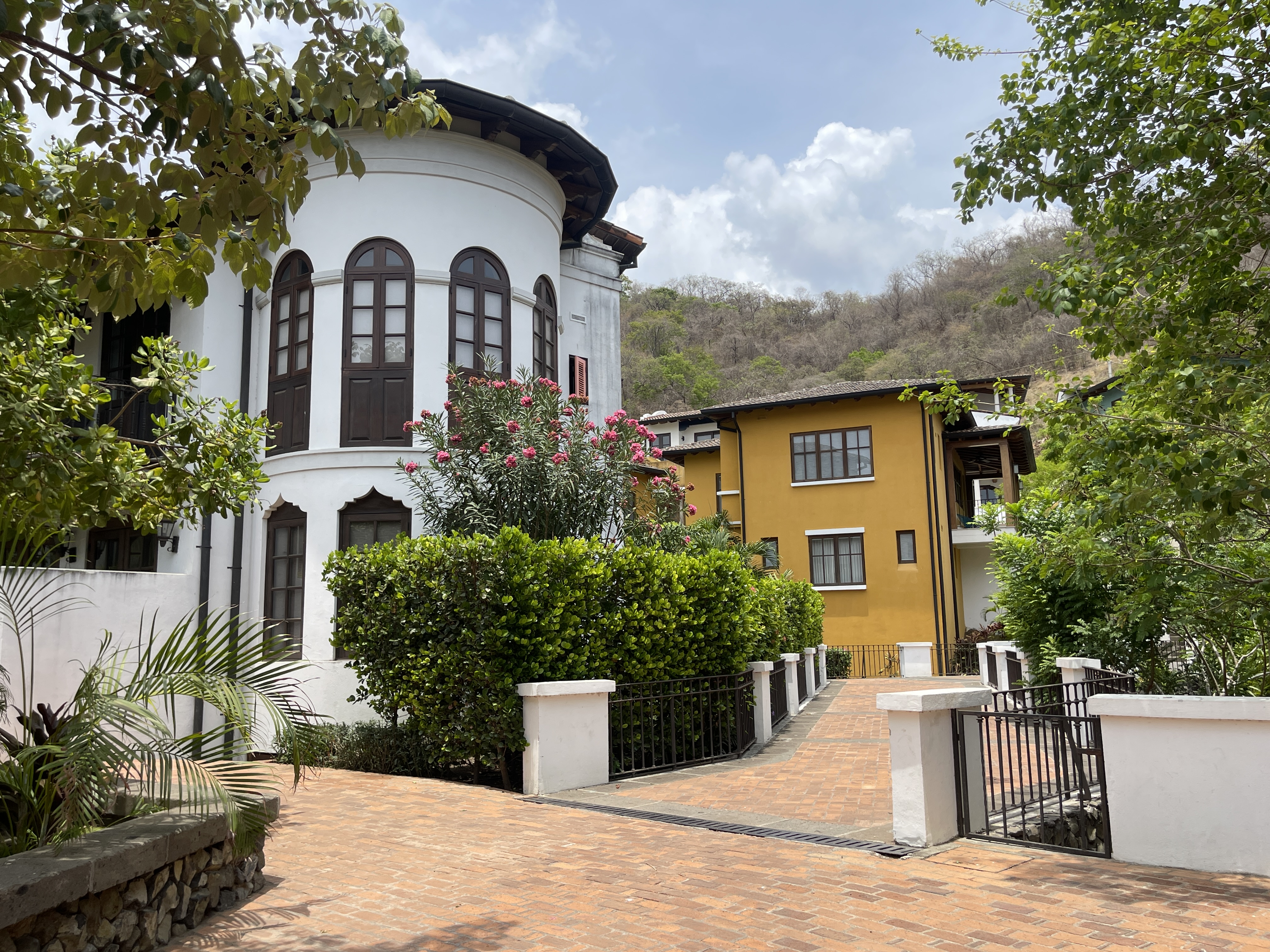
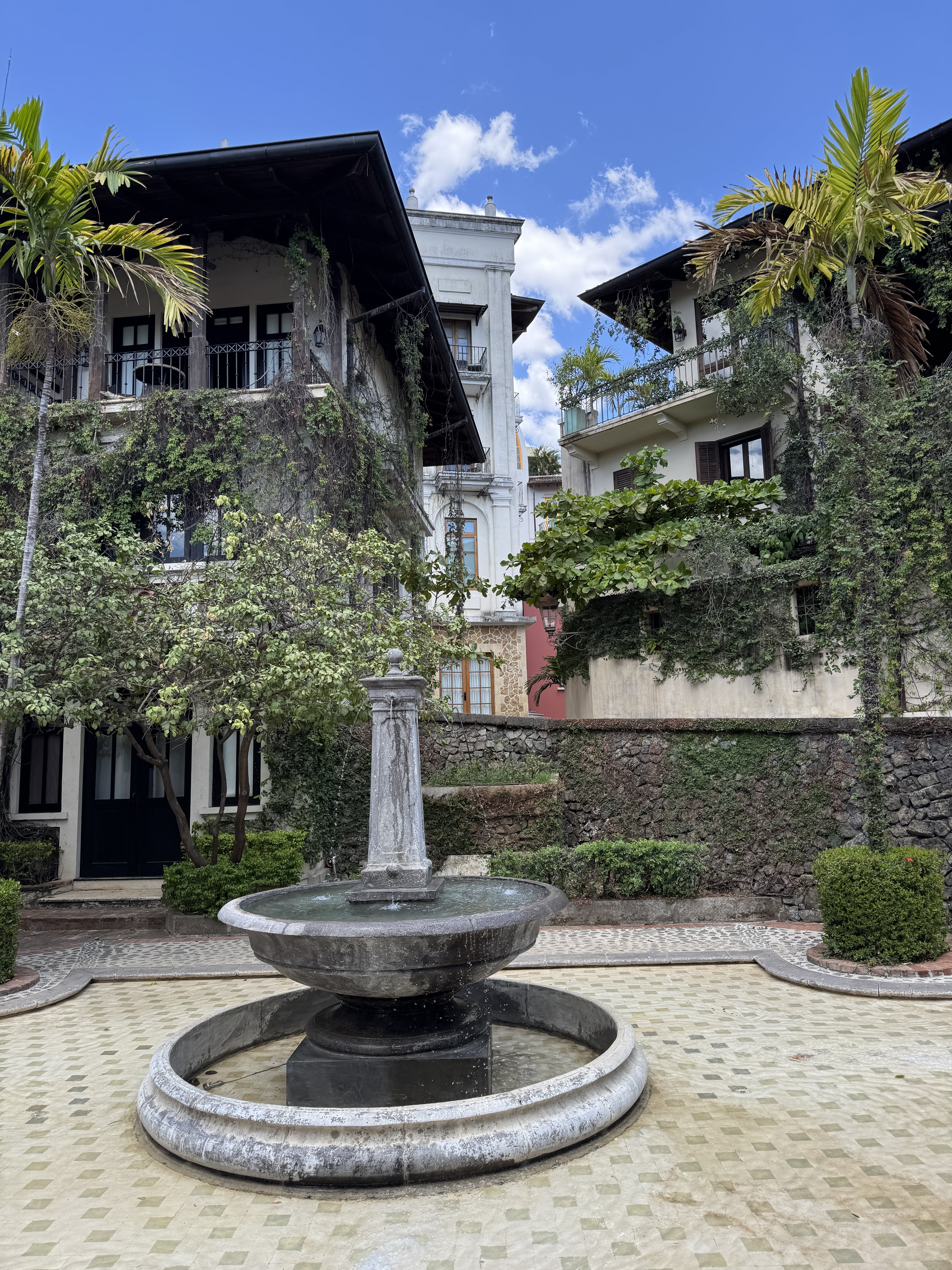
Las Catalinas is the brain child of Charles Brewer, who happens to be a college friend of Rich’s brother Will. Will is one of the original investors in the project, and remains an advisor to Charles and Las Catalinas. He says “Charles spent two years traveling the world in an effort to find a family friendly, walkable New Urbanist town.” Las Catalinas is the result. Charles first explored the land by horseback back around 2000 and founded the town in 2006. A road had to be constructed to reach it, and the town was built from scratch. The vision was a Mediterranean village, with tightly fit buildings of beautiful architecture and tropical colors, laced with pedestrian walkways – no cars. They are parked in a secure lot on the edge of town. Caretakers attend to the brilliant flowering landscaping and common areas. The vision has become a reality!
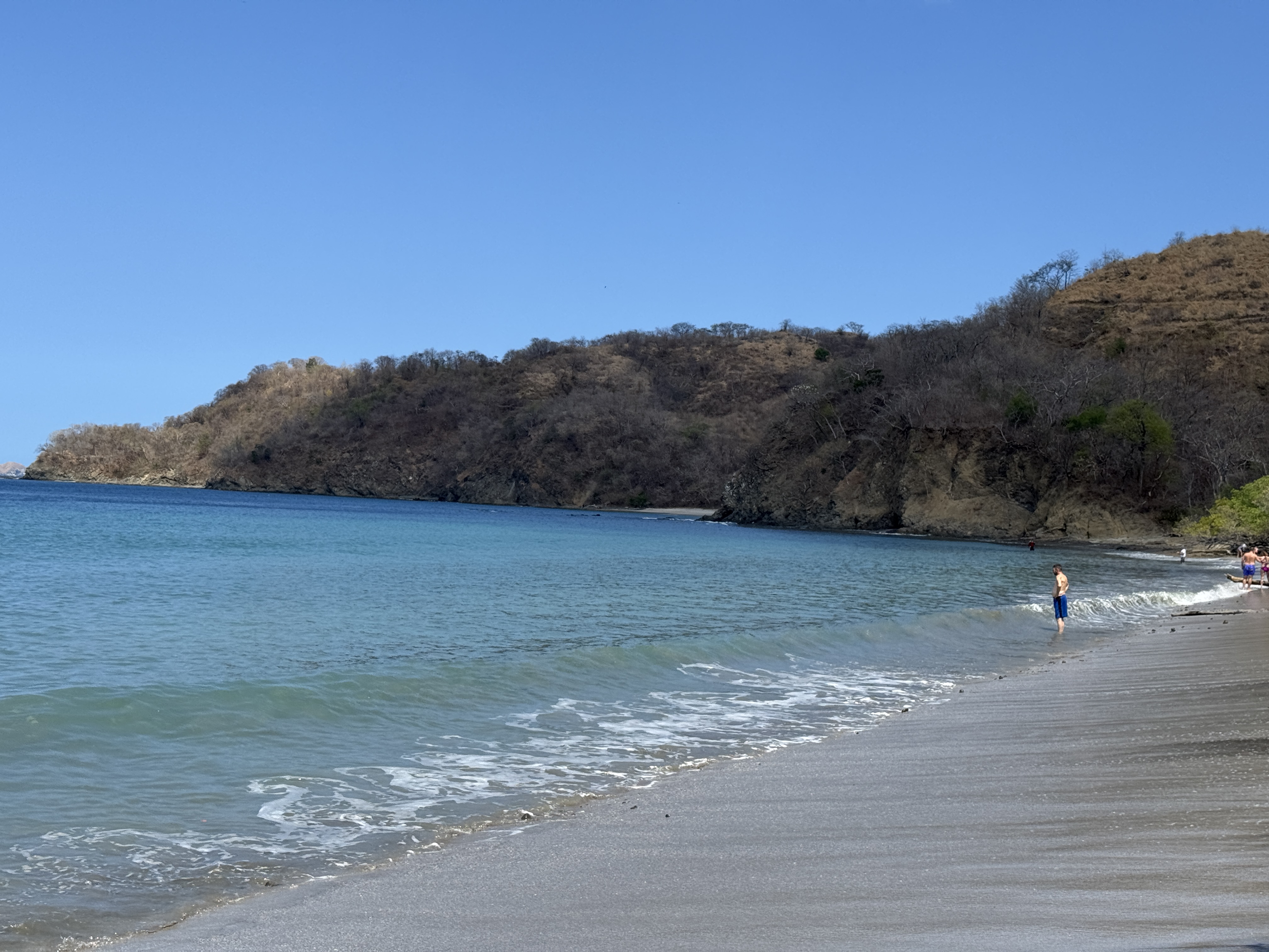
This is Beach Town, built around the curvature of a pristine sand beach in a protected bay surrounded by hills. When we first visited, it had a sports rental shop, and one restaurant. By now it has blossomed to host at least 6 restaurants, myriad shops, a grocer, an ice cream stand, day spas and a few professional offices. All the restaurants are open-air, and our favorite remains the one on the beach front where we can watch the sunset.
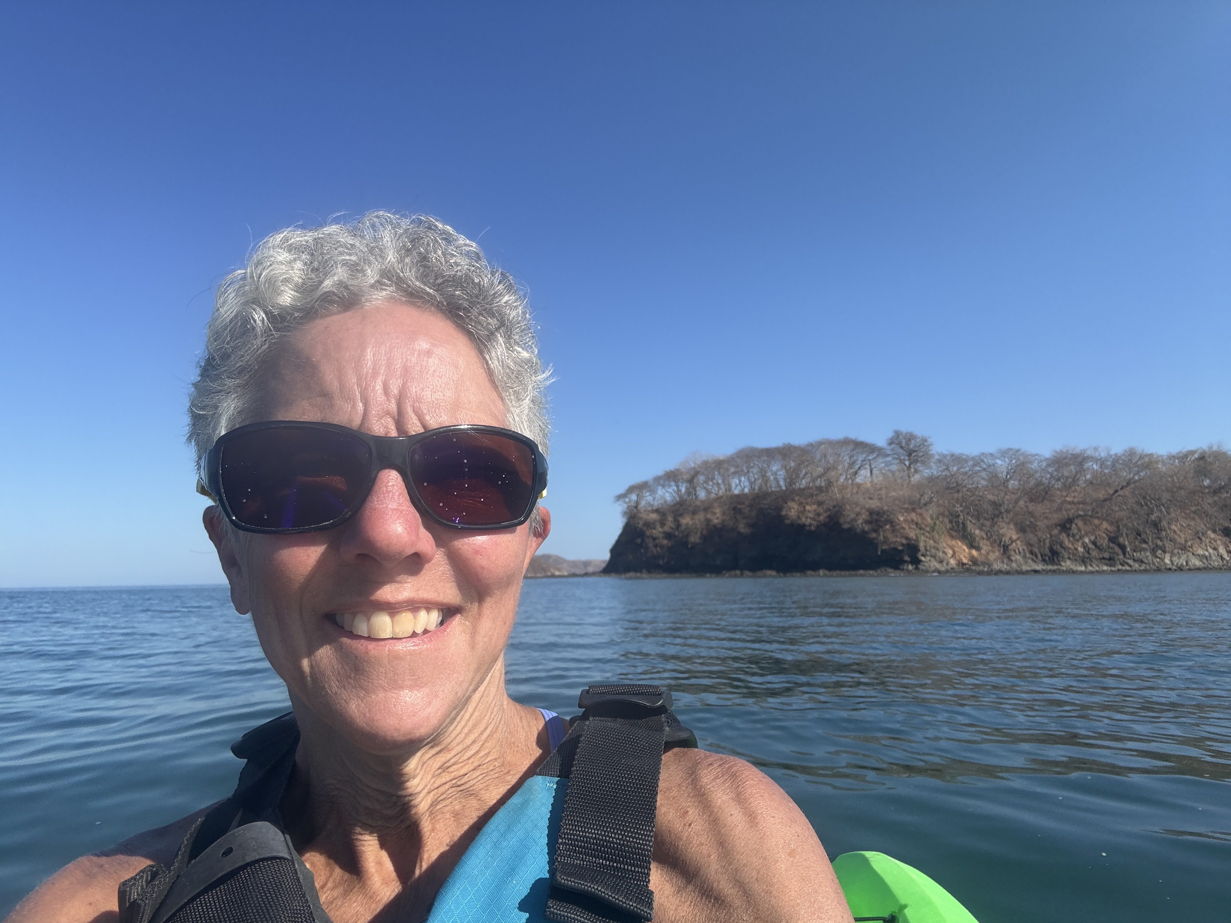
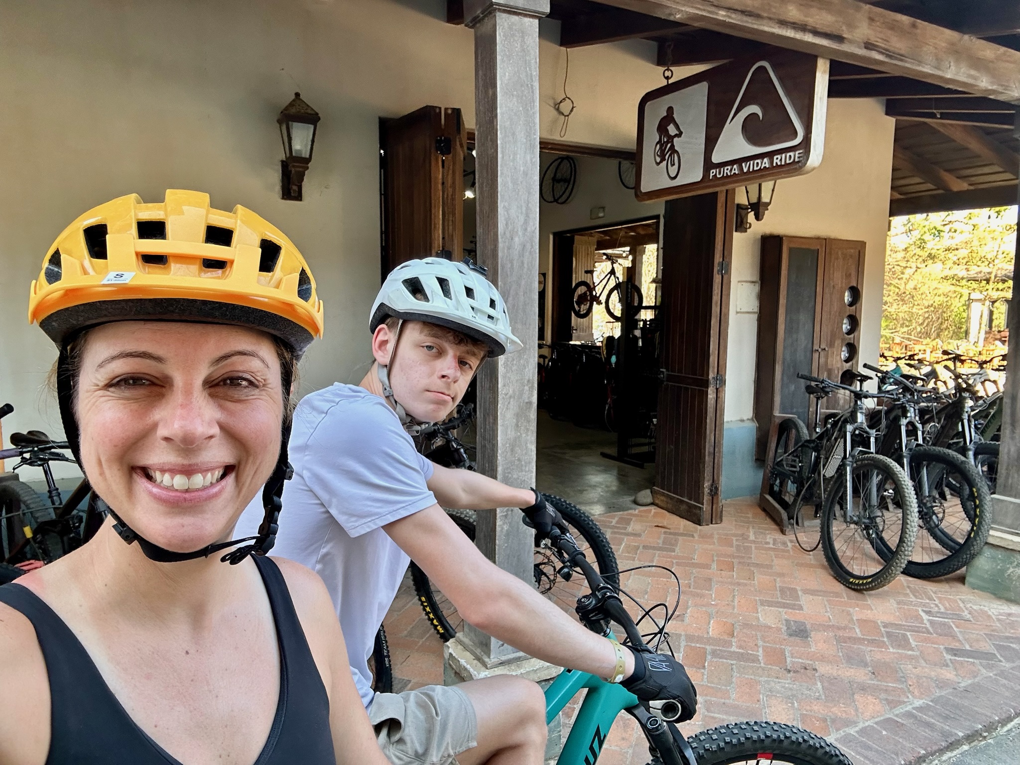
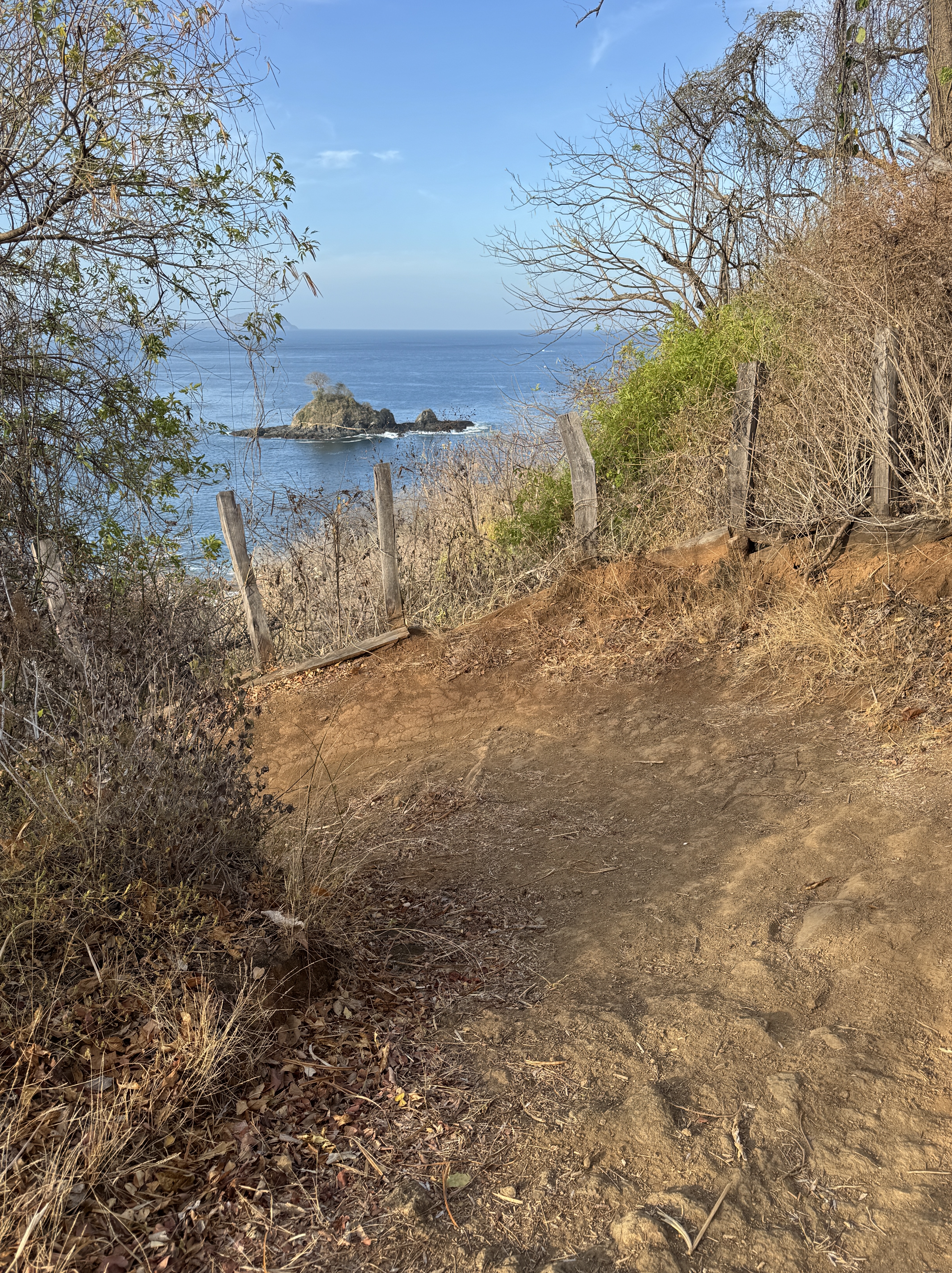
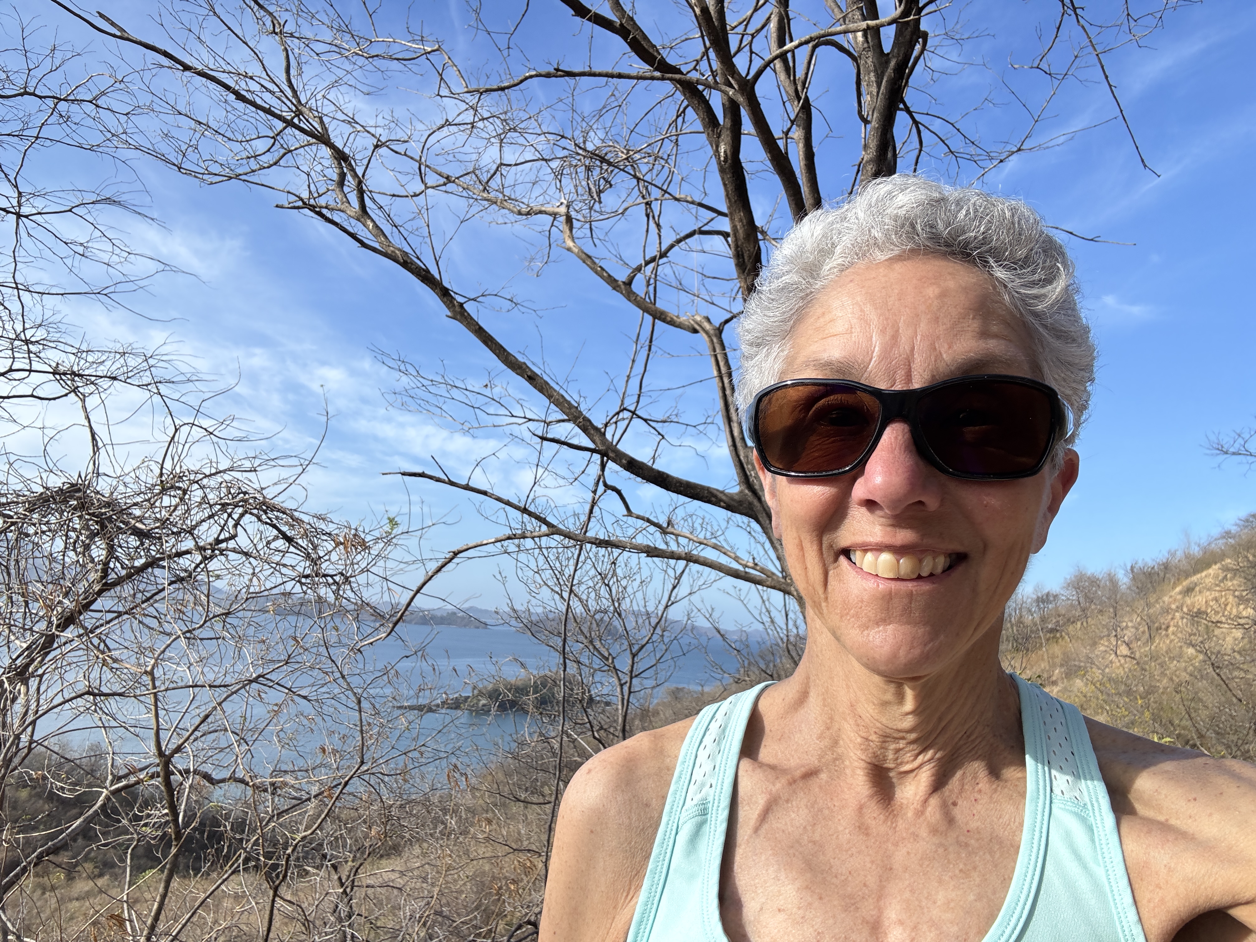
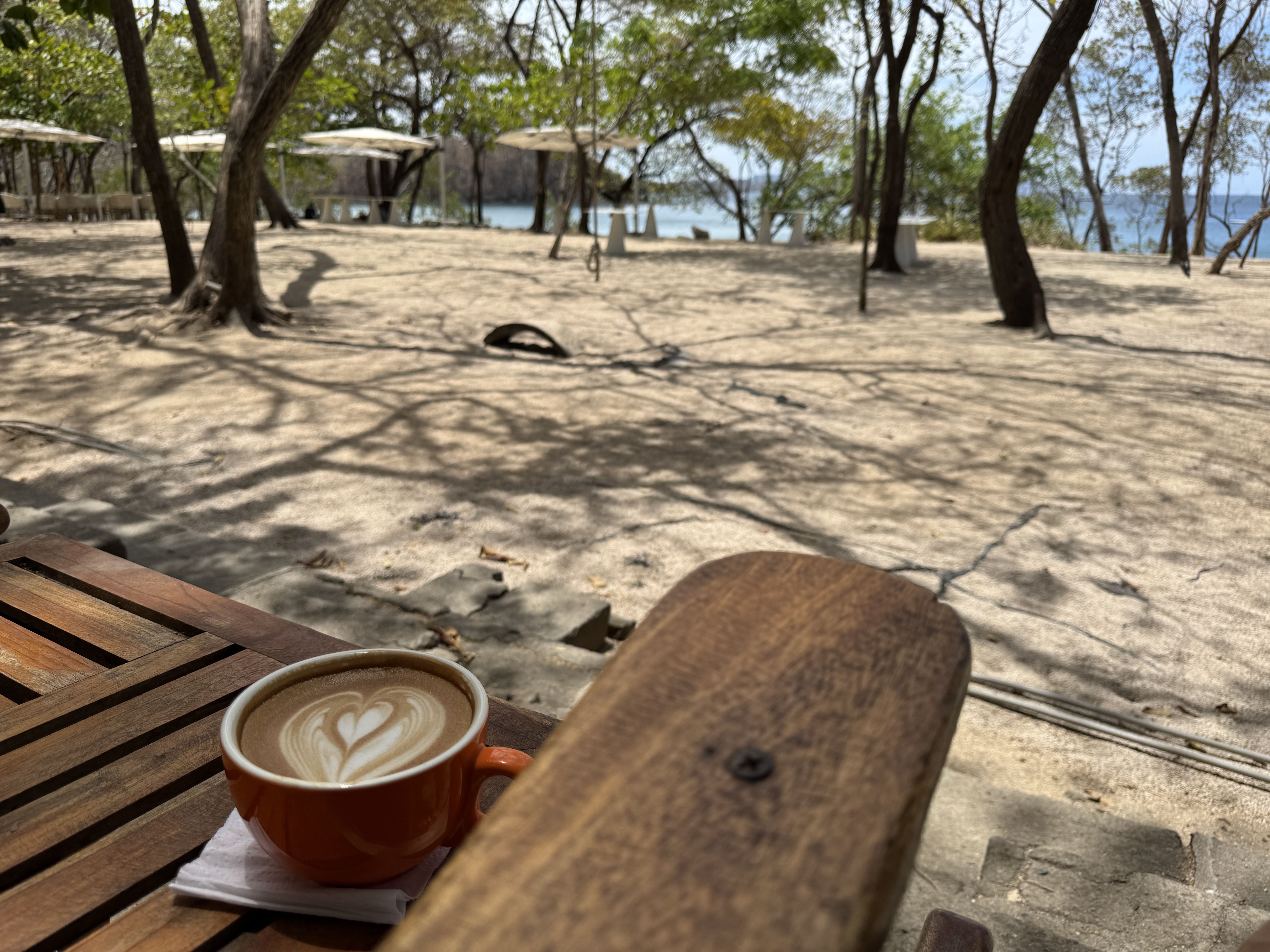
Pura Vida, the sports shop bears special mention. Part of the town’s mission is to promote a healthy outdoor lifestyle, and the shop offers a wide range of rentals from mountain bikes to kayaks, paddleboards, boogie boards and snorkeling equipment. The steep hills surrounding the town host 40 kilometers of mountain bike trails that are also open to walkers, trail runners and hikers. It is my favorite place to be at sunrise, before the heat of the day. I have also availed myself of their kayaks to explore the nearby bays.
The shop is also the hub of social life. Sports enthusiasts come and go, trade stories, compare experiences, share tips. And who knew sports guys made excellent baristas? Their espressos are best enjoyed in the row of rockers or tree-stump tables in the shade of the building. There it’s easy to converse with others while overlooking the beach. Howler Monkeys play overhead, and iguana prowl the area.
The Beach Club lies at the other end of town, a private club with its own restaurant and bar service, and a host of pools to suit all ages and interests. I’m partial to the lap pool where I can get in my strokes under the sun, while others prefer the waterfall pools, adult soaking pools and lounging in the beach chairs.
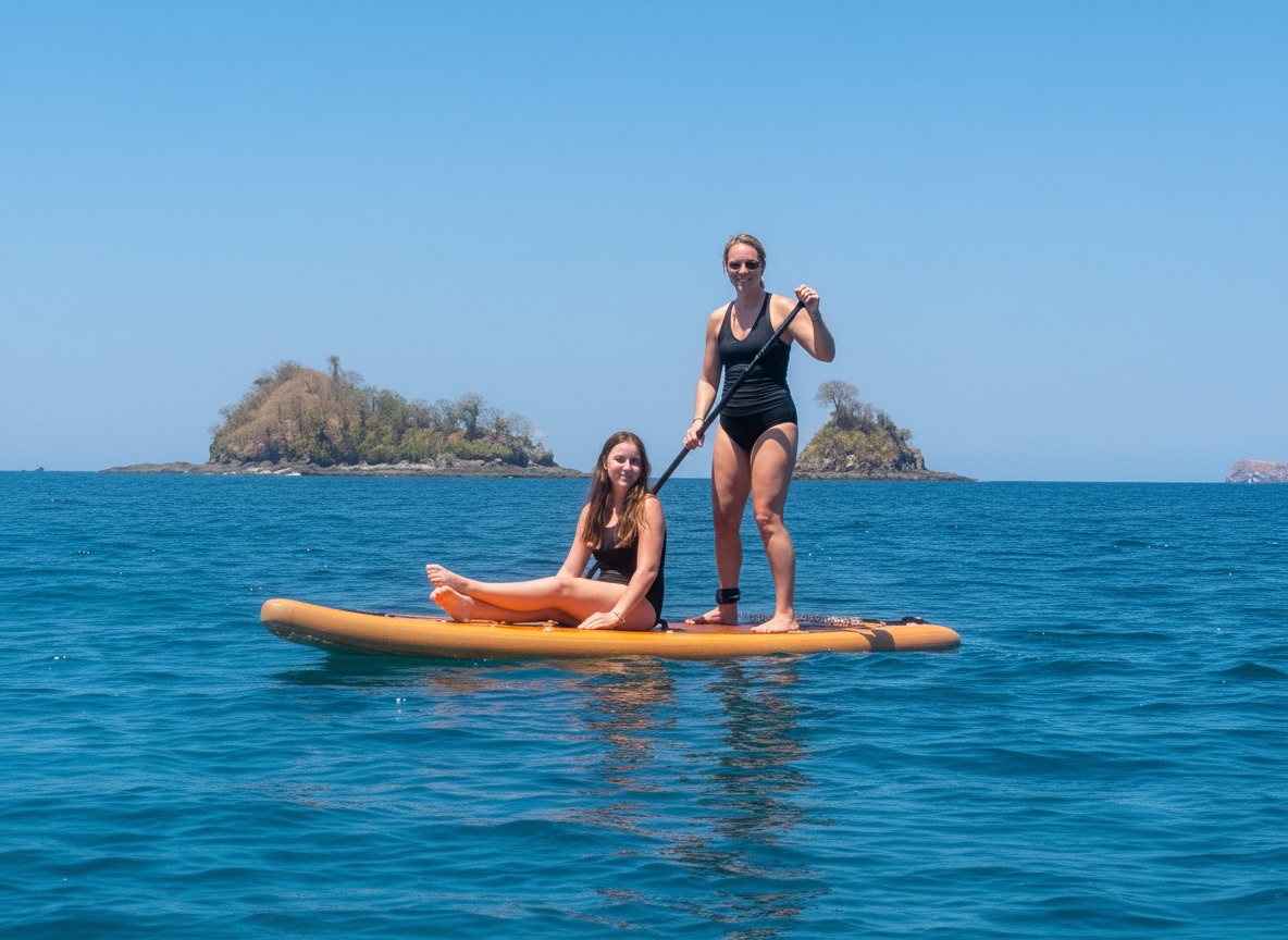
The beach is a natural draw. Families gather to play in the waves, try their luck riding in on boogie boards, and dig in the sand. Teens swim out to the raft in the center of the bay. The adventurous launch kayaks and paddleboards over the surf. With the fresh ocean breezes and a bit of shade, it’s a comfortable place to sit in a beach chair. If it gets too hot, a dip in the ocean is both refreshing and a nice temperature for swimming or just floating in the buoyant water.
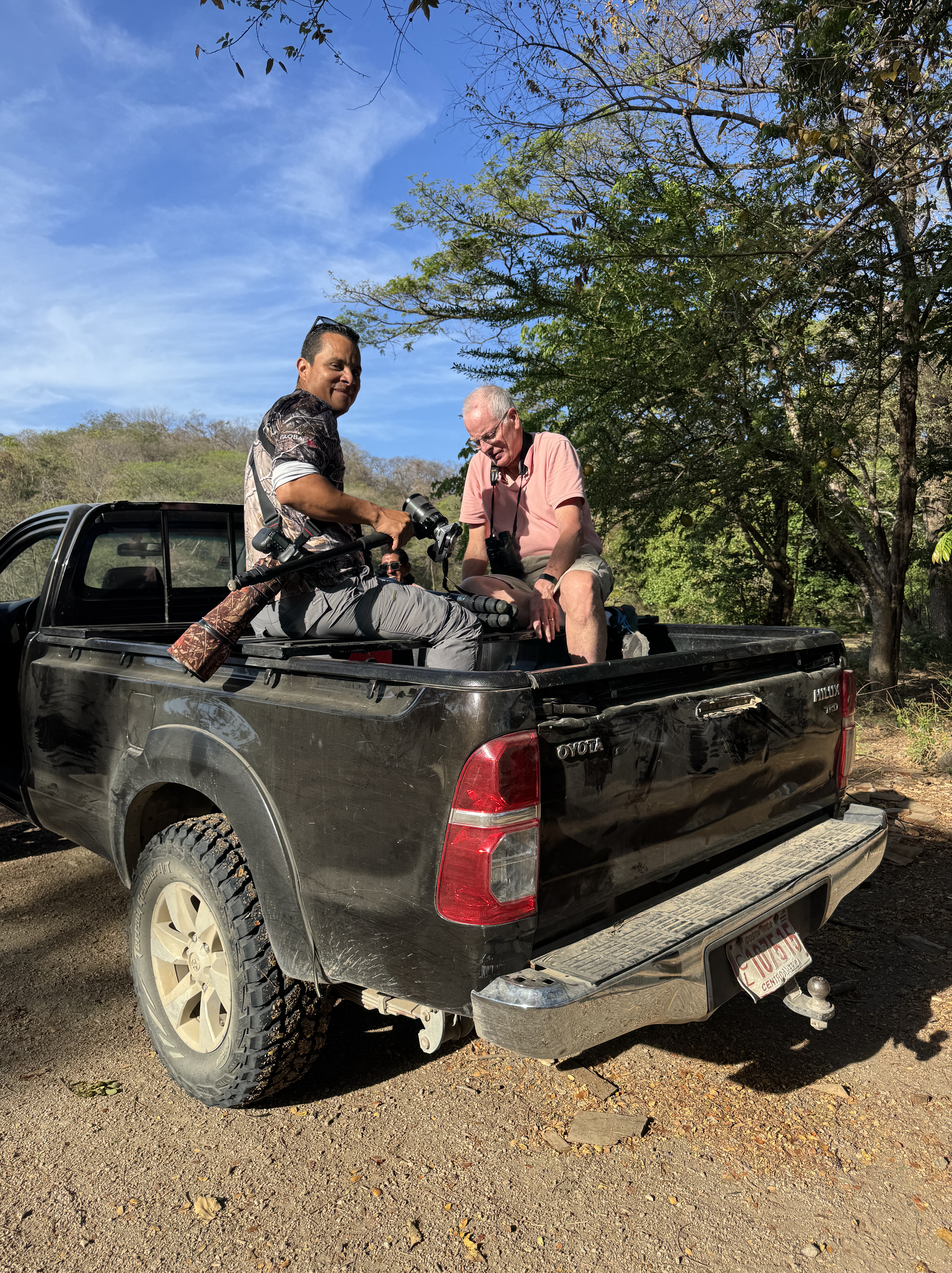
While there is no need to leave Las Catalinas, more true Costa Rican flavor can be found just 3 miles away in the town of Portrero, a drive that takes 11 minutes on the narrow, windy road. It is home to local restaurants, small grocery stores, market stalls and a beach hosting fishermen and a marina as well as water lovers. We have also enjoyed excursions to area parks for hiking, a wildlife boat tour, birding and exploring the area.
There’s a reason we keep coming back. If we’re going to escape winter, it might as well be somewhere with an abundance of sun and warmth, accessible to all kinds of outdoor activities, with beautiful birds for Rich to photograph, and an invitation to relax, slow down, read a book in the shade on the beach or enjoy the ocean waves. Life in Paradise.
It’s no secret that I am not a birder. It’s just not in my DNA to scan for birds, listen and learn their calls and understand their habitat. Nor do I have the extreme patience and skill to photograph birds. But I’m married to a birder who thrives on all of that and I admire his work.
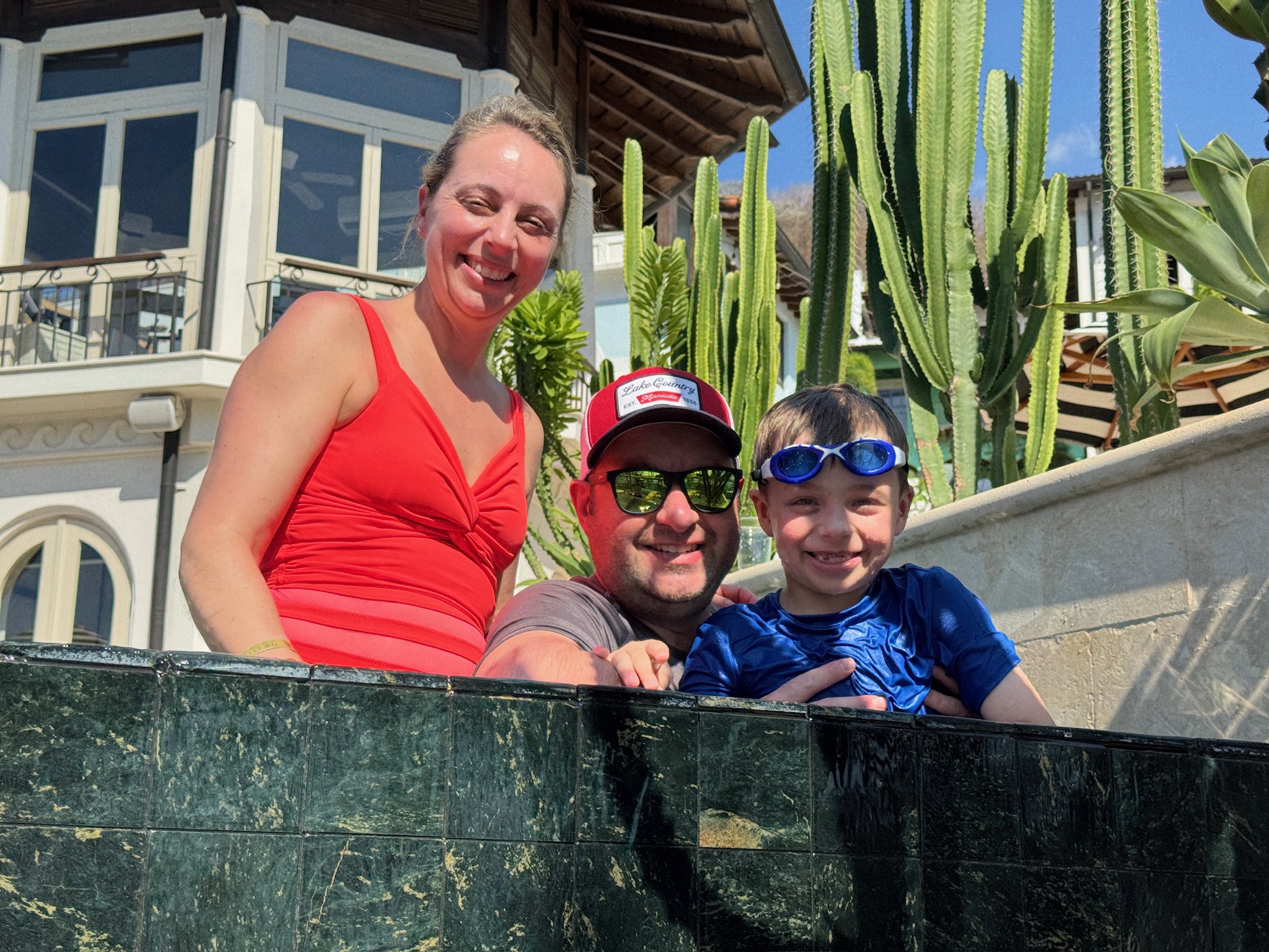
We are currently spending two weeks in Costa Rica, a birder’s paradise. This is our fourth time here, so I had no illusions about what would occupy Rich’s time. But I also knew I would have access to my own passions of hiking, playing in the ocean, swimming laps in the sunny pool and writing in the shade at Pura Vida with a view of the ocean over my laptop screen. Just like home, we live somewhat parallel lives and come together at dinner to talk about our days.
This trip we started with three nights at La Carolina Lodge, an eco lodge in the rain forest. It remained nearly unchanged from our last visit two years ago, and we even stayed in the same rustic cabin. Rich knew the drill well, that they put out big bunches of bananas to attract birds, and made a bee line for his spot framed by foliage to photograph birds.
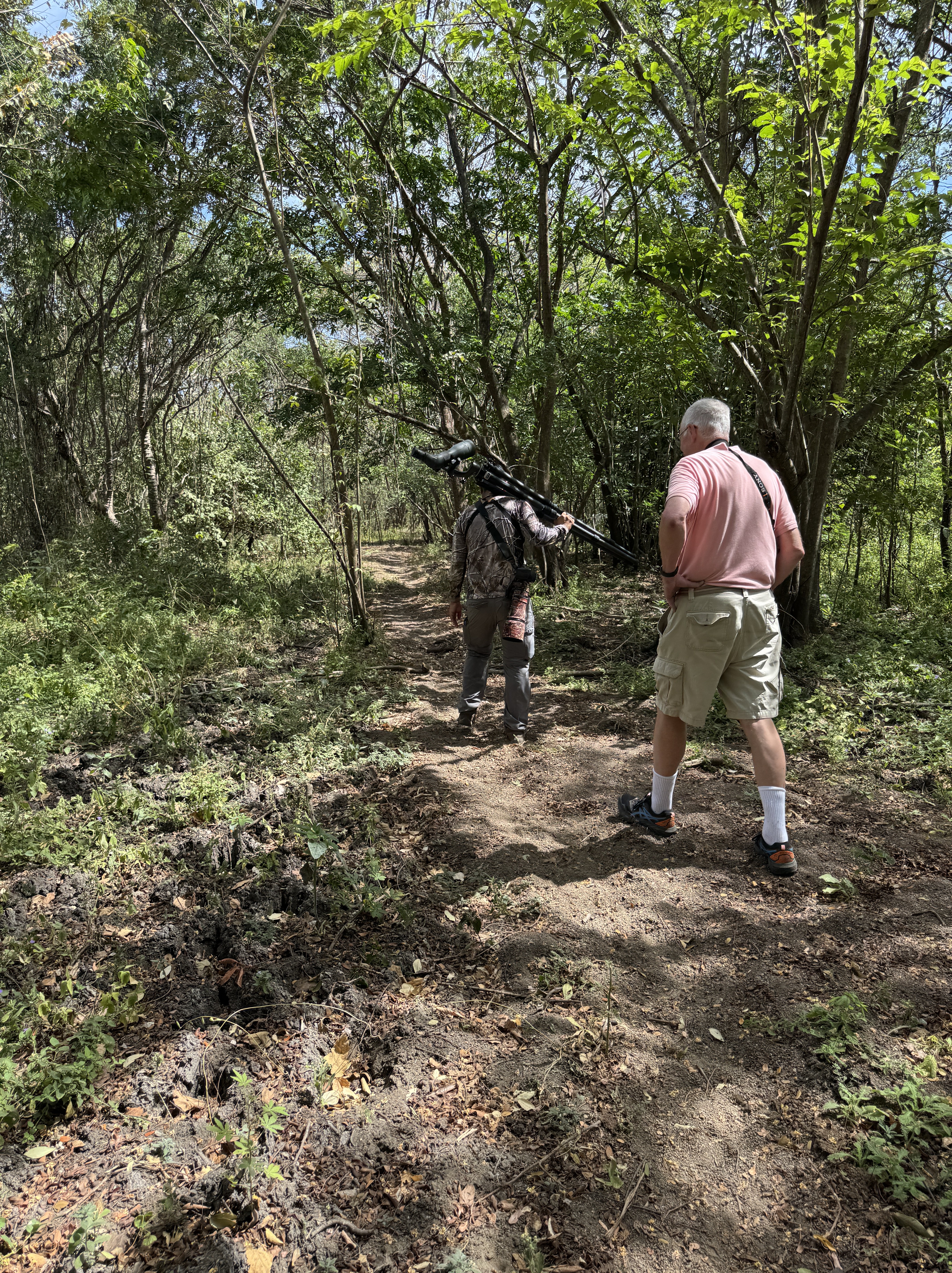
The one difference this trip is that Rich decided to hire a couple of birding guides – something he has never done in all his years of birding. At home, he knows the regional birds, how to find them, when they are active, and can identify them by their calls. He realized that he was at a distinct disadvantage down here, faced with birds he did not know but desperately wanted to see. So he researched guides, and booked two of them for different locations.
The first was in the rain forest, and Rich asked if I’d like to come along. I hemmed and hawed, weighed my options, and tried asking questions. “I don’t know what it will be like,” he said. “I have no idea how the guide will do this, I just know I have a half day with him to see birds.” I was afraid of being out of place, getting bored standing in one spot for ages, not being able to see the birds they were spotting. On the other hand, it would be something different to do, something local and unique to the area, and outdoors. I said yes.
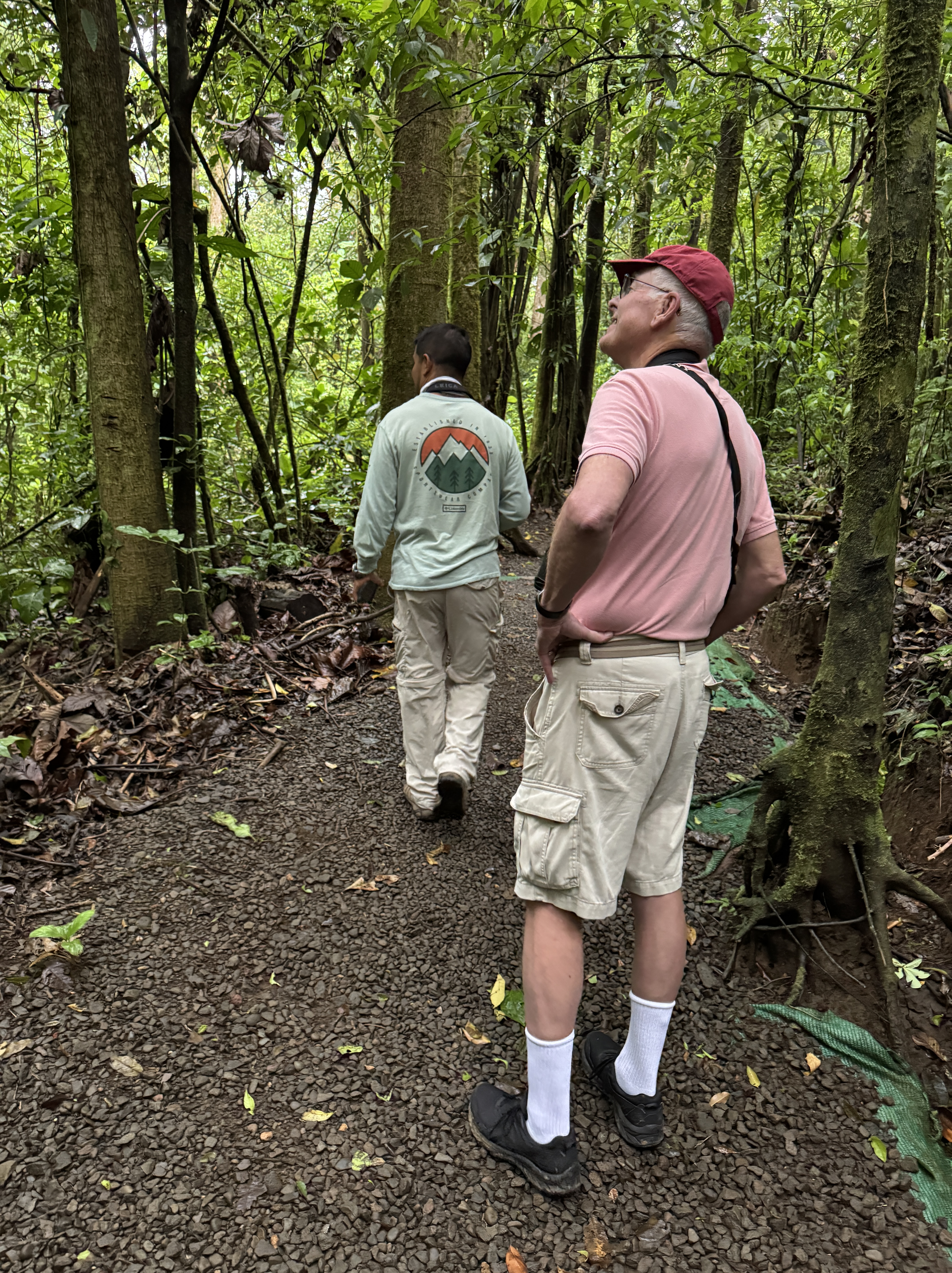
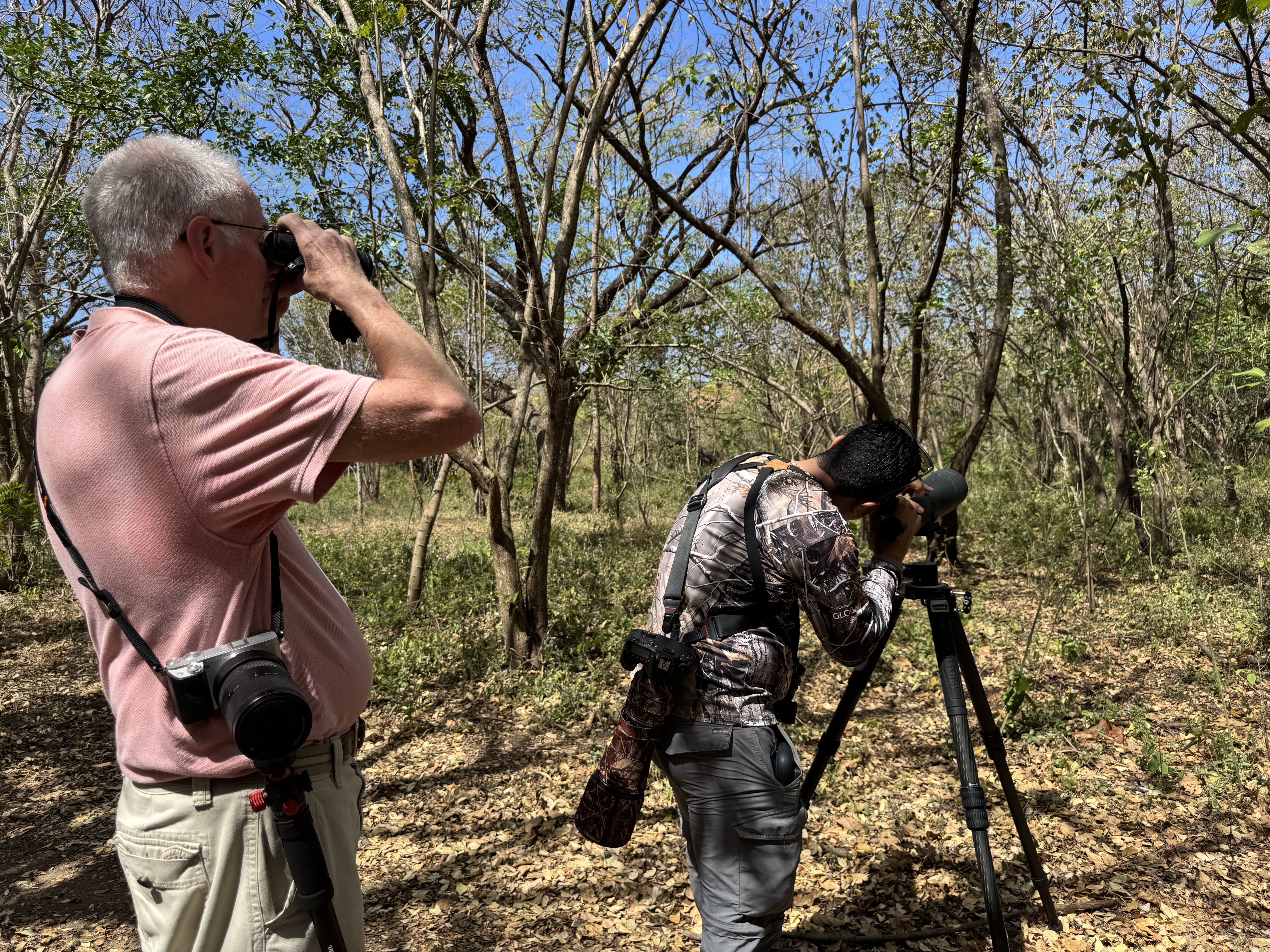
We were to meet Jesse at 6:00am at Heliconias Rainforest Lodge, which was about a half hour drive. Fortunately, sunrise in Costa Rica is 5:45am, so it was already light when we left. Jesse met us promptly and after our introductions I could tell he was already at work. We stood up high, overlooking the forest. He listened intently, constantly scanned the area, and named a number of birds right off the bat. He impressed me immediately, and more importantly Rich as well. Rich pulled up his binoculars following Jesse’s clear instructions on where to look. Better yet, Jesse had a laser pointer which he used to help us spot the birds. He never pointed it at the bird which could harm its eyes, he would aim below it and explain where the bird was in relation to that. Even I was able to follow his directions. When the bird was far away, he’d lend me his binoculars so I could see it better. We saw some larger colorful birds (don’t ask me the names) which I particularly liked. This was already turning out better than I expected.
When we seem to have exhausted that area, Jesse led us up the trail away from the lodge. I’d been there before and enjoyed hiking the trails and hanging bridges in the treetops. But this was an entirely different experience. It wasn’t about the hike, it was what we might see along the way. Jesse continued to listen, scan and identify, and we stopped frequently to look at birds. Sometimes he used a speaker to play bird calls from his phone. In addition, Jesse doled out his knowledge of the area, of the foliage, the habitats, the changes over time, and other animals that inhabit the woods. I found myself fascinated, happy to linger and take it all in. I was glad to be out moving and seeing new things.
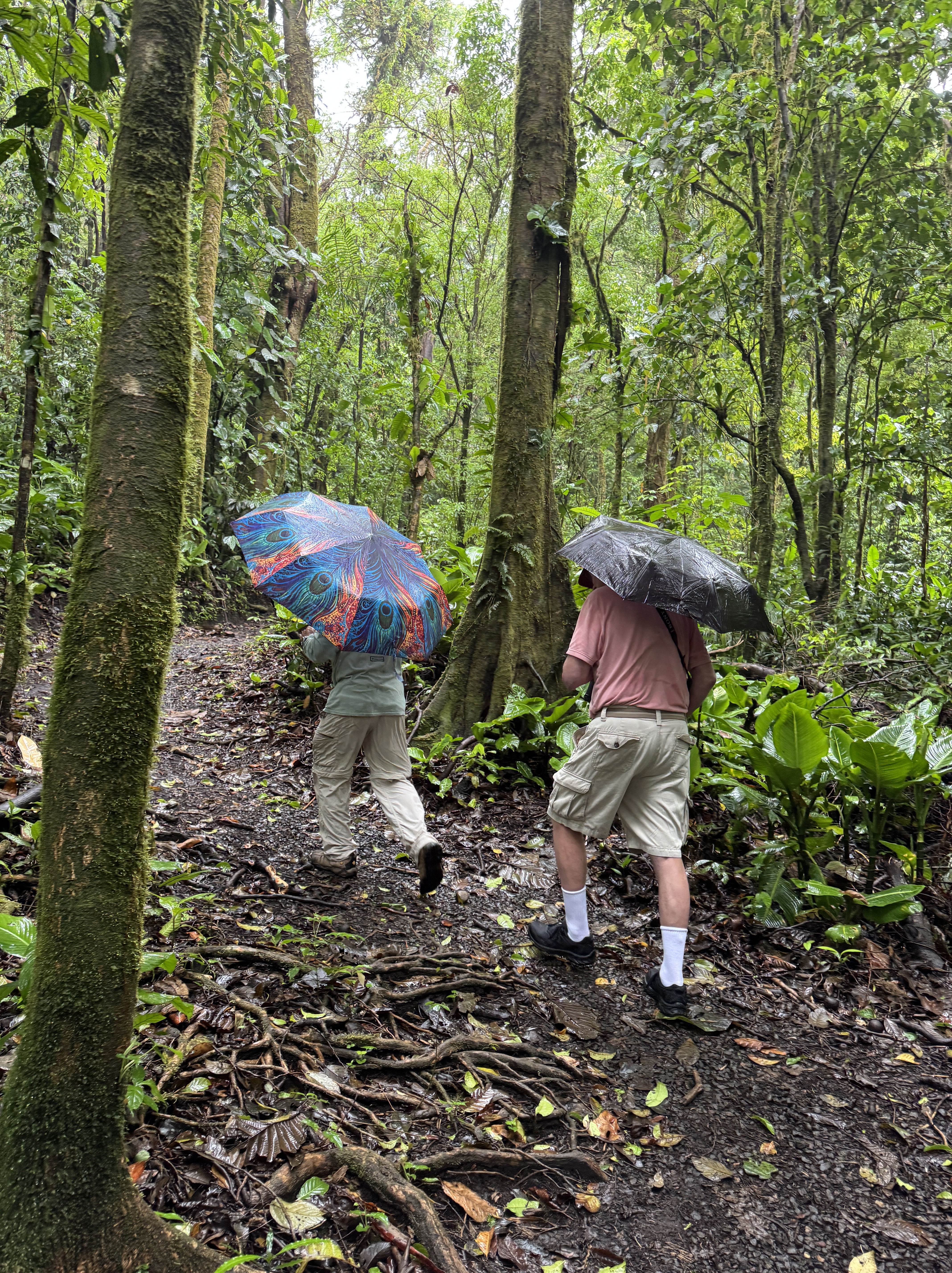
In time, it began spitting and misting. Rich and I each popped open our small umbrellas while Jesse forged on. None of us cared, we weren’t about to be deterred by getting a bit wet. It was the rain forest, after all.
As time went on, the rain got harder and the birds scarcer. We did see two large howler monkeys in the trees which I enjoyed. We crossed two of the hanging bridges, and I was sure they had gotten bouncier. When we got back to the lodge, it was raining quite hard. We went inside where you can sit and watch birds come to the feeders to eat bananas. Some birds came and went, but surely not nearly as many as on a nice day.
When we headed back out, even Jesse had an umbrella. I grabbed my rain jacket from the car and was glad to have it, even with my umbrella. Jesse took us on two more trails in the area, with decreasing returns. But we were not discouraged. We’d covered 4.6 miles and spent over 4 hours with Jesse and both agreed he was a great guide. It’s not his fault the rain washed away so many birds. Even without seeing more birds, we’d both learned a lot and had a fun morning. Rich took very few photos, but didn’t seem to care. He’d still seen the birds and loved the experience. As you can see, most of my iPhone shots were of the experience, not the birds.
We moved on from the rainforest to Las Catalinas, a beautiful beach town on the Pacific coast. Here the climate is dramatically different from the rain forest. It is very dry, with blistering sunshine all day long, nice breezes off the ocean, and easily in the mid-90s every day. Early mornings and evenings are the most comfortable, when the air feels soft on my skin. We have everything at our fingertips. An exquisitely designed pedestrian-only town with restaurants, shops and a Beach Club with multiple pools, a pristine beach, and rental equipment for outdoor sports. It is surrounded by hills, home to 40 kilometers of mountain biking trails, also great for hiking. And of course, good birding nearby.
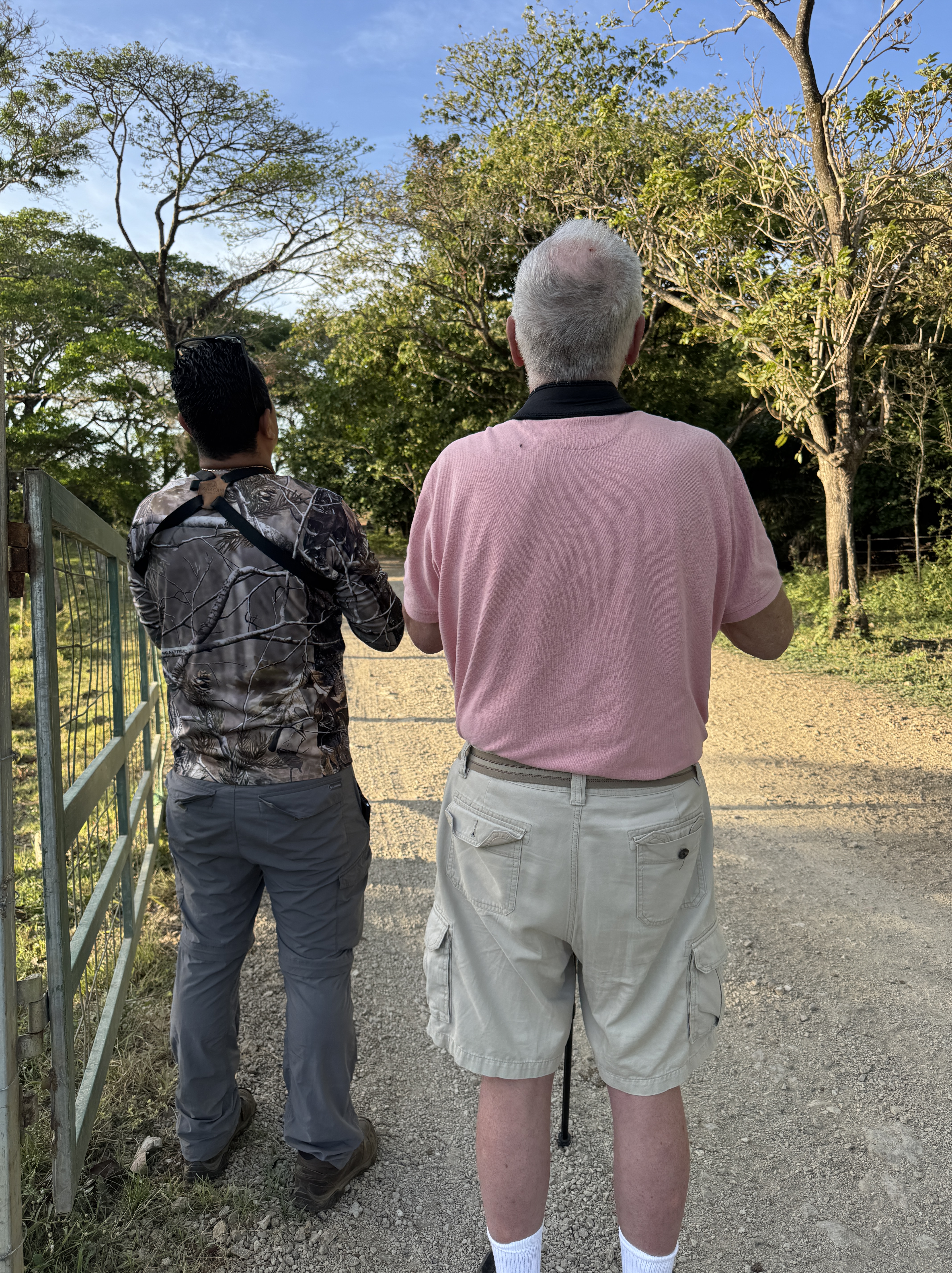
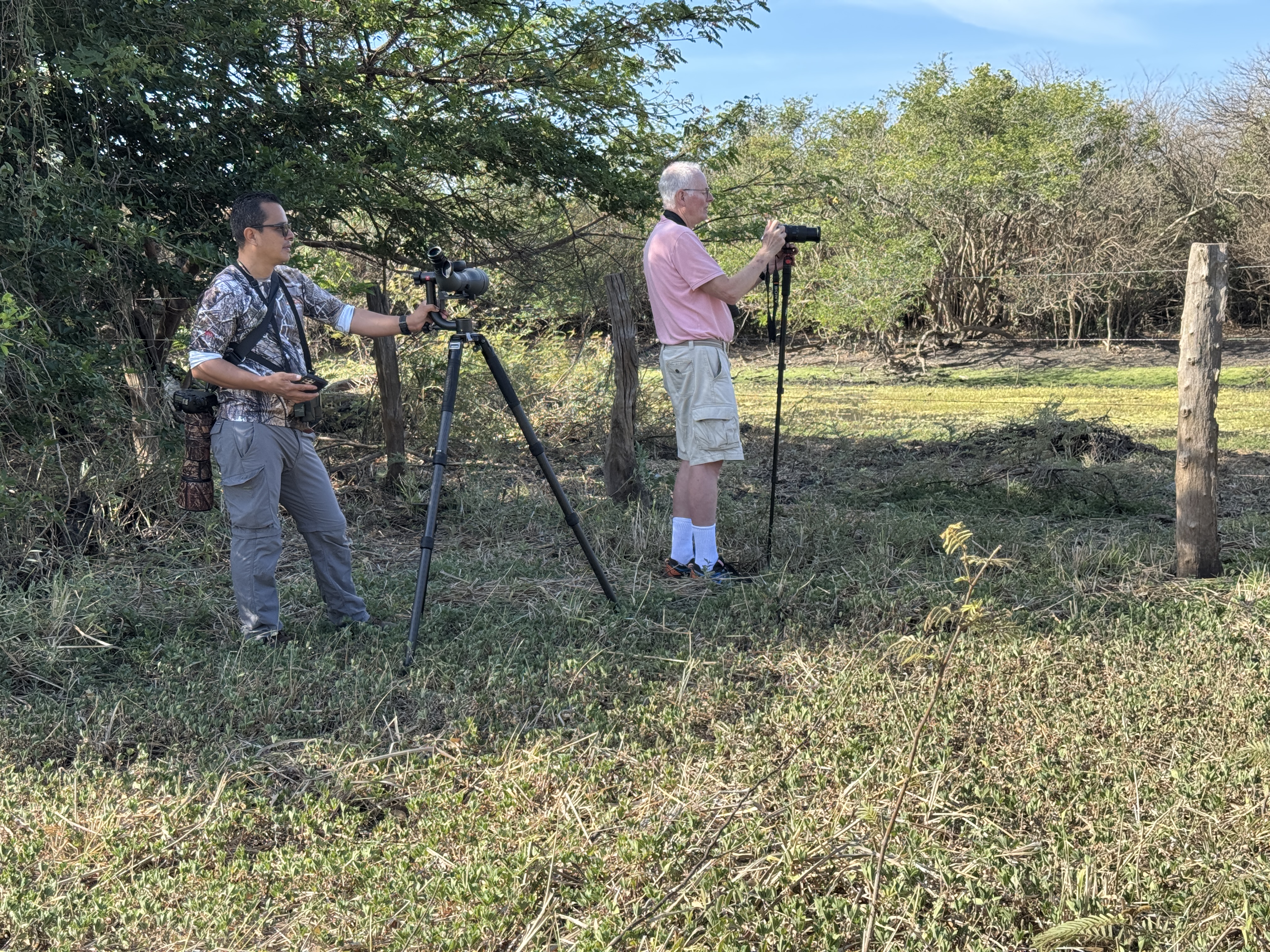
We met our second bird guide at Hacienda el Roble. It is actually an adventure center offering ziplining, ATV tours and horseback riding – the antithesis of birding. But this large tract of land has stayed in one family for generations, and they want to preserve its natural state and allow others to enjoy the birds and nature there. Hence they welcome birders early in the morning, and had recommended our guide Chris.
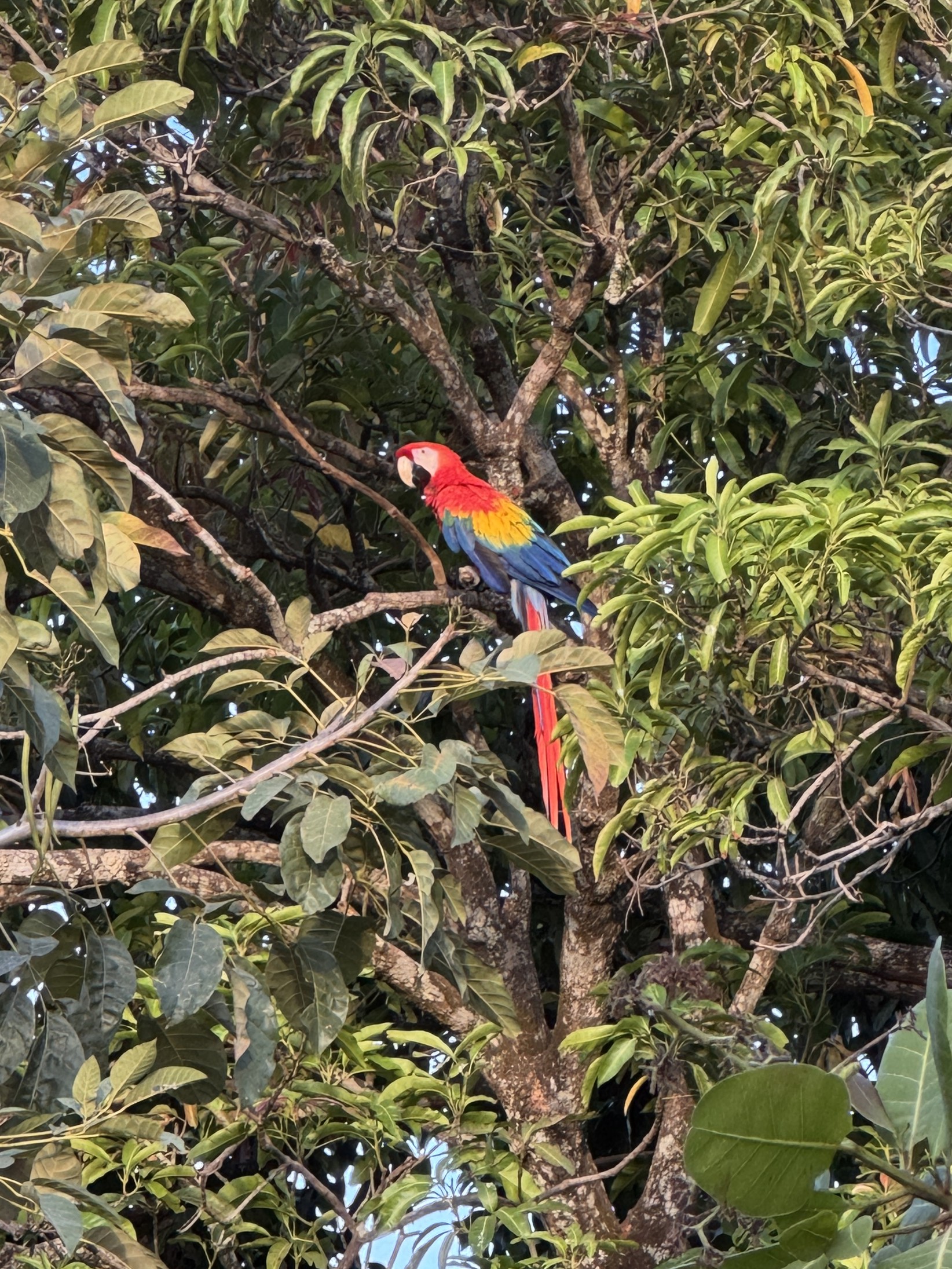
Chris came equipped with a huge tripod with a spotting scope, and the requisite camera with an enormous long lens. He introduced us to the lodge owner, a lovely, welcoming woman. As we were about to get in our car to begin, Rich mentioned that he’d seen that a Scarlet Macaw had been sighted in the area. Jumping back out of the car, Chris beckoned us to follow. Pointing up into a tree by the lodge with an expansive thick green canopy, there in perfect view was just that bird! He was huge, and so colorful – now there was a bird I could revel over! We were lucky that he’d chosen a perch so easily seen, and the golden morning light made his colors even more brilliant. What a start to the day!
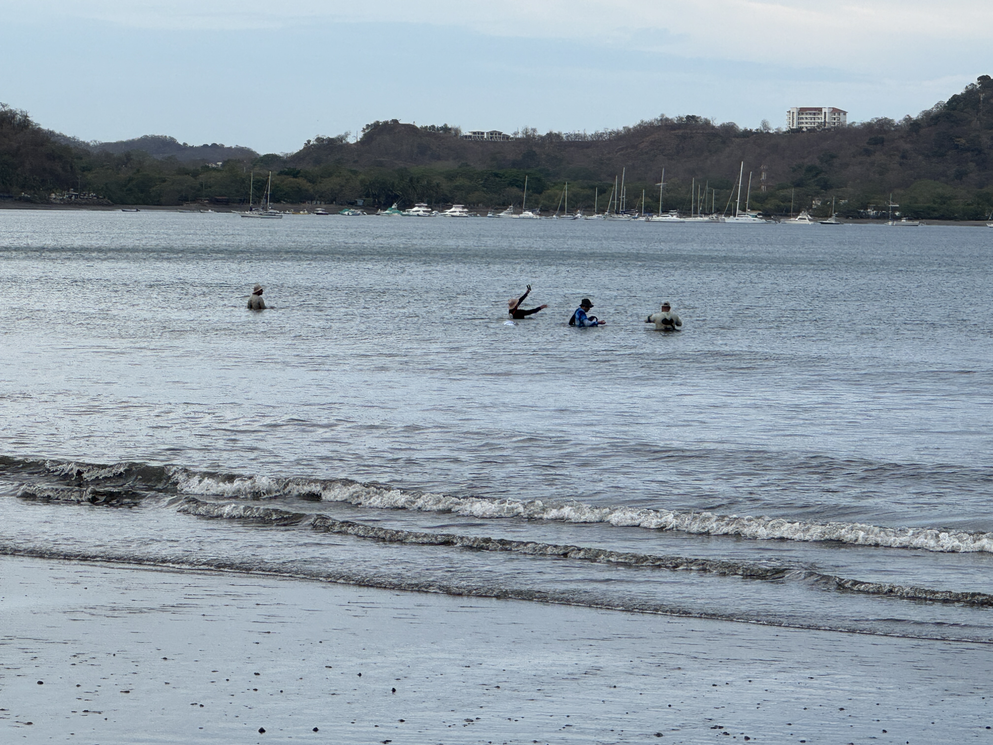
Returning to the car, Chris directed Rich down a bumpy dirt road. We didn’t get very far before Chris began rattling off birds, and we jumped out of the car for him to locate them for us. After several stops, we came to a small creek surrounded by trees and spent quite a bit of time there. It was a natural draw for birds, and like Jesse, Chris could find them by sight or sound. I could see many of the birds he pointed out, and if they were too far away he let me look through his scope. Suddenly they were right up close in brilliant detail! I could see colors that were impossible with my eyes, as well as watch the bird move.
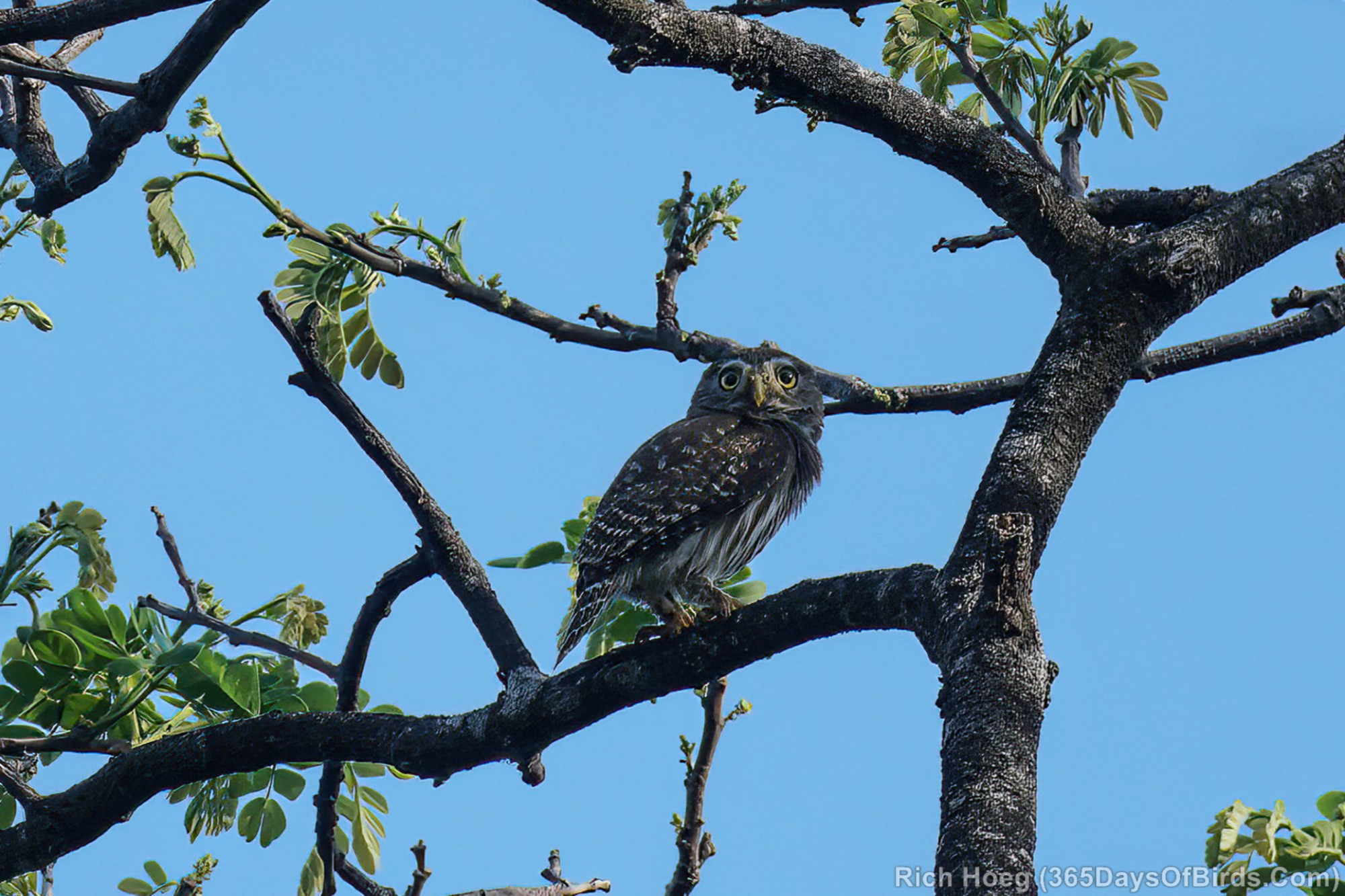
Chris also had a remote speaker that could play bird calls. He knew that a Ferruginous Pygmy Owl was in the area and used his speaker to draw it in. As all the other birds knew of the owl, they suddenly became active as soon as they heard the fake call. Sure enough, the owl arrived and perched in a tree. He was brown and small, nestled in the crook of a large branch. I couldn’t see him at all, but in Chris’ scope he was easily within view. We got lucky, and the owl flew to a branch and perched right out in the open. Even I could see it, and I was fascinated by how his whole body vibrated when he made his tittering call. I didn’t try to get a picture with my iPhone, but Rich got this great shot.
The conditions were far more favorable for photography this time with the sunlight and some cooperative birds. But even so, I think Rich did as much looking through his binoculars and learning.
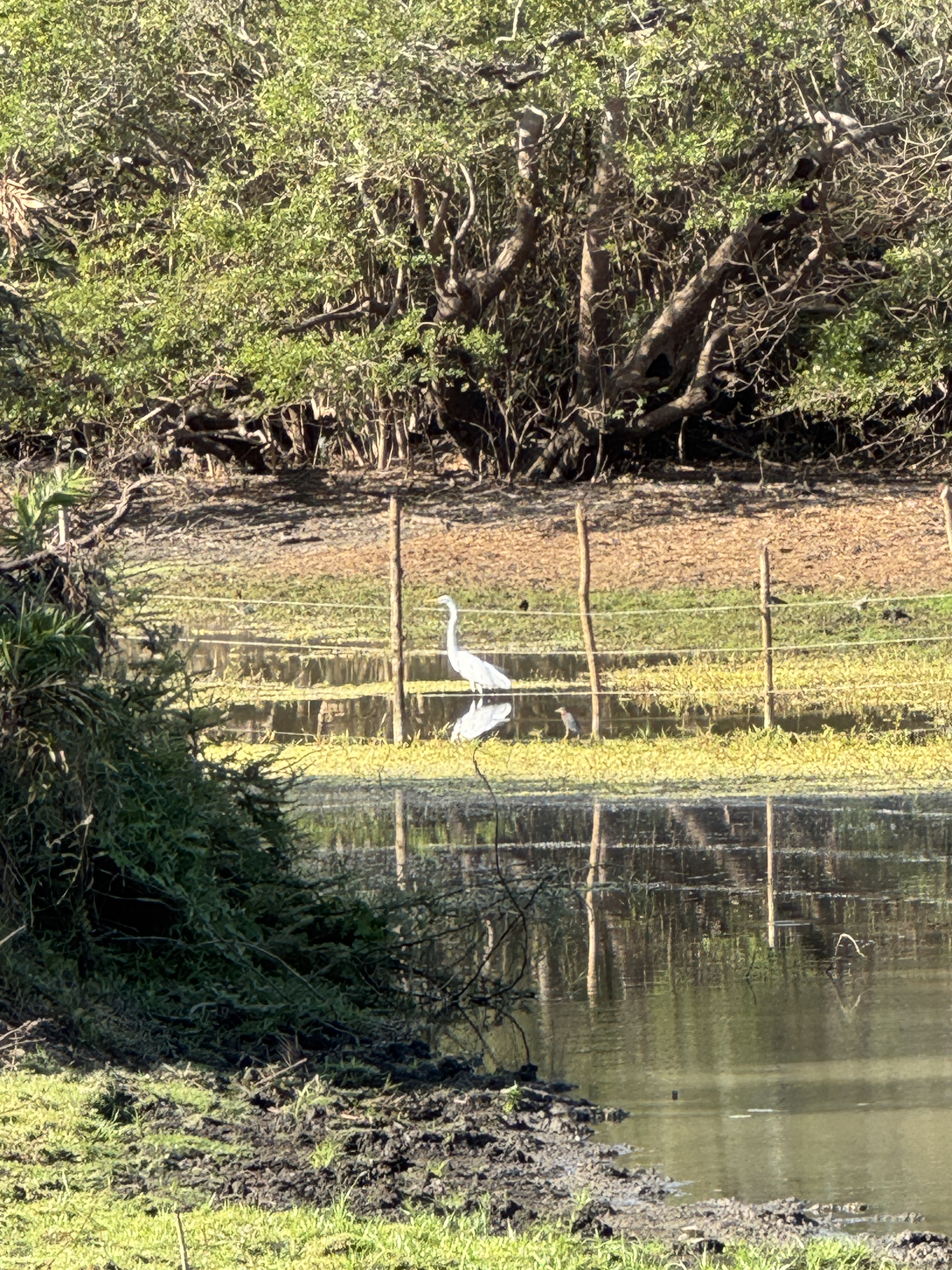
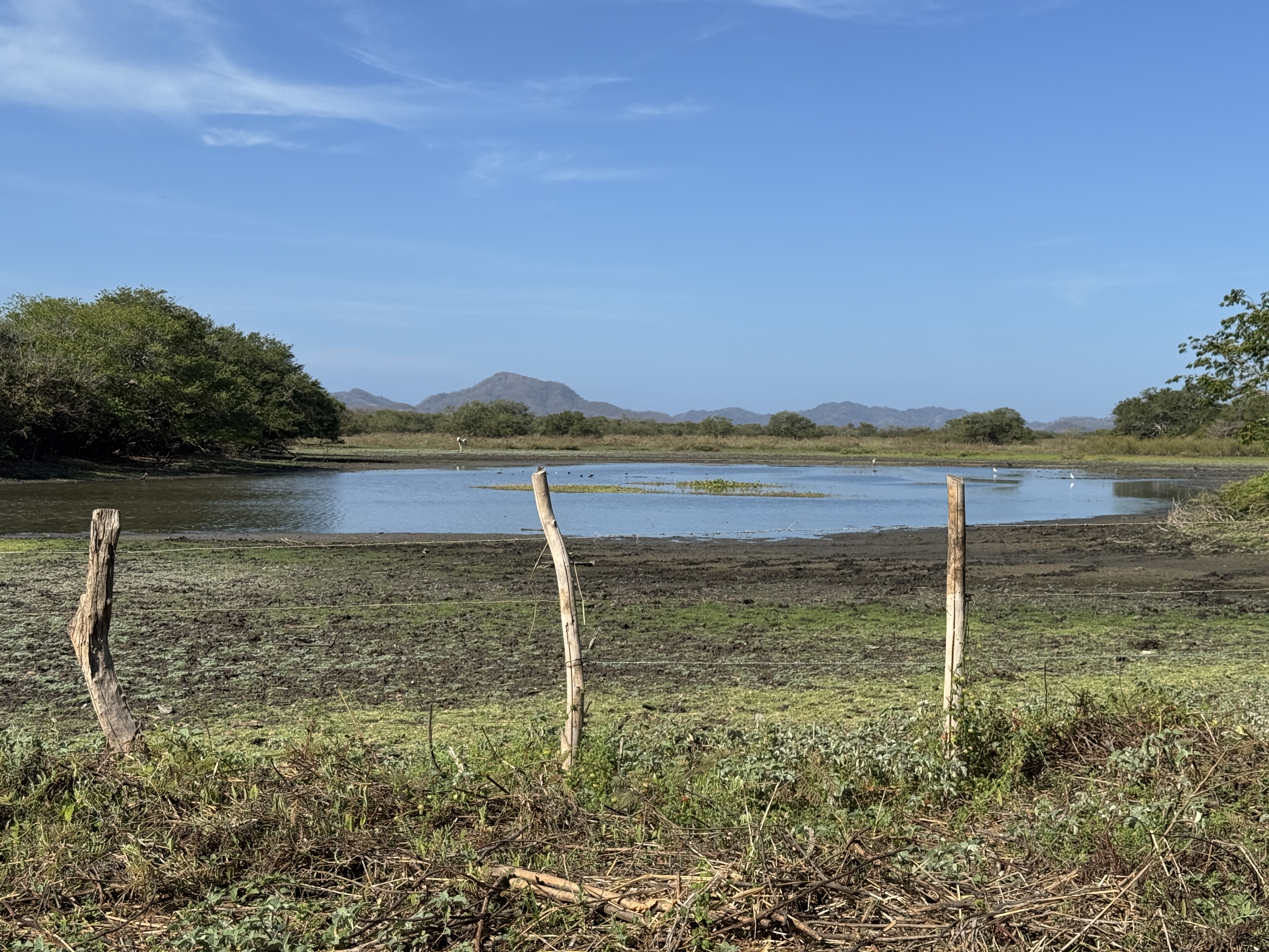
From that spot, a pickup truck took us to more areas of the property. Chris and Rich perched on benches in the bed of the truck, while I was told “ladies ride up front!” This time we headed to wetlands, repeating the same stop and look routine, then walked the farm trails to additional spots to find different birds. I recognized some of the birds like herons and egrets, and continued to be amazed at others through Chris’ scope.
The truck met us again and took us to the dry forest area. It was amazing the variety of habitats on this tract of land. There we walked on rough paths through the trees and brush, pocked by cow hooves from the nearby farm herds, stopping frequently to identify, view and photograph birds. We were glad for the limited shade, as the day had heated up quickly.
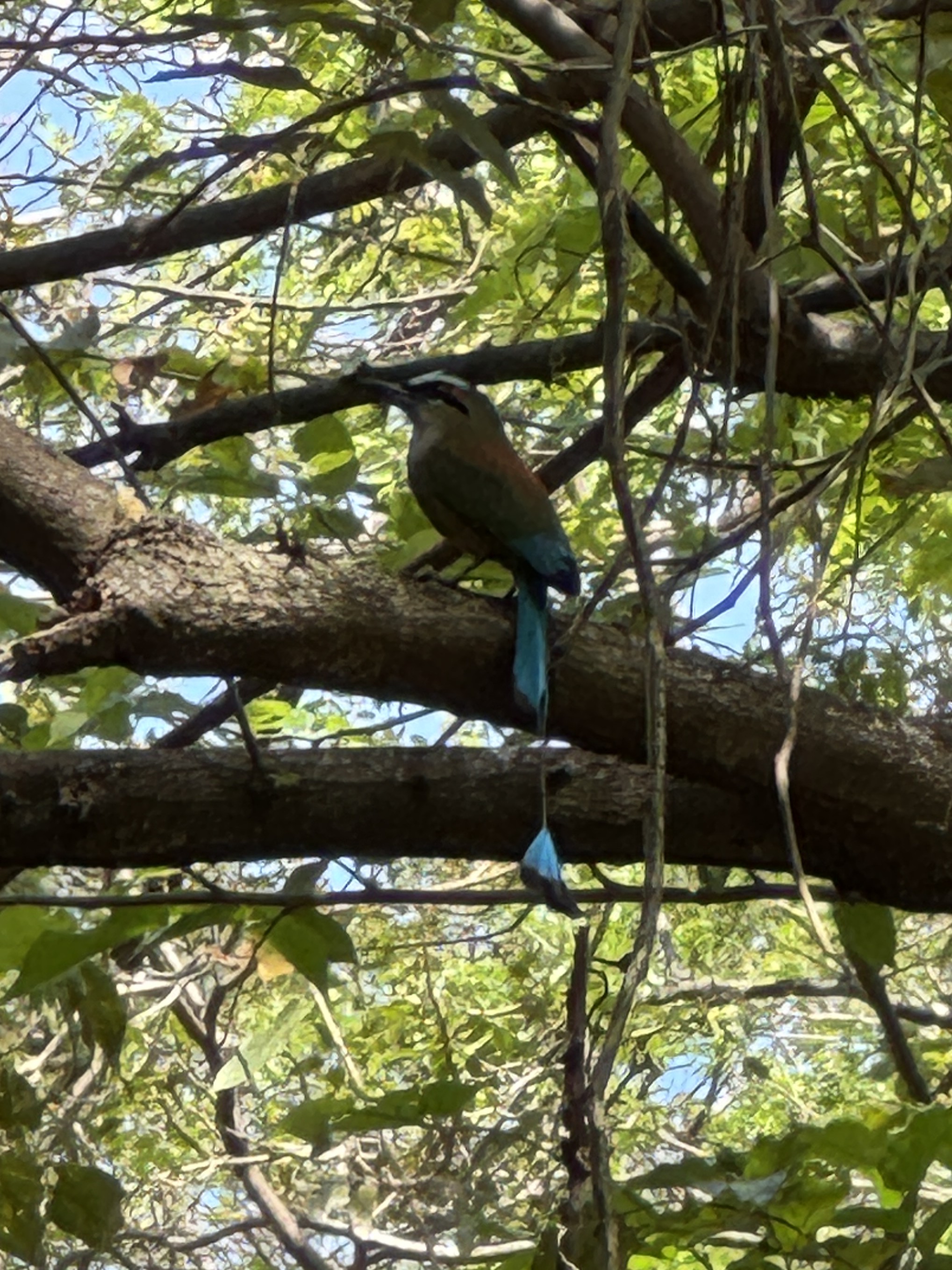
I particularly liked this brilliant Browed MoMo, with its beautiful turquoise color and the fun tail with a puff ball at the end. I’m sure birders would have a much more technical description!
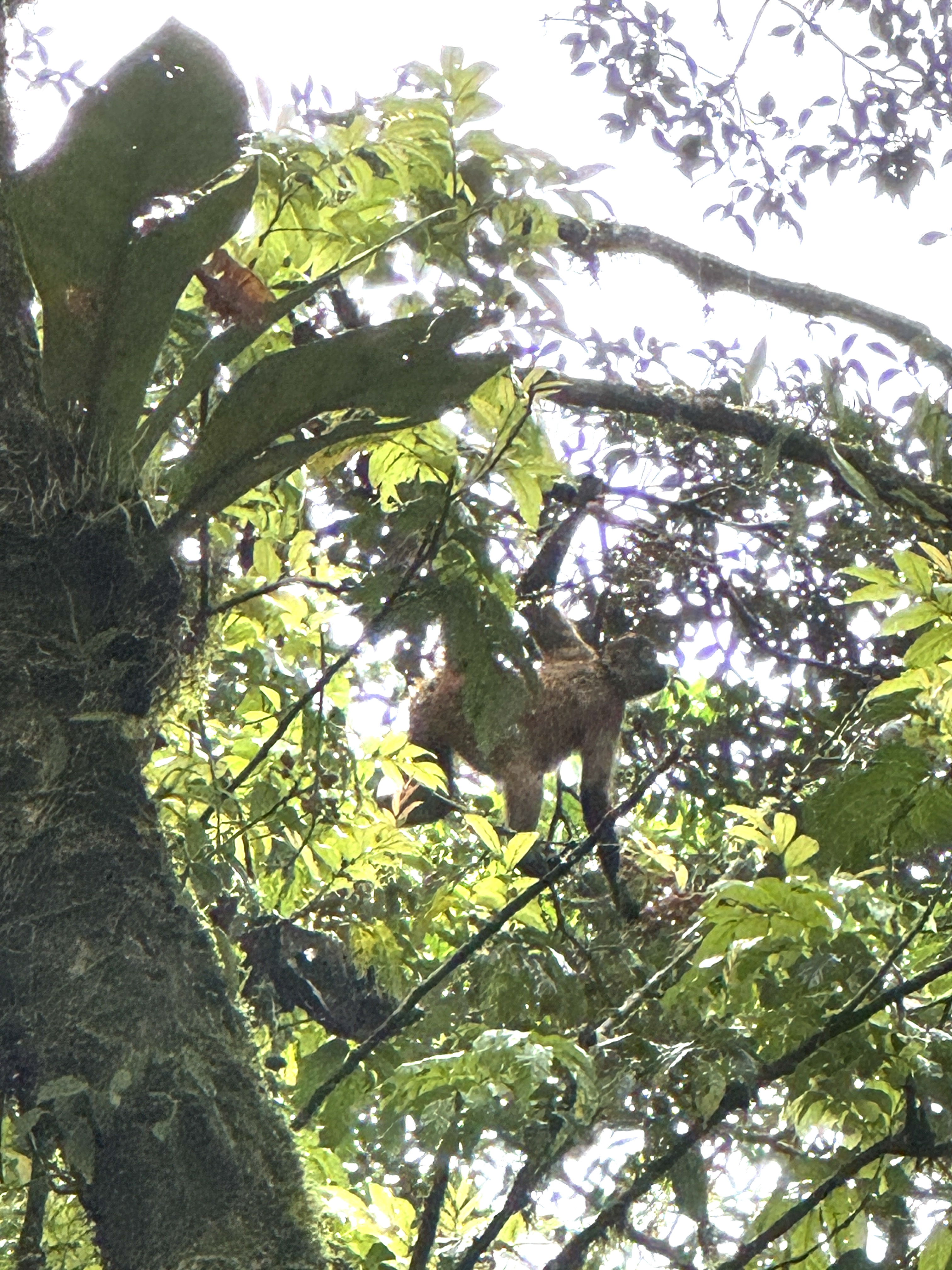
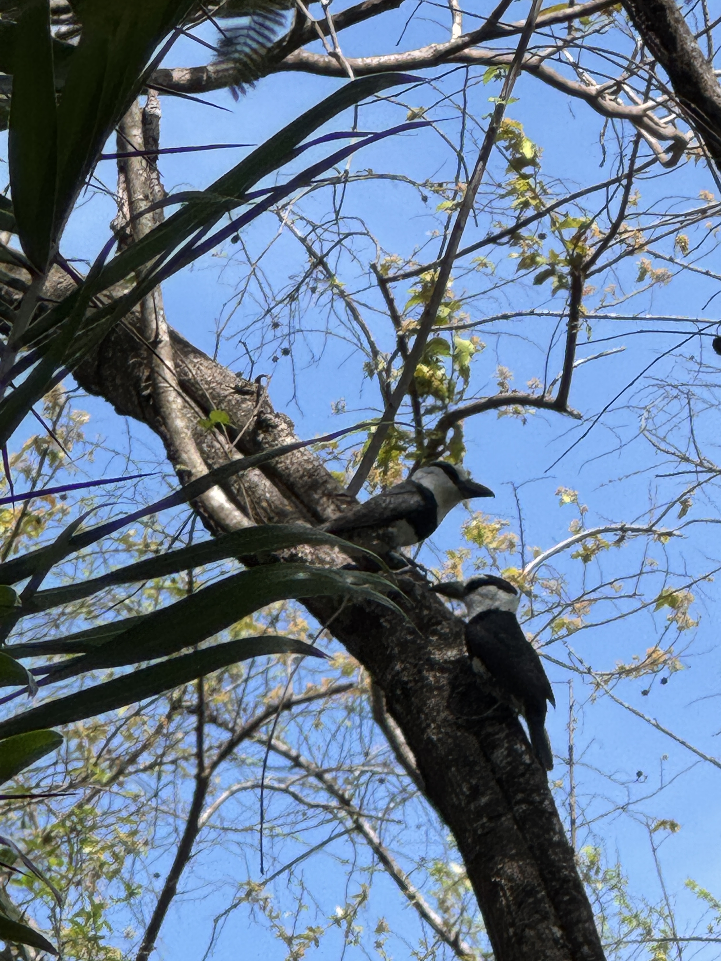
Suddenly Chris stopped and said, “That is a million dollar bird.” He explained that many people will pay big bucks for a guide to find that bird for them, and here we had stumbled upon not one but a pair! It’s called a White-Necked Puff Bird. The pair moved to a branch adjacent to a large termite nest (which looks like a big brown hairy ball up in a tree) and repeatedly flew to the nest to punch it with their beaks and return. It was clear they were going nowhere, available to us to view and photograph for the duration. Even Chris got out his camera to capture this rare bird. While I am typically less interested in the little birds, I could appreciate the special nature of this moment. It was definitely a high note for our tour.
I was surprised that a short walk from there took us back to our car, and we returned to the lodge where a Costa Rican breakfast awaited us out on the veranda. It was fun to talk to Chris on a more personal level and learn more about how he got into birding and guiding. And once again we felt that the experience was entirely worth it.
I may not know any more about birds than I did before these tours, but I would have to admit that going out with a bird guide can be fun even for a non-birder!
Note: If you would like a more detailed birder’s perspective of one of these guide experiences complete with photographs, check out Rich’s blog post Hacienda el Roble Birding.
Last year winter was a no-show. As it turns out, that was a moot point for me as I was in no shape to take advantage of its usual offerings. In fact, the lack of snow and cold was to my benefit as I walked my way back to health following surgery and throughout chemotherapy. I relished the clear sidewalks and mild weather as the length of my walks grew all winter long.
This year I admit to viewing snow and cold with some trepidation. My body is not what it once was and each foray back into the sports I love has been fraught with uncertainty and apprehension. Will I be strong enough? Is my balance good enough? Will I be warm enough in the cold? So I viewed winter’s delay this year a reprieve from testing myself. Almost a relief.
And then it snowed. A true significant snowfall. And it became clear what I wanted to do.
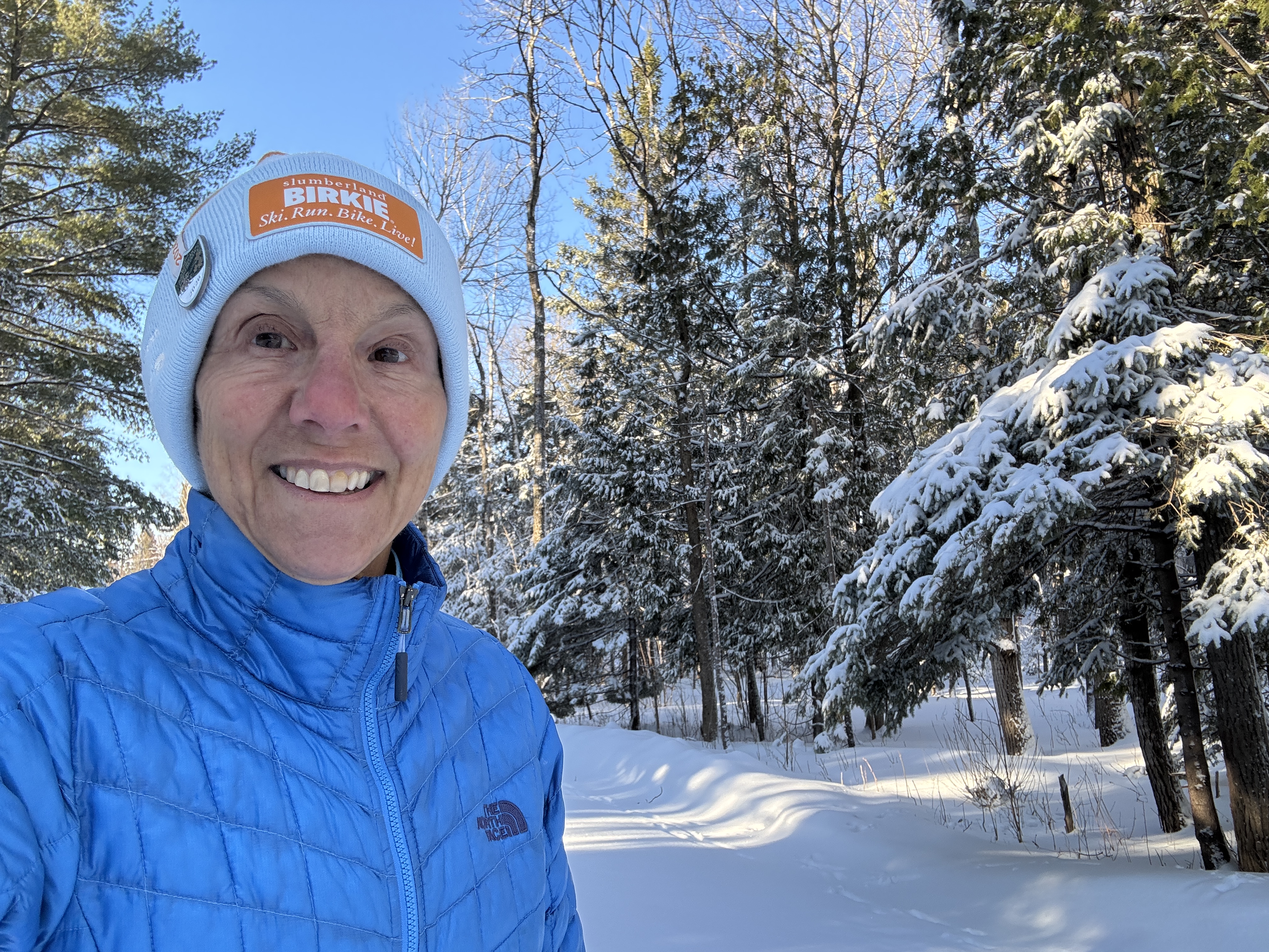
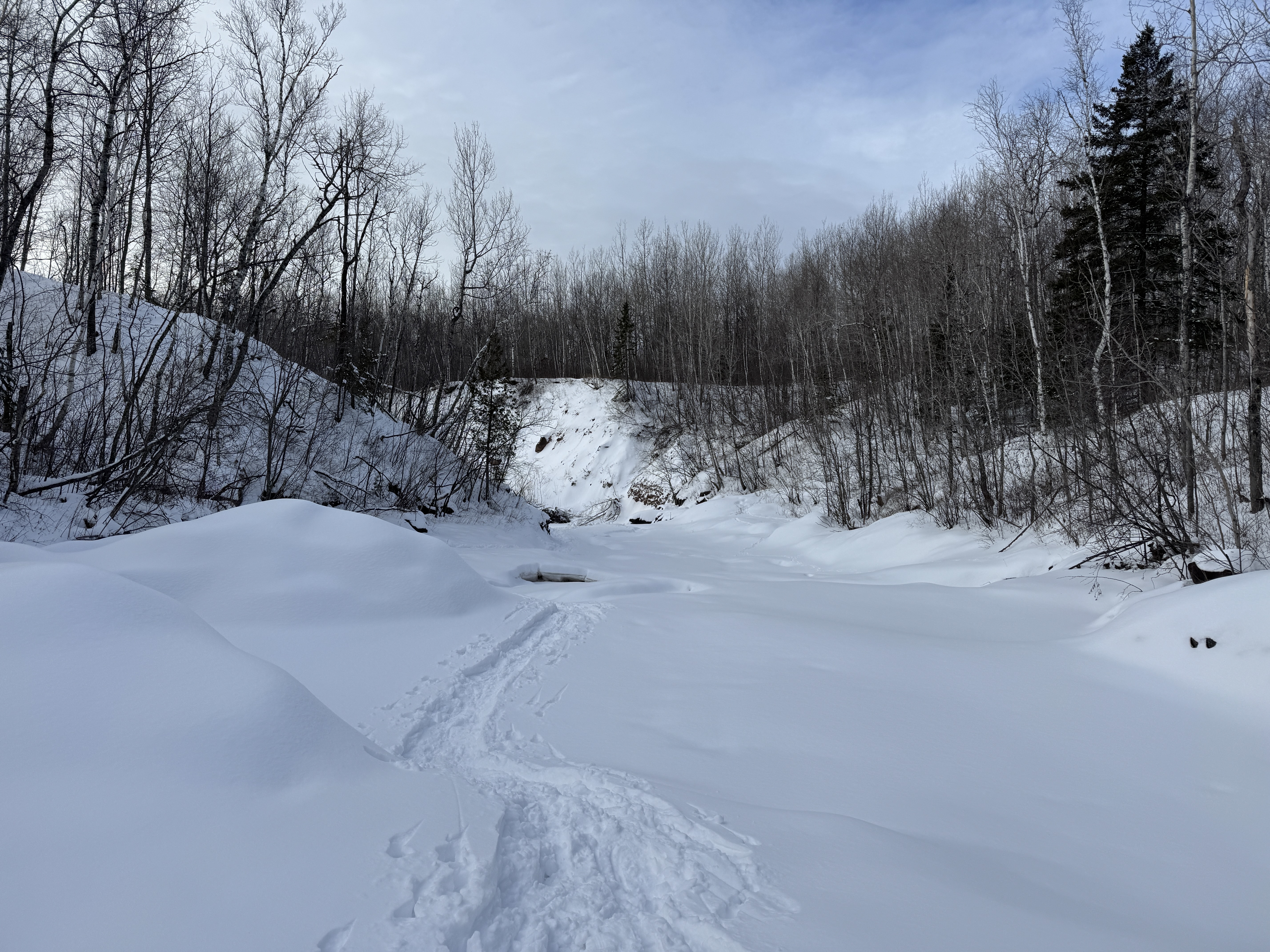
I was up early the next morning. I knew my window of opportunity was narrow, and I was out the door putting on my snowshoes before sunrise. My goal was to be on the Lester COGGS trails just across the street while they were still pristine, covered in snow, devoid of footprints and especially before the groomer arrived.
Snowshoeing felt safe. It’s an easy activity, does not require speed nor agility. I could plod at my own pace with nary a concern. Suddenly I couldn’t wait to be out there.
Jackpot! In the quiet of the early morning I had the trail to myself. Snow clung to the trees and muffled all the sounds. Only animal tracks marred the fresh blanket of snow. I stayed toasty warm with the effort of trudging through the fresh powder. This was what I loved about winter! It was all coming back to me now.
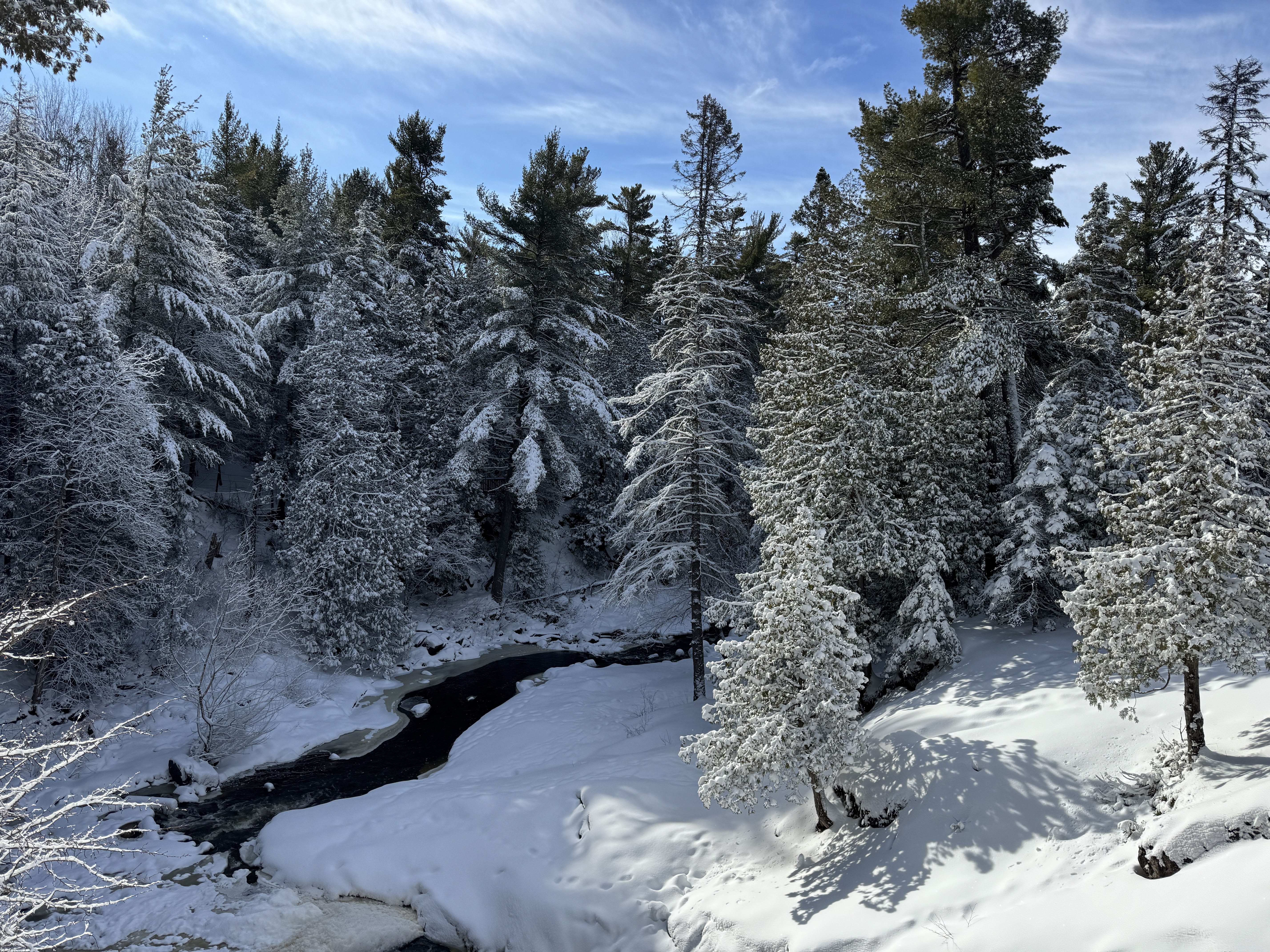
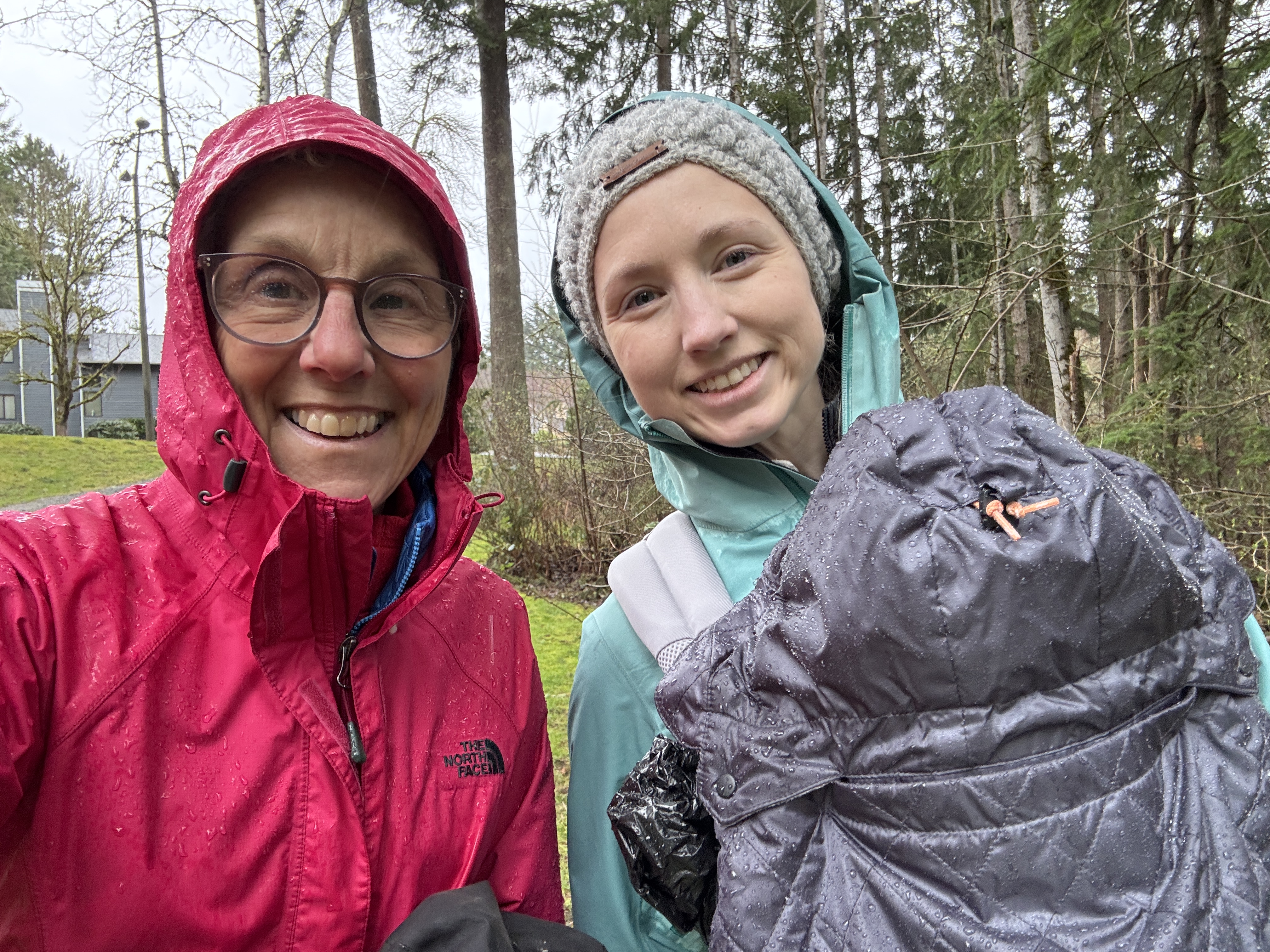
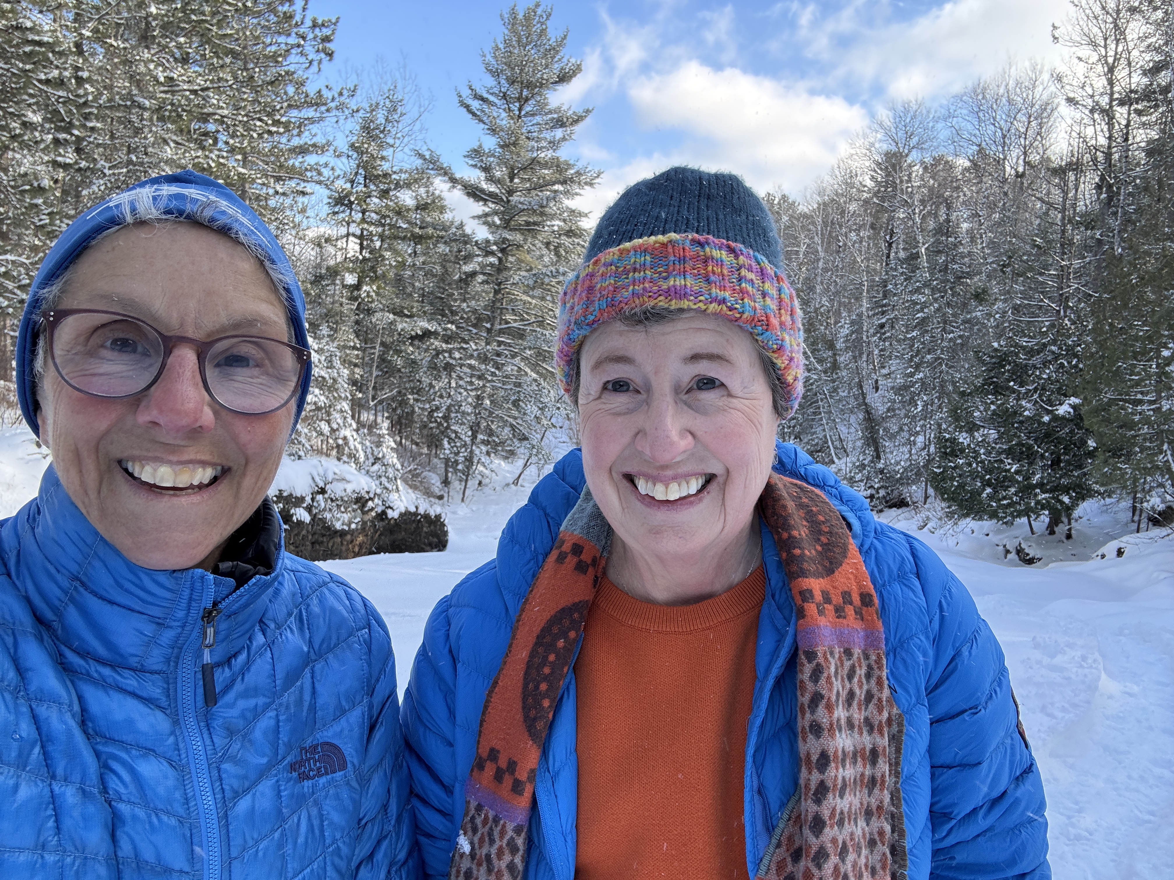
I went out two more times that day and the next. I love snowshoeing up the local rivers, and recruited friends to accompany me up the Sucker River and Lester River. Memories of past excursions came flooding back, and these adventures rivaled those experiences. We managed to scramble up and back down waterfalls, avoid the fast running open water exposed by holes in the ice, and stay upright. We marveled at the gurgling water under the ice and the beauty of our surroundings. Sharing it with friends who relish this kind of thing made it all the better. Yes, I do love winter!
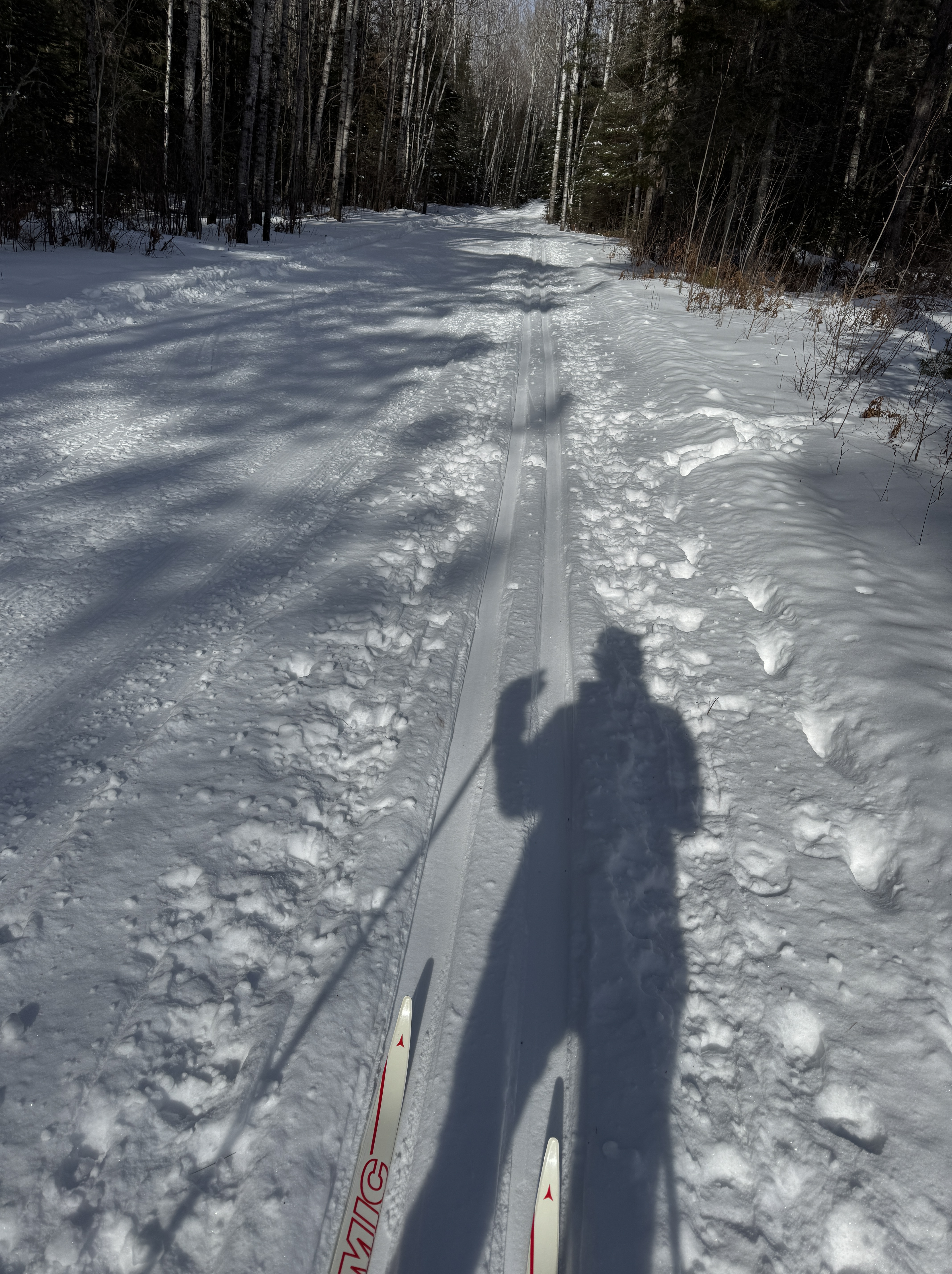
Two days later I was ready for the next challenge. I viewed cross-country skiing as crossing a higher threshold. It requires balance, coordination, technique and skill. I decided the best approach was to ease myself back into it. Although skate skiing is my preferred method, I chose classic as I could do it at a slower and more controlled pace. And I planned to ski at Boulder Lake where the terrain is very mild. I wanted to set myself up for success!
Donning far more warm clothes than I normally do, I nervously carried my skis from the parking lot to the trail. Stepping into my bindings and securing the straps of my poles around my wrist, I maneuvered myself into the tracks. This was it. I had to move forward. I double-poled once. Twice. Three times. I gingerly began striding. And I felt it – I knew just what to do! Despite the introductory wobbles, I was off and skiing!
It certainly helped that conditions were absolutely perfect. The trails were freshly groomed, and had hardly been skied. Except for the few folks who started around the same time and flew off into the distance, I had the trail system to myself. The sun came out, the sky turned that brilliant blue, and the trails were as mild as I remembered. When I came to the intersection at the far end of the first loop, I eagerly continued on to the next. And then the next after that. It felt so good I didn’t want to stop. I admit to more butterflies on the first downhill, and lost my technique trying to ski up the inclines, but that paled in comparison to the joy of being out in the snowy wilderness. Taking in the glories of winter.
Snow makes all the difference. Without it, winter is drab and long. With snow on the ground, there are so many ways to enjoy the outdoors. It reminds me that this is what I love about winter. I am so grateful that my body is once again up to it, giving me back the activities I enjoy. Allowing me to reclaim winter.