Following the Clark Fork River

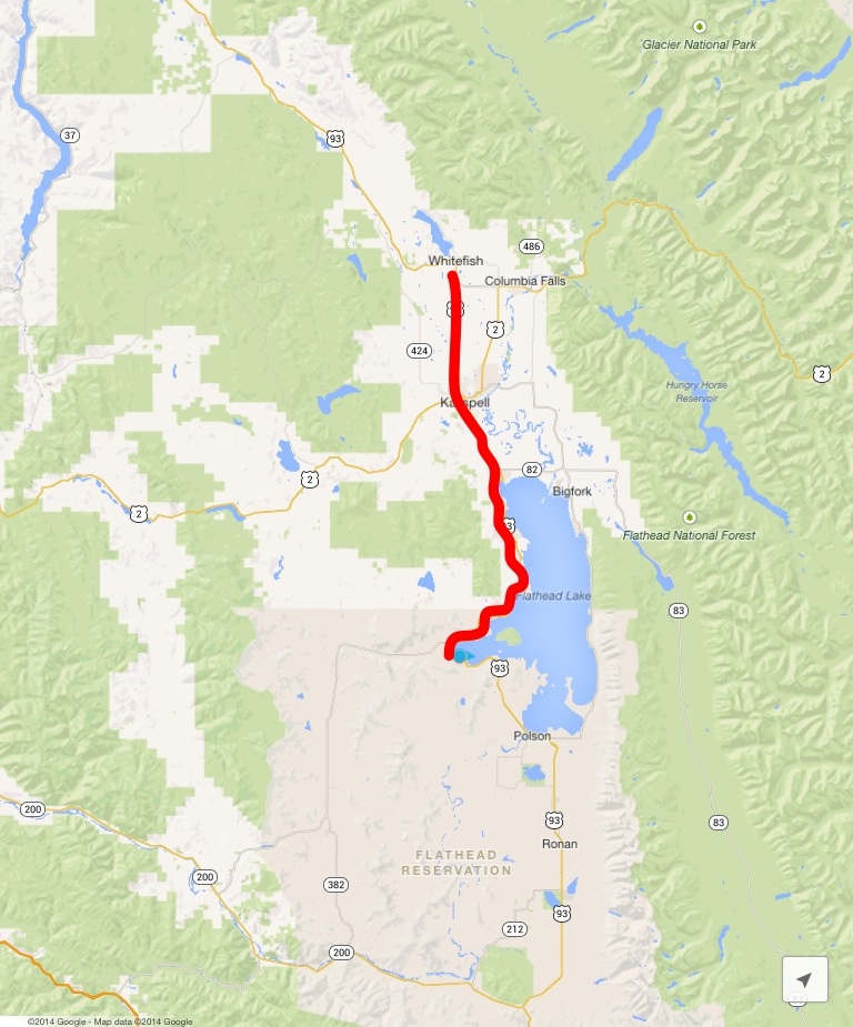
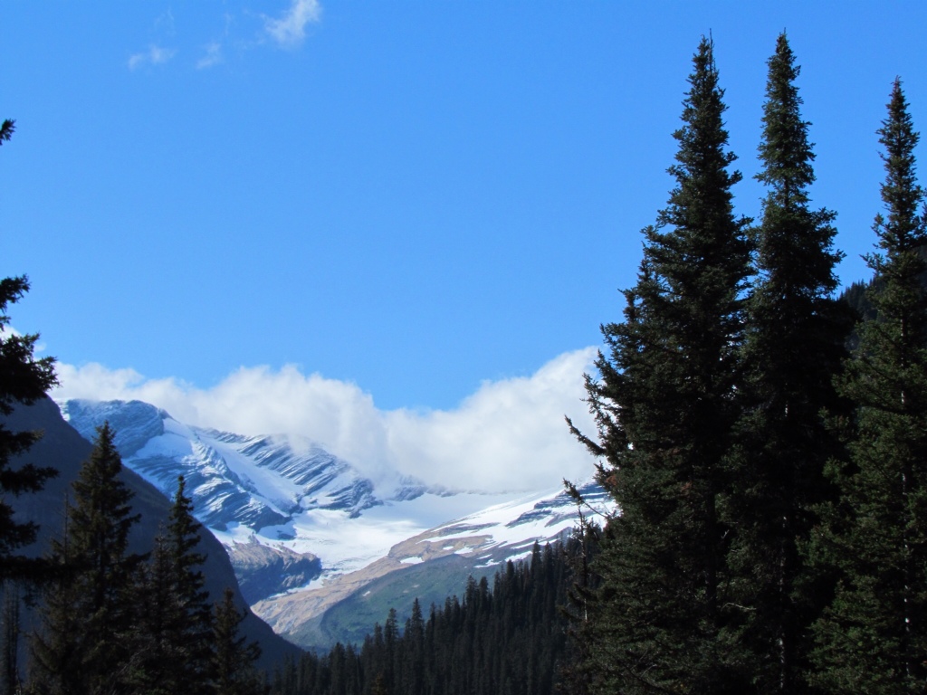
It was a day of contrasts, but the one constant was the Clark Fork River. We cycled along its east bank for the entire day. That kept us nestled between the Cabinet and Coeur d'Alene mountains, surrounded by tall pines and and frequently within sight of the ever changing river.

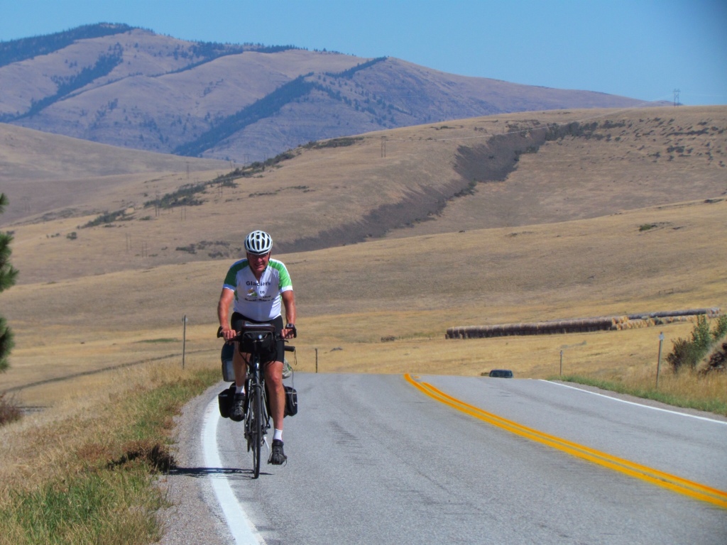
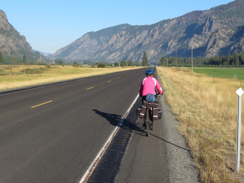
Returning to our preferred routine we were off early, shortly after sunrise. We love the early morning hours, when the sun casts a golden glow and the rest of the world has yet to surface. The road was blessedly deserted despite being a state highway, and it was flat easy traveling. Even the river was quiet, reflecting the mountain scenery.

There was a downside, though. With the sun so low, it was a chilly 42 degrees and I'd underestimated the amount of warm clothes I needed. I kept adding layers as we went along, but could hardly wait to reach our breakfast stop to hug a hot mug of coffee.

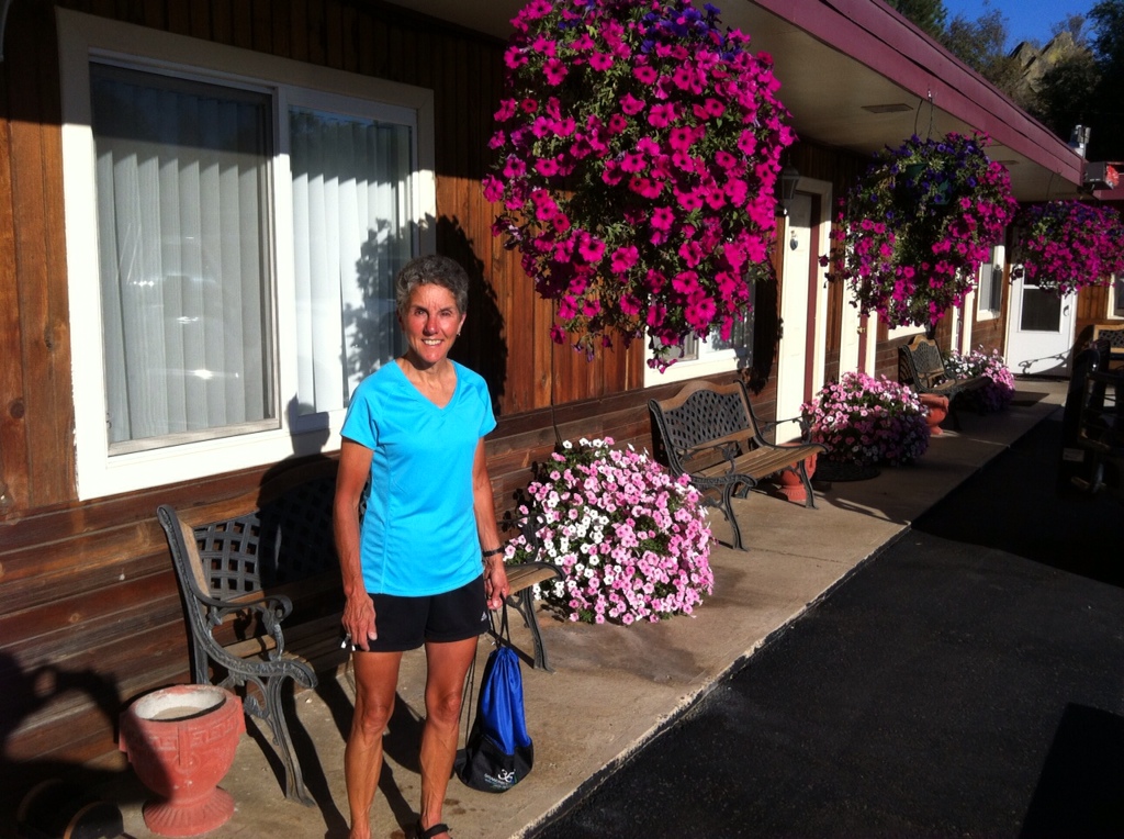
By the time we emerged from the breakfast cafe, it was warming quickly. Once again the day was transforming from cold to hot. There seems to be no in between. With half our mileage already completed and plenty of day left, we took a leisurely ride through the park in Thompson Falls to see the dams and waterfalls.

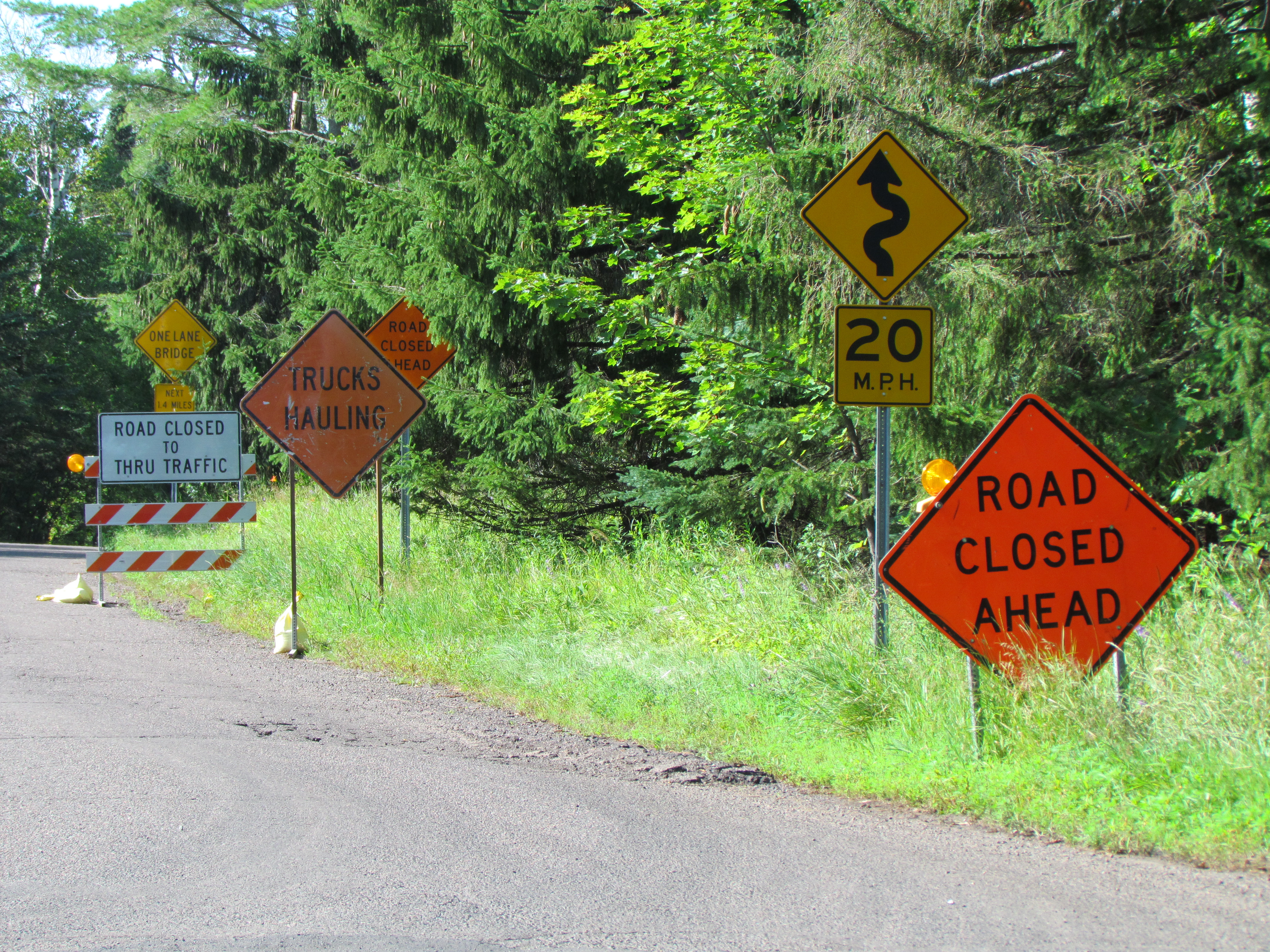
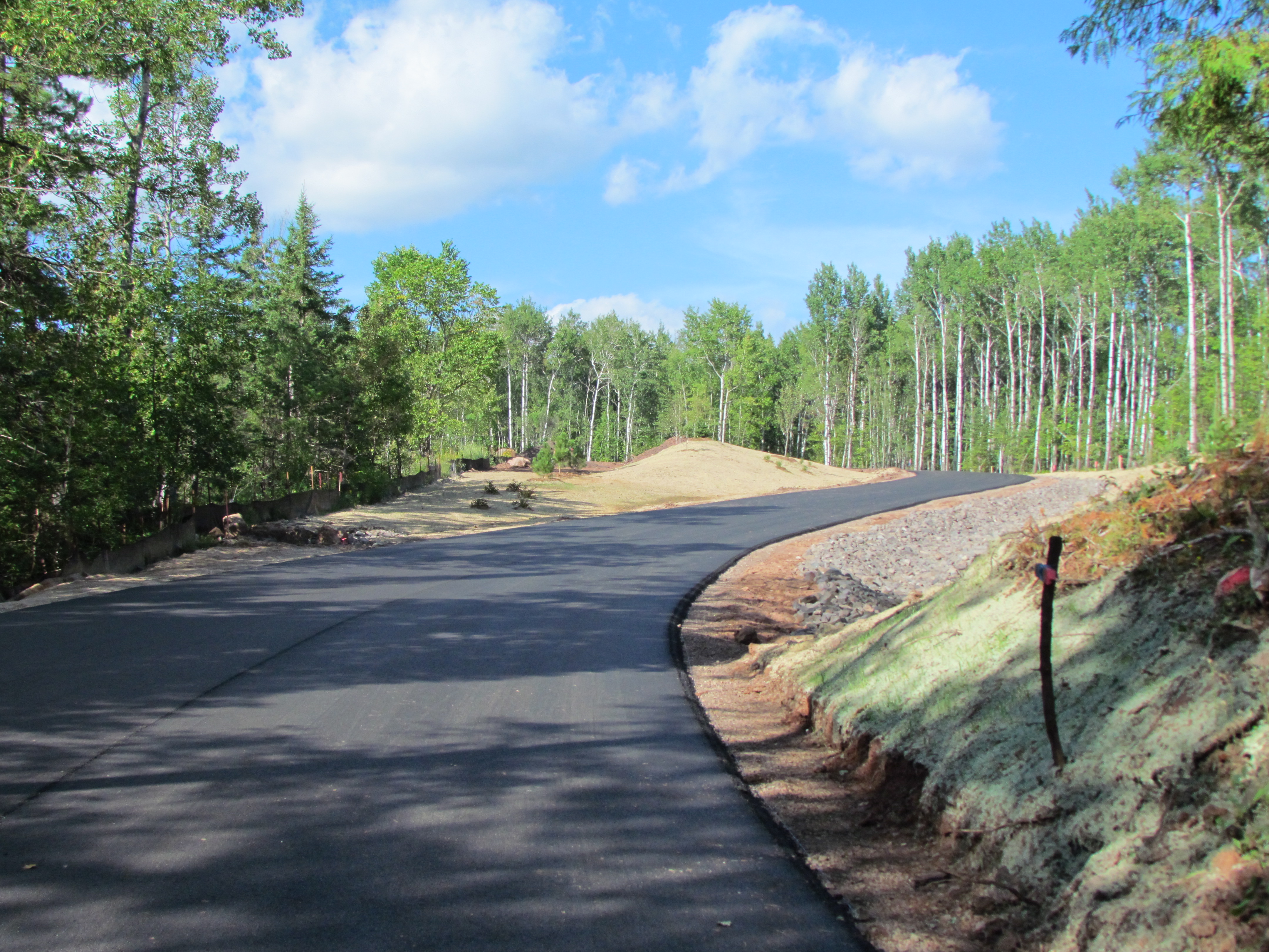
For the remainder of the route, we followed the advice of last night's motel owner. We would never have found Blue Slide Road without his directions, and it took us off the highway on a beautiful country road all the way to our destination. We saw nary a car along the way, and reveled in the peaceful and beautiful mountainside scenery.

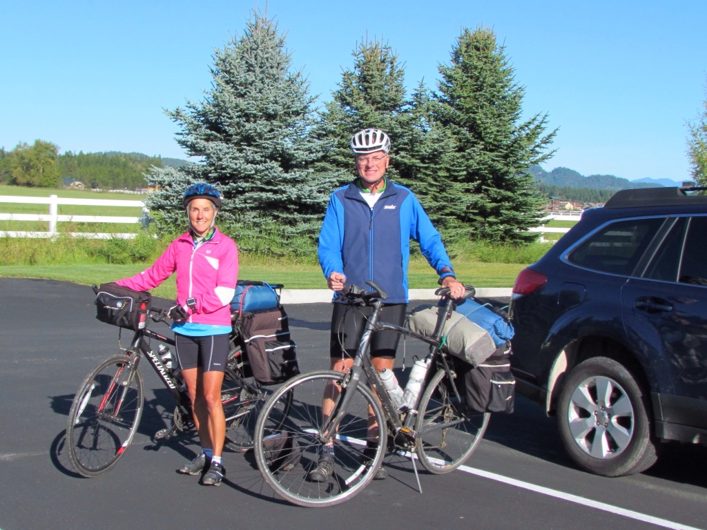
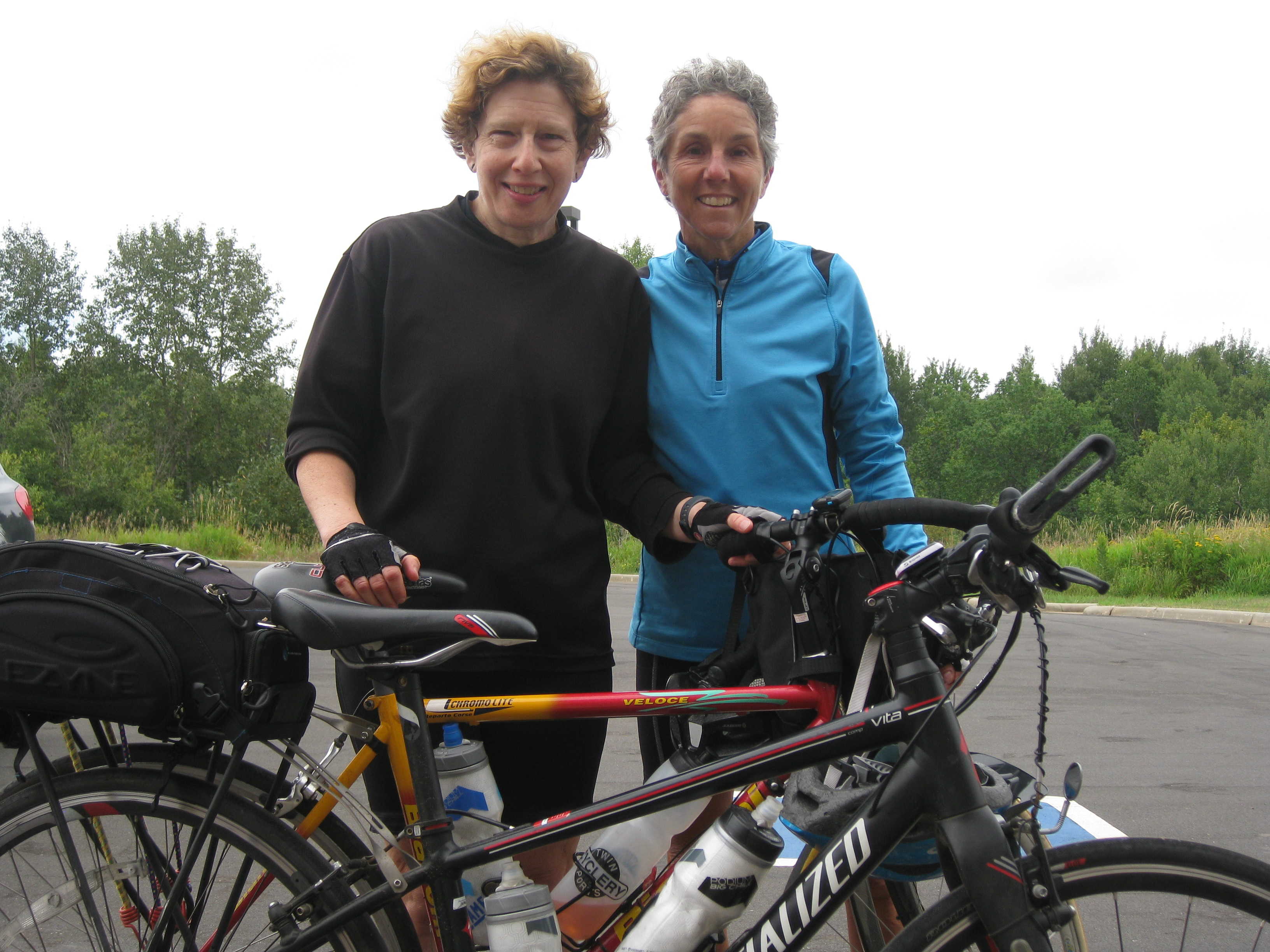
Of course we did know that venturing off the main road would entail more ups and downs, and this route had some doozies. They weren't as long as yesterday's climbs, but were much steeper and twisty. I managed to cycle up them, but even I needed some rest stops. One look at Rich's face will tell you the toll they took on him!

Even with the hills, we didn't realize just how high above the river we had climbed until the trees opened up to give us a view of the river – way down below.

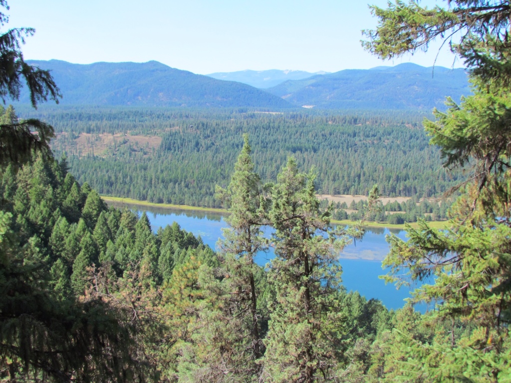
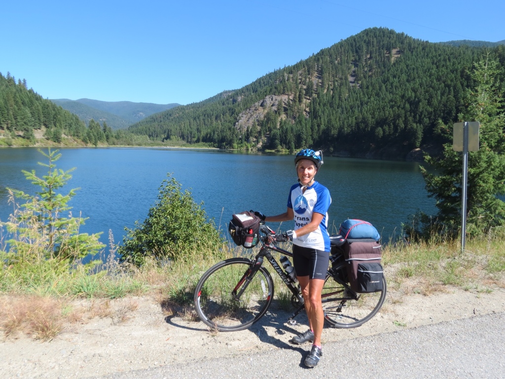
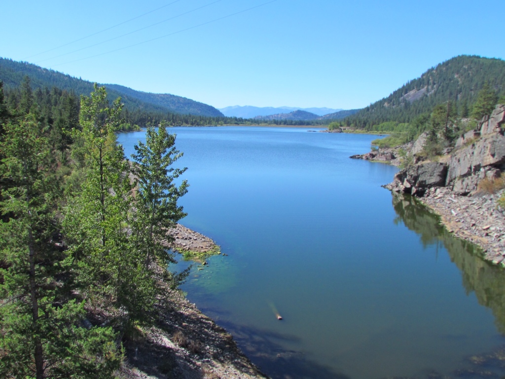
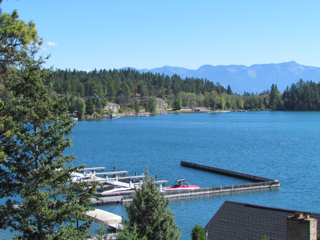
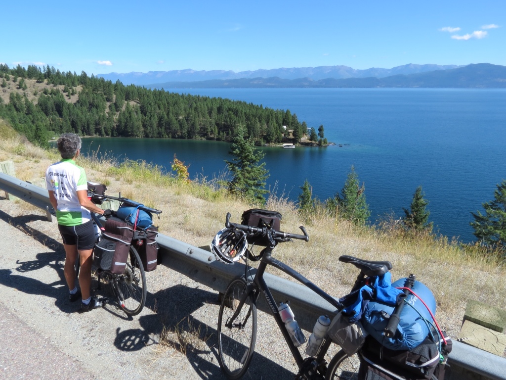
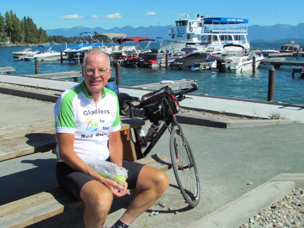
Near the end of our ride, the river widened out into a huge reservoir, which is a popular recreation area. It makes for a lovely place to sit and relax after the day's travels. Here the breeze helps keep the heat at bay, and I feel I earned this nice rest. Somehow it even makes enduring the morning chill worth while.

I don't know what tomorrow will bring for cycling and weather, but I do know we have another day following the Clark Fork River.


Summer Returns

I really had no idea what to expect weather-wise on this trip. Looking at forecasts for the areas we'd be in was marginally helpful, as things can change quickly. So I packed all the same clothes as for last year's trip, with many options for layering as fall weather approached. I worry more about being cold than getting too hot.

While the first two days may not be a true barometer for the trip, we are certainly off to a warm start. Despite the cool nights, each day has been cloudless from morning 'til night. With the sun beating down all day long it feels positively like summer. In fact, more like summer than we had in the past three months in Duluth!

Today's ride took us up and over a small mountain pass, which gave us plenty of hill work. Perhaps that's why it felt so warm – we were cycling hard! Once up on top the land plateaued and we rode through a very dry valley, dominated by grazing lands and barren ones at that. It felt like the wild, wild west even if we didn't see the promised bighorn sheep.

Rainbow Lake was a welcome sight up there in the hills, and was the precursor to a five mile downhill into Plains – our destination for the night. It was a whole lot hotter at the foot of the hills, registering 88 degrees at 6pm! Perhaps it was just as well we spent most of the day in the higher altitudes.

Our motel for the night, the Dew Duck Inn, claims to be the “Best little Motel in Montana” and I don't think it's overrated. Erich, the proprietor, gave us a verbal tour of the town with everything we could possibly want to know, and then some. And he provided great routing and restaurant suggestions for tomorrow. From the looks of it, he's has quite a green thumb which I thoroughly enjoyed.

Tomorrow's forecast promises more of the same. We're planning an early start to beat the heat. I can't believe I'm saying that in September in an area that is as far north as Duluth. I'd never have guessed that we'd be back in summer again. But I'm not complaining.


We’re Off and Cycling!

At last the waiting is over. Our Glaciers to the Sea cycling trip has been months in the planning. And we've spent the past three days in the car getting to the start. After all that forced inactivity I was just itching to start pedaling.

We were up for a bright and early start, per our normal routine, but our plans soon changed. With the temperature at 37 degrees, it made little sense to set off in the morning chill. Knowing that the clear skies and bright sun would soon warm things up, we lingered in our motel room until it was a balmy 45 degrees. Finally, we could hit the road!

Day 1: Whitefish to Elmo MT, 53 miles

Our route today took us from Whitefish, Montana south to the midpoint of Flathead Lake. We were pleased to find fairly quiet local roads, which then met up with a bike trail that took us right to the top of the lake. It was idyllic cycling, mostly downhill, a tailwind and the sun beating down. It wasn't long before I discarded all my extra layers of clothing. To the east the Rocky Mountains formed an endless ridge line that stayed with us all day. To the west were lower, softer tree covered rises. We were happy to ride in the flat valley between.

We knew nothing about Flathead Lake, but soon became enamoured with this huge pristine lake. It is the largest inland lake in the western US, and it is a Montana passion to preserve the integrity of the clear deep lake. We followed the shore of its blue waters for 25 miles, never tiring of its glistening surface.

Further down the lake, the road cut across some of the lake's peninsulas, delivering uphill and downhill stretches just to remind us that we were still in mountainous country. We figured they were good warm-ups for what is yet to come. We made such good time that by mid-afternoon we reached our Warm Showers host home. We were warmly greeted by Al and his sister Sharon, who graciously shared their home with a view of the lake and a bountiful dinner.

Oh yes, it sure feels good to be cycling again. And this is just the beginning.


Glorious Glacier

With only one day to explore Glacier National Park, weather was going to be a critical factor. Fortunately for us, it definitely made our day. I had my heart set on driving the Going to the Sun road, which seemed a perfect fit for our limited time frame, but was highly dependent on getting clear views.

We set out from West Glacier making our way along Lake McDonald. The mountains in that stretch were modest and tree covered, and it was a more pastoral scene than awe inspiring. The morning was chilly and although it was sunny, it brought low hanging patchy clouds that seemed to catch on the treetops and cling to the hillsides.

Once past the lake, we began to climb. The road hugged the mountainsides, curving with the contours of the rock and demonstrating the amazing feat of engineering it took to build it. Soon the vista changed dramatically. Sharp rocky peaks filled our field of view, and behind them snow-topped mountains appeared. Grandeur surrounded us. But it was still shrouded by clouds. It made for some dramatic views, with the sun radiating from behind. Yet we yearned for the full vista. Driving through Logan Pass, we ourselves reached the clouds. There was no incentive to stop to look or hike, so we ventured on.

As soon as we dropped over the other side, the weather pattern changed. As we've learned, in the Rockies it matters a lot which side of the continental divide you are on. Suddenly, the skies cleared and we could see the tops of the peaks surrounding us. It became a whole different show. One of our first stops was at an overlook to see Jackson Glacier. It is one of only 25 remaining glaciers out of an estimated150 that covered the park back in 1850.

We couldn't resist snapping our own pictures at one of the most photographed spots in the park. In Lake Mary, tiny Wild Goose Island stands out in sharp contrast to the towering mountains in the distance.

Reversing our direction at the far end of Lake Mary, the return trip provided an entirely different set of views. We could see all the mountains that were behind us on our way in. And the weatherman came through – the clouds lifted by the afternoon as promised, clearing even the western side of the route.

I had fond memories of Lake McDonald from my only other trip to Glacier around age 11. So I enjoyed revisiting the old Lake McDonald Lodge, and trying to re-envision the view of the mountains reflecting in the lake that has stayed with me all these years. But I found an even better spot from which to experience the lake further down on a stretch of rocky shore. There I reveled in the peace and quiet enhanced by the supremely clear water lapping gently on the shore. That may very well be one of my new favorite mental images of the park.

It was a most successful day. I think we experienced Glacier in several of her moods. But I will remember it only as being glorious.


The Father of our National Parks

I admit I didn't even know there was a Theodore Roosevelt National Park. But if I think about my history lessons, it seems more than appropriate that this man who set aside millions of acres of land for conservation purposes has a park honoring his name.

Making our way westward to begin our cycling trip, the Cottonwood Campground in this park was our targeted destination for our first night's stay. As we neared Medora, North Dakota the scenery developed the unique features of the Badlands. Buttes with distinctly colored strata interspersed wtih canyons covered in grasses and prairie shrubs dominated the landscape. Some of the mounds were more volcanic with fascinating shapes that resembled sand castles.

Theodore Roosevelt National Park is as understated as its reputation. It is an unassuming park whose greatest features are its natural beauty and wildlife. Its major activities are scenic drives and trails for hiking and horse back riding. Even our campground provided only the most basic of services. But it bordered a river and was tucked right into the dramatic sculptures of the land, which was of more interest to us anyway.

Up with the sun in the morning, we set off on the 36 mile circle drive through the south unit of the park. We had originally planned to cycle the route, but time constraints dictated that we cover it by car instead. The sky was blue and cloudless, and the rising sun set off the scenery to its greatest advantage. In addition, the park's natural inhabitants seemed to be especially active and abundant. Bison and wild horses dotted the landscape, and didn't seem to mind us passing by in close proximity. Prairie dog towns were frequent and bustling with activity. The little critters chirped at us in annoyance yet carried on popping in and out of their holes, keeping us entertained as we tried to take pictures.

The passing of Labor Day stripped the park of its peak visitors, leaving us to enjoy our drive in near solitude. Rich could take in the sights even while navigating the narrow curvy roads, and we took liberties with stopping to gawk or take photos. It was the ideal way to take it all in.

In sharp contrast, we are now headed to one of the best known of all U.S. National Parks – Glacier. I expect we will share its grandeur with a few more visitors. But the benefit is that its glory has been preserved for future generations. I think Teddy Roosevelt would approve.


Tour Preparations

Packing for a cycling trip is not hard.  It’s rather like following a script.  There is no room to improvise.  Literally, every inch of space is already allocated.

It helps to have done this before.  Last year’s trip was the true test, and after two months on the road I can say with absolute certainty that I got it just right.  I had exactly what I needed. No more, no less.  And so I return to my List.  It will not surprise anyone who knows me to find out that I have detailed documentation on every single item I carried.  And despite the brevity of contents in my panniers, my list runs to four pages.  I’m nothing if not thorough.  Want to know how many ziplock bags I used to keep everything dry?  My list will tell you: 8 gallon and 9 quart sized bags.

IMG_5186The hardest part is collecting everything.  Where did I put my Swiss Army Knife?  What happened to the little bottles for toiletries?  Looks like I’d better put granola bars on my shopping list.  But before long, I fill my assigned spare bed in the guest room.  All the paraphernalia I’ll need IMG_5188for 4-5 weeks of travel fits on a single size mattress.

From there, it is a simple matter of stuffing the works into those ziplock bags, squeezing out every last ounce of air and fitting them into my panniers.  If I have any doubt as to where certain items belong, I have only to refer back to an old blog post.  Who knew that blogging would come in so handy?wpid-Photo-Sep-15-2013-902-PM.jpgHonestly, it’s a lot harder to pack for the road trip out to Glacier where we will start our Glaciers to the Sea cycling tour.  After all, I have a whole car at my disposal.  There are endless things I can bring, especially as my cycling gear takes so little room.  And I don’t even need any ziplock bags.

Announcing Glaciers to the Sea

Glaciers-to-the-Sea-LogoA year has already gone by since our last cycling trip, so it’s time to push our pedals again and wheel our way through some scenic countryside. After considering numerous different options for our itinerary, we finally chose a trip through the Northwestern states. And as always, we have a name and a logo for our tour.  This one has been dubbed Glaciers to the Sea.

Rich has been plotting our route for months, carefully checking other cyclists’ trip reports, scouting out lesser traveled roads, and going to the greatest level of detail by viewing actual roads and shoulders on Google Street View.  He doesn’t leave anything to chance.  If our route looks a bit windy and twisty, there’s a good reason for it.  The straightest route is not always the best approach when traveling by bicycle.

Map-Glaciers-to-the-Sea-Route

Our route from the glaciers in Montana to the coast of Oregon and Washington

We start off in Whitefish, Montana which is just outside of Glacier National Park.  Rich took great care in selecting our starting point, making sure that we were already over the continental divide before we began cycling.  No climbing up mountain passes if he can help it.  We know there will still be plenty of ups and downs, but we hope the highest ones will already be behind us.  From there we will follow the Clark Fork River.  We learned on last year’s trip that staying in river valleys is the perfect way to minimize altitude changes – as long as we don’t stray far from the water.  After traveling through Spokane, Washington we will cross the high plateau.  That brings us to the next major waterway, the Columbia River, which takes us all the way to Portland, Oregon.

Rich’s brother and his wife live in Eugene, Oregon so we will dip down to visit them.  We’re planning a 3-night stay to rest up, enjoy a few luxuries and spend time catching up.  The final leg will be along the Oregon and Washington coasts, which promise some spectacular views.  After visiting my friend, Anne, in Olympia we will finish up in Seattle. There we will be hosted by some Warm Showers cyclists who stayed with us last summer on their cross-country cycling trip.  Amtrak will then deliver us back to our car in Whitefish.

In total, we expect to cycle about 1,400 miles over 4-5 weeks.  We’ve left it intentionally vague, which allows us to take advantage of opportunities that present themselves along the way.

Friends have asked what we are most looking forward to.  I think we both have the same answer.  The simplicity of the journey.  Traveling by bicycle trims everything down to the Rich and Molly in Jerseysbare necessities.  There are no decisions to make about what to wear – out of two sets of cycling clothes, we put on the clean ones.  Our possessions are few – tablets are our best friends, providing reading material, contact with family and blogging tools.  It’s just us, our bicycles and the scenery.  Oh yes, and our cameras.

We’re excited for this trip, from the glaciers to the deep blue sea.  And everything in between.

Our very own Mountain

It’s not every family that has a mountain named for them.  But that was one of the legacies my great-grandfather left for us.  For the record, this is no piddly little peak.  Mt. Brewer rises 13,576 feet high in the Sierra Nevada Range in California.

William Henry Brewer March 19 1902

William Henry Brewer, 1902

Back in 1860, Josiah Whitney headed up the first Geological Survey of the State of California.  He selected fellow Yale graduate William Henry Brewer to lead the field survey.  Over the next four years, my great-grandfather Brewer traveled over 14,000 miles mapping California’s topography as well as cataloging and collecting geological and botanical samples.

On July 2, 1864 Brewer and his team made the first ascent of Mt. Brewer.  The found the final climb to be much harder and higher than expected, traveling over steep rocks.  But once at the top they were amazed at the view – “Such a landscape!” Brewer exclaimed in his journal, surrounded by a hundred peaks over 13,000 feet.  In fact, from the summit Brewer’s survey party was the first to identify the highest peak in the range, Mt. Whitney.

GMBE 1970

The Great Mount Brewer Expedition, 1970

Over 100 years and three generations later, my older brother, my sister and her boyfriend (now husband) made the second family trek up Mt. Brewer.  Somehow it seemed fitting, as my brother is named after William Henry Brewer.  They boldly named their trip the Great Mount Brewer Expedition, and spent five days backpacking up the mountain and back.  They left the following entry in the log at the top:  “William Henry Brewer and party climbed this peak 106 years after our great-grandfather, William Henry Brewer.”  I was in awe of my siblings’ accomplishment, especially after they were featured in a big newspaper story when they returned.

Mt. Brewer Map

Carl and Erik’s planned route to the top

Now 150 years since Brewer’s first ascent, two of his great-great-grandsons are making the same trip.  My sons Carl and Erik leave this week to scale our family mountain.  If all goes as planned, they expect to complete their journey in three days, but have allowed four just in case.  Since they have planned a circular route, it means carrying all their gear to the summit.   I’ve been informed that only about half the route is on established trails.  Getting to the top requires finding their way off-trail.  They assure me that they are good with maps and a compass.

I’m thrilled that my sons care enough about our family history to carry out this challenge.  I’m excited to think about their new entry in that log at the top.  It’s an adventure I’ve dreamed of doing, but realistically will resort to living vicariously through their anecdotes and tales.  I’m sure there will be plenty to tell.  That’s a lot of mountain to claim and to climb.

Mount Brewer from South Guard Lake

Mount Brewer from South Guard Lake

Restoring Seven Bridges Road

We are about to lose our private cycling and walking trail.  It’s been nice while it’s lasted, but we knew it wouldn’t be forever.  And to be honest, Seven Bridges Road is such a treasure that the citizens of Duluth and our visitors ought to have access to this beautiful drive again.

For over two years, the road has been closed.  Contrary to popular belief, the major damage predates the flood of June 2012 by a couple of months.  The steep banks of Amity Creek became seriously eroded, carving away the land next to the road.  With the landslide area just inches from the roadbed, it became too dangerous for vehicles.  The flood added to the problems, causing a cave-in over a culvert a little further up the road, and further impairing bridge supports for the 3rd bridge.  Since no one lives on that portion of the road, it was a low priority for repairs.

IMG_5150All that changed this summer.  As soon as spring hit, the work began.  Trucks rumbled back and forth in front of our house all summer long as serious reconstruction took place.  Since the land next to the problem area rose steeply alongside the road, it required carving out the hill to move the road inland.  In addition, it meant relocating the cross-country ski trails as well (a project near and dear to our hearts, as we spend many hours on those trails).  We were anxious to see just how they were going to navigate that terrain.  I’ll admit, a few summer evenings we ambled up that way to take a sneak peak, and marveled at the huge mounds of dirt that would eventually transform the landscape.

Recently there has been an uptick in activity.  Longer work hours and even bigger trucks hauling.  Then it happened almost without our noticing it.  The absence of noise.  The lack of truck traffic.  Sure enough, a day or more went by without a single construction vehicle.  Did that mean the road was completed?  We just had to find out.

IMG_5152To our amazement, the pavement was complete and work was progressing nicely on  landscaping the area.  Where the road once went straight along the creek, it now safely curves inland with a berm between it and the edge of the drop-off.  Adjacent to the road, the ski trails follow a new path inland which is strikingly similar to the old route through the woods.IMG_5157

There is a hefty new culvert to replace the old one, and enough heavy duty drainage rocks to handle the worse rains.  All with a new roadbed over it.IMG_5156

The 3rd bridge is still undergoing repairs.  The footings have been replaced, and where the road was falling away from the bridge, a new concrete extension is in the works.  Soon it will be rocked in to look like the rest of the bridge.  A nice touch.

It’s getting close.  I hear the goal is to open the road by the end of the month.  I’d put my money on them making it.

I’ll miss being able to cycle up the road knowing there will be no cars.  It will undoubtedly mean more traffic going past our house.  And I dread the day the motorcyclists rediscover the road, noisily revving their engines as they roar by.  But it’s good to see the road restored.  Just in time for leaf season, when Seven Bridges is in its glory.  Then I can look forward to winter when the steepest sections of the road are closed for the season.  And we will have our private trail once again.

A Century on the Mesabi Trail

Mesabi Trail Century Ride

Our 100-mile route out-and-back on the Mesabi Trail

Three times must make an annual tradition.  With two century rides behind us, Myra and I couldn’t let the summer go by without adding to the count.

After cycling part of the Mesabi Trail on the North Shore Cycling Tour, I thought it would make an excellent choice for our annual outing.  Although it would mean doing an out-and-back ride, it had the advantage of allowing us to cycle side-by-side and chat all along the way – a signature feature of our rides.  Somehow we never run out of things to talk about.  And it sure makes the miles fly by.  All 100 of them.  It didn’t take long for Myra to buy into the idea, and as soon as we could agree on a date, it was set.

wpid-Photo-20140728212925.jpgWe were greatly impressed with the Mesabi Trail. The last time I rode it was years ago, and it was largely discontinuous – more a hopeful concept than a reality.  That has now been reversed, with 115 miles of trail stretching eastward from Grand Rapids toward Ely.  Only short sections, mostly in towns, left us on city streets or country roads.  Each of those sections, as well as the rest of the trail was well marked.  Between their signature Mesabi Trail sign posts and directions on the roads at all turns, we had no opportunity to make a wrong turn or mistake in following the trail.  That was significant!

We started our journey at Eveleth and followed the Trail west just short of Keewatin, then turned around and returned.  That allowed us to use the most complete portion of the trail.  Unlike “rails to trails” paths that follow a relatively flat and straight course, the Mesabi Trail winds through mining territory, skirting open pits that are now lakes and winding over and around mounds of tailings.  There were plenty of ups and downs in the rolling terrain, which kept things interesting without being too taxing.  It was fascinating to see how the land is transforming with new growth.  And there were frequent towns along the way to keep things interesting.

Just as we were nearing our turn around point, the dark clouds that we were trying to ignore began to drip.  Then rain came in earnest, and within a few miles we were in a serious downpour.  With the gusting winds, it cooled us down rapidly, but didn’t dampen our spirits.  It was all part of the experience we figured.  But we would be happy to see it stop.  After taking cover 15 miles later under a trail shelter near Hibbing to add layers under our inadequate light jackets (who thought we’d need real rain gear?) and snarf down a snack in hopes of fueling some warmth, we continued our journey.  It wasn’t long afterwards that the rain dribbled to a stop, improving our outlook significantly.

The return trip didn’t feel like covering the same old ground at all.  Somehow things look different coming from the opposite direction, and we often remarked on things we’d missed seeing on the first pass.  Before long we had dried out and were counting down the miles to the end.  Those last 20 miles are always the hardest, but we had no problem conquering them.

IMG_1423I didn’t have much appetite for taking pictures once the rain hit.  So we will have only mental images of the fun that we had, the beauty of the trail, and the soggy mess we presented under that shelter.  Perhaps that’s for the best.  But I couldn’t resist a final shot at the end of the day – victorious after our 3rd Century Ride.

Soon we will have to start planning next year’s Century.