The Father of our National Parks

I admit I didn't even know there was a Theodore Roosevelt National Park. But if I think about my history lessons, it seems more than appropriate that this man who set aside millions of acres of land for conservation purposes has a park honoring his name.

Making our way westward to begin our cycling trip, the Cottonwood Campground in this park was our targeted destination for our first night's stay. As we neared Medora, North Dakota the scenery developed the unique features of the Badlands. Buttes with distinctly colored strata interspersed wtih canyons covered in grasses and prairie shrubs dominated the landscape. Some of the mounds were more volcanic with fascinating shapes that resembled sand castles.
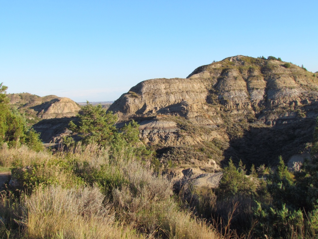
Theodore Roosevelt National Park is as understated as its reputation. It is an unassuming park whose greatest features are its natural beauty and wildlife. Its major activities are scenic drives and trails for hiking and horse back riding. Even our campground provided only the most basic of services. But it bordered a river and was tucked right into the dramatic sculptures of the land, which was of more interest to us anyway.
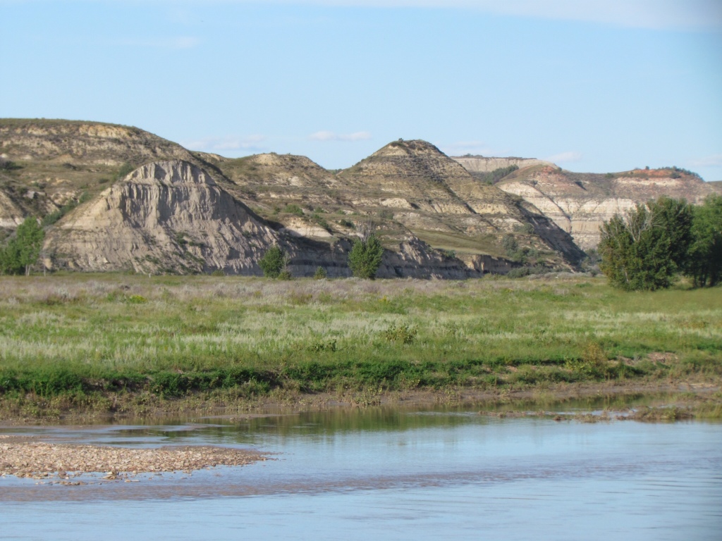
Up with the sun in the morning, we set off on the 36 mile circle drive through the south unit of the park. We had originally planned to cycle the route, but time constraints dictated that we cover it by car instead. The sky was blue and cloudless, and the rising sun set off the scenery to its greatest advantage. In addition, the park's natural inhabitants seemed to be especially active and abundant. Bison and wild horses dotted the landscape, and didn't seem to mind us passing by in close proximity. Prairie dog towns were frequent and bustling with activity. The little critters chirped at us in annoyance yet carried on popping in and out of their holes, keeping us entertained as we tried to take pictures.

The passing of Labor Day stripped the park of its peak visitors, leaving us to enjoy our drive in near solitude. Rich could take in the sights even while navigating the narrow curvy roads, and we took liberties with stopping to gawk or take photos. It was the ideal way to take it all in.

In sharp contrast, we are now headed to one of the best known of all U.S. National Parks – Glacier. I expect we will share its grandeur with a few more visitors. But the benefit is that its glory has been preserved for future generations. I think Teddy Roosevelt would approve.


Tour Preparations

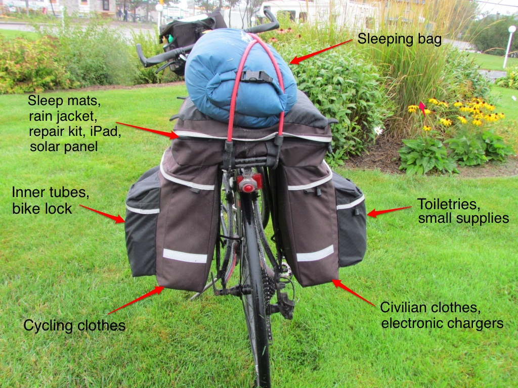
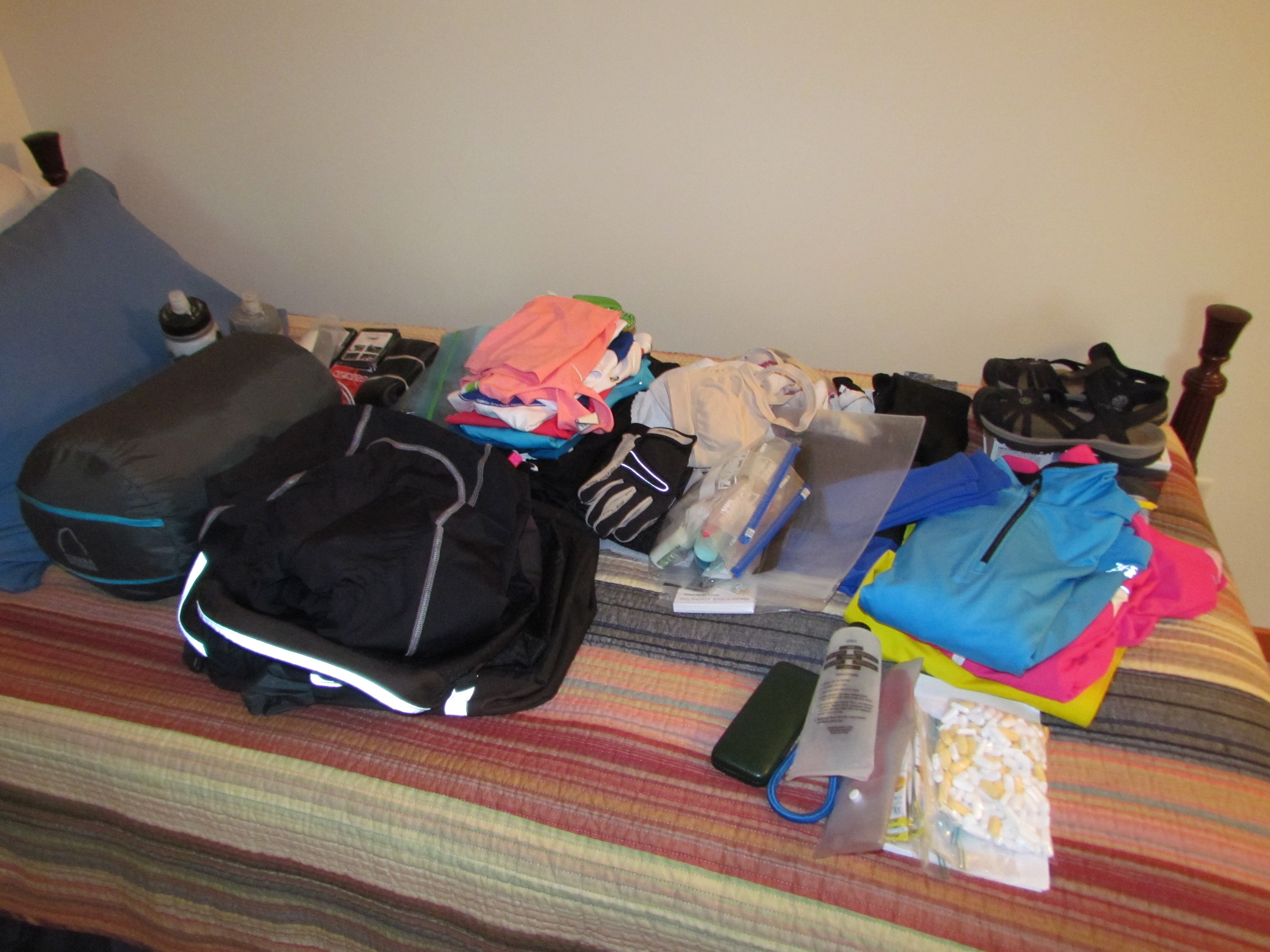
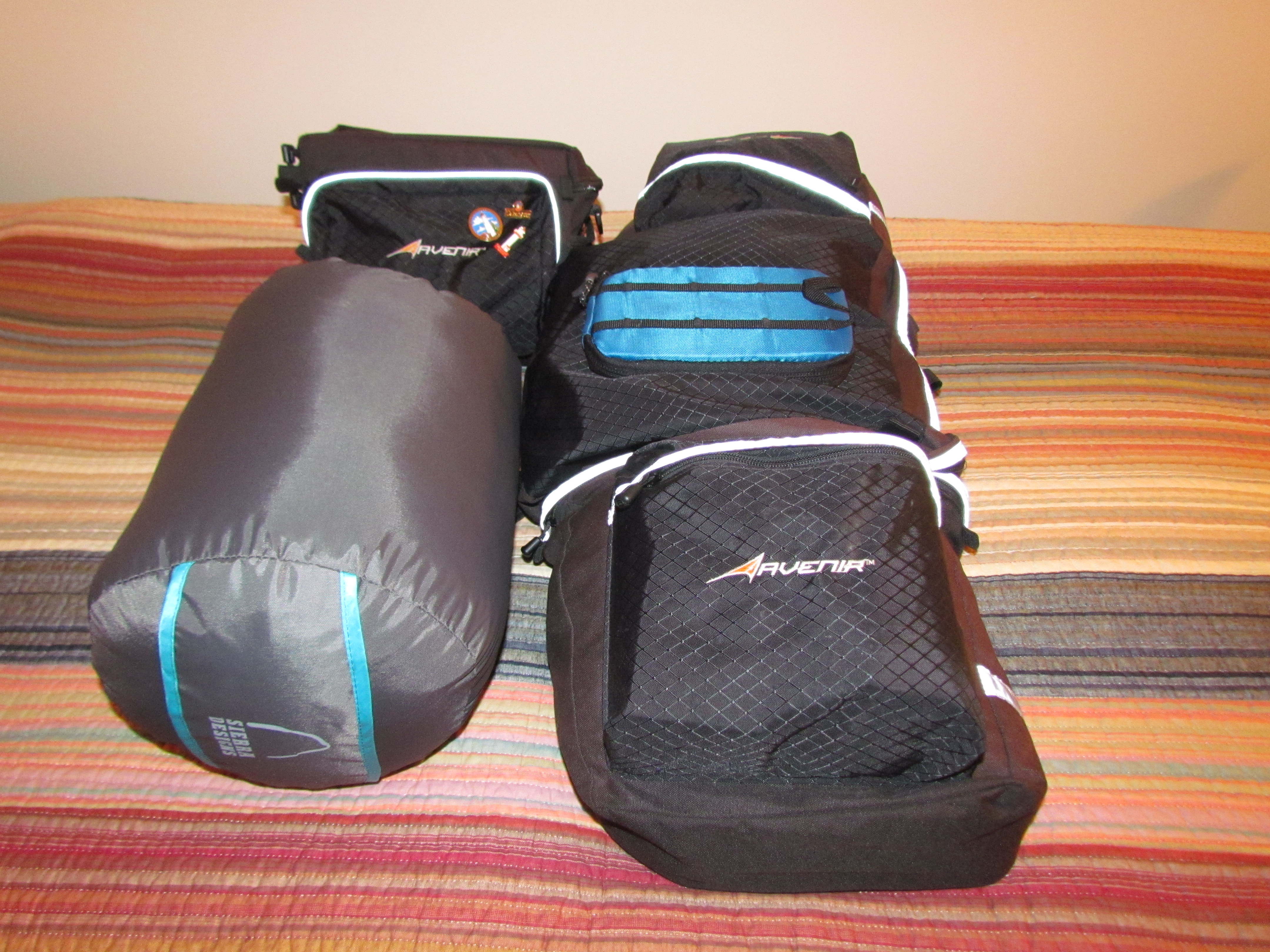
Packing for a cycling trip is not hard.  It’s rather like following a script.  There is no room to improvise.  Literally, every inch of space is already allocated.
It helps to have done this before.  Last year’s trip was the true test, and after two months on the road I can say with absolute certainty that I got it just right.  I had exactly what I needed. No more, no less.  And so I return to my List.  It will not surprise anyone who knows me to find out that I have detailed documentation on every single item I carried.  And despite the brevity of contents in my panniers, my list runs to four pages.  I’m nothing if not thorough.  Want to know how many ziplock bags I used to keep everything dry?  My list will tell you: 8 gallon and 9 quart sized bags.

IMG_5186The hardest part is collecting everything.  Where did I put my Swiss Army Knife?  What happened to the little bottles for toiletries?  Looks like I’d better put granola bars on my shopping list.  But before long, I fill my assigned spare bed in the guest room.  All the paraphernalia I’ll need IMG_5188for 4-5 weeks of travel fits on a single size mattress.

From there, it is a simple matter of stuffing the works into those ziplock bags, squeezing out every last ounce of air and fitting them into my panniers.  If I have any doubt as to where certain items belong, I have only to refer back to an old blog post.  Who knew that blogging would come in so handy?wpid-Photo-Sep-15-2013-902-PM.jpgHonestly, it’s a lot harder to pack for the road trip out to Glacier where we will start our Glaciers to the Sea cycling tour.  After all, I have a whole car at my disposal.  There are endless things I can bring, especially as my cycling gear takes so little room.  And I don’t even need any ziplock bags.

Announcing Glaciers to the Sea

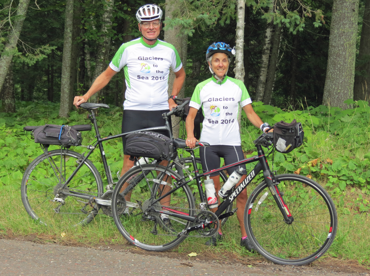
Glaciers-to-the-Sea-LogoA year has already gone by since our last cycling trip, so it’s time to push our pedals again and wheel our way through some scenic countryside. After considering numerous different options for our itinerary, we finally chose a trip through the Northwestern states. And as always, we have a name and a logo for our tour.  This one has been dubbed Glaciers to the Sea.

Rich has been plotting our route for months, carefully checking other cyclists’ trip reports, scouting out lesser traveled roads, and going to the greatest level of detail by viewing actual roads and shoulders on Google Street View.  He doesn’t leave anything to chance.  If our route looks a bit windy and twisty, there’s a good reason for it.  The straightest route is not always the best approach when traveling by bicycle.

Map-Glaciers-to-the-Sea-Route

Our route from the glaciers in Montana to the coast of Oregon and Washington

We start off in Whitefish, Montana which is just outside of Glacier National Park.  Rich took great care in selecting our starting point, making sure that we were already over the continental divide before we began cycling.  No climbing up mountain passes if he can help it.  We know there will still be plenty of ups and downs, but we hope the highest ones will already be behind us.  From there we will follow the Clark Fork River.  We learned on last year’s trip that staying in river valleys is the perfect way to minimize altitude changes – as long as we don’t stray far from the water.  After traveling through Spokane, Washington we will cross the high plateau.  That brings us to the next major waterway, the Columbia River, which takes us all the way to Portland, Oregon.

Rich’s brother and his wife live in Eugene, Oregon so we will dip down to visit them.  We’re planning a 3-night stay to rest up, enjoy a few luxuries and spend time catching up.  The final leg will be along the Oregon and Washington coasts, which promise some spectacular views.  After visiting my friend, Anne, in Olympia we will finish up in Seattle. There we will be hosted by some Warm Showers cyclists who stayed with us last summer on their cross-country cycling trip.  Amtrak will then deliver us back to our car in Whitefish.

In total, we expect to cycle about 1,400 miles over 4-5 weeks.  We’ve left it intentionally vague, which allows us to take advantage of opportunities that present themselves along the way.

Friends have asked what we are most looking forward to.  I think we both have the same answer.  The simplicity of the journey.  Traveling by bicycle trims everything down to the Rich and Molly in Jerseysbare necessities.  There are no decisions to make about what to wear – out of two sets of cycling clothes, we put on the clean ones.  Our possessions are few – tablets are our best friends, providing reading material, contact with family and blogging tools.  It’s just us, our bicycles and the scenery.  Oh yes, and our cameras.

We’re excited for this trip, from the glaciers to the deep blue sea.  And everything in between.

Our very own Mountain

It’s not every family that has a mountain named for them.  But that was one of the legacies my great-grandfather left for us.  For the record, this is no piddly little peak.  Mt. Brewer rises 13,576 feet high in the Sierra Nevada Range in California.

William Henry Brewer March 19 1902

William Henry Brewer, 1902

Back in 1860, Josiah Whitney headed up the first Geological Survey of the State of California.  He selected fellow Yale graduate William Henry Brewer to lead the field survey.  Over the next four years, my great-grandfather Brewer traveled over 14,000 miles mapping California’s topography as well as cataloging and collecting geological and botanical samples.

On July 2, 1864 Brewer and his team made the first ascent of Mt. Brewer.  The found the final climb to be much harder and higher than expected, traveling over steep rocks.  But once at the top they were amazed at the view – “Such a landscape!” Brewer exclaimed in his journal, surrounded by a hundred peaks over 13,000 feet.  In fact, from the summit Brewer’s survey party was the first to identify the highest peak in the range, Mt. Whitney.

GMBE 1970

The Great Mount Brewer Expedition, 1970

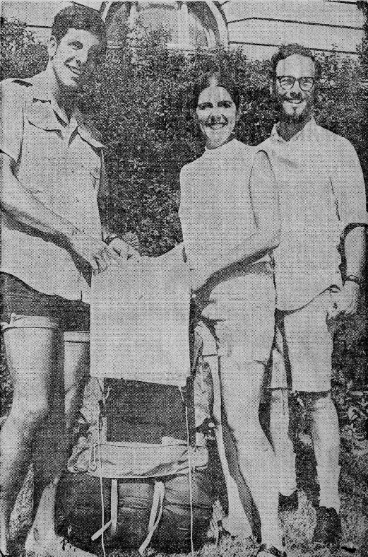
Over 100 years and three generations later, my older brother, my sister and her boyfriend (now husband) made the second family trek up Mt. Brewer.  Somehow it seemed fitting, as my brother is named after William Henry Brewer.  They boldly named their trip the Great Mount Brewer Expedition, and spent five days backpacking up the mountain and back.  They left the following entry in the log at the top:  “William Henry Brewer and party climbed this peak 106 years after our great-grandfather, William Henry Brewer.”  I was in awe of my siblings’ accomplishment, especially after they were featured in a big newspaper story when they returned.

Mt. Brewer Map

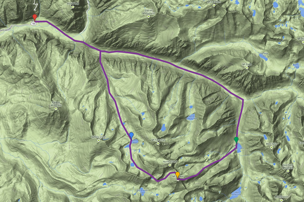
Carl and Erik’s planned route to the top

Now 150 years since Brewer’s first ascent, two of his great-great-grandsons are making the same trip.  My sons Carl and Erik leave this week to scale our family mountain.  If all goes as planned, they expect to complete their journey in three days, but have allowed four just in case.  Since they have planned a circular route, it means carrying all their gear to the summit.   I’ve been informed that only about half the route is on established trails.  Getting to the top requires finding their way off-trail.  They assure me that they are good with maps and a compass.

I’m thrilled that my sons care enough about our family history to carry out this challenge.  I’m excited to think about their new entry in that log at the top.  It’s an adventure I’ve dreamed of doing, but realistically will resort to living vicariously through their anecdotes and tales.  I’m sure there will be plenty to tell.  That’s a lot of mountain to claim and to climb.

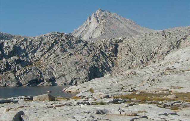
Mount Brewer from South Guard Lake

Mount Brewer from South Guard Lake

Sharing the North Shore

NShore Day 5

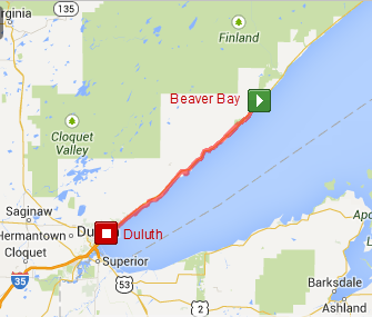
Day 5 – Beaver Bay to Duluth MN, 52 miles

It seemed most appropriate that we spent this final day of the Minnesota North Shore Tour with Bike Tour Vacations following the tour’s namesake.  It’s a stretch I’ve done many times, and is very familiar.  But cycling with a group who had never been on the North Shore before gave it a whole new twist.  It was fun to re-experience the sights and lake views through the eyes of those seeing it for the first time.

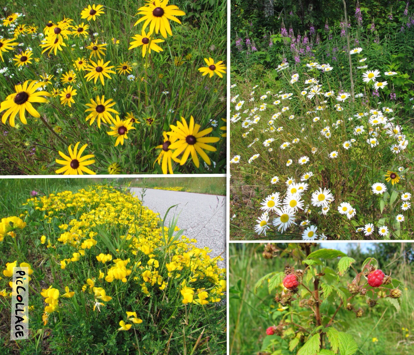
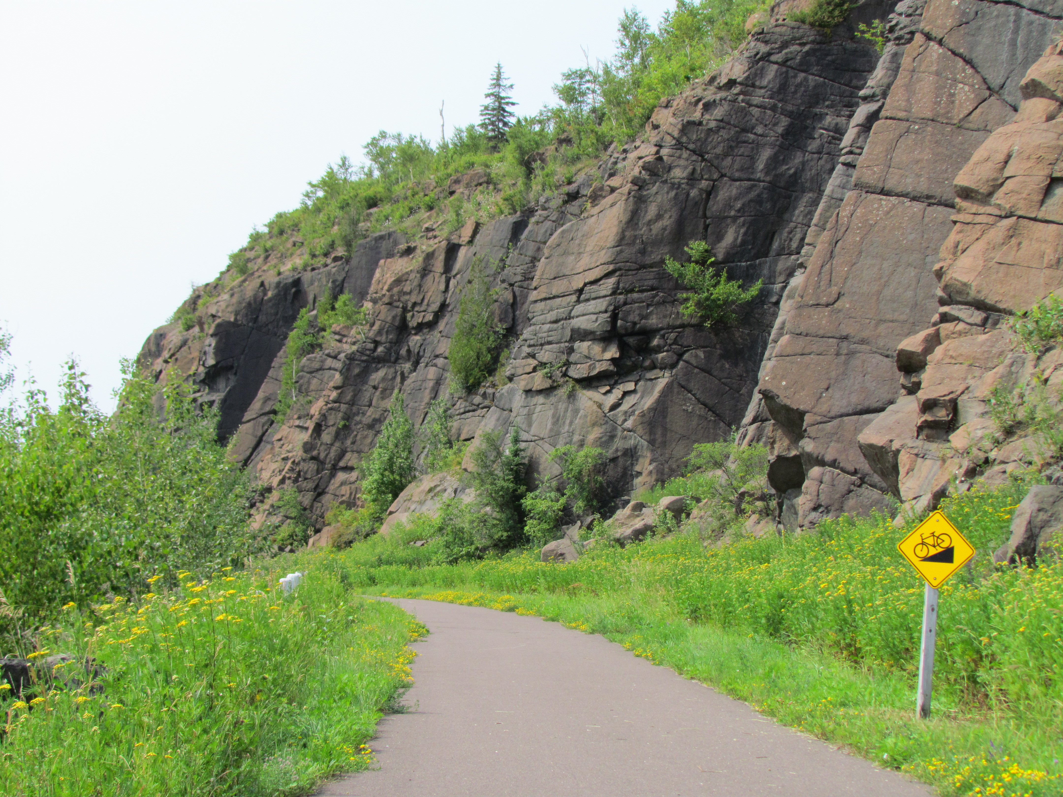
Starting in Beaver Bay was a treat as we had immediate access to the longest completed section of Gitchi-Gami State Trail, a wonderful bike trail on the North Shore.  It afforded us hassle-free cycling away from the highway.  In addition, it was lined with wildflowers blossoming in brilliant colors.  It was interesting to note the difference in season compared to inland from the lake.  Berries were just beginning to ripen, and we still found fireweed and a few remaining lupine due to the cooler climate.

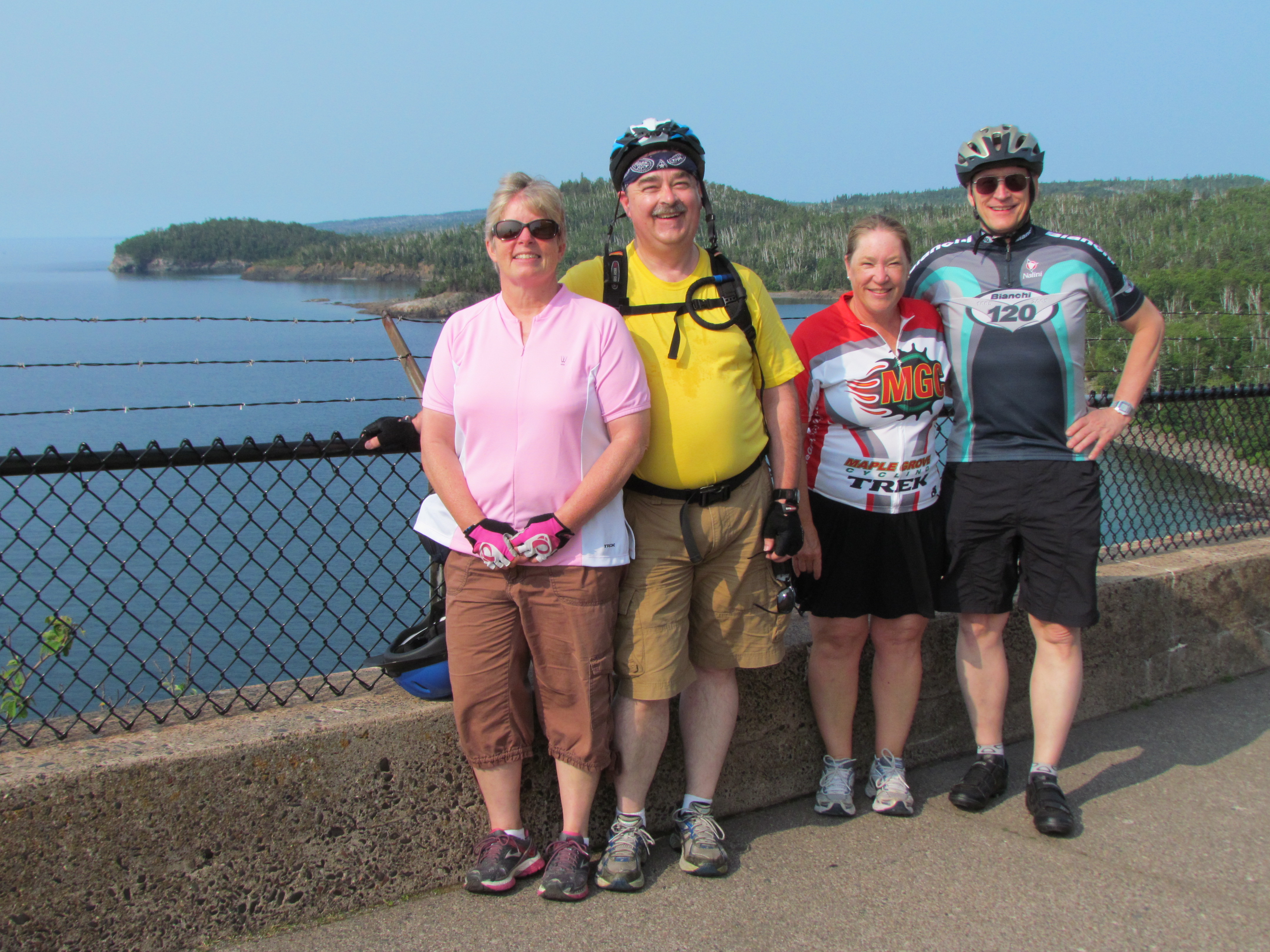
Photo Aug 01, 6 54 02 PMIt’s also worth nothing that our numbers swelled to 13 for this portion of the tour as we were joined by Jim’s sister, her husband and another couple.  They were a welcome addition to our lively group.IMG_5052

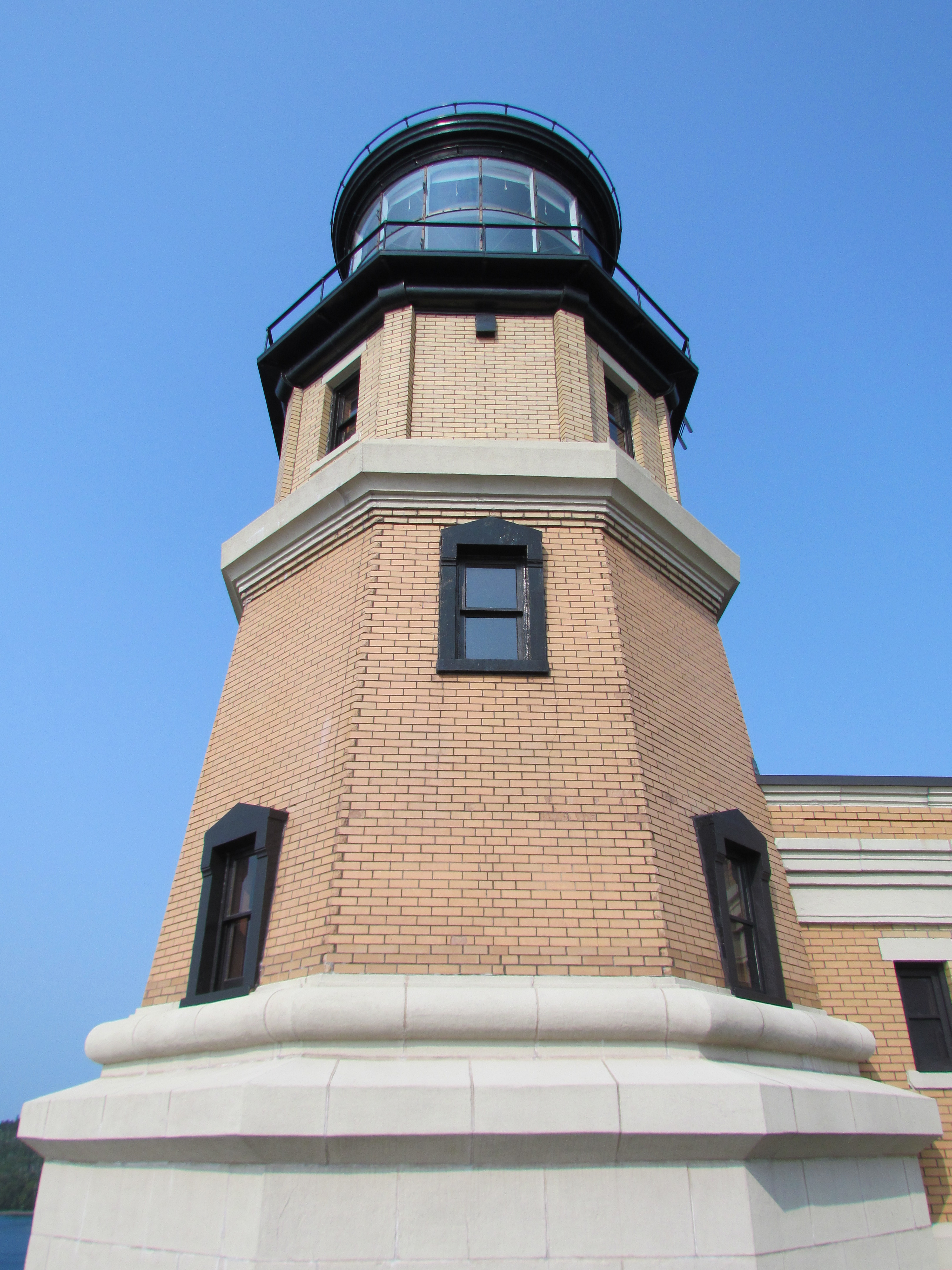
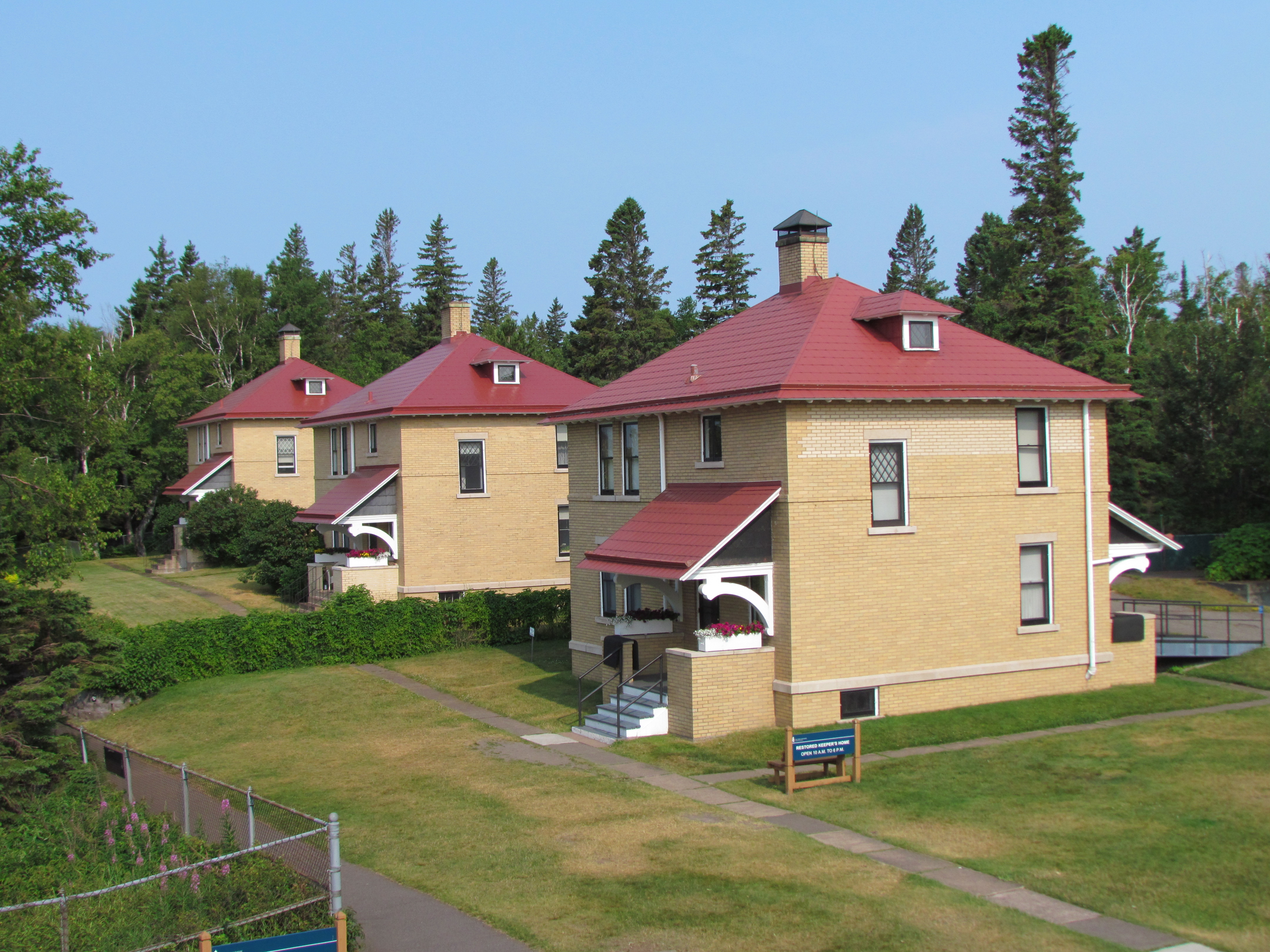
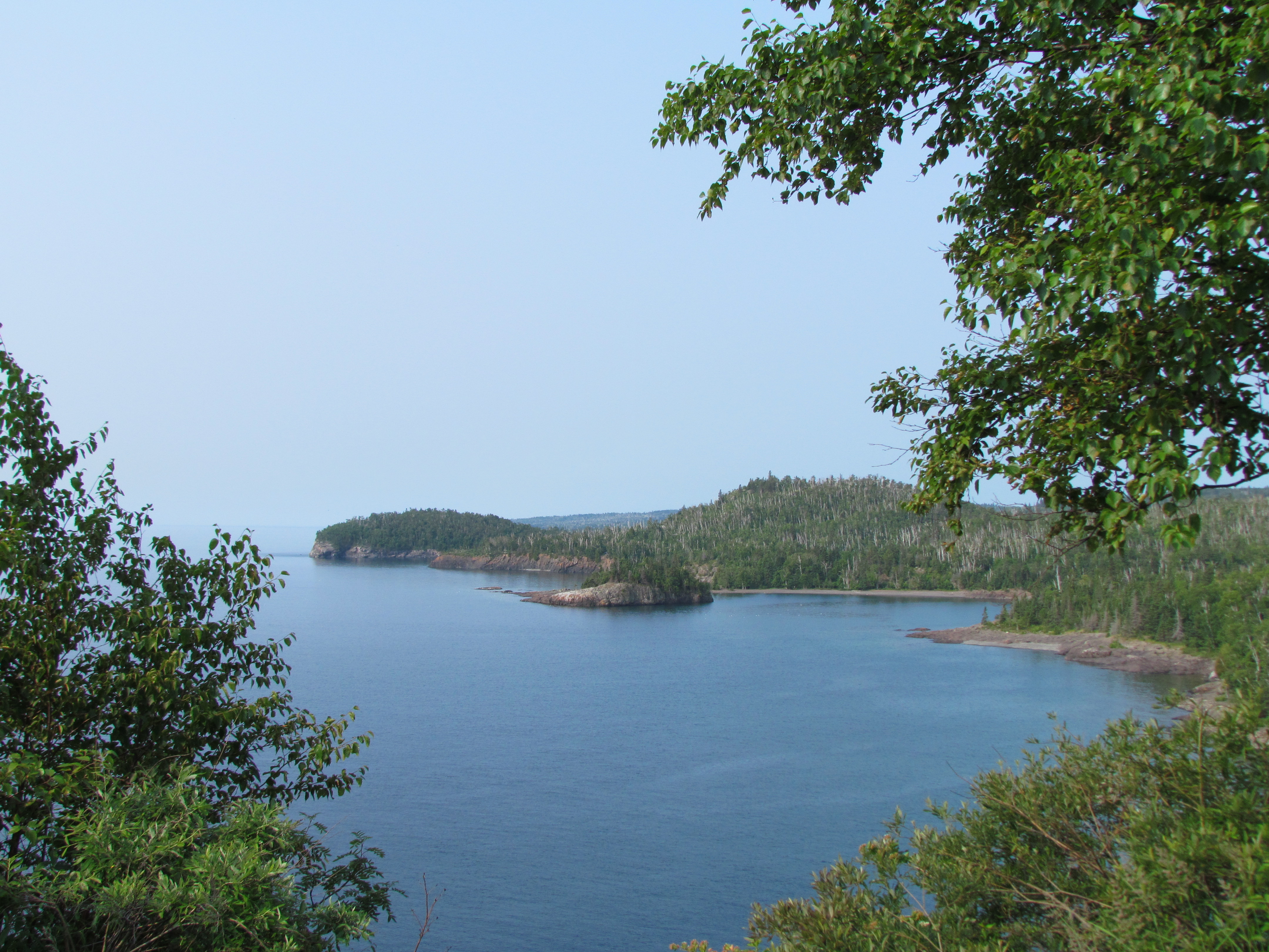
We had many stops today due to the numerous sights on that stretch of the North Shore.  First was Split Rock Lighthouse – a must-see for any tourist.  Personally, I enjoy being there before the park opens for tours to beat the crowds.

IMG_5055 IMG_5057 IMG_5058Next up was Gooseberry Falls.  I’ve taken so many photos of the iconic falls that I felt compelled to try a different view.  This is how it looked from the bike path below the highway bridge.

IMG_5083Everyone was required to stop at Silver Cliffs, to take in the view and imagine the original highway that clung to the cliffs on this stretch of the North Shore.  I never realized before reading the signs that it has the longest views on the Minnesota portion of the North Shore.

IMG_5087IMG_5089 All day long we leapfrogged each other, collected at sights and exclaimed over the beautiful weather.  Our final stopping point was for refreshment at the Mocha Moose on Scenic 61.  Then we pushed on to the end, finishing up on the Duluth Lakewalk.  It was a glorious end to our 5-day tour.  And I was ever so pleased that the other guests found the North Shore to be as special as I do.  Sharing with them was a fitting finish to the trip.

The Ultimate Downhill

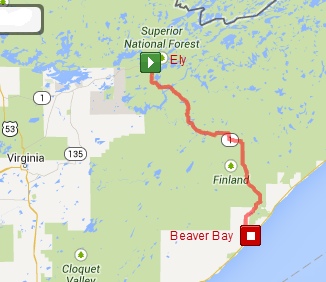
Day 4 – Ely to Beaver Bay MN, 71 miles

By definition, today’s route was one big downhill run. Starting in Ely and ending up at Lake Superior means dropping over 800 feet in elevation over 62 miles. What more could a cyclist ask for? Well, good weather, a tailwind, and beautiful scenery for starters. And we got all those too!

But I have to be honest. It wasn’t all downhill. In fact, getting out of Ely involved numerous uphill climbs and plenty of rolling hills. It wasn’t until we reached the continental divide, about 42 miles into our trip, that the road finally attained an overall downward tilt. And even then, there were undulations. But by then my momentum went a long way in carrying me up those hills, which just felt like little blips. For the most part, we whizzed down at great speed. Yes, those final 20 miles to the lake were quite the trip.

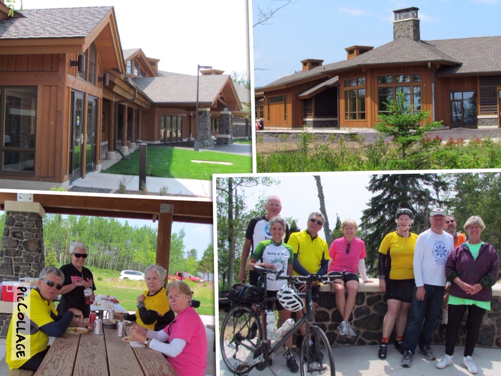
Our reward at the foot of the hill was a picnic lunch at the newly completed Tettagouche State Park Visitor Center. The new building certainly makes a statement, with its native rock and log exterior and it’s vast size. We set up shop in a nearby pavilion, where Lake Superior’s cooling breezes were in evidence. It was a delightful spot, and fun to explore the new building after watching it in the building process for the last two years.

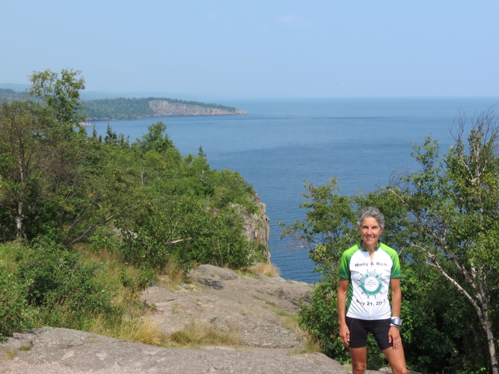
It was nice to know we had just eight more miles to reach Beaver Bay, rounding out our longest day at 70 miles. Rich and I took the opportunity to visit Palisade Head on the way, despite the incredibly steep road to reach it. There was a bit of haze in the air but the view was still stunning. And Rich was thrilled to find that the local nesting Peregrine Falcons were active and in view. So of course a photo session ensued.

Today’s top sights, apart from the beautiful scenery, evolved into a common category – tall wood carvings. The first was a chainsaw statue in Finland. It is a unique rendering of St. Urho, a legendary and entirely fictional Finnish saint, which apparently has become part of Minnesota lore. The second was a signpost for our motel, Camp 61, complete with lumberjack, eagles, fish and a raven.

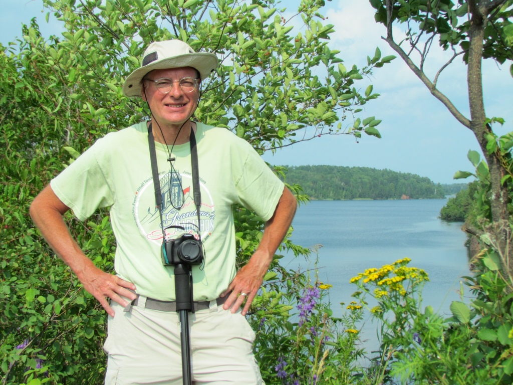
I also enjoyed this peaceful scene, crossing the South Kiwishiwi River early in the morning with a bit of fog still hanging over the water.

We may now be at the low point on this cycling tour, but everyone agreed that getting here was quite a highlight.


Cycling with the Wind

wpid-Photo-20140730214100.jpg

Day 3 – Tower to Ely MN, 50 miles. Our revised route in green

Northern Minnesota is largely unpopulated, except by lakes and trees. And our cycling route for the day certainly confirmed that fact.

The planned route was to head straight to Ely, requiring only 31 miles of cycling and leaving plenty of time there for other pursuits. Since Rich had a reprieve from sag wagon duties, we took the liberty of following an alternate and more circuitous route to Ely. Straying from the main highway, we enjoyed quieter roads and the unexpected benefit of brand new pavement. To a cyclist there is nothing better than a smooth unblemished surface!

As if that wasn’t sweet enough, we were also pushed along by a steady tailwind for the whole ride. We fairly flew down the road, barely feeling any resistance on our pedals, and covering 50 miles in record time. It’s not often everything lines up so perfectly, and we fully appreciated our good fortune.

Just to balance things out, we did ride through some significant rain. But the warm day and returning sunshine dried us off in a hurry once it stopped.

Throughout our whole ride we didn’t pass through a single town, with the exception of Babbitt which was a deliberate detour for a comfort stop. The remainder of our miles were all through quiet woodlands with a few houses and lakes nestled behind the trees. It was the kind of ride that encourages my mind to wander – a very liberating feeling.

Arriving in Ely the weather was sunny and hot, and the Red Cabin Frozen Custard stand across from our motel called out to me. There is nothing better than ice cream at the end of a long ride. Although I originally spurned the thought of their flavor of the day, one taste convinced me that watermelon custard was a most excellent choice.

Our speedy journey left us with a free afternoon, and we took a leisurely walk around Ely and along Miners Lake. It felt truly summer-like, which has been a rare sensation this year. Rich found a new “dorky hat” to keep the sun off his fair skin, which he promptly put into service.

Dinner this evening was out on the patio of the Rock Wood restaurant. The food was excellent, including the decadent desserts we all shared without guilt. To top it off, a bluegrass band provided live music. Sitting outside on a warm evening with friends and music was an unbeatable combination. Almost as good as cycling with the wind.


Dodging the Rain

wpid-Photo-20140729213459.jpg

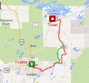
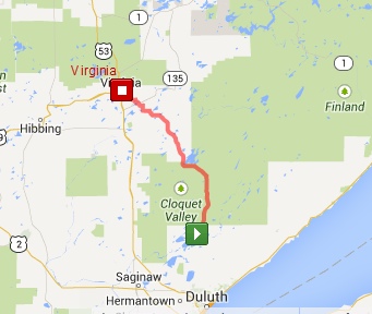
Day 2 – Virginia to Tower MN, 49 miles. Our detour in green

The forecast for today looked great. Sunshine and warm temps, perfect for cycling. But the weatherman got it wrong. Instead, we had intermittent rain showers, some of them quite heavy with a smattering of thunder. And yet, through the virtue of perfect timing, we managed to avoid much of the wet weather. And the sunshine in between was all the sweeter.

We started the morning with breakfast at a cafe that came straight out of the 50s. They served the standard fare, and had the requisite bar stools at the counter. Half the fun of traveling is discovering local eateries, and this downtown staple was pure local flavor.

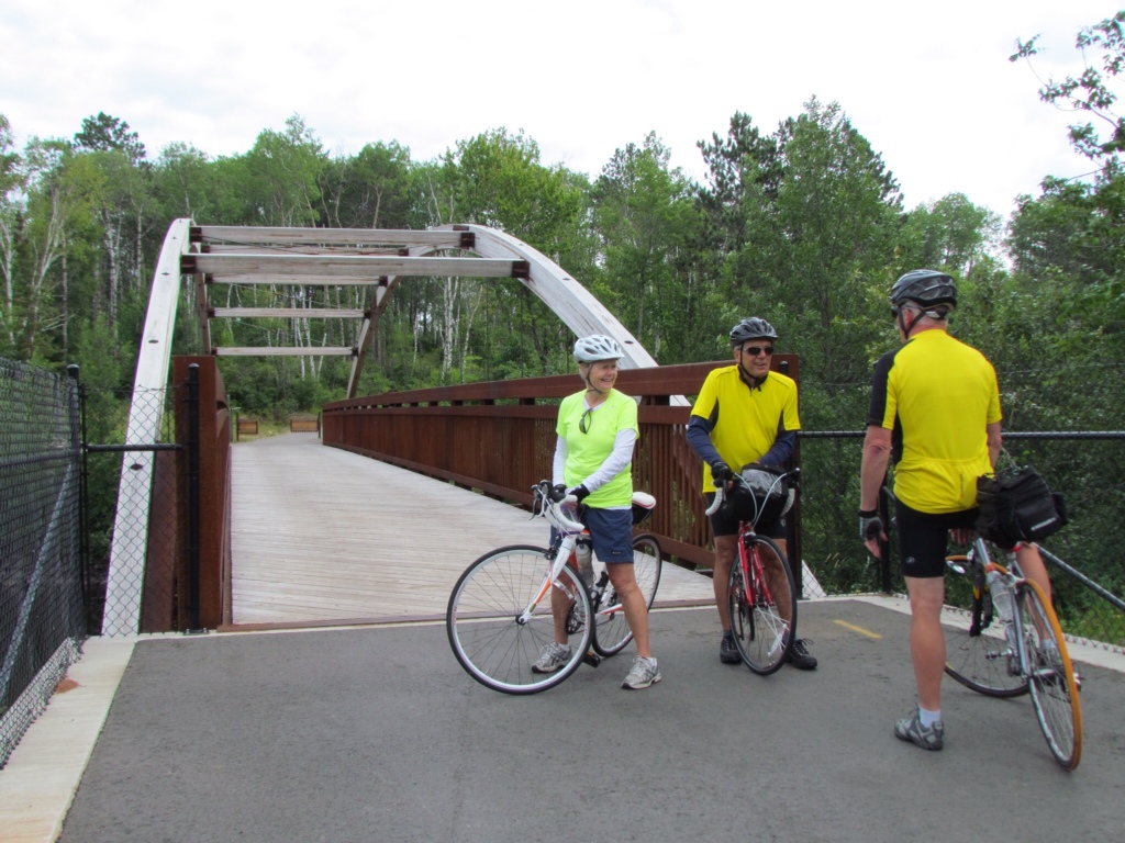
Our route retraced the Mesabi Trail back out to the highway that led to Tower. This time around we enjoyed the rolling hills and curves even more than yesterday. Reaching the end of the trail, we noticed dark clouds collecting overhead. Sure enough, soon it was raining. But being with people who are able to roll with the punches, it did little to dampen our spirits. Donning our rain jackets, we soldiered on. And eventually we managed to out cycle the rain clouds.

Our group split in two today, and I cycled in a group of four. When the Mesabi Trail mysteriously reappeared, we decided to take it, believing it would eventually return us to the highway. Despite some twists and turns, and moments of uncertainty, our hunch proved to be right. That section of trail, including the sunshine that had returned was delightful. We made our way to Giant’s Ridge ski area on smoothly paved trail and plenty of rolling hills. We had beautiful views of lakes and woods and returned to our intended route just short of our lunch spot, very pleased with our revised route.

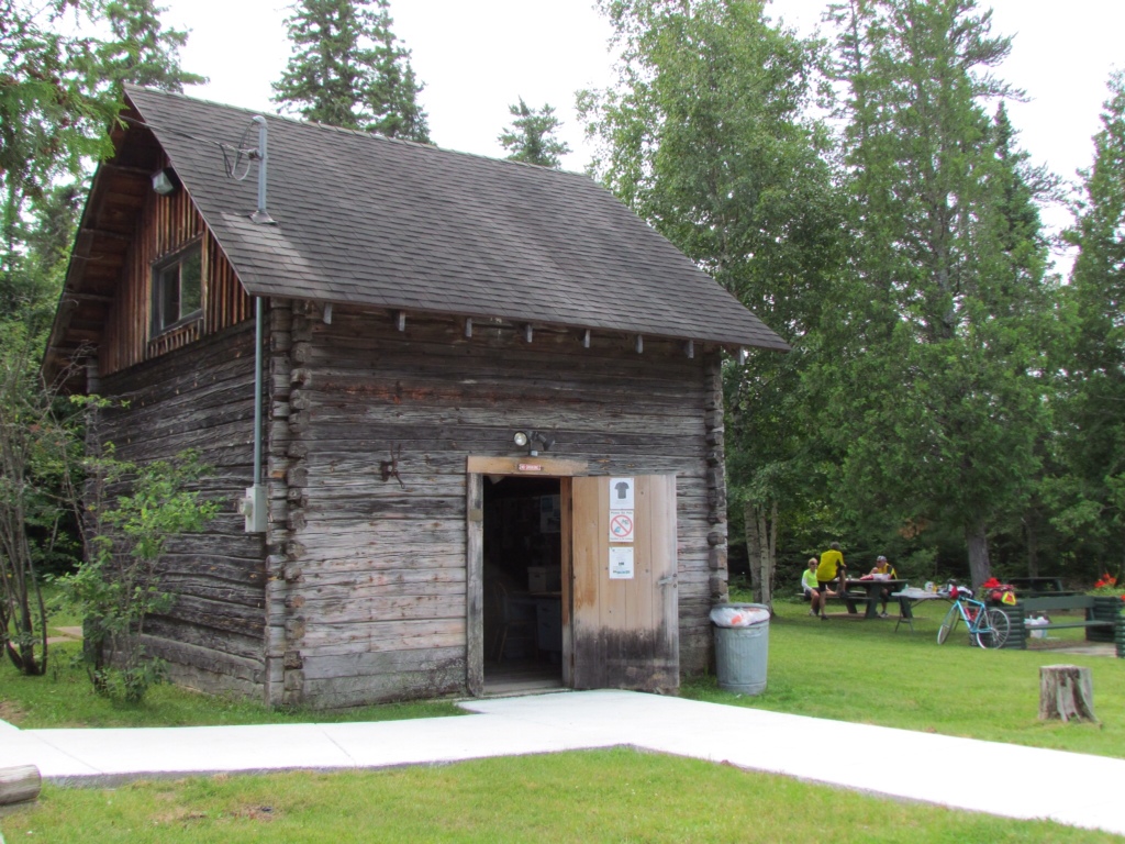
Our lunch stop was on the grounds of a Finnish homestead – a refreshing break.

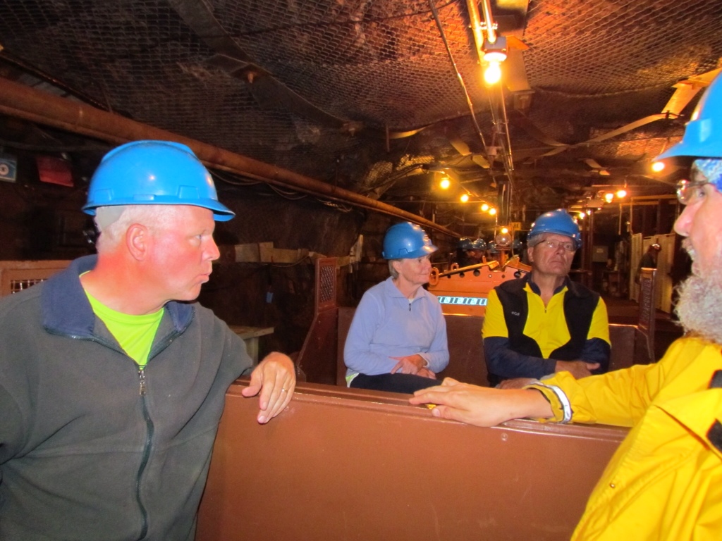
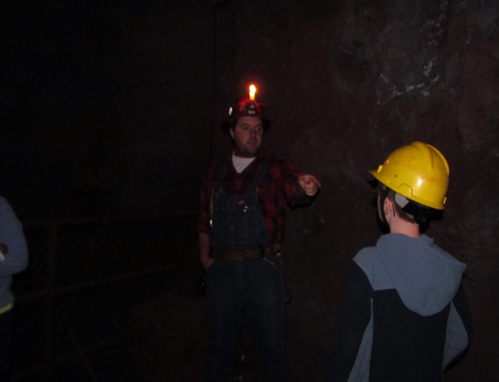
The afternoon’s main attraction was taking the tour of the Soudan Mine. And it just happened to coincide with another bout of rain, which we totally missed. Outfitted in warm clothes and hard hats, we descended in mine shaft to reach the 27th level of the mine, 1/2 mile underground! Crammed into the tiny elevator box, it rattled and shook noisily as we plummeted at rapid speed. Frankly it was a relief to feel it finally begin to slow and eventually stop. As promised, the mine was a cool 51 degrees down there.

We continued with another 1/2 mile ride, this time in rail cars to the mining site. There we climbed up to a higher level which was an enlarged space. Our animated and enthusiastic tour guide explained the mining process and how they got the ore back to the surface. To demonstrate the conditions under which the miners worked, he turned out all the lights. We were plunged into true darkness, and when he lit a single candle it was surprising how much light it shed. Yet it was hard to believe that was all the light they had to work by, years ago.

We managed to fit our remaining miles to the hotel perfectly into a sunny window. No sooner had we arrived than the rain came down in sheets that came in waves across the parking lot. Looking out on it from a dry hotel room was very satisfying. 49 miles completed, successfully dodging the worst of the rain.


Cycling in Style

Day 1 – Island Lake (Duluth) to Virginia MN, 54 miles

Relaxed. That’s the best word to describe my first day on the North Shore Tour with Bike Tour Vacations, and my introduction to cycling on an organized ride. It’s a pretty nice way to travel, I will admit.

We first met our fellow travelers last night at a social hour, where we were treated to Jim’s homemade cheese. If his travel expertise rivaled his cheese, we knew were going to be in good hands. Our group consists of eight cyclists, including co-leaders Jim and Rich, and we have an additional non-cycling participant who is enjoying other outdoor pursuits each day. They hail from as far as Pennsylvania, Alabama and Florida. And we all sport gray hair, whether it shows or not.

Our day started with loading up the sag wagon to ferry us to Island Lake where we would start our ride. With plenty of time to hit Dunn Bros during the process and nurse my latte on the drive, I was already getting the hang of this no-hurry mode. It was a beautiful morning for cycling, and spirits were high as we assembled for our start, and after a quick pose for a group photo, we were off.

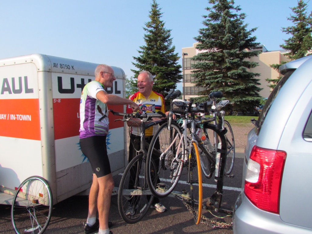
Rich and Jim load up the bikes

At Island Lake, eager to begin cycling

Our route took us along quiet roads lined with tall trees and grasses with abundant wildflowers. We quickly fanned out and cycled at our own pace, collecting about once a hour to gather around the sag wagon for drinks and snacks. My favorite part was cycling through the Cloquet Forest, with it’s towering pines and rich evergreen scent. While the route was mostly flat, we had a compensating challenge with a persistent headwind. But the day was so nice that no one minded. Lunch was a delightful spread alongside the road, served by Jim in his classy hat. There was no rush to move on. We still had plenty of time to reach Virginia.

Jim serves up lunch for everyone

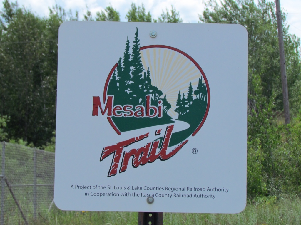
The final 10 miles of our 53 mile day was on the Mesabi Trail. It was a delight to ride on a wide dedicated paved trail, free from traffic and winding through the countryside. Much of it covered old mining land, which is gradually being reclaimed by trees and undergrowth. We stopped for a view of Rouchleau lake that was formed out of multiple old mining pits.

Cycling the Mesabi Trail

Rouchleau mine lake

Upon arriving at our hotel, our keys were waiting at the front desk and our bags already deposited in our rooms. A pure class act. I could enjoy being spoiled like this. Our day concluded with dinner at a Mexican restaurant and a leisurely walk around town to admire the large murals adorning the sides of the buildings. We just took our time, enjoying the mild evening and golden sunlight.

I don’t know how many people would consider a full day of cycling to be relaxing, but I sure did. And traveling in style sure didn’t hurt either.

Along for the Ride

Once again Rich and I are off on another working vacation. Only this time he’s working and I’m vacationing!  I think I got the best end of this deal.

The gig is with Bike Tour Vacations.  The company is owned by an old neighborhood friend of Rich’s, Jim Plaunt.  Although he defected and moved to Michigan, he hasn’t forgotten the appeal of Northern Minnesota, and still returns to lead bike trips through our beautiful wilderness scenery.7-25-2014 4-34-53 PM

Last year Jim enticed Rich to co-lead a trip with him.  Rich rather enjoyed his position as a “flunky,” helping out the cycling guests yet still being able to ride his bike for a large share of the trip.  It was a great way to earn his way through an enjoyable tour.  And the experience was good enough that he agreed to return and assist with two more trips this summer.  Given an invitation to accompany Rich and bunk with the “paid help,” I easily decided to join the 5-day Minnesota North Shore Tour.

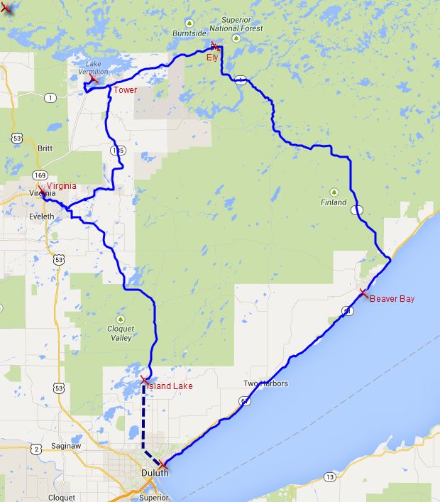
North Shore Tour MapThis will be an entirely new experience for me.  Not the biking, but the whole concept of a supported ride.  The norm is for Rich and me to take off on our own, traveling with everything we need in one set of panniers each.  Sometimes for months.  This time Jim and Rich will trade off driving the support van, transporting my belongings from hotel to hotel.  I will cycle with only day bags on my bike, and no camping gear.  I feel lighter already!

That same van will make stops for us.  No need to worry about running out of water or long distances between food.  They will be there for us with water and snacks on board.  Any breakdowns will also be serviced by the friendly and handy co-leaders.  And I hear we even stop for lunch.  Since Jim handles all the lodging reservations and meals, Rich gets a bit of a break as well.  Normally, that falls on his shoulders to research each night before we move on.

Perhaps one of the biggest adjustments will be traveling in a pack.  How tightly we cycle together is yet to be seen.  But mealtimes and evenings allow opportunities to socialize and enjoy local entertainment offerings. I’m looking forward to the extra company and camaraderie.

Rich jokes that since he’s the flunky on this trip and I’m a paying guest, I have a legitimate right to order him around.   Hmm, it’s tempting…  If I know what’s good for me, I think I’ll pass on that.  But I’m still looking forward to going along for the ride.