Northland Mud Season

Few would claim that the Northland is at its best in the spring.  While temperatures are nearing the comfort zone in the Twin Cities, we are still hovering around freezing.  Although spring flowers may be poking up in warmer climes, here the vegetation is still brown.  The ground is muddy and still icy in spots.  In short, it’s pretty bleak.

And yet, when the sun comes out it is hard to resist heading outdoors.  Never mind that cold wind off the lake, spring calls.  That’s exactly how I found myself in Gooseberry Falls State Park this morning.

Muddy path at Gooseberry Falls
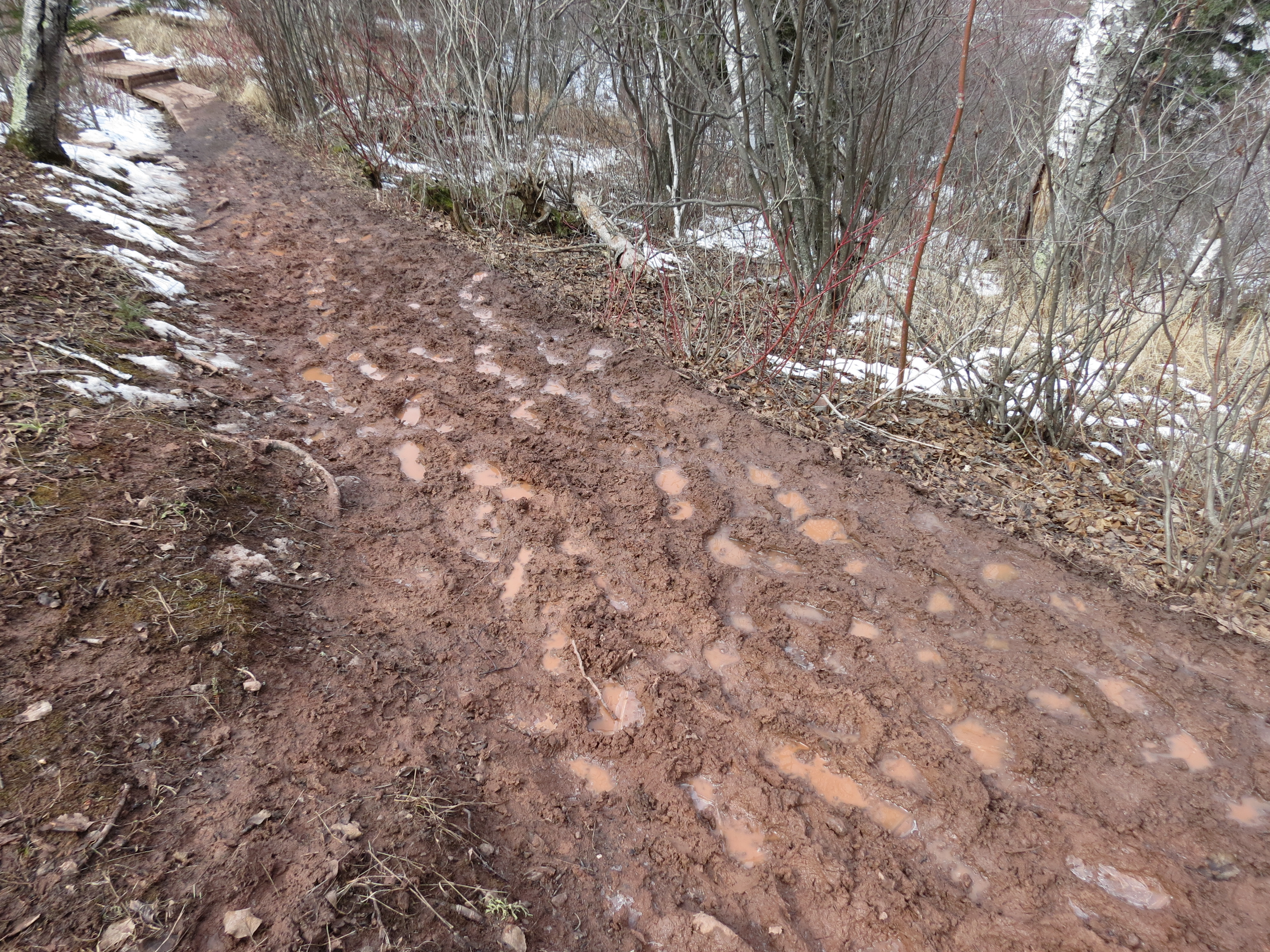
The woman in the Visitor Center warned that the trails were wet and slippery.  But the draw was irresistible.  I hadn’t come to the park to walk on the road.  From the abundance of muddy footprints I followed, I wasn’t the only one who felt that way.  Others too were enjoying the squish and slide of mud season.  There is something innately satisfying about setting foot squarely in the midst of that soft wet earth and the squidgy suctiony noise that accompanies its exit from the quagmire.  Big kids that we are.

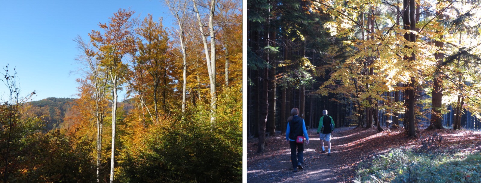
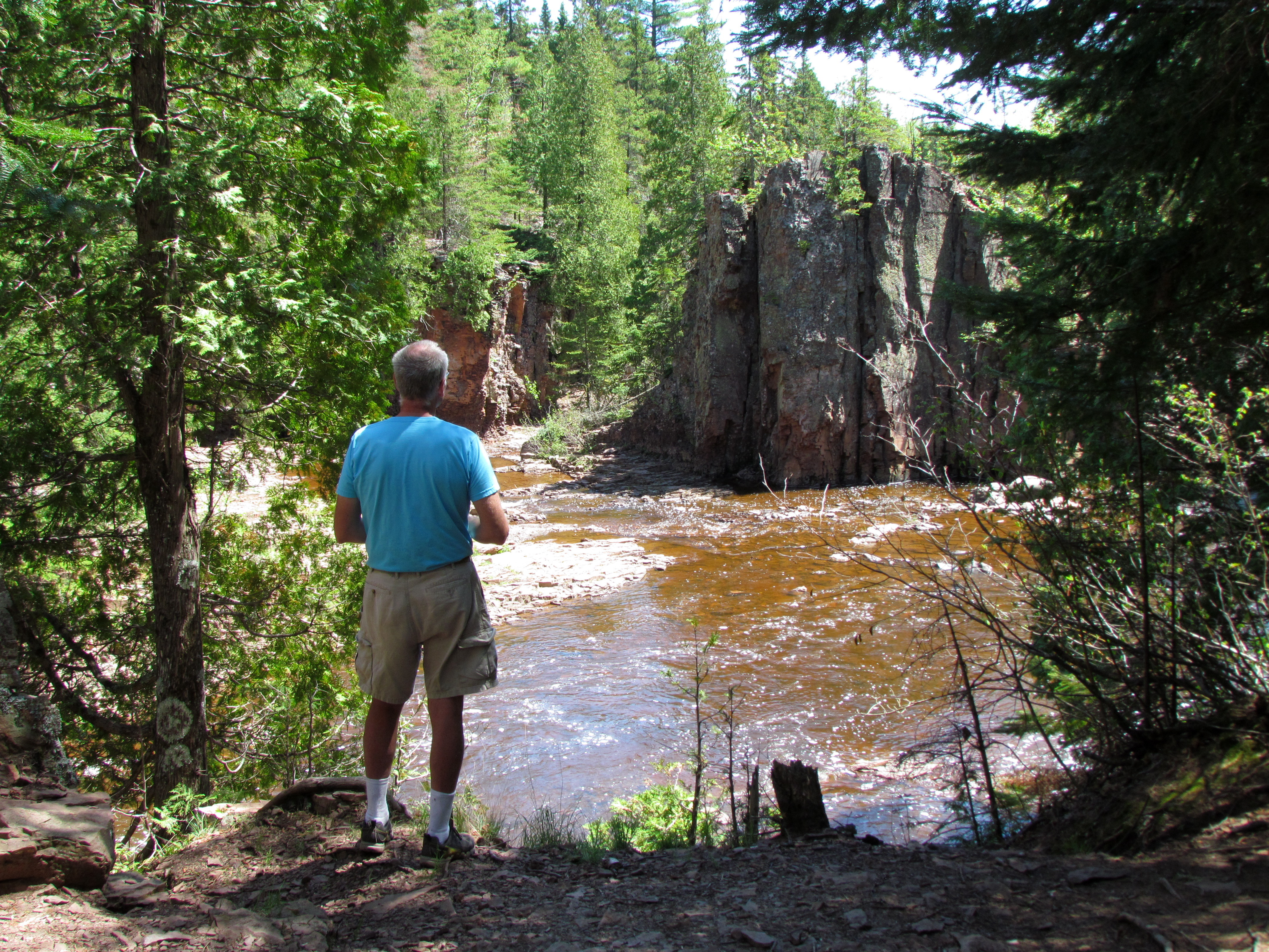
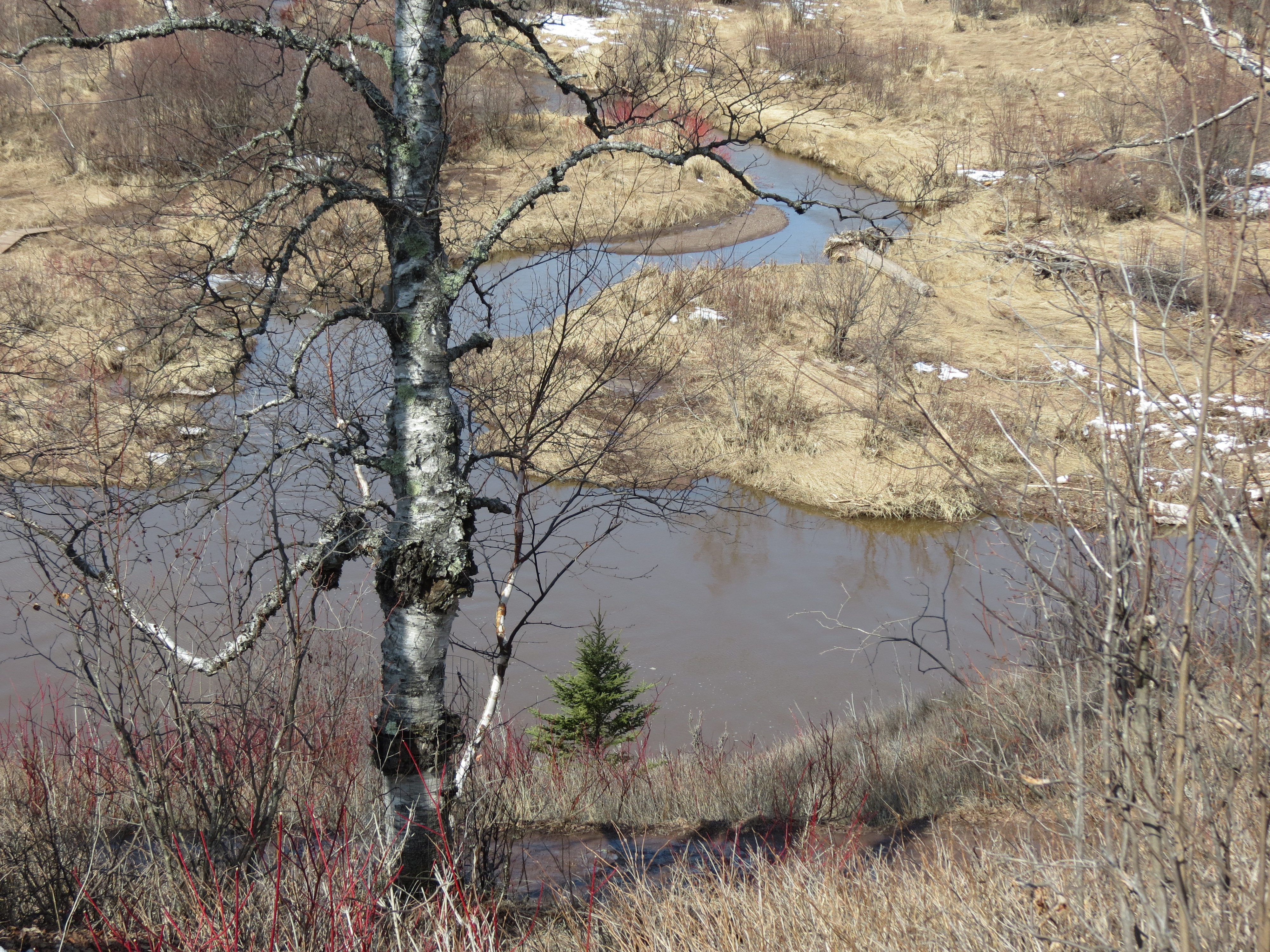
If the lack of vegetation deprives us of color, it also grants vistas.  En route to the lake shore, I was able to take in the falls from a distance, and enjoy the twisty, windy path of the river.  It’s fascinating how it transitions from roaring falls to lazy stream in just a short distance.  The dogwoods added a welcome touch of red to the scene.Long distance view of Gooseberry Falls Gooseberry River
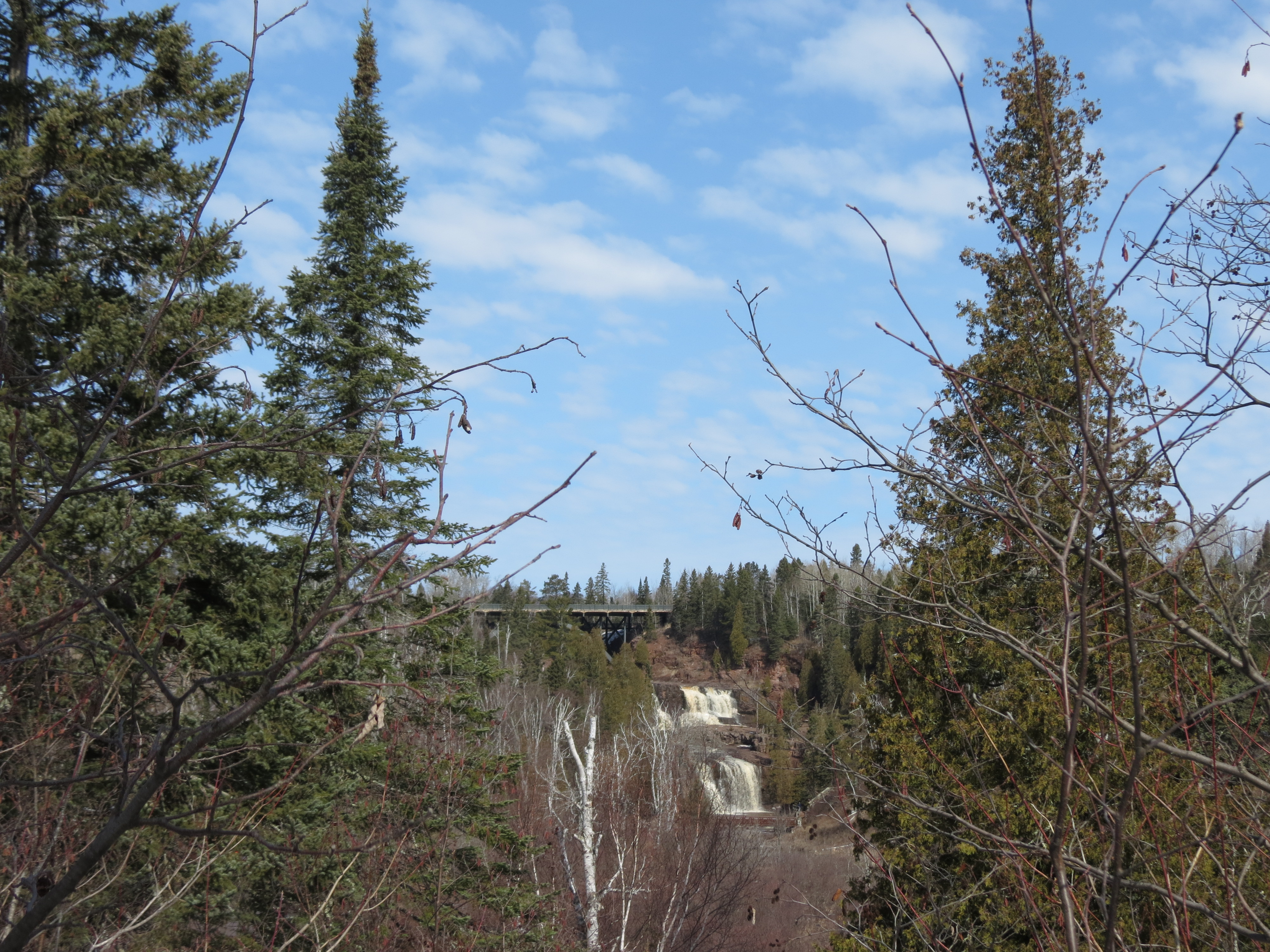
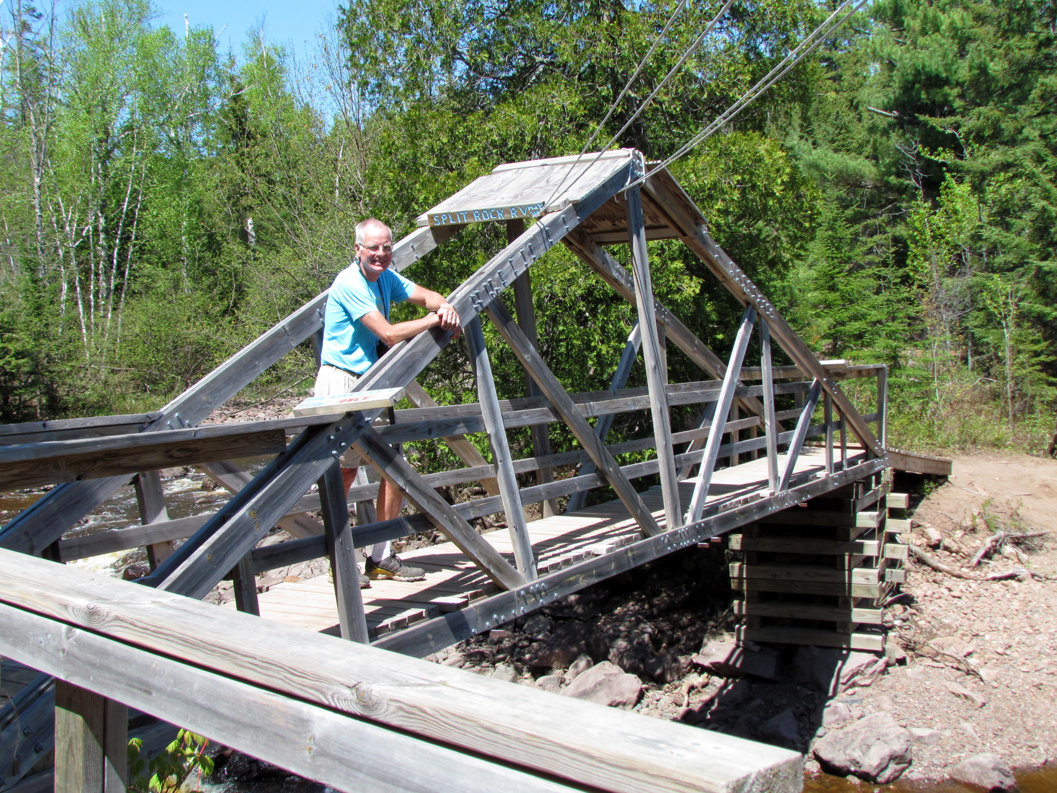
Not all scenic views were a product of nature.  I particularly enjoyed the symmetry and design of the steps that took me high above the river to the cliffs above.  Workers more recent than the original CCC crews that created the park’s magnificent log and stone buildings back in the 1930s were responsible for this ascending sculpture.Modern steps in the park
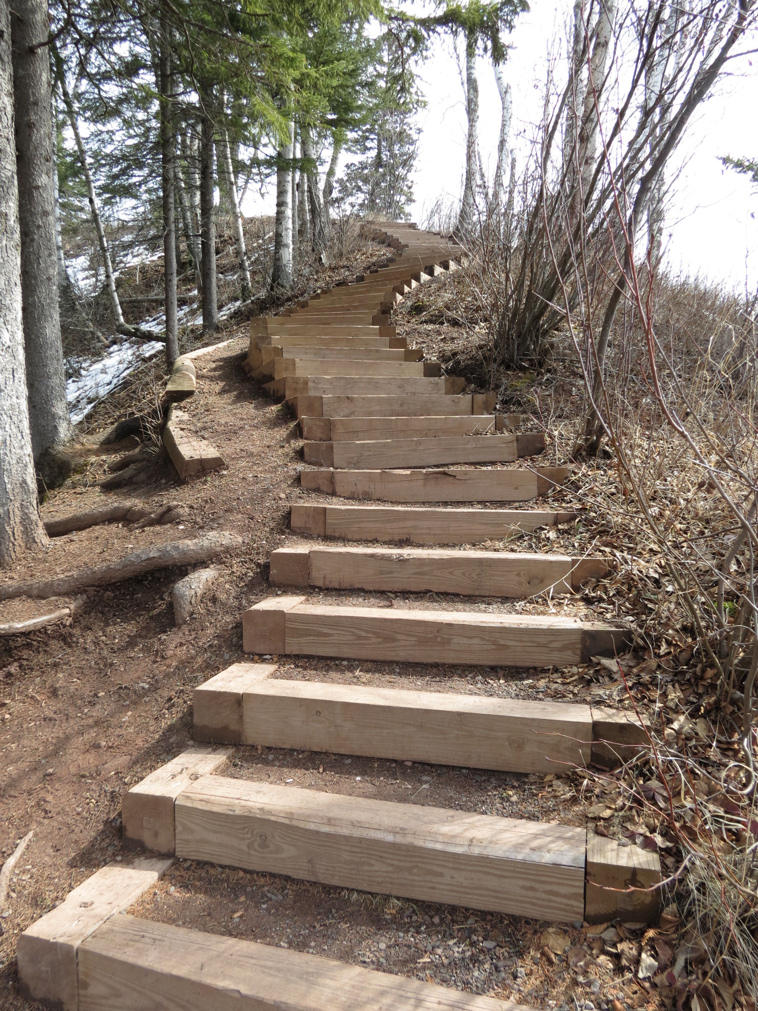
Hiking between the shoreline and the falls, I decided it was a dual sound track park.  Next to Lake Superior, the rush of the wind and the pounding of the waves filled my ears.  It was a familiar noise I could feel as well as hear.  Both sensations retreated as I moved away from the lake, soon to be replaced by the roar of the falls.  The thunderous din grew as I drew closer to the source, and witnessed the power of the water as it crashed over the rocks.  Still swollen by the spring run-off.Gooseberry Falls in springMy circuit complete, I tracked globs of mud back to the car on my boots, fresh air tingling on my face, and fingers feeling a slight chill despite my warm gloves.  All so very satisfying.  Spring in the Northland, mud season at its very best.

Staying after Class

Writing Class

Class was dismissed, time to head home. Or so I thought. It was the end of a wonderful 4-day stint in Grand Marais, rubbing elbows with real authors and nascent writers at the inaugural North Shore Readers and Writers Festival put on by the Grand Marais Art Colony. My time there was jam packed with workshops, craft seminars, entertaining speakers, readings by authors and book related special events. I left with a head full of inspiration, myriad ways to improve my writing, and great role models among both presenters and attendees to fuel my ambition.

The noonday sun shone brillliantly in the deep blue sky. I shuffled through the fall leaves while breathing in the brisk air, listening to the waves crashing against Lake Superior's shore as I walked back to the motel. After days indoors perched on chairs, listening intently, thinking and practicing writing, the outdoors felt envigorating. So when Rich proposed staying on for another day, it didn't take me long to overcome my natural inclination to stick to the original plan and agree to the extension.

Northern Lights Lake Trail

In short order we headed up the Gunflint Trail. With hunting season just opened our hiking options were limited, but Rich assured me no sane hunter (or deer) would choose the steep trail up alongside Northern Lights Lake. The trail rose steeply rewarding us with nice views of the lake through the trees. Navigating the path required careful attention to where I was going. Avoiding slippery rocks, wet mud and tree roots kept my eyes riveted on the trail. Perhaps that's what brought the forest floor into such sharp focus, with all its intricate detail. There the lichen spread its delicately patterned fronds over the green mossy ground cover. From a distance, it resembled a field of cauliflower. Up close it was like fine lace.

Lichen along the trail

Similar looking decor proved to be something else entirely…snow! Just a gentle reminder that winter is not far away.

Snow along the trail

The silence of the trail was a calming influence. With only the wind rippling through the trees as accompaniment to our falling footsteps, it made for a relaxing retreat. My only regret was that the trail wasn't longer, to prolong our foray into the woods.

With the fall days rapidly growing shorter, by mid-afternoon the shadows were lengthening and dusk was already beginning its advance. We chose to spend the remaining hours of golden sunlight at the harbor, watching the waves crash on the rocky breakwater. By then, I was grateful for bringing a warm jacket, gloves and hat. On the North Shore, one can never be over-prepared for the weather.

Grand Marais harbor

As the sun set behind the lighthouse, casting its fiery glow, I knew we'd made the right decision. It was worth staying after class.

Grand Marais sunset


Hiking, Czech Style

You have to hand it to the Czechs. When hiking in the mountains, they do things right. How well I remember the first time we went hiking with our Czech daughter, Pavla, and her family. After toiling up the steep climb, wading through deep snow, slipping on the ice and marveling at the stamina of the locals we came to the summit. And a pub! Taking in the surprise registering on our faces, Pavla patiently explained that all such hikes terminate at similar establishments. After all, what would be the point otherwise? Good thinking. We decided on the spot that we liked hiking in the Czech Republic.

MoravkaOur latest visit with Pavla included a stay in Morovka, where she and her family spend most weekends in husband Pavel’s family home. It is a beautiful spot in a valley situated in the Beskidy Mountains. And right from the doorstep there are numerous hiking options. Blessed with a perfect fall day featuring peak foliage and brilliant sunshine, we set out shortly after lunch with extended family members to tackle the hillside.

Hiking near MoravkaThe air was crisp and cool, particularly in the shade of the towering trees. It was good incentive to keep moving. We weren’t the only hikers on the trail by any stretch. And nearly all were family groups. What impressed us most of all was the way the young ones carried on without complaint. The youngest in our group was only four, and she covered nearly the whole 5 kilometer distance uphill on her own. She definitely earned the piggy back ride she got on the way down. Those only a few years older hiked round trip with energy to spare. Clearly, they were raised on this stuff.

This particular hike delivered in style. There were multiple resting spots along the way, with plenty of beverage and food options to refresh the weary traveler. At the first, we paused long enough to indulge the children in a pony ride. Our destination was Chata Kotar, where we happily gathered around outdoor tables to enjoy the view. And lift a glass or two.
Chata Kotar on the hiking trail
The views were as spectacular going down as they were on the way up. We couldn’t help marveling at our good fortune with the weather. And there was no better way to enjoy it than traipsing through the colorful, rustling leaves with our Czech family.

Hiking in the Beskidy MountainsThank you, Pavla, for introducing us to hiking, Czech style!Molly, Pavla and Rich

Circling the Sound

I'd never realized before just how extensive and meandering Puget Sound is. It's long and sinewy fingers stretch well inland, creating endless miles of coastline. We enjoyed exploring quite a few of them.

Our first introduction was in Olympia. We had the luxury of a rest day there spent with my good friend, Anne, who shared her favorite outdoor haunts with us. Blessed with sunny calm weather, we happily traded our bikes for walking and enjoying nature.

Exploring the restored delta on the boardwalk at the Nisqually National Wildlife Refuge.

Lunch and a colorful eyeful at the Olympia Farmers' Market

Walking the beach at Priest Point Park

Beautiful wooded trails in Priest Point Park

We were advised that the best bicycle route into Seattle was not the direct one. It took a full day of cycling to circle around to Bremerton, on the western side of the Sound. But it was far more pleasant and less stressful then trying to navigate through a busy metropolitan area. Every time we had a scenic view of water, it turned out to be another bit of the Sound. The sight varied greatly depending on the status of the tide and the nature of the shoreline. It could never be tiresome.

Stopping for a mid-day break on the fishing pier in Allyn

Our Warm Showers hosts in Bremerton had a beautiful home with a wonderful view of Kitsap Lake. Although not part of the Sound, its waters eventually drain there. The unseasonably warm weather provided a fine opportunity to hang out on the deck to enjoy the view, including the Cascade Mountains in the distance.

Lake Kitsap and the Cascade Mountains

A beautiful sunset over the lake

Tomorrow we will complete our circuit of Puget Sound, as well as our trip. Since we didn't do a circle route this time, let's just say we are about to come full cycle.


Our very own Mountain

It’s not every family that has a mountain named for them.  But that was one of the legacies my great-grandfather left for us.  For the record, this is no piddly little peak.  Mt. Brewer rises 13,576 feet high in the Sierra Nevada Range in California.

William Henry Brewer March 19 1902

William Henry Brewer, 1902

Back in 1860, Josiah Whitney headed up the first Geological Survey of the State of California.  He selected fellow Yale graduate William Henry Brewer to lead the field survey.  Over the next four years, my great-grandfather Brewer traveled over 14,000 miles mapping California’s topography as well as cataloging and collecting geological and botanical samples.

On July 2, 1864 Brewer and his team made the first ascent of Mt. Brewer.  The found the final climb to be much harder and higher than expected, traveling over steep rocks.  But once at the top they were amazed at the view – “Such a landscape!” Brewer exclaimed in his journal, surrounded by a hundred peaks over 13,000 feet.  In fact, from the summit Brewer’s survey party was the first to identify the highest peak in the range, Mt. Whitney.

GMBE 1970

The Great Mount Brewer Expedition, 1970

Over 100 years and three generations later, my older brother, my sister and her boyfriend (now husband) made the second family trek up Mt. Brewer.  Somehow it seemed fitting, as my brother is named after William Henry Brewer.  They boldly named their trip the Great Mount Brewer Expedition, and spent five days backpacking up the mountain and back.  They left the following entry in the log at the top:  “William Henry Brewer and party climbed this peak 106 years after our great-grandfather, William Henry Brewer.”  I was in awe of my siblings’ accomplishment, especially after they were featured in a big newspaper story when they returned.

Mt. Brewer Map

Carl and Erik’s planned route to the top

Now 150 years since Brewer’s first ascent, two of his great-great-grandsons are making the same trip.  My sons Carl and Erik leave this week to scale our family mountain.  If all goes as planned, they expect to complete their journey in three days, but have allowed four just in case.  Since they have planned a circular route, it means carrying all their gear to the summit.   I’ve been informed that only about half the route is on established trails.  Getting to the top requires finding their way off-trail.  They assure me that they are good with maps and a compass.

I’m thrilled that my sons care enough about our family history to carry out this challenge.  I’m excited to think about their new entry in that log at the top.  It’s an adventure I’ve dreamed of doing, but realistically will resort to living vicariously through their anecdotes and tales.  I’m sure there will be plenty to tell.  That’s a lot of mountain to claim and to climb.

Mount Brewer from South Guard Lake

Mount Brewer from South Guard Lake

North Shore Discoveries

Despite the amount of time I’ve spent on the North Shore, there there is always something new to discover. This week it was two “new to me” hiking trails. Admittedly I have spent more time cross-country skiing on the area’s trails, so it’s not too surprising that there are still plenty of hiking opportunities to explore.

IMG_4450

Root cellar once used to store food is the only remaining structure on the land.

The first was Sugarloaf Cove. This 34-acre site was formerly occupied by Consolidated Papers for their pulpwood rafting operation. Back in those days, thousands of logs dropped down a chute into the lake and were collected in a bay until there were enough to form a “raft.” Surrounded by log booms, 6-8 loads were towed across Lake Superior to Wisconsin each summer.

In 1988 the land was acquired by the State of Minnesota with the intent of turning it back to its natural state, and preserving it for future generations. A tasteful nature center was constructed, with green technology to minimize its impact. There is a lovely 1-mile self-guided nature trail through the property. It’s a beautiful trail on its own, including its pebble beach and lake views. But the numbered points of interest along the way also detail the history of the log operation and identify remnants that still remain visible.

The site has only a modest dirt road and little in the way of signage at the entrance, so it’s easy to miss. It’s just four miles southwest of Schroeder and is well worth a visit.

IMG_4540The second was finding the “split rocks” that may have given the Split Rock River its name. Although the exact origin of the name is still in question, the rocks are impressive. The Split Rock River Loop trail departs from the roadside parking area southwest of the lighthouse entrance of the park. Heading inland along the river, the trail follows the Split Rock River. About 1/2 mile in, it joins the Superior Hiking Trail and crosses the river which branches into East and West branches. The trail follows the East or main branch, closely following the water which boasts a continual flow of waterfalls and rapids along its course. With the foliage sporting that new spring green color as it emerged, and small wildflowers dotting the trail side with yellow, white and purple, it was an enchanting hike.

IMG_4542The trail maps weren’t clear about the location of the rocks, so we began to doubt our route as we continued to climb upward over terrain that was crisscrossed with tree roots and at times rocky footing. But suddenly there they were – huge, tall rocks with a split down the middle. And well worth the 2-mile hike to reach them. The view of the river from that spot IMG_4543was impressive as well, with high cliffs across the way.

To return, we continued up the river about another 1/2 mile to reach a bridge. It warned us that only one hiker should cross at a time – and we complied. On the other side, the trail proved to be gentler and more smooth underfoot. It was easy walking down, particularly when we veered away from the river. Reaching the Split Rock Shelter, we found ourselves at the top of a large plateau with unlimited views of lake and land.  A short spur trail took us back to the parking lot, for a total of about 5 miles of hiking.

It didn’t hurt that we had beautiful weather for hiking. But even without it, both trails felt like gems. Very different, but great discoveries. And I’m sure the North Shore holds a lot more.


Park Point Delivers

The weather wasn’t the greatest, but needing to get outside we decided on the Park Point Hiking Trail.  We had no particular purpose in mind.  Rich would be happy to find some birds, and I’d be content with a bit of exercise and fresh air.

With strong NE winds blowing off the lake, chilled by the miles of ice crushed up against the sandy beach, we were glad to find that the trail’s trees kept us reasonably sheltered.  In fact, as the skies brightened and we warmed with the effort of walking through shifty sand, the afternoon’s prospects improved considerably.

IMG_4026Detouring to the bay side, it was positively calm and almost warm.  There it was easy to dawdle through the grasses, soak up the sun and listen to the water quietly lapping at the shore.  While Rich checked his favorite birding spots, I wandered the shore admiring the driftwood, including the teepee sculpture left by some industrious visitors.

Warmed by that interlude, we continued along the trail.  Despite the growing patches of snow, and the cold winds that pierced the IMG_4038 cropped 2tree branches, we happily carried on and eventually made our way to the end – the Superior entry.  Walking out the narrow catwalk on the outside of the piers was chilling as we met the full force of the wind and were surrounded by ice that clogged most of the entry.  But having come that far, it wasn’t an option to stop short of the end of the pier.

It was only chance that made Rich look up as we carefully picked our way back to land, and there it was – a IMG_4053 croppedboat about to enter the canal.  We’d seen it loading at the grain dock across the harbor, and wished it would finish in time to see it leave.  It appeared our wish was being granted! Pushing its way through the floating ice, the Algoma Equinox created currents that propelled other ice flows past our perch back out at the end of the pier.  Slowly, gracefully it slid past us as our cameras clicked and whirred.

At the same time, we realized this was turning into a double-wish day.  Rich had speculated that the boat anchored off shore was waiting for the same grain dock, and sure IMG_4035enough – now it was visibly moving closer.  It seemed to be barely inching forward, and it was frigid standing out there in the wind.  But we knew we couldn’t leave.  Neither of us had ever seen a boat go through the Superior entry before, and now we had the chance to see one go in and one out all in one visit!  We alternately huddled behind the cement ramparts and peered over the edge to check on the boat’s progress.  ByIMG_4066 cropped the time it came close enough to put our cameras into action again, we’d been out there nearly an hour.  It looked like a twin of the departing ship.  But we welcomed the entrance of the Burns Harbor and accompanied it along the length of the pier, nearly keeping pace with its careful movement.

Regaining the protection of the hiking trail, we couldn’t help but feel pleased with our adventure.  We’d experienced the dichotomy of Park Point weather, ushered two ships through the Superior entry, and found plenty of photographic material.  For an afternoon with no expectations, Park Point certainly delivered.

Hiking in Short Bursts

The idea was a good one.  In concept.  We planned a short get-away to take advantage of the off-season mid-week rates at Cascade Lodge and do some hiking at the State Parks along the North shore.  The advance forecast looked reasonable, so we went ahead and booked our room.  We even splurged on the extra $5 for a lake view and corner room.

What we didn’t count on was the fact that the State Parks now allow hunting on a good share of their land.  While everything between highway 61 and Lake Superior was off-limits to hunters, much of the remainder was posted with bright orange signs warning us away from the trails.  Although Rich looked longingly at the enticing trails along with the empty parking lots, I became the trail police and insisted we stick to safe ground.  As a result, our options were rather curtailed, and we ended up with shorter hikes than planned.  But it wasn’t all bad.

The first day turned out to be cold, gray and blustery.  By the time we finished hiking along the shore at Split Rock Lighthouse State ParkIMG_3038 trimmed, the wind had picked up and snow was starting to fly.  We consoled ourselves with bowls of hot soup at Coho Cafe in Tofte and watched the snow swirl and settle on the deck outside.  Cascade Lodge suddenly seemed very appealing, and we quickly traded the chilly afternoon for reading by the fireplace in the lodge.  We could further rationalize our decision with the promise of a better forecast for the next day.

Sure enough, morning brought bright clear skies.  We were up before dawn and crept outside and across to the lakefront to catch the first morning rays of sunlight.  It was crisp and cold, but an invigorating and rewarding photo session.IMG_2987 straightenedIMG_2956 straightened

The Cascade River was open for hiking to the top the waterfalls.  The trail was beautiful, following the icy flowing waters up one side of the river and back down the other.  We followed that with a trip up the Temperance River.  The gorges were as impressive as ever, with the added attraction of icicles clinging to the edges of the IMG_3051rocky canyons.

NS-Temperance-2

IMG_3058

Returning to Split Rock Lighthouse, we hunted down good vantage points for photos.  We had great fun clambering around the campsites and down on the rocky beach, testing out all the sites for good shots.  What we lost in terms of hiking mileage, we made up for in photography research.

IMG_3103 straightened

All the way from Cascade Lodge, we followed the Roger Blough ore boat down the lake.  When it turned into Two Harbors to dock, we couldn’t resist the opportunity to watch it come into the harbor.  We were amazed at the sharp turns required to slip past the breakwater and position the boat for the ore docks.  Despite the close proximity of Two Harbors, we’d never seen a boat come into port there before.

Our get-away wasn’t the hiking trip we’d originally envisioned.  But neither of us minded the short bursts of hiking interspersed with photography and some creature comforts.  In fact, we quite enjoyed it.

Acadia Rain or Shine

Acadia National Park was high on our list of sights to see as we cycled the Maine coast. So we allowed a day and a half there for hiking and exploring its natural beauty. Everyone had different interests and priorities, so we split up and

Carl on the trail up Cadillac Mountain

Our first afternoon was a continuation of the bright sunny weather we'd enjoyed all week. Carl and I took advantage of the clear skies to hike up to the top of Cadillac Mountain to take in the views. We had planned to take the easiest route to the top, but somewhere our logistics went awry. When we set off from our starting point, the gentle climb quickly turned into a steep ascent. Clambering up boulders and clutching sheer rocks while I tried to traverse them, I became certain it was not what I signed up for. But going back down seemed the worse option, so I persevered. Fortunately, either the terrain improved slightly, or I became more adept at climbing and my comfort level increased with our progress. I'm certain Carl could have scampered up the trail in half the time, but he patiently stuck with me and surreptitiously ensured I didn't take a tumble. And that route certainly had breathtaking views on the way up, when I dared to turn around and look.

Molly and the view on the way up

The view from the top was indeed spectacular. Being the tallest point in the park, we could see in almost all directions. Ocean, coastline, boats, forests, lakes and rock everywhere we looked. We tried hard to ignore the hoards of other tourists who had driven to the top and dominated the scene. In our minds, hiking was the best way to enjoy the summit.

Molly and Carl at the top of Cadillac Mountain

Our second day brought the first rain of our trip. Not to be deterred, we still ventured out to hike. The Ocean Trail attracted several of us, with its craggy shoreline and cliffs. Hiking in Acadia seems to be synonymous with walking on rocks, and that trail was no exception. It offered plenty of shoreline rocks for walking across. Myra and I preferred the fact that the direction was horizontal not vertical.

View from the Ocean Trail
Myra on horizontal rocks

Carl, on the other hand, was enamored with the climbs that offered real vertical ascent. He scaled the Precipice, loving the challenge of the climb. It didn't matter that the views were obscured. Achieving the summit was reward enough for him. It definitely was not the climb for me. Just seeing his pictures made me nervous.

Carl climbing Precipice
Carl's feet, looking down Precipice...

For a group of outdoor enthusiasts, Acadia was a great match. We barely scratched the surface of all the park had to offer. Although we did manage to fit in a bit of cycling getting to and from our hikes. After all, we're on a cycling tour.


Capital Delights

Washington DC.  I’ve lived there for a summer as a young intern, visited as a tourist multiple times, and traveled there on business trips.  It’s a place that never ceases to be fun and interesting.  This visit orchestrated by my son, Carl, who now lives and works there, was no exception.

The calendar said it was springtime, the brilliant sunshine was very convincing and became increasingly warm over the weekend.  It just wasn’t quite enough to entice the cherry blossoms into full bloom.  But we still circled the Tidal Basin with the other blossom seekers, enjoying the spectacle and snapping photos of the same few trees with the most blooms.  Since we hadn’t counted on catching them at their peak, seeing any at all was gravy.  And there were plenty of other flowerPhoto Apr 06, 8 46 10 AMing trees and flowers around town to feed our yearning for spring color.

Photo Apr 06, 8 45 51 AM

I love how DC is so walkable.  On our circuit around the Tidal Basin we took in the surrounding memorials, including the new Martin Luther King Memorial.  From there it was a natural to continue on to the reflecting pool and the sights that surround it.  It was a day on which it was easy to linger and savor the flavor of the monuments.Photo Apr 06, 11 11 20 AMPhoto Apr 06, 11 04 20 AM

It was inevitable that we would eventually end up on the Mall.  Who can resist visiting a few of the Smithsonian Museums, wandering through the sculpture gardens, and just taking in all the activity?  And I’ll even admit to lying on the grass in the warm afternoon sun, resting after a long day of walking.  It felt sooo good.

IPhoto Apr 07, 4 10 27 PM thoroughly enjoyed seeing Carl’s personal piece of DC.  Visiting his workplace, walking his daily commute together, eating at a few of his regular spots, staying at his apartment and getting to know the eclectic neighborhood where he lives was a treat for this Mom.  I even began to recognize the telltale colorful buildings when we approached his street.

From there it was only a short distance to the National Zoological Park, which we easily covered on bicycle and spent a relaxed afternoon meandering outside among the zoo’s exhibits, enjoying the animals and laughing at their antics.

Our final day was actually an escape from DC.  We drove up to Shenandoah National Park and followed Skyline Drive.  By nature, it is a leisurely drive on the twisty, winding road with abundant overlooks.  We stopped frequently to admire the view, and went on two hikes.  The best part was reaching the rocky outcroppings that afforded sweeping views of the valleys below and distant ridgelines.  Despite the fact that spring was far behind and we crossed patches of snow on the trail, we relished being outdoors and active.  Oh yes, and the sunshine.  It was the perfect finale to our weekend together.

Photo Apr 07, 10 08 56 AM

Photo Apr 07, 10 33 58 AM

I can’t imagine a more delightful way to do DC.  Thank you, Carl!